
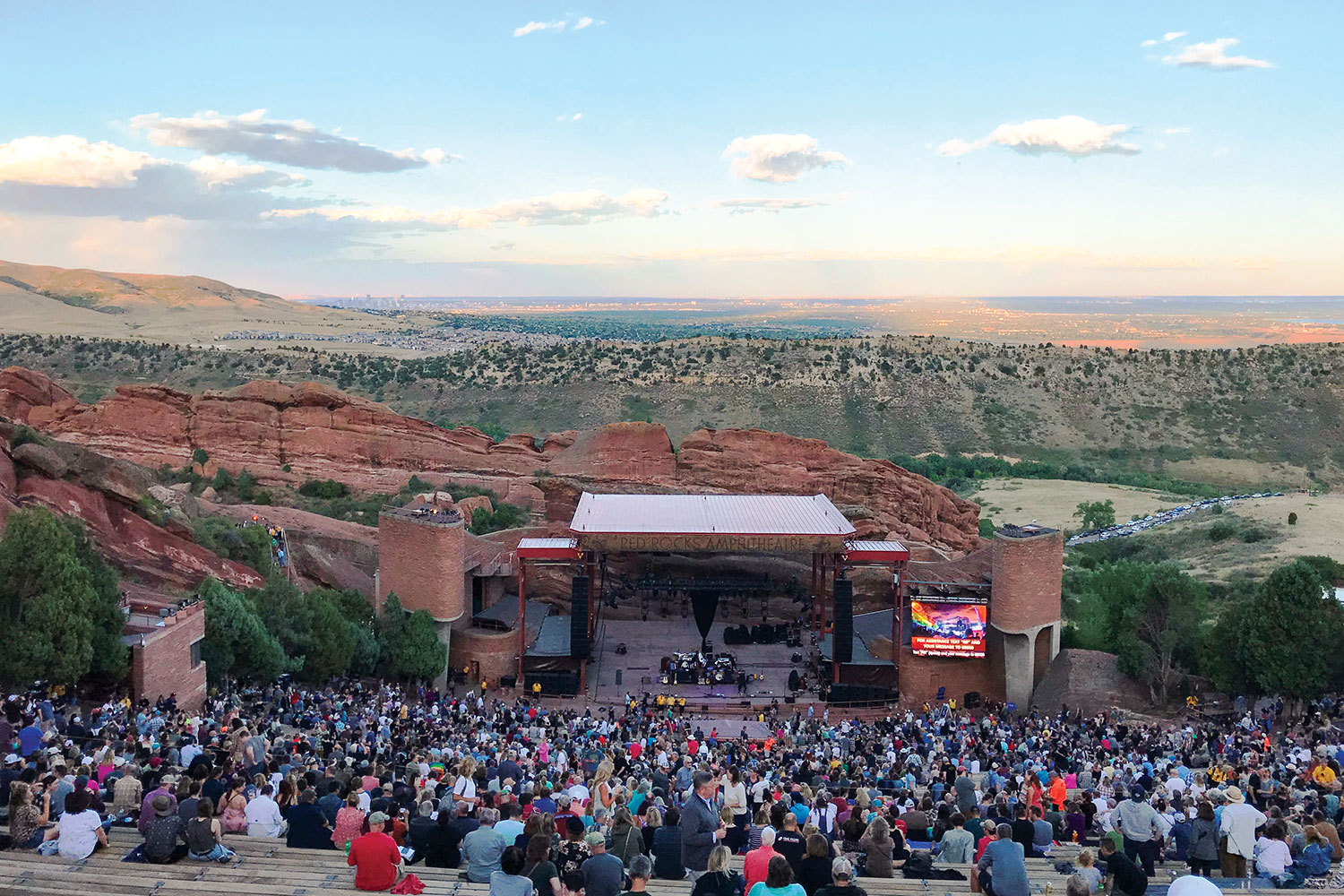
As we sat in the crimson hue of the Colorado Front Range sunset, the stone walls of the iconic Red Rocks Amphitheatre echoed with familiar lyrics. David Crosby’s face was laced with as many crevices as the surrounding sandstone spires, but his vocals gave no evidence of the octogenarian’s age. As he was joined onstage by Jason Isbell for an incredible version of “Wooden Ships,” the last lines sparked anticipation for the next day’s ride: And it’s a fair wind blowin’ warm out of the south over my shoulder / Guess I’ll set a course and go.
The next morning, that course was indeed set. Our route would be a figure-8 exploration of the eastern slope of the Rockies, flanking the Denver urban corridor. As we packed the side boxes on the Yamaha Super Ténéré with water and a few extra clothing layers, that fair wind rustled the leaves in the trees around our vacation rental in Golden. Thumbing the starter, the big parallel-Twin quickly settled into a smooth idle. I shifted into gear, and my wife, Cheryl, and I were off.
GOLDEN TO ESTES PARK
Figure-8 routes have always intrigued me. It may well go back to my youth watching the insane style of racing at the state fair. Anyway, I mapped a ride leaving Golden to the northwest and tracing that general direction to Estes Park, the northernmost point on our planned ride. The return route would traverse different roads intersecting that path on the way back south.
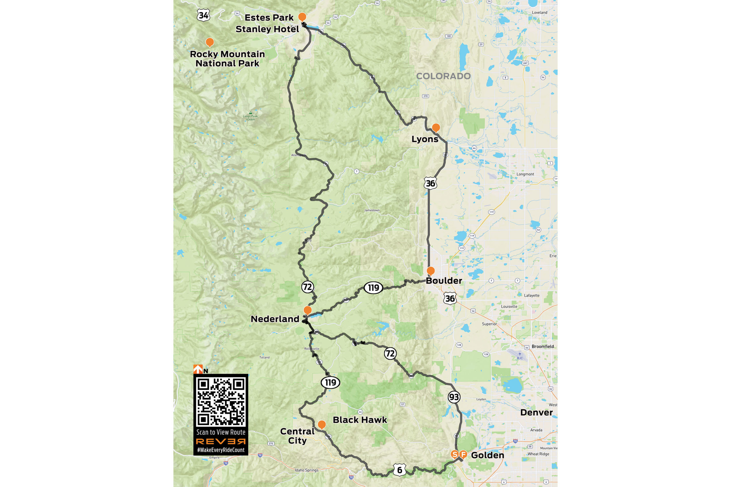
View Front Range Figure-8 ride route on REVER
After a little GPS-assisted navigation out of Golden, Coal Creek Canyon Road (State Route 72) was a relaxed warm up. Wide sweepers cut through treeless grassland at the lower elevation, and with the rise in elevation came a gradual increase in vegetation. Soon, it was clear that this was truly going to be a mountain ride. Near the tiny community of Pinecliffe, the ever-tightening corners coiled into a beautiful series of cliff-lined hairpins at an elevation of 8,000 feet. The fun had really begun.
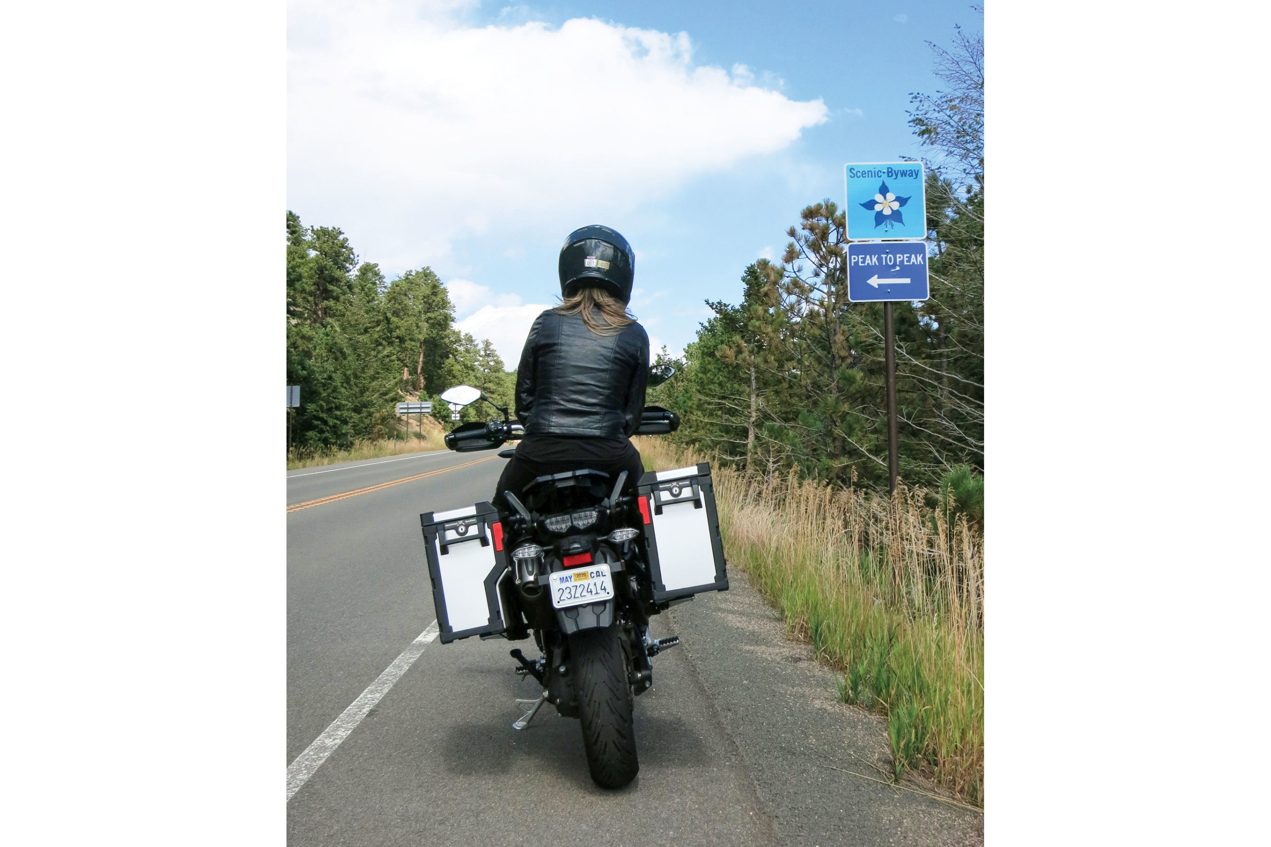
We approached Nederland, which marked the intersection of our figure-8 route. The quaint town is due west of Boulder and sits near the picturesque Barker Meadow Reservoir. After rolling through the town, we resumed our northern trek on the Peak to Peak Scenic Byway (State Route 72). The Peak to Peak is a famous ride in the Front Range of the Rocky Mountains that is considered one of the most beautiful stretches of road in the state.
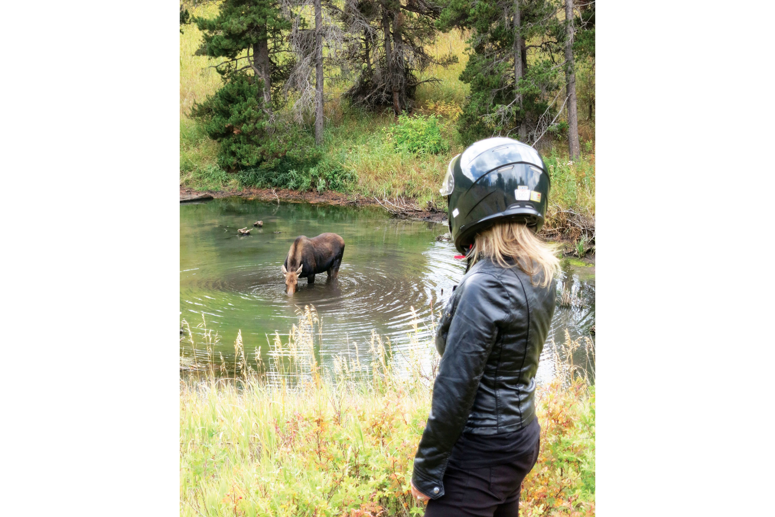
Not a dozen miles into this leg, I spotted something moving in the woods to my right. A moose was standing in the middle of a tiny pond drinking. As we parked the Yamaha and strolled to get a better vantage point, the creature raised its broad, dripping snout and regarded us with supreme disinterest. I did not blame her. After more motorists discovered what we were watching, the shoulder became an impromptu parking lot. It was time to head out.
Back on the bike, we continued the curvaceous route on the Peak to Peak toward Estes Park. Intermittent sprinkles met us along the way. There were patches of very wet tarmac, indicating that we had the good fortune of arriving just after a few downpours. It was becoming clear that, despite the rough winters in this region, the road condition was remarkably smooth and consistent.
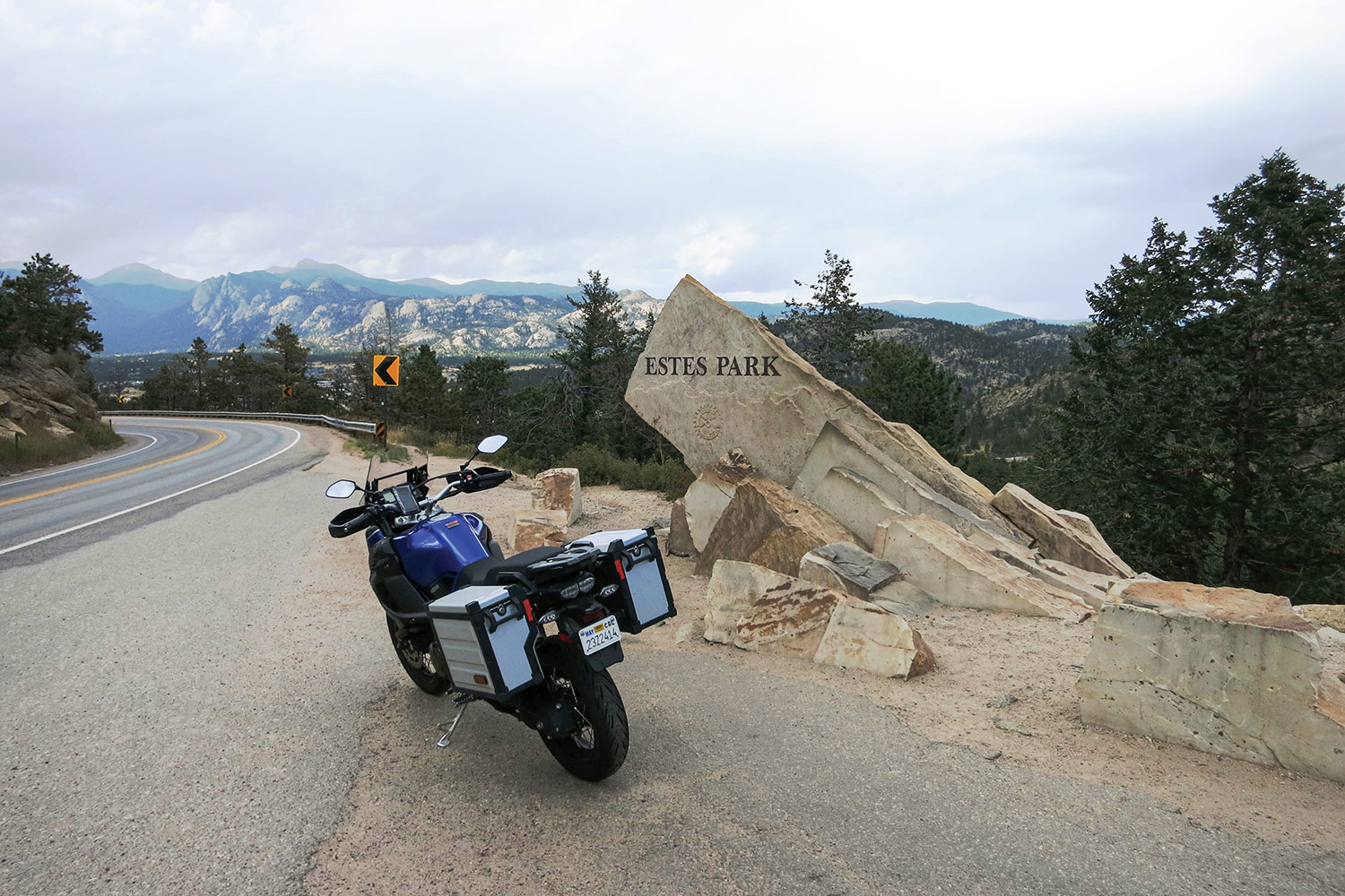
The Peak to Peak Scenic Byway lived up to its majestic reputation, and every mile was a joy. Mountain peaks flanked the road on both the near and far horizon. The long morning of riding had us more than ready for lunch as we rolled into the outskirts of Estes Park, which is the gateway to Rocky Mountain National Park and was bustling with tourist activity.
We pulled into the first diner we saw. After our patty melts arrived, the owner stopped by for a chat. When we told him about the moose sighting, he was genuinely impressed. He said we were in the middle of the elk rut, so seeing those behemoths butting heads would not be that unusual. However, he said that folks who had lived in the area for years have not seen the elusive moose. We felt uniquely lucky.

After finishing our lunch, we made a brief stop at the Stanley Hotel, a stately 140-room Colonial Revival hotel built in 1909. It was the inspiration for the Overlook Hotel in Stephen King’s 1977 novel The Shining and the 1980 film, and it served as a filming location for the 1997 TV miniseries. The Stanley was also the setting for the fictional Danbury Hotel in the 1994 film Dumb and Dumber. You can stay in the hotel, drop in for a tour, or pick up a variety of “REDRUM” souvenirs from the gift shop.
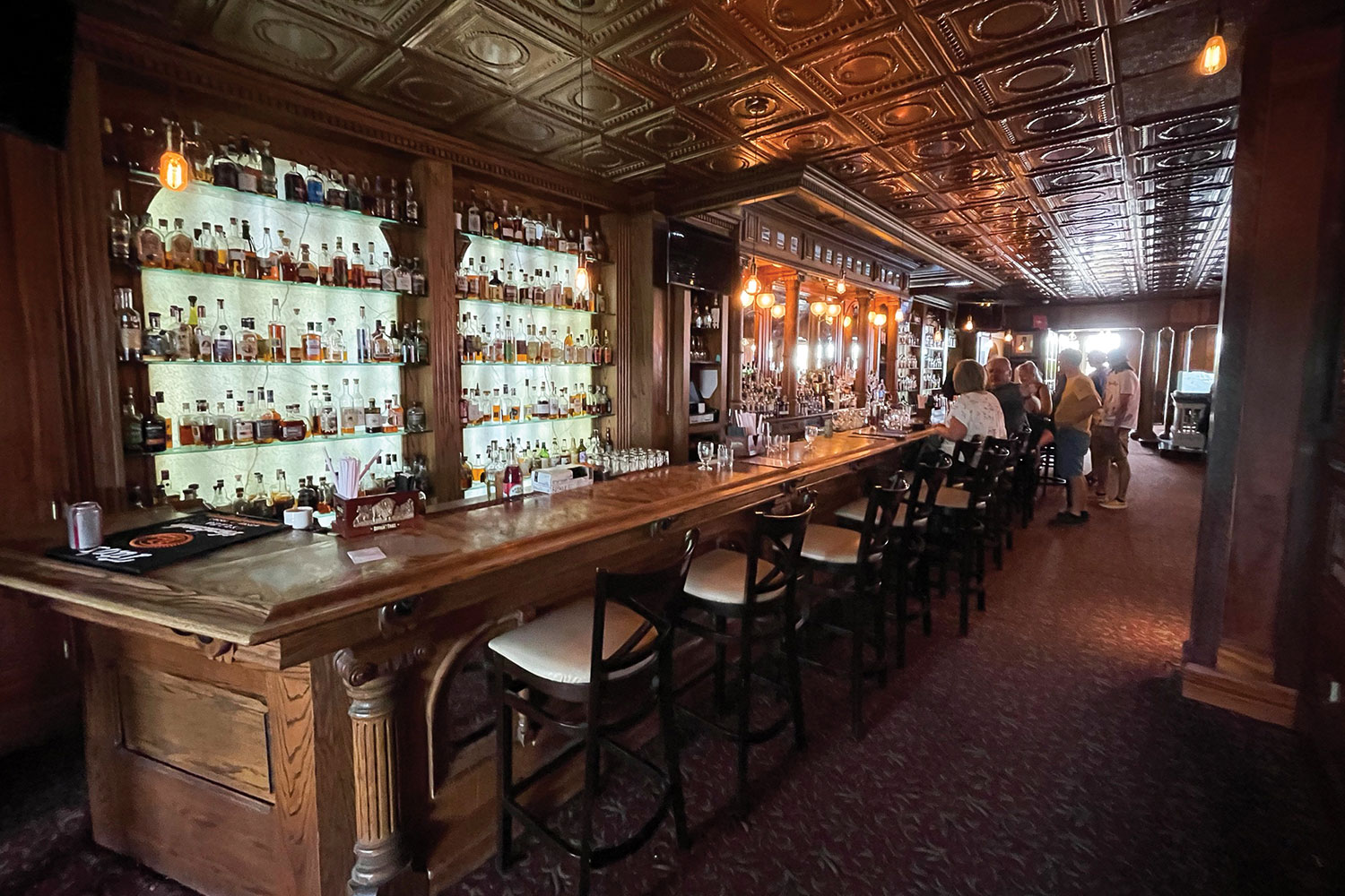
We could have spent the rest of the day in the Stanley’s historic lounge, which has an elegant carved wooden bar, a pressed-tin ceiling, and an impressive selection of whiskeys. But the road was calling, and it was time to finish our figure-8.
ESTES PARK TO BLACK HAWK
We rolled southeast out of Estes Park past a few golf courses and lush green hills. U.S. Route 36 proved to be another fantastic motorcycling road in the Front Range. Gray granite outcroppings laced with a variety of conifers lined the winding road. The riding was enjoyably devoid of traffic, and the threat of rain had thankfully subsided.
At the town of Lyons, U.S. 36 started the southern curve back toward the intersection of our figure-8. We were back in the grasslands and rolling hills for several beautiful miles, and then 36 straightened out on its southern line toward Boulder. Of course, the closer to the city that we got, the heavier the traffic became. When the 36 morphed into State Route 7, we were fully in the Boulder suburban area.
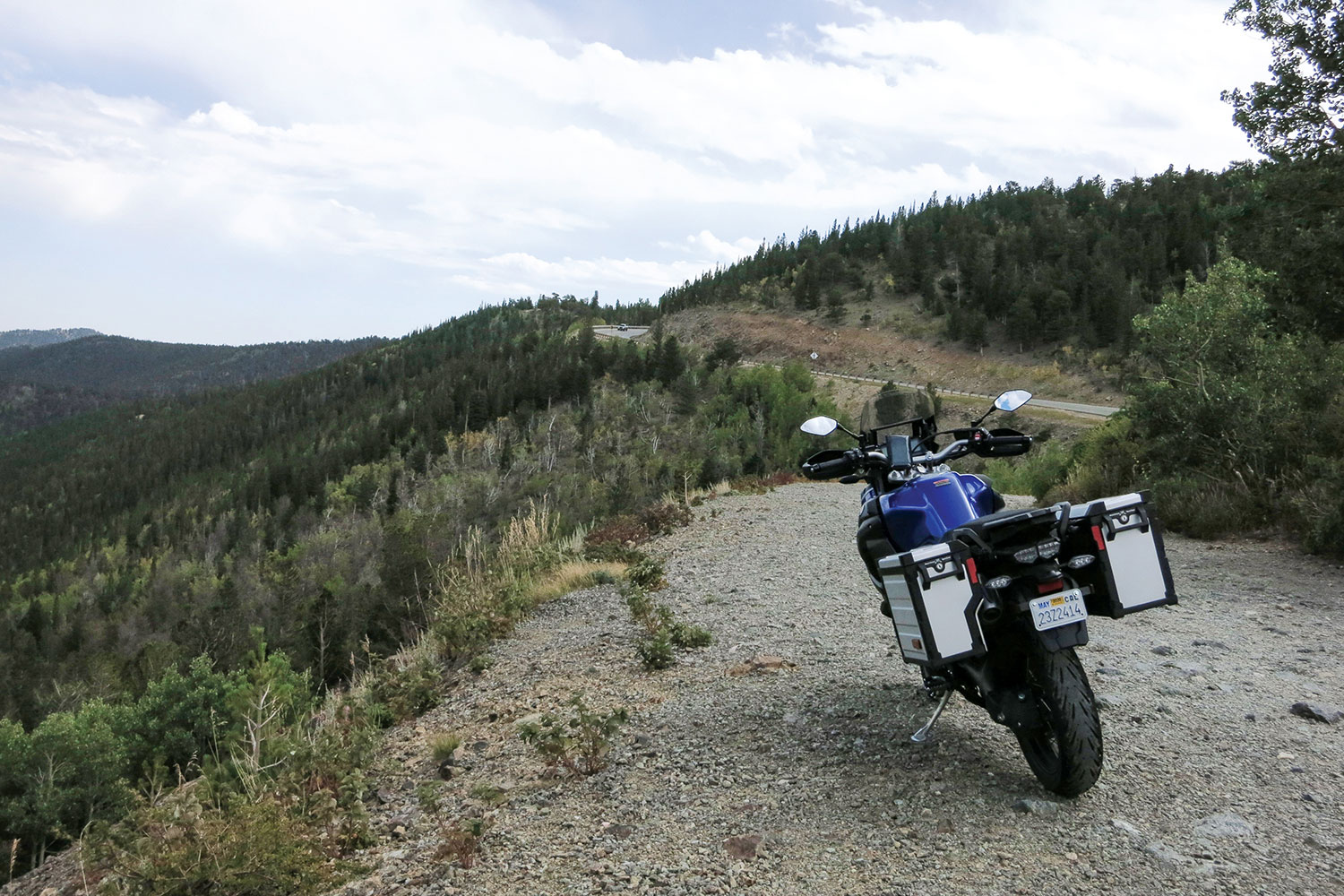
When we made the western turn onto Boulder Canyon Drive (State Route 119), we were more than ready to climb back into the foothills of the Rockies. When a motorcyclist hears the word “canyon” in a road’s name, it’s like music to ear-plugged ears. Again, the Front Range did not disappoint. The road snaked through tunnels, beside evergreen-lined rivers, and beneath gray rock formations on its route west. It is a truly spectacular motorcycle ride.
When we were approaching the now familiar town of Nederland, we rolled along the banks of the Barker Meadow Reservoir that we previously saw from a distance on the first half of the figure-8. South of Nederland, Route 119 took a decidedly southern bend toward our next planned stop. In our pre-ride mapping, we discovered a pair of historic gold mining towns that have since undergone a metamorphosis as gambling destinations.

We were greeted in Central City by historic buildings and narrow streets. Saloons, shops, and restored hotels graced the brick architecture. We saw the quaint and colorful history, but not the gambling, and that was just fine with us. We stopped at a brewpub on the town’s main street and had a nice chat with the bartender. The gregarious barkeep graced us with a few painfully corny jokes before answering our myriad questions about the town.
The treasure trove of local knowledge told us that the town of Central City and its close neighbor Black Hawk were hotbeds of the Gold Rush after a huge local gold strike in 1859. Later in the 1800s, the towns were connected to Denver by rail, and the boom continued. However, as they say, all good things must end, and the towns both declined with the dwindling of the mineral wealth in the 1900s.
After a few more wonderfully bad jokes, our raconteur brought us to the current state of the area. In the early 1990s, Colorado passed limited-stakes gaming in the state, and the tiny towns picked up on the idea. He said the towns have become the gambling heart of the state, accounting for nearly 90% of Colorado’s gaming revenue. Noticing our quizzical looks after scanning the small smattering of video poker machines and one-armed bandits in the pub, he said with a smile, “Wait until you ride south.”
The merry jokester was prophetic. As we left the quaint ambience of Central City, we rolled through a bit more history before it became clear. High-rise casinos and hotels rose like specters as we rounded a corner. The dichotomy that has been created in this area emerges most distinctly in the town of Black Hawk. Juxtaposed with 150-year-old brick buildings are massive, engineered tributes to modern man’s lust for a quick buck. The irony is more than evident. Gone are the starry-eyed miners, only to be replaced by glassy-eyed gamblers.
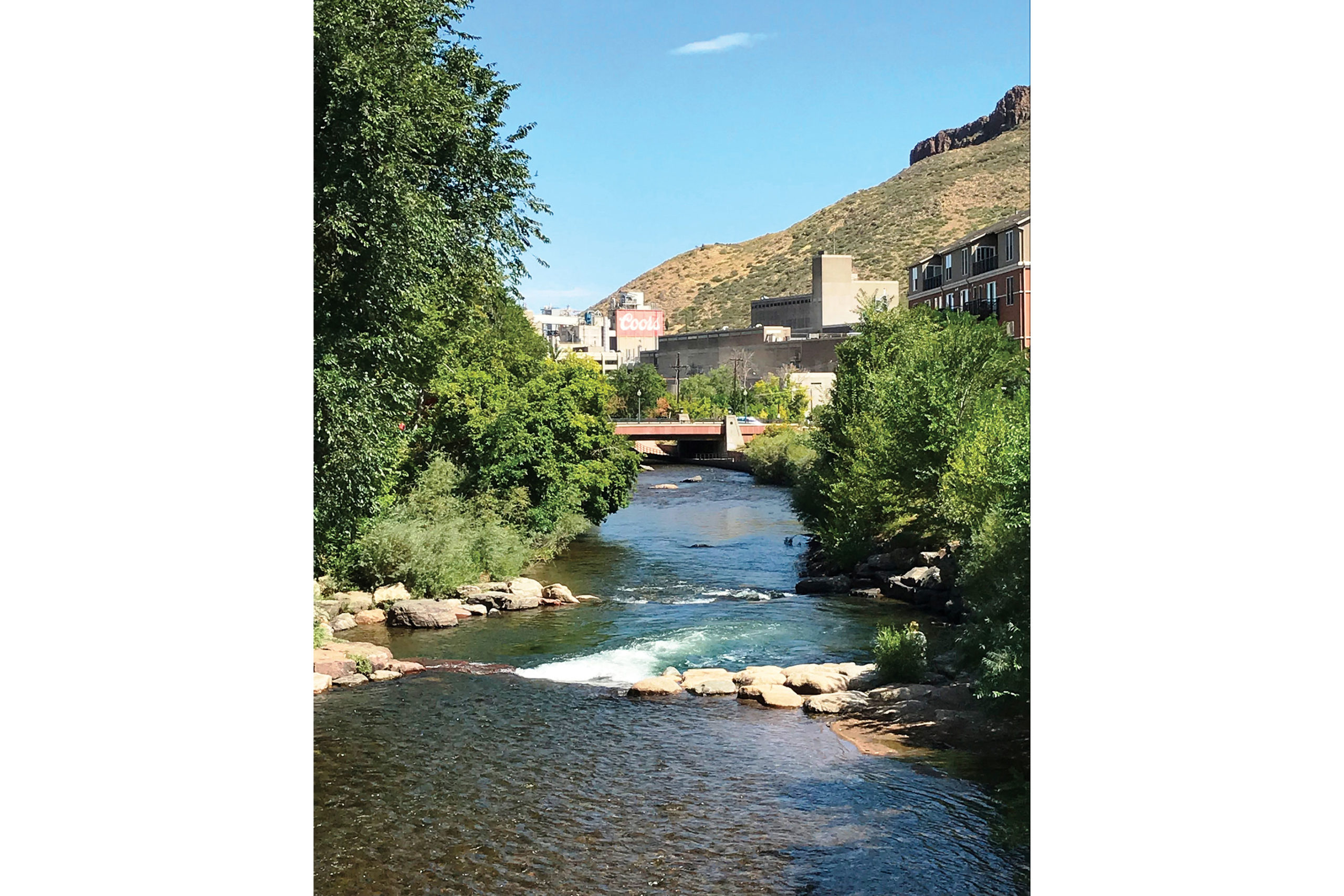
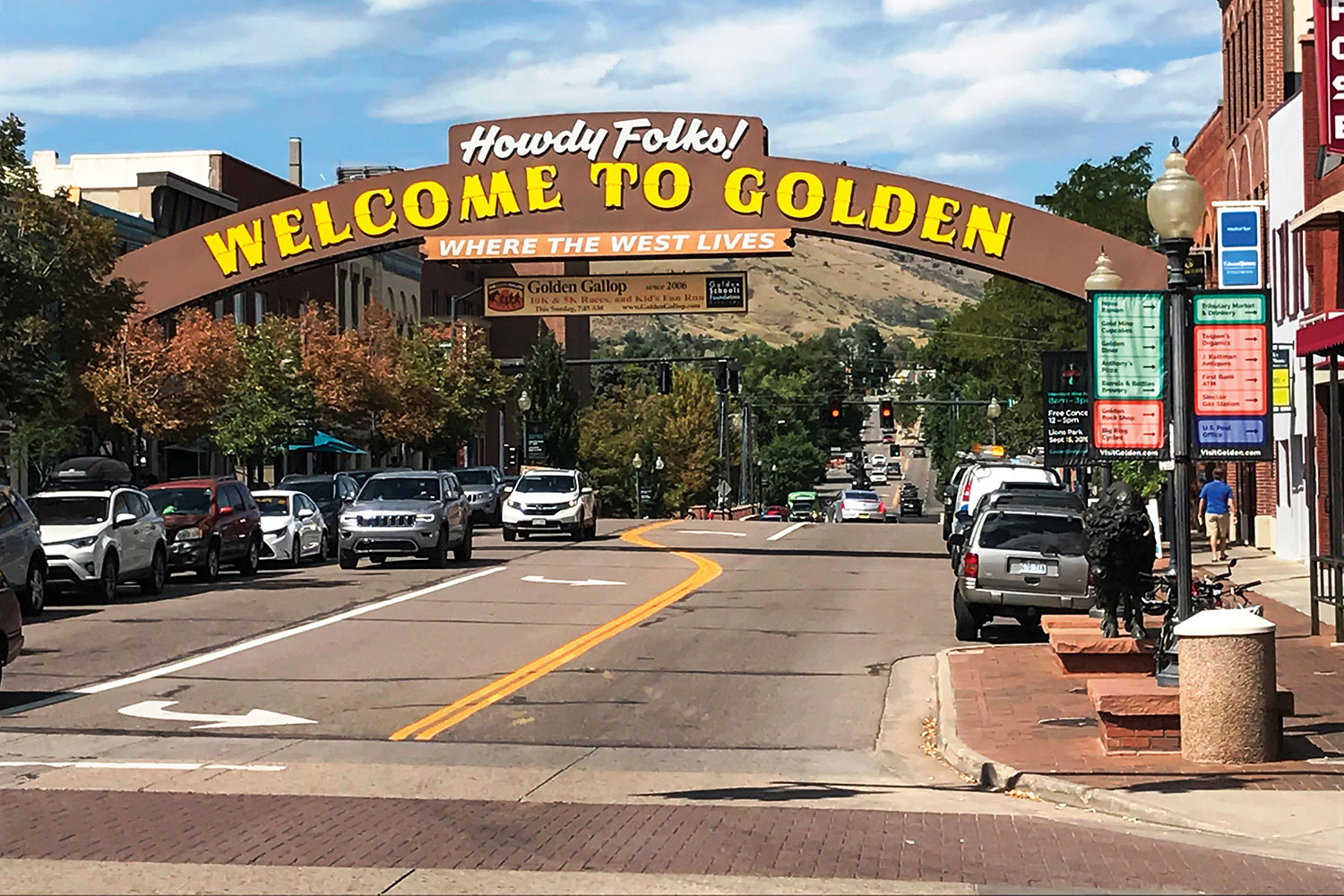
We motored out of the unlikely Rocky Mountain “Vegas” and back toward our starting point. The last portion of the ride was a great mix of all that we had experienced on the figure-8 ride into the Front Range. The road was smooth and well maintained, and the scenery was spectacular. We dropped from thick forest, to grassland, to the bustle of Golden.
While not a full exploration of the Colorado Rockies, our tour was a nice overview of the roads and ecosystems of the area. The 40-degree swing in temperatures and the varied precipitation on the ride made it clear that gear choice and preparedness is vital in the Rockies. Because of the elevation, this is strictly a late spring to early fall ride. That said, we would love to return for the spring bloom or the fall leaves to explore the Front Range further.


Tim, A great article. Well written and accurate. Having lived along State Highway 72 for decades, I have ridden all of your route many times and some “favorite” sections 100+ times on many different bikes. Yes, the Moose, Elk, and Deer are always a possible hazard on these roads, but very rewarding to see them feeding away from the roadway. Waiting for springtime and sand free roads to return to these fantastic routes.
I’m from Denver, and have done that ride a hundred times. It’s as good as you say it is. And no, I never saw a moose.
I too, have lived in the Front Range all my life and ridden these roads many times. Never have I seen a moose in this area, I usually see them in and around Walden. Consider it lucky of that sighting. I have read that the Peak To Peak highway was originally designed to go from Longs Peak to Pikes Peak. Financing problems caused the road to become what it is today. KHT
Highway 7 from Lyons is another gem. Just go left at the light, instead of following 36 to the right. Both ways end up in the town of Estes Park. The advantage of 7 during the summer is none of the tourist traffic going up 36 to Estes National Park.
And you can just take a left off Highway 7 at the Peak-To-Peak and avoid Estes crowds and go play in the 5 canyons. Don’t miss the canyon that’s 10 miles from my house, Lefthand/James Canyon. These road got heavily damaged in the 2013 Flood, and only got reopened a bit ago, so the pavement is pristine. Lots of corners.
Nice comment, Mountain Goat. Good write up, too. Magic country.