For many riders, especially those in northern states who must put away their bikes during winter, Daytona Bike Week kicks off the new riding season. Upwards of half a million motorcyclists come from far and wide to enjoy warm sun, sandy beaches, and the weeklong party in and around Daytona Beach.
For 10 days straight, major streets and hotel and restaurant parking lots are packed with motorcycles. Some are parked, some are cruising, many have loud pipes and even louder sound systems.
If you want to escape the Bike Week scene, or if you’re in the area the other 355 days a year, there’s a great ride just north of Daytona. It’s only 32 miles long, but it packs a lot of scenery.
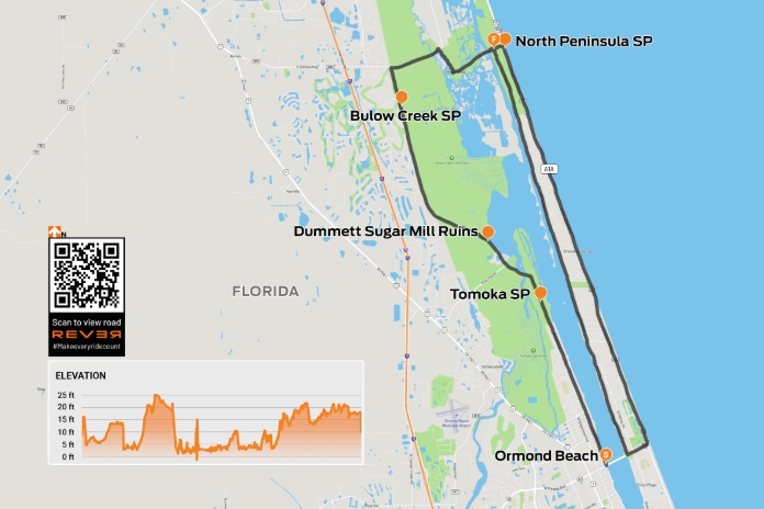
Scan QR code above or click here to view the route on REVER
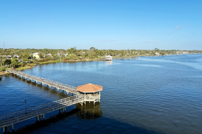
From the corner of Main Street and Atlantic Boulevard (State Route A1A/Jimmy Buffett Memorial Highway), head north for 5 miles to the city of Ormond Beach, turn left on Granada Boulevard, take the bridge over the Halifax River, and then immediately turn right on Beach Street. Pull into the parking lot at Bailey Riverbridge Gardens. Take a few minutes to enjoy the landscaped park built around a historic church and stroll out onto the pier to see boats on the river.
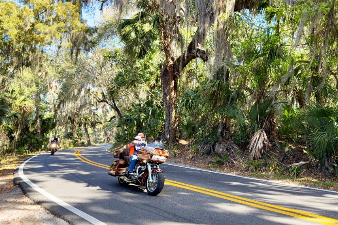
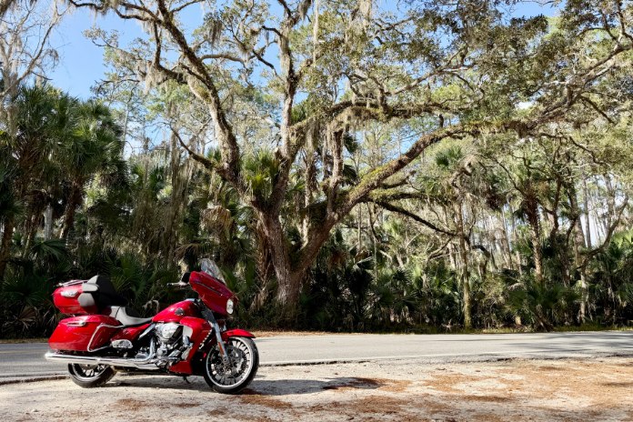
The junction of Granada Boulevard and Beach Street is the start of the Ormond Scenic Loop and Trail. The first 3 miles pass through a residential area, then the road plunges into a long, straight tunnel of trees. Majestic southern live oaks, their branches laden with Spanish moss, create a shaded canopy with dappled sunlight. Suddenly you’re in a different world, and if it’s early in the morning, you may have the road to yourself.
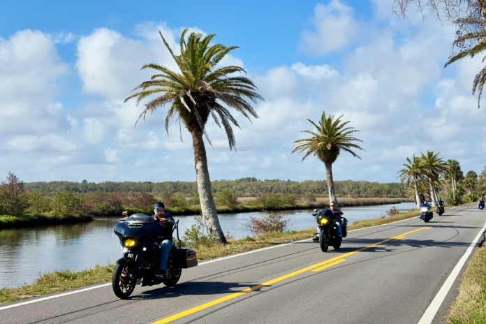
The road cuts through a wetlands area between the Tomoka and Halifax rivers. A mile into the tunnel of trees you’ll see the entrance for Tomoka State Park, a popular spot for birdwatching, fishing, boating, and hiking, and it has a campground with a well-stocked store.
After Tomoka State Park, you’ll encounter the first curve of the loop, bending gently to the left before a bridge crosses the Tomoka River. The view opens onto a broad area that’s part of the Tomoka Marsh Aquatic Preserve. At the junction with Pine Tree Drive, the road’s name changes to Old Dixie Highway. The next 5 miles were once part of a 1915-1929 network of auto trails that created a corridor connecting the upper Midwest to Miami.
After passing through a small residential area of big houses, the road gently curves its way through another tunnel of moss-heavy oaks. Slow down. Just ahead on the right is a small pullout for the Dummett Sugar Mill Ruins, the remains of a sugar and rum processing factory built in 1825.
Old Dixie Highway straightens out. You’ll pass the tomb for James Ormond II, who migrated to Florida in the early 1800s and ran a thriving plantation in the area. Then Bulow Creek State Park, which protects the largest stand of southern live oaks on Florida’s east coast.
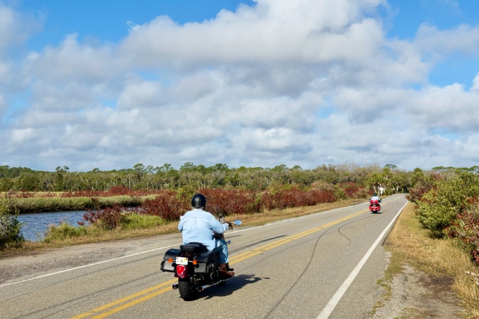
Turn right on Walter Boardman Lane and ride 1.2 miles through a dense tropical forest of oaks, pines, cypress, and palmetto. Make a sharp right onto High Bridge Road for the curviest section of the entire loop, which lasts for a little over a half mile. Most of High Bridge Road runs alongside Bulow Creek and feels a world away from the hustle and bustle of Bike Week.
After crossing over the Halifax River again, turn right on John Anderson Drive. The first 1.5 miles are through more undeveloped land, then the next 7.5 miles go through a residential area with houses of all shapes and sizes. Some facing the river are mansions that would make Tony Montana proud.
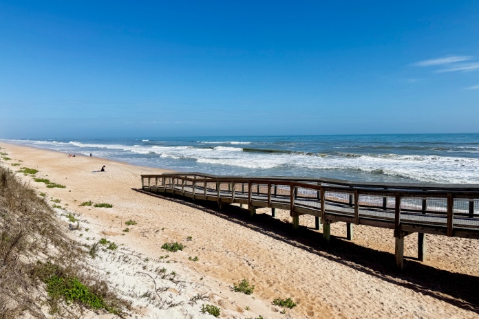
Turn left on Granada Boulevard, ride east for a half mile, and turn left on Ocean Shore Boulevard (Route A1A). Now you’re heading north along the Atlantic coast. For the first few miles houses and condos block your view, but once you reach Al Weeks Sr. North Shore Park, the next 5.7 miles give you an unobstructed ocean view. Welcome to paradise!
At the junction with High Bridge Road, there’s a beach access parking area on the right. Go ahead, get your toes wet. If you turn left on High Bridge, in 0.2 mile you will have completed the loop. You can continue riding west and enjoy the marsh and woodlands scenery in reverse. Or you can hightail it south and rejoin the festivities at Bike Week.
See all of Rider‘s touring stories here.