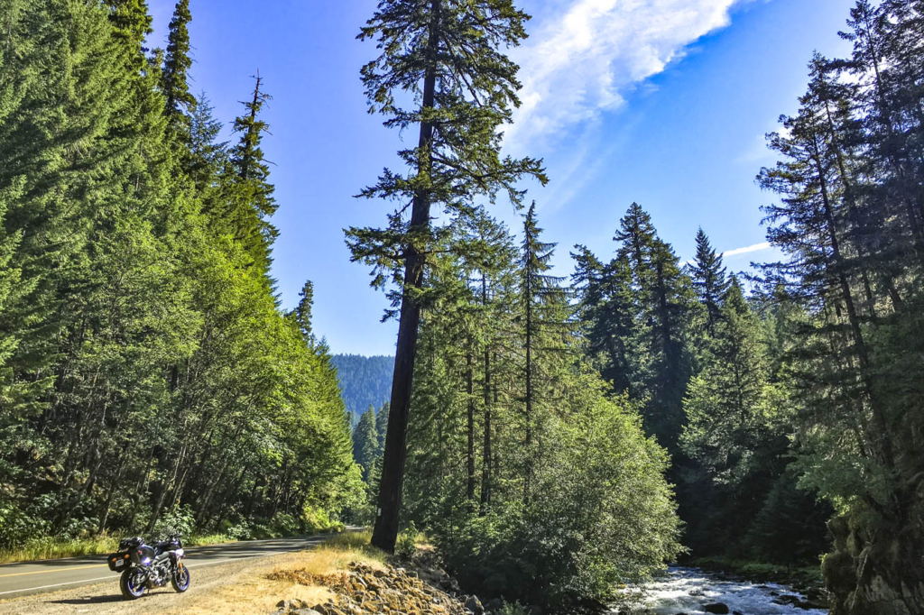
Winding through a dark canopy of evergreens, the road played hide-and-seek with the Clackamas River, offering a glimpse here and there of clear water pouring over rocks as it made its way downstream to the Willamette, then the Columbia, and finally the Pacific. A break in the canopy was like popping out of a tunnel and I set my eyes on a patch of gravel next to the road, just a few feet from where the river made a sharp turn. Down went the Yamaha Tracer 900 GT kickstand, off went the ignition. I hadn’t seen a car for miles. It was just me and the trees and the river. Just what I was looking for.
The previous day I logged 250 miles aboard the Yamaha at the bike’s press launch. The event was based in Stevenson, Washington, a small town in the heart of the Columbia River Gorge National Scenic Area, and I spent a long, hot day testing the GT on local backroads. Weighing just 500 pounds and packing a punch from its 847cc inline-Triple, the Tracer 900 GT is a light, agile, comfortable sport-tourer, perfect for a solo traveler. Yamaha entrusted me with the keys to one for the long ride home to Southern California.
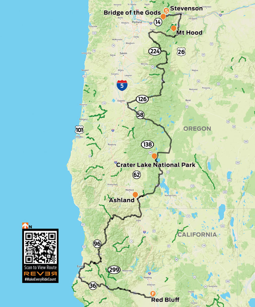
For years I’ve heard and read about how good the riding is in the Cascades, a mountain range that runs from British Columbia down through Washington and Oregon to Northern California. Whenever possible, I like to fill in the blank spots on my mental map –to experience first-hand what roads and scenery are really like. So I sketched out a route from the Columbia River to the California border that zigzags several times over the Cascades, winds its way through four national forests and one national park, and follows three designated scenic byways. Like any good motorcycle route, it would take at least twice as long as a more direct path.
Click here to view the route above on the REVER app/website
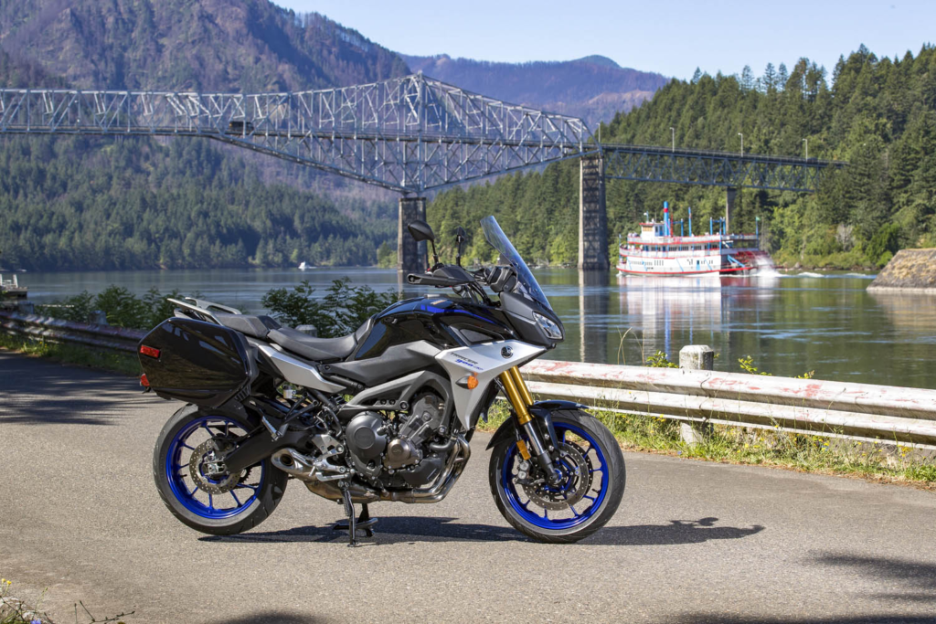
With the GT’s saddlebags packed and a tailbag strapped to the passenger seat, I hit the road at 6 a.m., crossing the mighty Columbia – and into Oregon – on the Bridge of the Gods, a steel truss bridge named after a natural dam that was created by a landslide at the same location nearly 1,000 years ago. The narrow, 90-year-old bridge has no pedestrian walkway, but it’s where the Pacific Crest Trail crosses the river, so weary hikers with heavy packs must contend with cars and trucks.
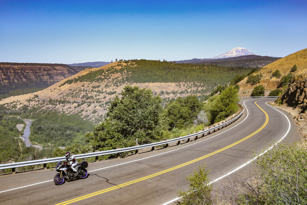
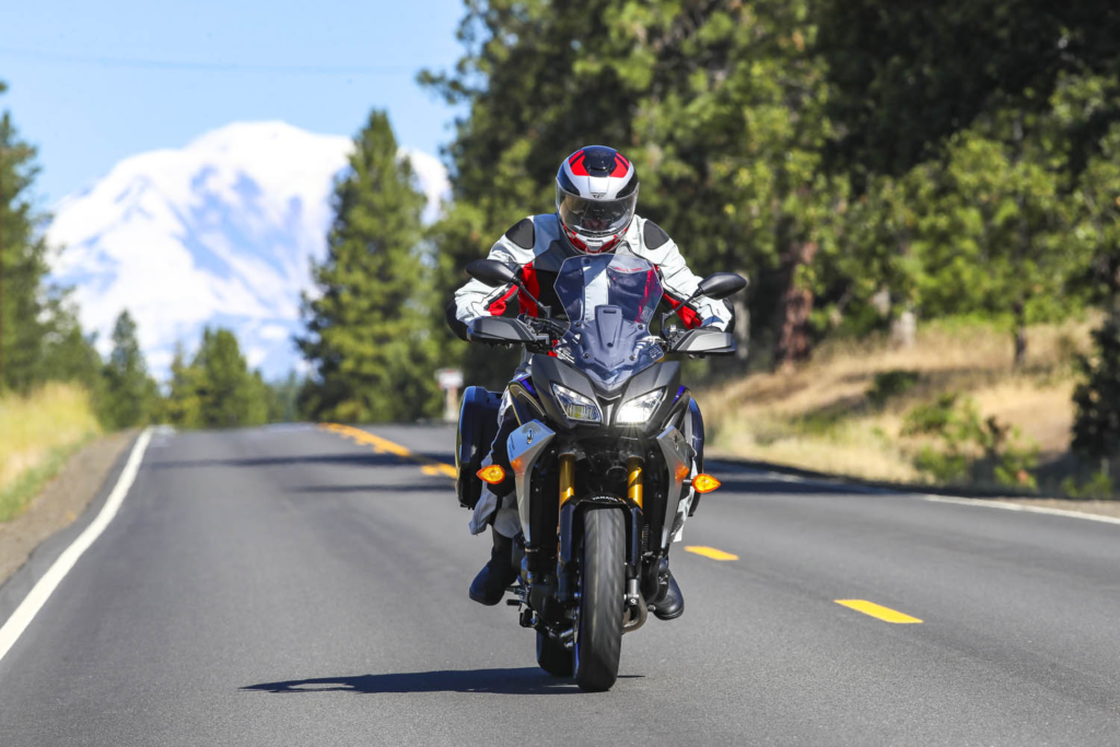
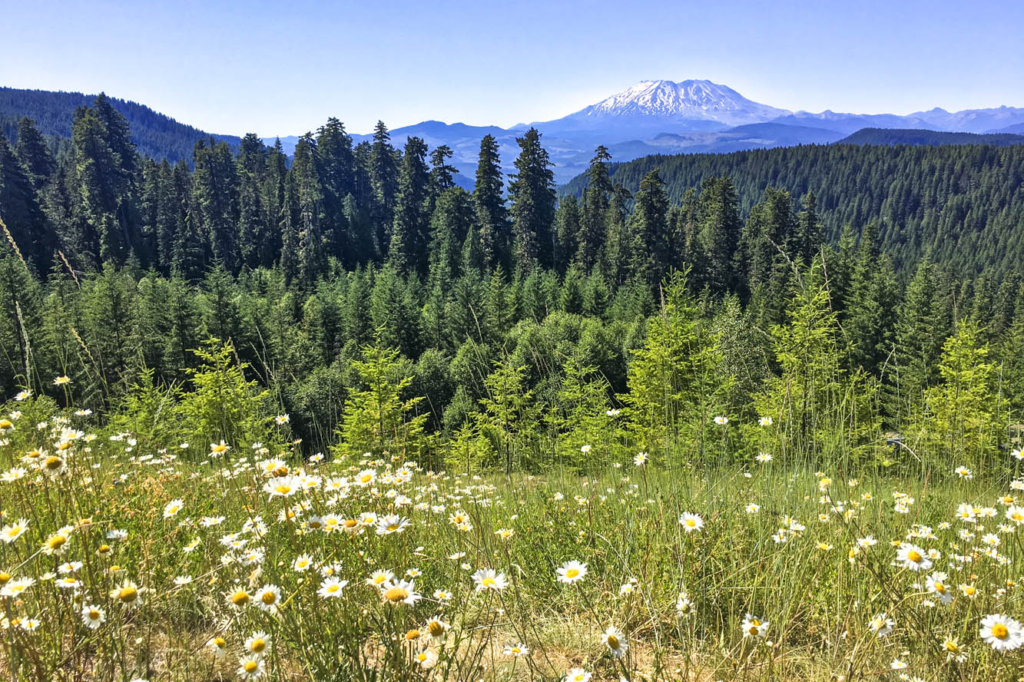
What makes the Cascades special is its many stratovolcanoes –the cone-shaped variety we learned about in grade school –that rise thousands of feet above the surrounding mountains. I’ve ridden along the eastern side of the Sierra Nevada in California dozens of times, and every time I pass through the town of Lone Pine, I struggle to pick out Mount Whitney – the tallest mountain in the lower 48 states – from the neighboring peaks that are nearly as tall. On the Tracer 900 GT press ride we saw several volcanic peaks, Mount Adams (12,281 feet) and Mount St. Helens (8,363 feet – before it blew its top in 1980, it was 1,300 feet taller) in Washington, and Mount Hood (11,249 feet) in Oregon, standing head and shoulders above the landscape, easily visible from miles away. They’re part of the Cascade Volcanic Arc, a series of 12 volcanoes stretching from Mount Silverthorne in British Columbia to Mount Lassen in California, which is part of the Pacific Ring of Fire –more than 450 volcanoes scattered along the outer edge of the Pacific Ocean.
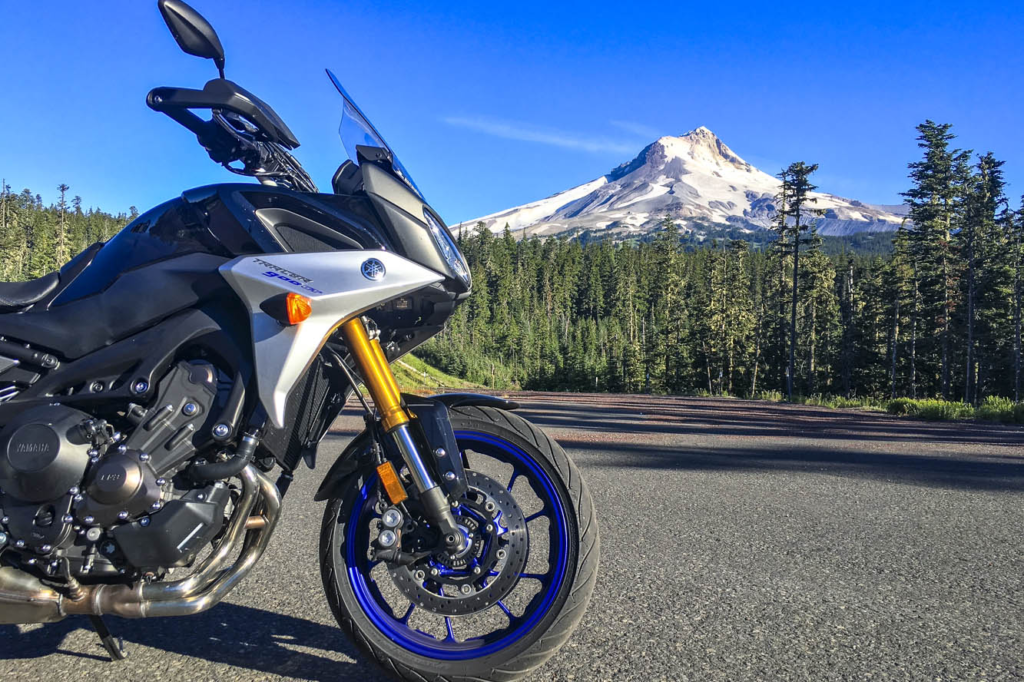
Like a good omen, snow-covered Mount Hood greeted me as I turned south on State Route 35, the beginning of Mount Hood Scenic Byway, where I rode through apple farms on a sunny, cloudless July morning. The previous day topped out at 105 degrees, and the heat wave wasn’t done with me, but early in the morning the byway along the East Fork Hood River was still in deep shadow and my teeth began to chatter. On went the heated grips, and I tried to hold onto the physical memory ofbeing cold, hoping to recall that feeling during theheat of the day (it never works). With graceful curves and smooth pavement, the byway is a pleasure to ride, especially when the screen of trees falls away and Mount Hood takes center stage, framed perfectly in brilliant blue.

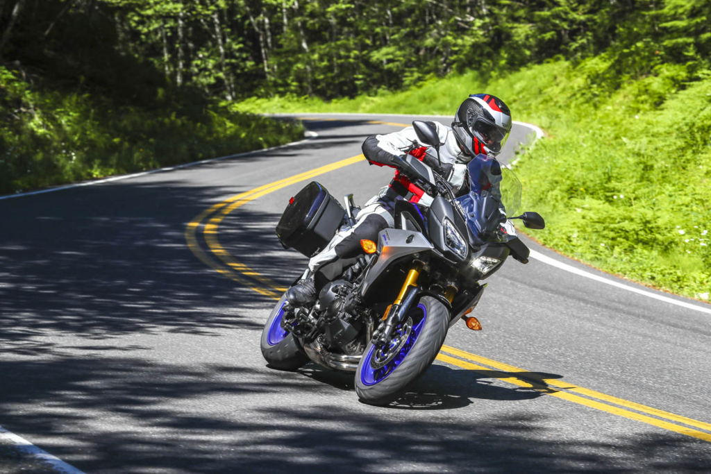
After cutting a wide arc around the eastern and southern sides of Mount Hood, my first crossing of the Cascades came to an end in Sandy. Turning south and then east on State Routes 211 and 224, I picked up the West Cascades Scenic Byway, heading southeast along Estacada Lake and North Fork Reservoir, two finger lakes created by dams on lower sections of the Clackamas River. As the byway crosses into Mount Hood National Forest, it enters a deep, narrow valley as it climbs up into the Cascades, where the Clackamas flows wild and free. The Tracer and I were in a groove, experiencing this road together for the first time –bends, kinks, dips, rises, bridges, blind corners, and fleeting views of the river, the contours of which give the road its character.
With the low-fuel light on, I pulled into Detroit, a crossroads on the shore of Detroit Lake. Folks were starting their summer weekend early. Subarus laden with kayaks and pickups overflowing with camping gear were parked in lots, coolers were being filled with ice and beer. I refueled and scarfed an egg salad sandwich in the shadow of Rivers Run Deli, trying to stay cool while enjoying a view of the marina and the lake’s milky blue water. When traveling solo and covering a lot of miles in just a few days, I rarely stop for long. Just a few minutes here and there, then I’m back in the saddle, trying to cram 10 pounds of riding into a 5-pound sack.
From Detroit to Chemult – south, zig west, zag east, back over the Cascades –all I remember are trees, and a cross-section of America. Stopping to use the bathroom at a McDonald’s, I had to negotiate my way through a crowd of boisterous kids wearing matching blue T-shirts bearing the name of their church summer camp, ready to fill their bellies with Happy Meals. Outside, two young women were sitting on the curb, holding a sign: Family in Need. And next door I topped off the Tracer’s tank after the flirtatious – not to mention bald and tattooed – gas station attendant handed me the nozzle. (In Oregon and New Jersey, you’re not allowed to pump your own gas, but attendants often let motorcyclists break the law.) I was just passing through, little more than an observer. Experiences like these give me something to mentally chew on while ticking off miles.
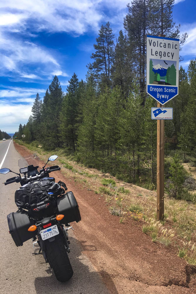
Passing through Chemult, a truck stop on U.S. Route 97 brought back memories of stopping there to refuel during my one and only SaddleSore 1000 ride back in 2013 – a very long day that I’m not likely to repeat. Turning west on State Route 138, the Volcanic Legacy Scenic Byway took me to Crater Lake National Park, where I queued up behind a rumbling Harley and a line of cars and RVs outside the northern gate, keeping my faceshield closed to prevent the army of mosquitos from waging war on my nose. Crater Lake was high on my list of must-see places, and it didn’t disappoint. Created thousands of years ago when a volcano collapsed, the caldera lake is nearly 2,000 feet deep – the deepest in the U.S. – and because it is filled only by rain and snow, the water is pure and a brilliant shade of blue. But I was pressed for time and there were construction delays on the East Rim Road, so I’ll have to go back to ride the full loop.
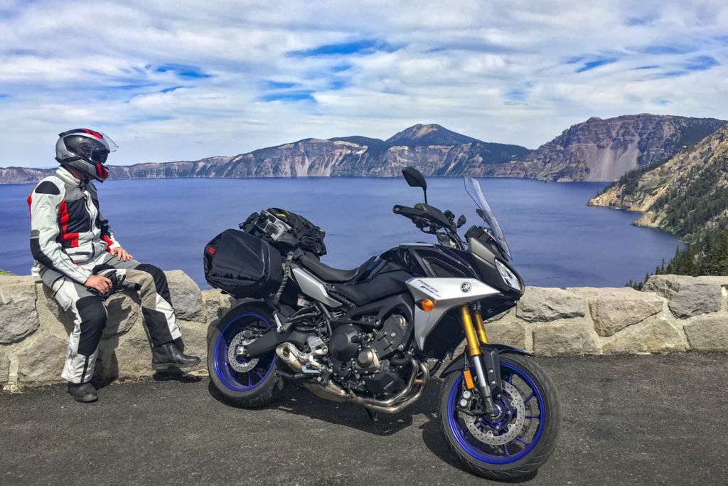
On the not-politically-correct but wonderfully twisty Dead Indian Road, I descended from the green heaven of the Cascades into the dry, brown hell of Ashland. It’s actually a lovely little town, home to Southern Oregon University and the world-famous Oregon Shakespeare Festival, but it was over 100 degrees and I had been in the saddle for 12 hours. I was in desperate need of a cold shower, a colder beer, and some pizza.
The next day I left the Cascades, riding a few miles south on Interstate 5 into California, where I filled up at a Chevron in Hornbrook. On both sides of the interstate and all around the gas station, the ground and vegetation were charred black from the Klamathon Fire, which roared through just days earlier. It was one of many wildfires that would plague California and other western states in the weeks and months ahead.
More blanks filled in on my mental map: State Route 96 along the Klamath and Trinity rivers, which cuts through rugged, remote country. In 1941, a group of armed men stopped traffic near the town of Yreka, handing out a Proclamation of Independence for the State of Jefferson, which was in “patriotic rebellion against the States of California and Oregon.” Although the new state never materialized, the movement is still active, and the State of Jefferson Scenic Byway runs along Route 96 from State Route 263 to Happy Camp. After that, 96 becomes the Bigfoot Scenic Byway. Regardless of one’s views on state politics or mythical forest dwellers, the riding along Route 96 is sublime and traffic is almost nonexistent.
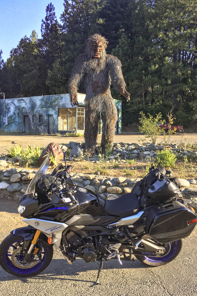
At Willow Creek, I turned west onto State Route 299, known as the Trinity Heritage Scenic Byway because it follows the path of 19th-century gold miners and pioneers. It snakes its way through the heavily wooded Trinity Alps and climbs over a pass before making a long descent to the coast. Even in mid-July, U.S. Route 101 through Arcata, Eureka, and Fortuna was socked in with chilly fog. At Alton, I turned east again, heading inland on State Route 36 –not a designated scenic byway, but known as Serpent to the Sea. Traveling west-to-east, it passes through a few rural communities before entering Grizzly Creek Redwoods State Park, where enormous coast redwoods rise hundreds of feet above the roadside.
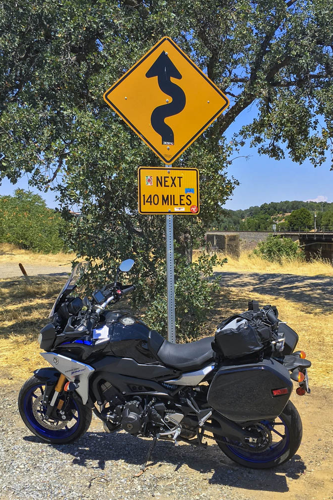
Beyond Bridgeville, Route 36 turns into a narrow goat path as it goes over a ridge, but it’s currently being straightened and widened to accommodate big trucks and RVs –an improvement for them but not for motorcyclists. East of Dinsmore, Route 36 was freshly paved, like having a racetrack all to myself, scraping the Tracer’s peg feelers in corner after corner. And on it goes, over more mountains with endless curves and finally roller-coastering its way through ranch land with blind crests and sudden drops and quick turns. As I approached the town of Red Bluff, just before Route 36 crosses I-5, I found the well-known sign that warns motorists and entices motorcyclists: curvy roads next 140 miles.
The thing about riding roads as good as these is that it becomes addictive. Now that I have experienced the Cascades and California Routes 96 and 36 for myself, all I want to do is go back for more.



Sadly, I don’t even read articles about bikes until I flip to the specs and check the seat height. Really, 33.5 inches for the 900 GT??? And thus the bike is immediately off my list for consideration. When that happens, I usually don’t even read the article if it’s a technical article about the bike (why read about a bike that I won’t ever buy?) I did read this one since it was more about the ride (good article!), but c’mon manufacturers, a lot of us guys and a whole lot of women riders don’t fit these tall bikes safely. It appears this is a nice light touring bike, but alas, it will never grace my garage.
Hey, Jim. I have a 30″ inseam and can flat-foot my 2020 Tracer 900GT. The bike has a narrow waist. In the unlikely event you can even find one at a dealership, swing a leg over it. I really like this bike and it has many improvements over the FJ-09.
I have a 2019 Tracer GT that just turned 20,000 miles. My inseam is 31″ and I am comfortably able to have both feet on the ground. Took it to Arkansas from Florida with a stop at the Barber Museum in Leeds, AL. I ‘Iron Butted’ back home a distance of 972 miles (I did a saddle sore for membership years ago) and the bike was flawless. It’s a fun sporty bike that I think is one of the best that I’ve owned.