Planetary alignment, good fortune and luck helped me complete a SaddleSore 1000—riding at least 1,000 miles in less than 24 hours. The previous day (Friday) I completed Route 5 of the Oregon Backcountry Discovery Route, a multi-day dual-sport ride and camping trip from California to Washington, mostly through national forests. At the end of the OBDR, one of my riding buddies was headed to Calgary and the other to Seattle, leaving me on my own to travel back home to Southern California. Needing to be back at work on Monday morning, I wanted a day to recover from my weeklong trip. One long Saturday in the saddle would give me Sunday to recover.
What I also had going for me was a comfortable, middleweight adventure bike with good wind protection and a 6.3-gallon fuel tank—good for 225-250 miles between fill ups. Also, there’s no shortcut between Walla Walla and Ventura—it’s well over 1,000 miles no matter what route you take.
Friday, August 23, 10:00pm
After arriving in Walla Walla around four in the afternoon, I take a quick dip in the pool followed by a long shower, and then I prep the GSA for my ride home. Air up the tires, lube the chain, check everything over. Since I need a start witness and a gas receipt at the start of my SaddleSore 1000 (for official verification by the Iron Butt Association), I don’t fill up the tank. After dinner with my buddies to celebrate our successful completion of the Oregon Backcountry Discovery Route, I pack all of my gear and get to bed early.
Saturday, August 24, 3:56am
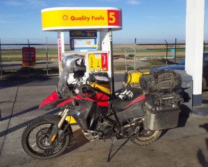
Up just before my alarm, quick shower, coffee in the hotel room, quick breakfast of trail food (energy bar, almonds, chocolate), then pack the bike. I ride next door to the Conoco station to fill up. What?! My gas receipt erroneously says 2:07am. Ugh. Back to the hotel, knock on Marten’s door, have him sign my witness form at 4:30am, back down to the bike, reset the GPS trip computer, take a quick photo—GPS clock says 4:37am. On my way to U.S. Route 12, which will take me west toward the Columbia River, I stop at a Chevron and put 23 cents worth of gas into the BMW’s already-full tank so I’ll have a proper start time receipt (4:41am).
Still dark, so I ride below the speed limit, mindful of creatures or other surprises lurking on or near the road. Not much illumination in front—is the headlight burned out? Pull over to check it out, find that all of the bouncing around on the OBDR knocked the headlight out of position. Get it pointed in the right direction; with the fog lights on too, there’s now a wide beam of light ahead of me.
Oh man, Mother Nature wants her coffee back. Time to pull over again. Geez, at this rate, I’ll never make it. Quick roadside pit stop, almost trip over a downed barbed wire fence, back on the bike.
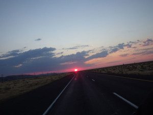
The sky starts to lighten around 5:30am, been on the road just under an hour, nasty crosswinds as I turn onto U.S. Route 730 along the Columbia River. South on I-82 at Umatilla, then west on I-84/U.S. 30. My camera is tethered to my backpack, so I pull it out and snap a quick shot of the sunrise behind me. Stunning morning, with big windmills turning, clouds turning pink and orange, the mighty Columbia to my right and—what’s that?—my guess is that the snow-capped peak in the distance is Mt. Hood.
Saturday, August 24, 7:01am
Exiting I-84 at the Sam Hill Memorial Bridge, I turn south on U.S. Route 97, where I pass a sign that says “Journey Through Time Scenic Byway,” and then another: “Next Gas 94 Miles.” Only 140 miles on the tripmeter, I should be able to make it, but severe range anxiety and possibly running out of gas while in the boonies doesn’t sound like much fun.
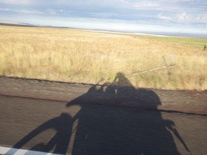
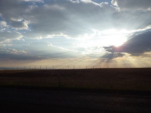
Quick U-turn, another quick roadside pit stop (dang coffee!), back about a mile to the Shell station. Add 3.224 gallons with 141.2 miles on the tripmeter, averaging 43.8 mpg (good for 276 miles with 6.3 gallons of fuel) and just under 61 mph. Back on the road, up through the sculpted canyon, come out atop rolling wheat fields, the crop having been recently harvested. More windmills, sun higher in the sky but tucked behind clouds, projecting a halo of rays and creating a moving shadow of the bike and me to the right.
With beautiful early-morning views and passing through charming, frozen-in-time towns like Moro, Grass Valley and Shaniko, one of the challenges on this ride—other than my bladder—is to resist the urge to stop and take photos. As U.S. 97 turns west and heads down into a valley, I can see three snow-capped cinder cones spaced out along the horizon. I grit my teeth as I pass a scenic pullout with a sign saying “Mountain Identifier”—I’ll just have to wait until I get home to can Google their names (they turn out to be Mt. Hood, Mt. Rainier and Mt. Saint Helens).
Saturday, August 24, 10:20am
After passing through the towns of Madras, Redmond and Bend, U.S. 97 enters the Deschutes National Forest and passes by the Newberry Volcanic National Monument. More stuff I’ll have to come back and see another time. Traffic is heavier but still not bad, moving swiftly. In the heart of the national forest, I stop in the unincorporated hamlet of Chemult to fill up at a Chevron. Another 4.119 gallons, 196.0 miles since my last fill up, with over three hours in the saddle. Except for a few yawns around 9:00am, I feel alert, awake and I’m enjoying the ride. But with so many miles to cover, I stay vigilant, constantly checking in with myself.
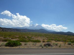
Gas, bathroom, Clif bar, a few sips from the hydration bladder in my backpack, quickly check the bike over, quick text to my fiancée. Back on the road in less than 10 minutes. Continuing south, I pass the turn for Crater Lake (never been), then along the edge of Upper Klamath Lake, then through the town of Klamath Falls, and on to the California border. Butte Valley National Grassland, then Shasta-Trinity National Forests, with Mt. Shasta in the distance, its volcanic peak hidden behind clouds.
At the town of Weed (hehe), I turn onto Interstate 5, which will take me the entire length of the Central Valley and most of the way home. Down through the national forest, past Castle Crags and over Lake Shasta (more places I’ve never been), then down, down, down to the valley floor. The temperature, which has been in the 50s-70s all morning, climbs into the 80s. The landscape changes from green to golden brown, and the road straightens out. When my knees get sore, I stretch my legs by resting my calves on the engine guards. I move around often to keep my back loose and to prevent sore spots on my bum.
Saturday, August 24, 2:25pm
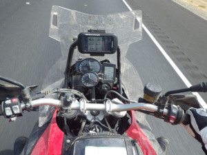
Another fill up, this time 5.422 gallons with 252.2 miles on the odometer and just over four hours since my last stop. Bathroom break, Gatorade and a Snickers, stretch my back and legs, back on the road. I’m concerned that I’ll hit a wall at some point, that fatigue will set in or the heat will create a barrier as formidable as the wind, but I have some special road mojo today. I’m focused, I’m a man on a mission. I check the GPS trip computer regularly and do math in my head. I don’t need music; I have my own rhythm.
Pass through Sacramento, California’s state capital and the largest city on my route, but keep a good pace. Unpredictable variables like traffic and construction delays are not an issue. After riding across the flat valley floor near sea level, I-5 climbs into the parched-grass foothills on the western edge of the San Joaquin Valley.
I start obsessing over the GPS trip computer, which has numbers going in opposite directions: miles since start and miles to destination. As the latter number works its way down, it seems to take forever to break through the 300-mile barrier. For some reason, I tell myself, if I can get to the last 300 miles, I’m home free.
Saturday, August 24, 5:58pm
Low-fuel light at 223 miles, another fill up near Los Banos with 235.2 miles on the tripmeter. Three and a half hours since my last stop, and only 260 miles to go. I’m in a groove, I’m gonna make it.
Sunset, then a sign as I approach Bakersfield warning of dusty conditions for the next 40 miles. The stench of cattle feed lots is overpowering, and my windscreen and face shield accumulate bugs at an accelerated rate. It’s still 90 degrees outside. Worst section of the trip.
Exit at State Route 223, Bear Mountain Road. GPS odometer says 997.3 miles. I want a photo of the GPS when it says exactly 1,000.0 miles, so I ride down the road aways, U-turn, and ride back to the freeway. I did it! Now I just need to get home. A few pieces of candy for energy, a quick text home, back on the road.
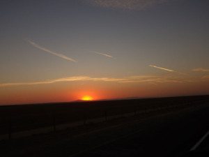
As I-5 climbs to 4,160-foot Tejon Pass over a section known as the Grapevine, the temperature drops into the 70s. I know this stretch of road well, I’m a horse nearing the barn.
Saturday, August 24, 10:03pm
Past Castaic, I turn onto State Route 126 west. Crossing the Ventura County line, I beep my horn to celebrate, then again at the Ventura city limits. On to U.S. Route 101 for a few miles, exit at California Street, last fill up at Chevron.
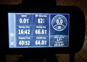
I put my kickstand down at home at 10:12pm. Final GPS reading: 1,113.6 miles. In the saddle and moving for 16 hours, 42 minutes, total stopped time was less than one hour. Google Maps put the distance at 1,105 miles. According to the odometer on the 2014 BMW F 800 Adventure, I had logged 1,088 miles, but no matter how you slice it, I completed a SaddleSore 1000, though it won’t be official until my forms and documentation are approved by the Iron Butt Association.
Why ride 1,000 miles in one day? I did it because I wanted to get home and just to see if I could. I did it to check the box, to get my official IBA certificate, pin and license plate frame that says “World’s Toughest Riders.”
Will I do it again? With so much great scenery that I wasn’t able to stop and appreciate, with so many vistas that went by in a blur, probably not anytime soon.



I appreciate you sharing your thoughts as you went through this. I’ve wanted to try a saddlesore but have been intimidated by the internal process more than the technical ones. Great article, fellow trip log obsesser!
Congrats on completing an SS1000. Did my first and perhaps only one recently. Now time to send in the paperwork.
My hats off to you if that’s a stock seat.
Congrats on the SS1000. Did a BBG (1500 miles in 24 hours) but would never consider doing it with a stock BMW seat.