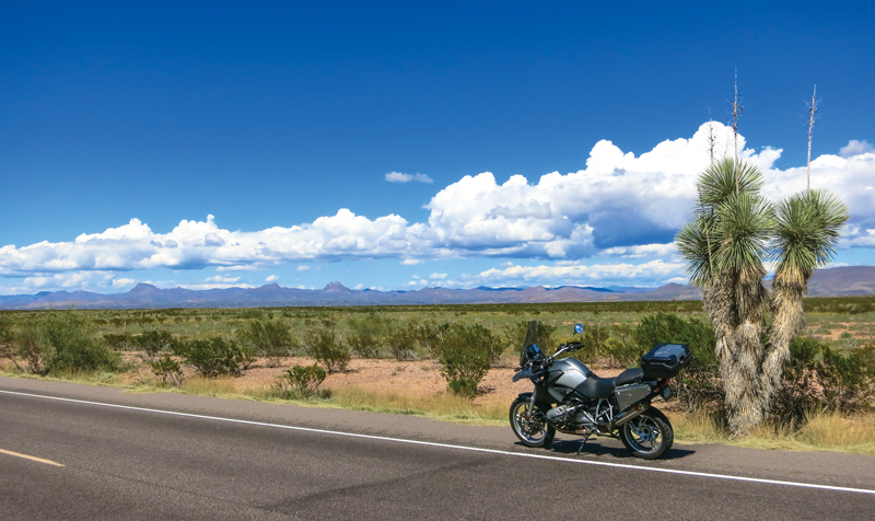
Let me tell you about a perspective-changing, paradigm-shifting roll through a spectacular region spanning two great southwestern states. Before you accuse me of hyperbole, ride this loop that combines Arizona’s serpentine Coronado Trail with the alpine vistas of extreme western New Mexico. I believe you’ll agree that your view of the ultimate motorcycle road has shifted.
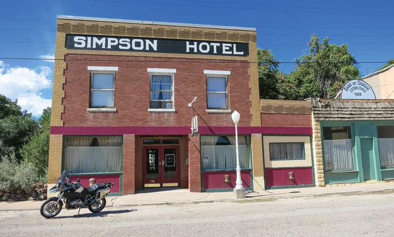
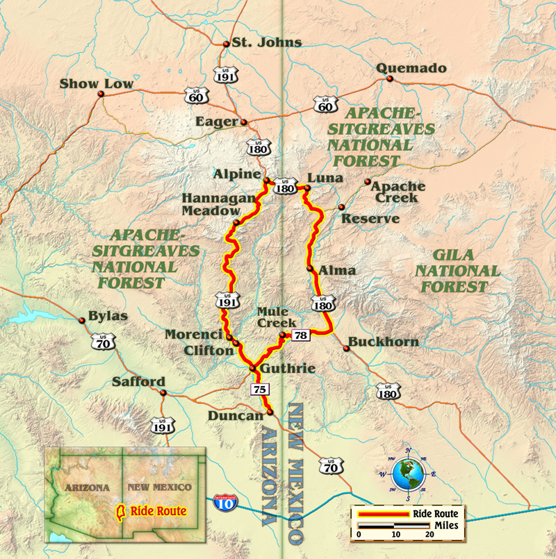
By most anyone’s standards, this is a remote region. Furthermore, most of these roads are so coiled that any GPS program in the world will avoid routing through them. No, these roads are not the “fastest route” to anywhere. With these points in mind, you’ll likely want to lodge in close proximity to this route. For me, that means a stay in the tiny Arizona town of Duncan and a room in the delightful, historic Simpson Hotel. After a restful stay at the quaint bed and breakfast, I gas up at the local pump and head north toward U.S. Route 191.
The Coronado Trail
My ride up the Coronado Trail, which is a magical portion of U.S. 191, begins with a slow roll through a region that has been amazingly, disturbingly and even somehow beautifully sculpted by large-scale mining. If that sounds like a dichotomy, it is. The mines around the small company towns of Clifton and Morenci are massive, multi-hued tributes to man’s ability and willingness to massage the earth to satiate his needs. This open-pit copper mining operation is one of the biggest in the world.
Farther north on the trail, the huge stair-stepped tiers of the mines give way to the natural erosive contours of the mountains and the rumble of the mining trucks fades. I am now on the “real” Coronado Trail. This road is the stuff of legend. The tarmac closely follows Coronado’s route as he searched for the Seven Cities of Cibola nearly 500 years ago. Hairpin turns are the rule of the day. In fact, it is said that the Coronado Trail features more than 300 curves in its span. I didn’t count, but I can vouch for the road’s staggering curvature. For a motorcyclist, there simply can’t be too many turns in a road and this ride is a grin-inspiring way to even the wear on your tires.
The only real civilization on the main portion of the trail is Hannigan Meadow. The high mountain retreat is a place to grab a sandwich and a soda and watch the deer wander through the meadow’s wildflowers. After this stop, the road straightens out only slightly as I make my way north toward Alpine, Arizona. This tiny mountain community is perched at an elevation of 8,000 feet. I gas up, stretch the legs and recount in my mind the incredible number of turns I have made since breakfast. Alpine is the northernmost point on this loop ride, and sits at the intersection with U.S. Route 180, which will begin the return leg of the ride.
New Mexico Mountain Ride
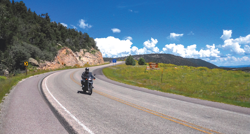
I make my way east on U.S. 180 for the short jaunt to the New Mexican border. Once in the Land of Enchantment, the views are simply amazing. There are several viewpoints in the upper portions of U.S. 180 and I am compelled to stop at each. The combination of wildflowers and Ponderosa pine forests makes for a visual treat.
The road turns south at the microscopic town of Luna and winds gently down in elevation. This return portion of the ride is much more relaxed than the tight turns that make the Coronado Trail famous. Truly, I find this a beautiful wind-down from the intense morning ride. The farther south I go on U.S. 180, the straighter the road becomes, but there is never a stretch on which I spend much time squaring off the center portion of the tire.
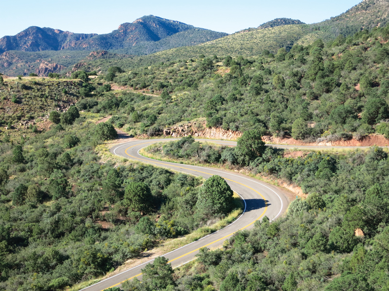
I make my departure from U.S. 180 onto the westward leading New Mexico State Road 78. This ride on State Road 78 is a fitting end to this amazing loop. It has a little of everything the route has offered. I ride through high-speed sweepers to the Arizona border. After crossing back over into the Grand Canyon State, there is a short series of hairpins that are reminiscent of those on the Coronado Trail. After a last roll through some high desert ranchland, I have come full circle.
This 250-mile ride is as good a route as I have ever experienced. It is a tour that is really about the road and the views. Yes, there are tiny clusters of civilization along the way, but more than anything, twisties, trees and topography define this remote ride. If you still have “chicken strips” at the edges of your tires after this ride, you have done something wrong. And I will eat my words if your paradigm of the nation’s best motorcycle roads hasn’t shifted at least slightly to the southwest.



I had the pleasure of doing most of that ride. Stayed in az and and went into show low and back to Phx. One of the best rides I’ve ever done. It was called the 666 hwy or the devils hwy I beleave.
Similar comment as Bob Ford. I started in Scottsdale with a rental GS and headed north to Show Lo (Google the history of the name) and on to Alpine for the night. Had dinner at the Bear Wallow Cafe and hobnobbed with former riders, the local Sheriff (who warned about the critters ahead as well as ice in March) and the high plains cattle ranchers. Interesting geology on the way to Alpine called the Springerville Volcanic Fields.
Highway 180 (Formerly 666 until all the signage was stolen) was without traffic in either direction for over two hours. Many vista points in the White mountains of AZ. Ended up at a lower elevation riding through the Morenci Copper Mine, on to Globe and then back to Scottsdale and home to OH!
Tim was awed by the mines in Morenci; I was appalled. Rather than scenic it is brutally monochromic, the air was filled with dust and working trucks used the highway. I’m not against mining. I simply prefer not to ride through the middle of huge open air copper mines for miles.
If you are fond on 10mph hairpins one after another, narrow mountainside roads with no guardrails with 1,000 foot or more falloffs mere feet from the road, then the part of HWY 191 north of Morenci until a few miles from Hannagan Meadow will appeal to you.