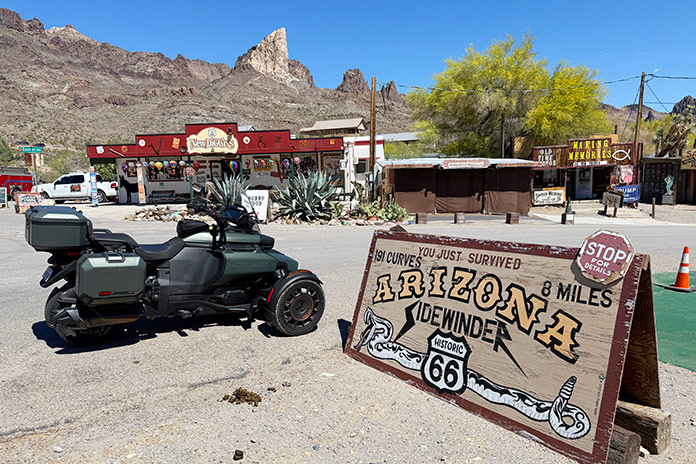
No road tells the story of 20th-century America and captures the spirit of adventure like Route 66. The history of Route 66 is one of ingenuity, patriotism, and capitalism; of transportation, migration, and tourism; of transformation, inspiration, and evolution. In popular culture, it has inspired songs, movies, TV shows, books, and magazines. In the popular imagination of the past, it represented hope, freedom, and a better way of life. Today, it represents nostalgia for a bygone era.
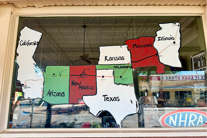
Designated in 1926 by the U.S. Bureau of Public Roads as part of the first federal highway system, Route 66 established “the shortest, best, and most scenic route from Chicago through St. Louis to Los Angeles,” as advertised by the U.S. 66 Highway Association. Spanning 2,448 miles, passing through eight states, and connecting dozens of small towns and major cities, Route 66 came to be known as the “Main Street of America.”
According to the National Park Service, in 1926 the newly designated route “was just an assignment of a number to an already existing network of state-managed roads, most of which were in poor condition.” U.S. 66 stitched together parts of several older routes, including the Lone Star Route from Chicago to St. Louis, part of the Ozark Trails system from St. Louis to New Mexico, and the National Old Trails Road westward to L.A.
Due to its diagonal orientation and southern routing, Route 66 established a year-round, mostly flat highway that opened the American West, becoming a major truck route and democratizing over-the-road, cross-country travel. In 1938, it became the first U.S. highway to be completely paved.
Two major events during the 1930s – the Great Depression and the Dust Bowl – contributed to development, improvement, and increased use of Route 66. Two of President Roosevelt’s New Deal economic recovery programs, the Civilian Conservation Corps and the Works Progress Administration, put thousands of people to work building and improving American infrastructure, including U.S. 66.

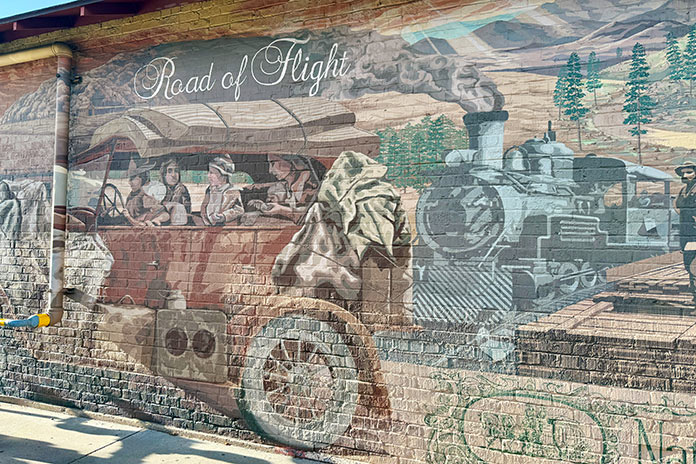
Widespread drought and dust storms in the Midwest and southern Great Plains prompted hundreds of thousands of farmers and their families to migrate via Route 66 to find work in California. John Steinbeck, in The Grapes of Wrath, his 1939 novel about the devastating effects of the Dust Bowl and the mass migration that followed, provided a vivid description of Route 66 and established one of its most enduring nicknames, the “Mother Road”:
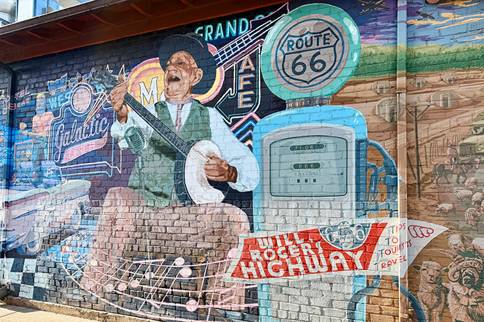
Highway 66 is the main migrant road. 66 – the long concrete path across the country, waving gently up and down the map, from Mississippi to Bakersfield – over the red lands and the gray lands, twisting up into the mountains, crossing the Divide and down into the bright and terrible desert, and across the desert to the mountains again, and into the rich California valleys. … 66 is the mother road, the road of flight.
During World War II, U.S. 66 served as a vital route for moving soldiers and supplies across the country, and several military bases were established on or near the route. After the war, economic prosperity allowed more Americans to buy cars and take vacations, creating a culture of travel and exploration that still exists today. As traffic on Route 66 increased, hundreds of mom-and-pop businesses – gas stations, motels, restaurants, souvenir shops, and roadside attractions – sprang up to serve the needs of travelers, bringing much-needed revenue to small towns.
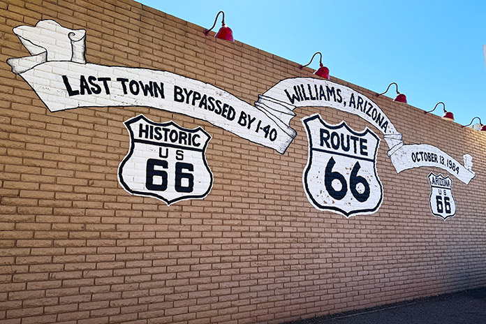
Ironically, the popularity of automotive (and motorcycle) travel along Route 66 led to its demise. U.S. 66 was in a constant state of improvement, which led to rerouting and realignments that bypassed major cities (like Santa Fe, New Mexico, in 1937) and dozens of small towns. President Eisenhower signed the Federal Aid Highway Act of 1956 to create a national system of interstate highways. Five interstates (I-55, I-44, I-40, I-15 and I-10) gradually replaced U.S. 66 between the 1950s and the 1980s. After the 1984 bypassing of the last section of U.S. 66 by I-40, Route 66 was officially decommissioned in 1985.
Many sections of Route 66 were entirely replaced by interstates; some lived on as business routes or frontage roads, while others were abandoned and left to deteriorate. Recognizing the importance of Route 66 in American history and pop culture, state-level preservation associations and dedicated volunteer groups were formed to preserve, protect, and promote the roadway, often to encourage tourism in the small towns that received an economic boost from Route 66 but were later bypassed by interstates. In 1990, Congress passed a law authorizing the National Park Service Route 66 Corridor Preservation Program.
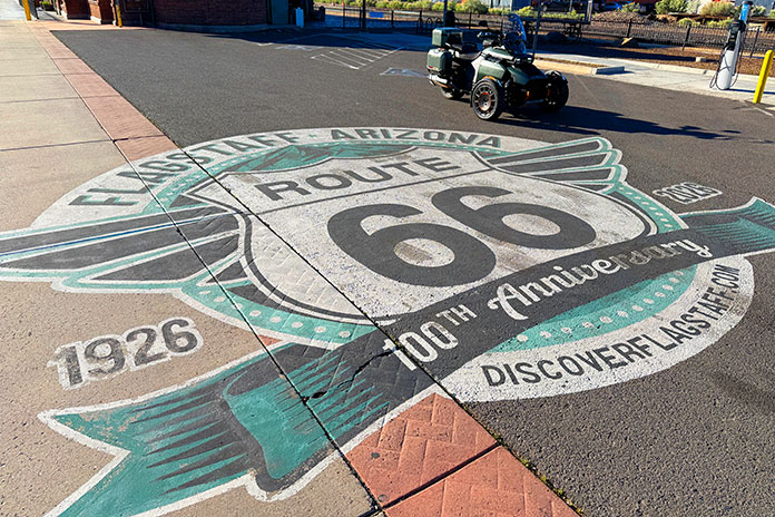
Next year, Route 66 celebrates its 100th anniversary, and the August 2025 special issue of Rider honors the milestone with dedicated tour stories, a travel guide, essays, and resources. Many cities, towns, and tourism bureaus along the Route 66 corridor have centennial celebrations planned, so next year will be a great time to ride America’s highway. Go get your kicks on Route 66!
See all of Rider‘s Route 66 tour stories and resources


It is my greatest desire to travel Route 66 before the Lord calls me home. I am 77 yrs of age and have always wanted to see the wonders and artistic history of this magnificent piece of America!! My personal opinion, and I’m sure that of many Americans, would love for our government would rebuild what is left of Route 66!!!!!
I hope you can do it. I had to settle for doing AZ Route 66 border to border a few years ago (plandemic year). It’s a great road, and I rode as much of the original roads (now often frontage roads) as possible.