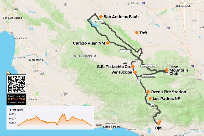
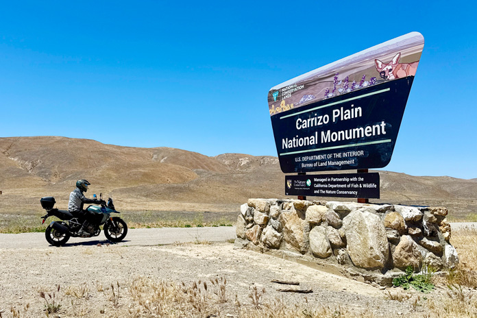
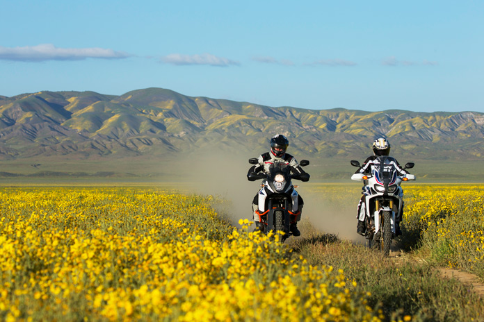
When I want a taste of adventure in my own backyard, one of my favorite rides is around the Carrizo Plain National Monument, a native grassland situated between two mountain ranges. It’s a special place that showcases unique geology such as Soda Lake and the San Andreas Fault, both Indigenous and ranching history, and flora and fauna that includes wildflower superblooms in the spring and animals such as California condors, coyotes, and pronghorn antelope.
Scan the QR code above or click here to view the route on REVER
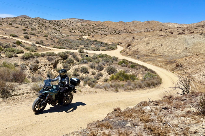
For adventure riders, 460 miles of (mostly) unpaved roads run the length of the Carrizo Plain, cross its interior, and wind their way into the surrounding Caliente and Temblor ranges. Soda Lake Road, the main road through the national monument, is partially paved and is smooth enough for streetbikes, though care must be taken on sandy sections.
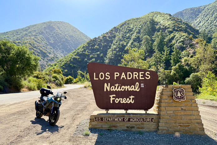
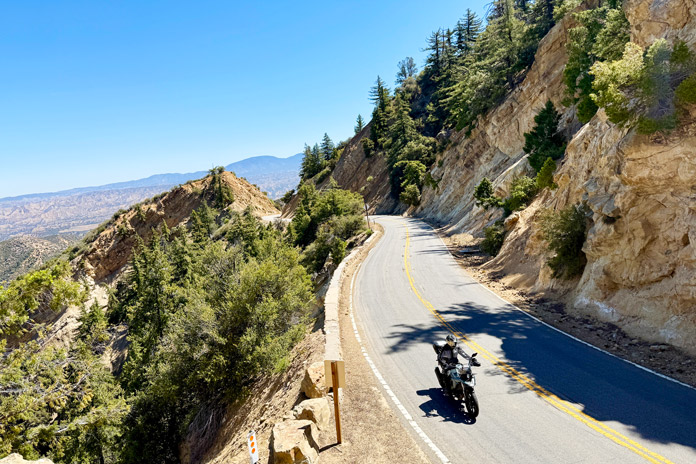
Half the fun of a Carrizo Plain day ride is getting there. Starting in Ojai, about 15 miles inland from Ventura, State Route 33 goes through Los Padres National Forest and serves up some of the best curves and scenery in the region. Once past Wheeler Gorge Campground, there isn’t a stop sign for 56 miles!
After cresting Pine Mountain Summit (5,160 feet) and descending into the Cuyama Valley, I always stop in the small farming community of Ventucopa at the Santa Barbara Pistachio Company, which has gas, snacks, cold drinks, and tasty dry-roasted pistachios.
Continue on SR-33 to its junction with State Route 166, hang a right, go 4.7 miles, then turn left on Soda Lake Road. After about 5 miles of rough pavement, you’ll enter the Carrizo Plain National Monument, which is under the jurisdiction of the Bureau of Land Management (a helpful recreation map and guide is available on the BLM.gov website). No entry fee or permit is required. The pavement ends after a cattle guard.
Soda Lake Road follows the western edge of the valley, and as you ride north, the rolling Caliente Range is on your left. You’ll pass several dirt roads – Pipeline, Quail Springs, and Padrones Canyon – that climb into the mountains and offer some fun ADV exploring, but they dead-end at the southern boundary of the monument.
Pavement resumes on Soda Lake Road just before passing Traver Ranch, where you can see old farm equipment and access a public restroom. Then you’re back on a wide sandy track for miles. It’s easy to get lulled into a relaxed cruising pace but then get surprised when the road bends sharply, so stay frosty.
There are two campgrounds off Soda Lake Road – KCL and Selby – as well as the Goodwin Education Center, which serves as a visitor center and has maps and information about the monument. Two unpaved roads – Panorama and Simmler – cross the valley to Elkhorn Road.
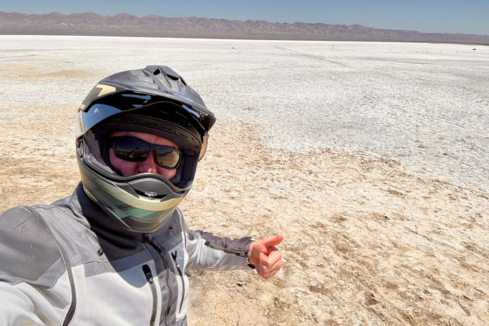
In the northwest corner of the monument is Soda Lake, a seasonally dry lake that spans 3,000 acres and is covered in dry white sulfate and carbonate deposits most of the year. During the rainy season (November to April), Soda Lake may have water in it, and if it has rained recently, most of the unpaved roads in the Carrizo Plain turn into impassable mud bogs.
After passing Soda Lake, turn right on Seven Mile Road, go 5.8 miles, then turn right on Elkhorn Road, a one-lane dirt road that is more undulating and winding than Soda Lake Road. Now you’re on the eastern side of the valley, in the foothills of the Temblor Range, heading southeast.
In about 4 miles you’ll see a sign for Wallace Creek. Park your bike and walk up the path to the interpretive placard. You’re standing on the San Andreas Fault, a 750-mile split down the length of California where the North American Plate (which moves south) meets the Pacific Plate (which moves north).
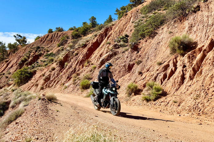
Elkhorn Road is a fun ride for about 36 miles, and in some places it’s long and straight, so you can kick up some dust. The last few miles climb up and over the southern end of the Temblors, and there are some tricky downslopes covered in loose gravel, so be mindful.
See all of Rider‘s California tour stories here.
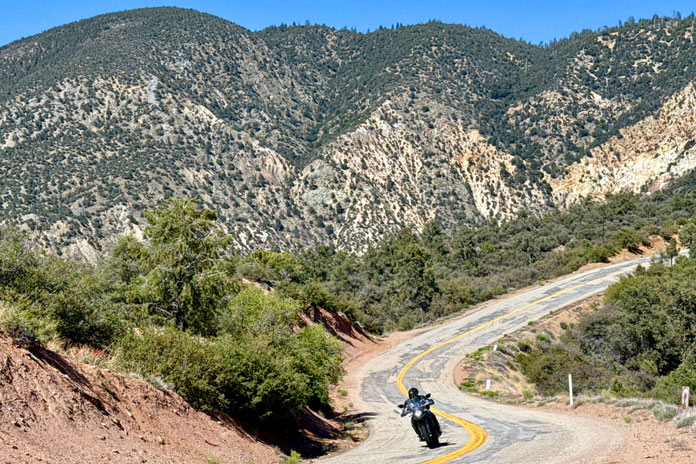
Soon the pavement resumes and Elkhorn Road ends at SR-33/166. Turn right, enjoy a fast, smooth climb for nearly 8 miles, then turn left on Hudson Ranch Road, one of the best-kept secrets (oops!) in Southern California. The lightly trafficked road twists up and over grassland hills with long sweepers, then follows a ridgeline that ascends to more than 7,000 feet and offers commanding views on both sides. It’s a fantastic 25-mile ride to the alpine community of Pine Mountain Club. Stop here for gas, drinks and snacks at the general store, or a meal at one of the casual restaurants.
Next, backtrack a few miles to Quatal Canyon Road, a dirt byway that connects Hudson Ranch Road to SR-33 in Ventucopa. The first few miles of Quatal are a little tricky, but then it straightens out into a fun, rolling ride. But beware! There are some tire-swallowing cross-ruts in low places that will sneak up on you. Once back on SR-33, it’s a fast, curvy ride on pavement for 50 miles back to Ojai.
See all of Rider‘s touring stories here.


What a great ride! I wonder if those street tires felt like a good balance, given the good mix of pavement and dirt?