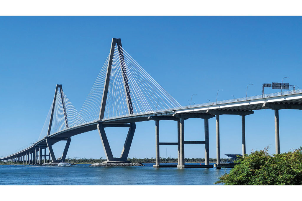
Charleston, South Carolina, is a true Southern belle. She turns 352 years old this year and has quite a past. In America’s early days, her importance rivaled New York and Boston. Shipping, as well as rice and cotton production, created extreme wealth. Hurricanes, wars, and bondage brought great despair. Like Scarlet O’Hara, Charleston has persevered, and today she wins “Best City” awards for her food, culture, and history.
One of the best ways to experience Charleston is from the seat of a motorcycle, flying over her many bridges. Charleston’s bridges link more than land and water. They link past and present, problems and answers, people and places. These days, twisting the throttle over Charleston’s bridges provides reflection and hope.
Check out more of Rider‘s Favorite Rides
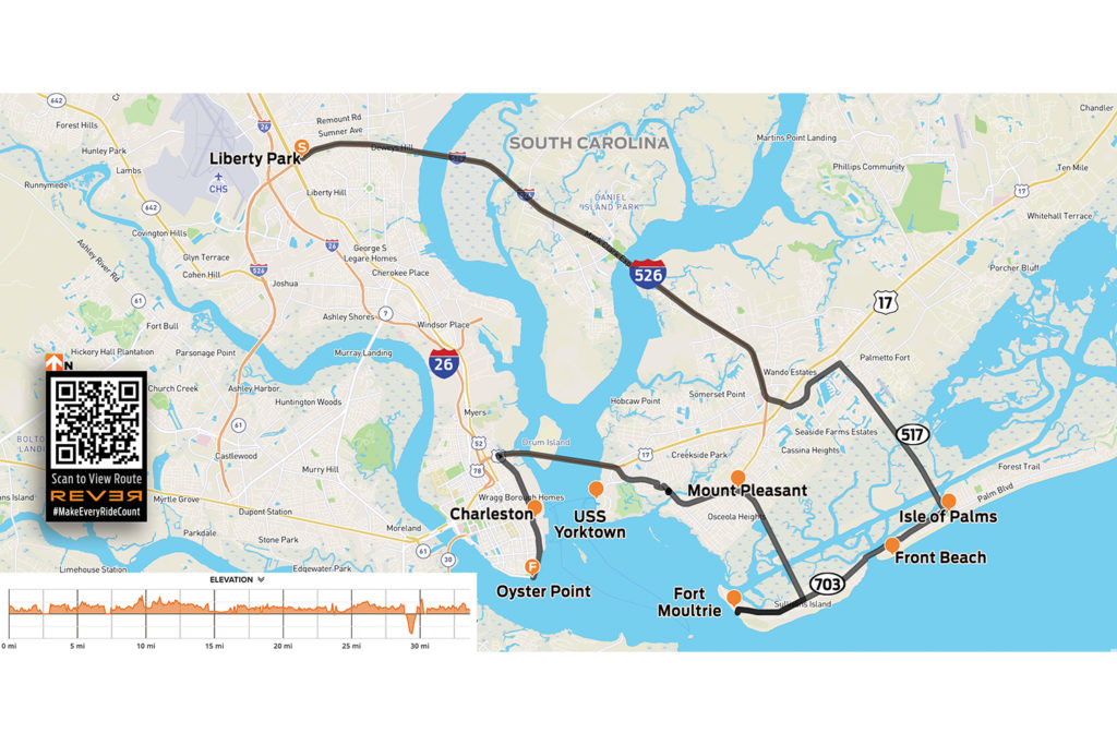
To view route above on REVER, scan the QR code or click here
Since Charleston is located an hour off the I-95 superslab, many riders miss her charms. That’s a shame, as Charleston hits the redline on the motorcycle smile-to-mile dial. For you Northern bikers on a Florida run, this is a fantastic stop-over spot. I’ll bet you a flounder sandwich it will be a highlight of your journey. Lodging is plentiful at all price levels, and the local cuisine is world renowned, bringing together farm, ocean, Southern, and soul.
This ride can be done any time of year, but beware: Charleston is in the Deep South. Summers can be stifling and rainstorms can be intense. Wearing mesh apparel, keeping raingear handy, and avoiding afternoon traffic are highly recommended during summer months.
From I-95, head southeast on I-26 for an hour. Take the ramp for I-526 East to Mount Pleasant. Cruising high above the salty marsh, in the first 15 minutes you’ll glide over two major bridges – the Don N. Holt over the Cooper River, and the James B. Edwards over the Wando River. You’re riding over the Lowcountry, a sprawling coastal region that’s just above sea level. With the tides shifting four times a day, much of the marshy terrain spends half its time under water.
Take the exit for Hungry Neck Boulevard, then turn right onto the Isle of Palms Connector (State Route 517). Cruising over the estuary, flip up your visor and enjoy the salty air and coastal views. At low tide, you’ll see mounds of “rocks” in the marsh, which are actually wild oysters. Raw, roasted, or in a Bloody Mary shot, they’re delicious.
You’ll cross two more bridges before reaching Isle of Palms. When the Connector ends, keep going straight to Front Beach. Biker law says you can’t get this close and not get in the ocean, so this is a great place to kick off your boots and get your toes wet.
Continue southwest on Palm Boulevard (State Route 703). Ride with the breeze along the Intracoastal Waterway until you cross Breach Inlet on the H.L. Hunley Bridge, named after the first submarine to sink a ship in battle. In 1864, the hand-cranked Hunley sank a Yankee ship but then disappeared off the coast of Sullivan’s Island, along with its crew of eight men. It wasn’t found until 1995. Stop at Thomson Park to enjoy the views and learn more about this historic location.
From the park, hang a left on Middle Street. You’re now riding through “shabby chic” Sullivan’s Island, South Carolina’s wealthiest zip code, and you’ll see bars and restaurants. All are good, but the crispy/spicy Bangin’ Shrimp tacos at Mex 1 Coastal Cantina are my go-to. Salt in the air, beach on your boots, shrimp tacos in your hand, and your faithful steed parked under a palmetto tree. Life is good!
Continuing southwest on Middle Street takes you to Fort Moultrie National Historical Park. This high ground has a long history as a military post, going as far back as the Revolutionary War. The self-guided tour and harbor views are interesting, inspiring, and a great way to stretch your legs.
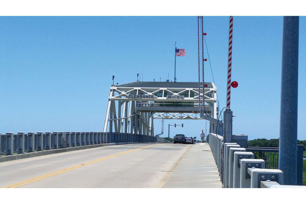
Backtrack to where Route 703 turns north and becomes Ben Sawyer Boulevard, a causeway that cuts back across the marsh. Take in the scent of salt, oysters, and tidal “pluff” mud. The Ben Sawyer Bridge is a swing bridge that rotates to allow tall boats to pass through. First opened to traffic in 1945, it was heavily damaged by Hurricane Hugo in 1989. When the islands evacuated, the tender left the bridge unlocked. When hurricane-force winds hit the bridge, it spun like a top, and one end plunged into the water.
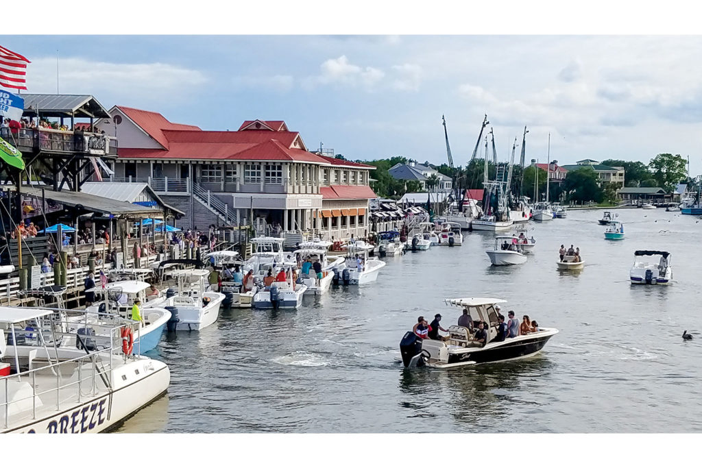
Crossing the Ben Sawyer takes you into Mount Pleasant. Traffic increases through this vibrant area, with plenty of good restaurants and bars attracting the hungry and thirsty. Another bridge on Route 703 crosses over Shem Creek, with boats, kayaks, and bars below jammed with folks having a good time. Fresh local seafood is sold right on the docks. For a closer look, make a left and visit Shem Creek Park.
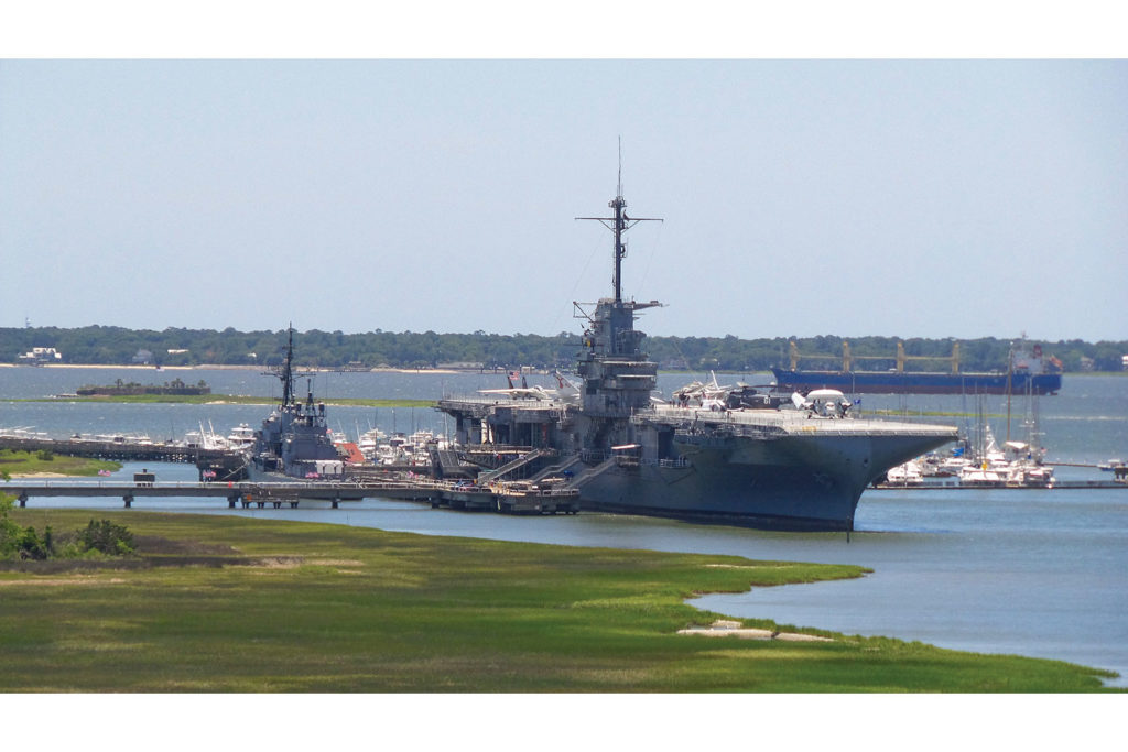
Continuing west on Route 703 (Coleman Boulevard), the road merges with U.S. Route 17 before crossing Charleston’s most prominent span, the Arthur Ravenel Jr. Bridge over the Cooper River. Riding over the Ravenel, you’re at the highest point in the Lowcountry, with inspiring views of Charleston Harbor and the USS Yorktown, a WW2-era aircraft carrier anchored near Patriots Point. The Yorktown is now part of the Patriots Point Naval & Maritime Museum, and military buffs can easily spend a full day touring the ship, imagining or remembering the challenging days of our Greatest Generation.
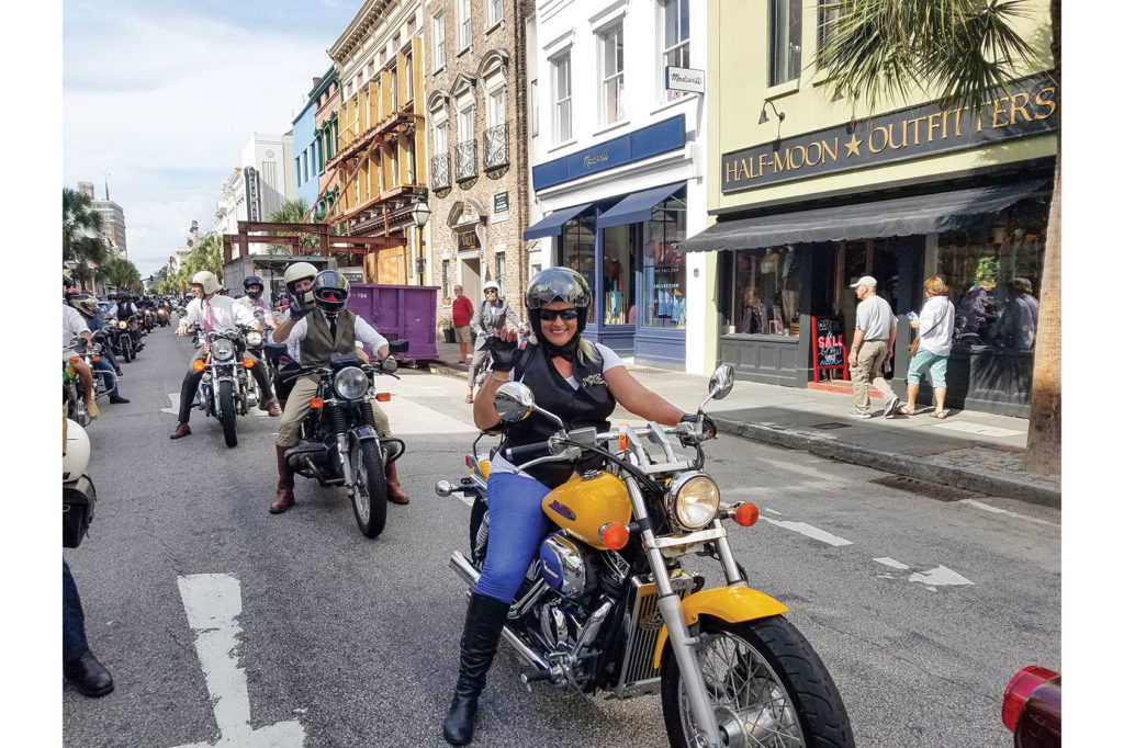
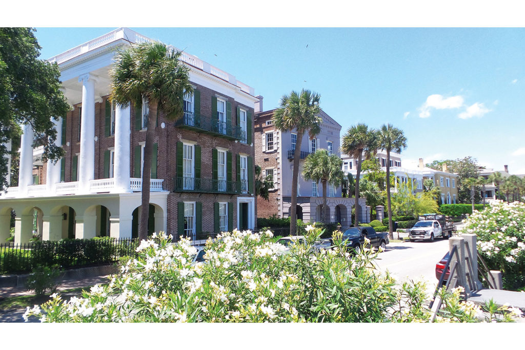
After crossing the Ravenel, follow signs for U.S. 17 South to Savannah and take the King Street exit. Turn right onto King Street for a fun, sweeping ride through history, from modern hipster hotels to perfectly preserved colonial-era homes. It’s a great time to reflect on our nation’s past, present, and potential.
Take King Street until it ends at Oyster Point overlooking the harbor. The views are spectacular, but Charleston is more than just her pretty petticoat and parasol. She’s beautiful and strong, old and new, happy and sad. Like America, she’s not perfect, but she’s authentic and awesome. This ride makes me proud, and hopeful for what’s over the next bridge.




My wife and I have lived in quite a few different states. We liked Charleston, SC
Probably better than anyplace we ever lived.
We were there working in the East Cooper Community Hospital E.R. when hurricane Hugo hit. That was some night. There were some injuries from the storm, but most occurred during the cleanup.
Everyone pulled together, shared whatever they had with others, people who’s homes survived took in folks who’s homes didn’t and on and on.
There’s lots to do and see with plenty of history and culture. You could eat at a different restaurant every night and it would take you many weeks to finish.
Put 60k +/- miles on a 1978 Yamaha XS 650 Special in 2 years living there. Great memories.