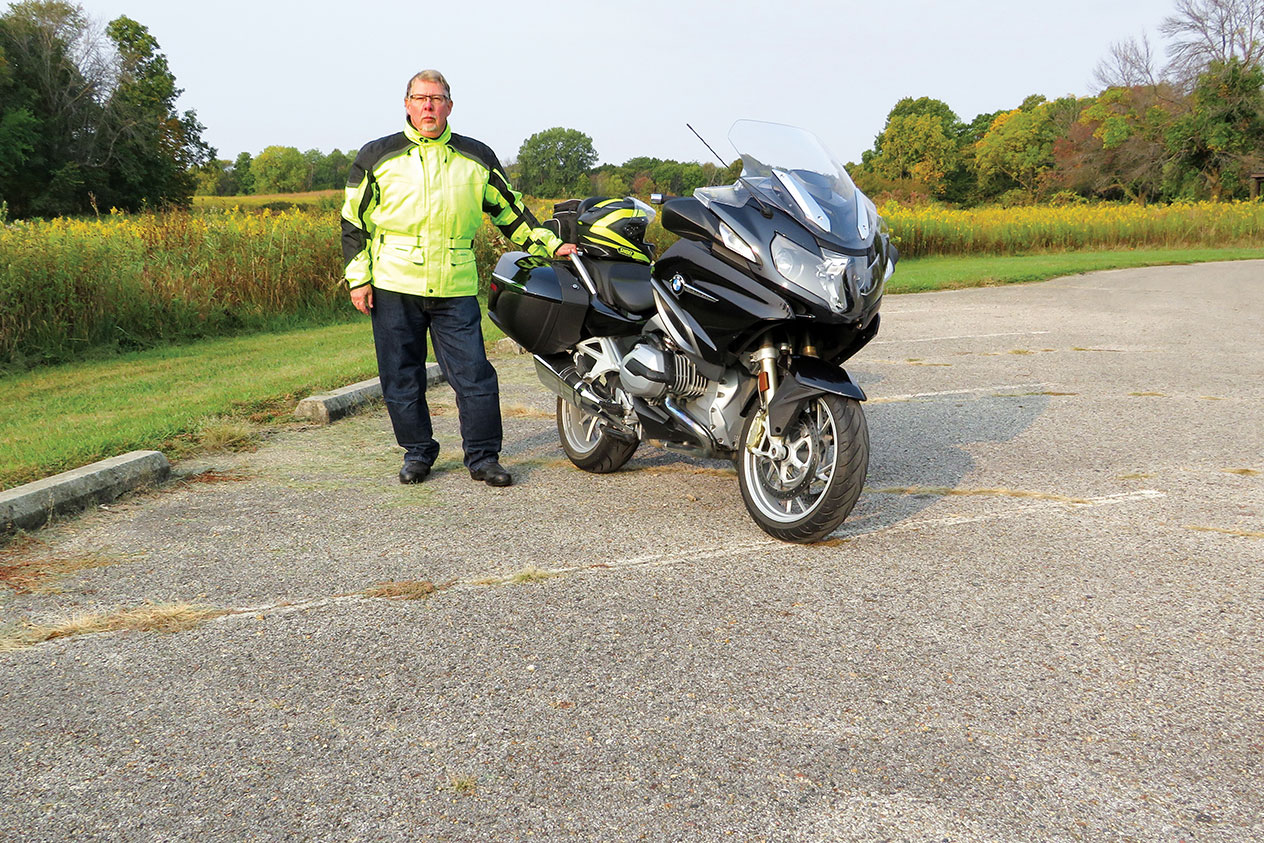
There are some great roads in central Iowa around the town of Boone, which is about 45 miles north of Des Moines. This ride crisscrosses the Des Moines River on a series of county highways and backroads, offering a nice selection of curves and scenery. I’m on a BMW R 1200 RT today, but these roads are friendly for just about any kind of motorcycle. This 124-mile loop minimizes straight sections and takes a few hours, so let’s go!
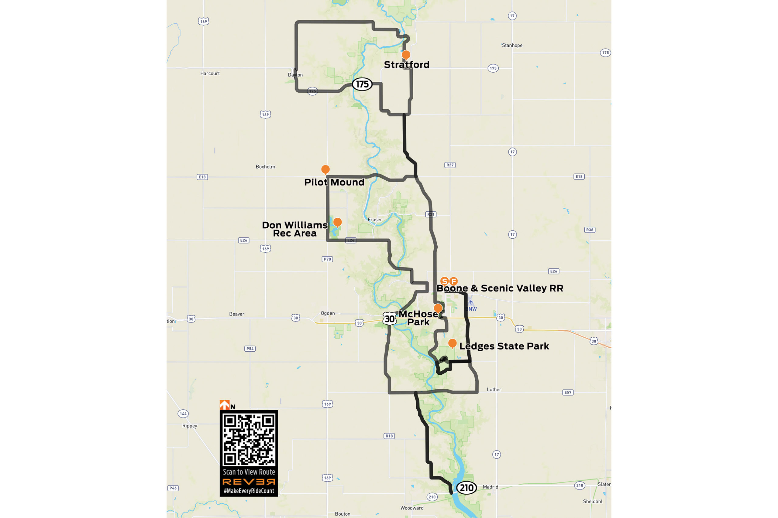
Click here to view route on REVER
First things first: this ride is in rural farm country, so be alert for deer, farm equipment, and debris on the road. Our starting point is in downtown Boone. We follow Mamie Eisenhower Avenue (the former First Lady was born here) east to the junction with Highway R27, where we turn south and ride along the west side of Boone Municipal Airport. Like all the roads on this ride, the pavement is in good condition and meanders easily; you can see through the curves, so they’re fun to ride at any pace.
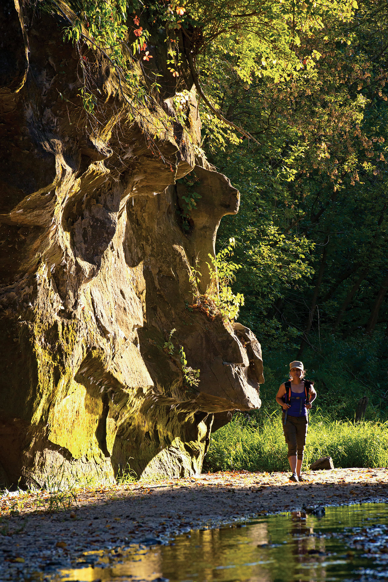
We cross U.S. Route 30 and continue south to Highway E52 (250th Street). Turning right (west), we continue to the upper entrance of Ledges State Park, where sandstone ledges tower 100 feet above the Des Moines River. The scenic park offers hiking, picnicking, and camping, and we’ll return to it at the end of the ride.
We backtrack to R27, turn right, and head south again until R27 ends at the junction with Highway E57 (270th Street). We turn right (west) and cross the Des Moines River, enjoying the first of many scenic river views. Past the river is a sign for Camp Mitigwa, and we turn left (south) on R26, also known as Magnolia Road. We follow the twists and turns on excellent pavement down into the Des Moines River valley, and then turn left (east) on Highway E62 (325th Street) and soon arrive at the junction with State Highway 210.

Looking straight ahead, you’ll see the High Trestle Trail Bridge, a former railroad bridge over the Des Moines River that’s now a biking and walking trail. After enjoying the view, we turn around and ride E62 and R26 north again to E57. We turn left (west) on E57, then right (north) on R18 (L Avenue) toward the small town of Moingona.
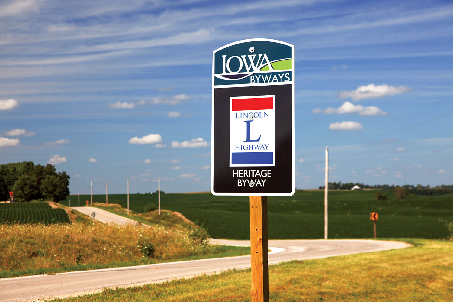
We cross U.S. Route 30 and turn right (east) on Highway E41 (216th Drive), which is part of the Lincoln Highway Heritage Byway and crosses the Des Moines River. After a twisting climb out of the river valley, we see a strange-looking shale mound on the left, a reminder of Iowa’s once-booming coal industry. We enter Boone again from the west, picking up Mamie Eisenhower Avenue and then turning north on Marion Street.
After crossing the train tracks, we turn left on Highway E26 (12th Street) and make a few more turns as we follow E26 along curvy pavement and cross back over the Des Moines River. We exit the river valley on a wonderfully smooth and winding stretch of road followed by a short straight section.
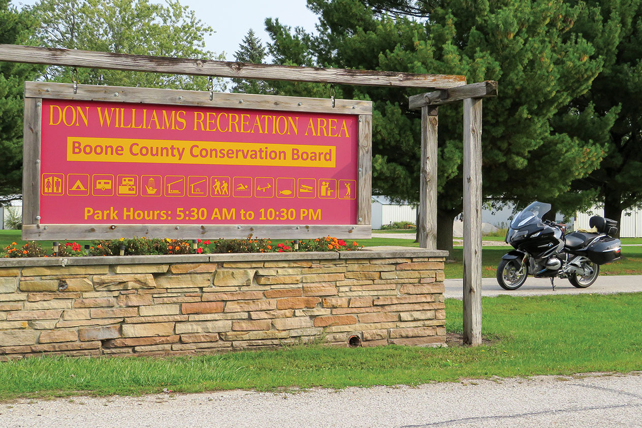
We turn right (north) on Highway P70 (H Avenue), which runs along the western edge of Don Williams Recreation Area, which has a lake, camping facilities, and a golf course. We continue north to the junction with Highway E18 (130th Street), and turn right (east) toward Pilot Mound, a small town with a sense of humor that you’ll notice as you ride by. We cross the Des Moines River once again on E18, and then turn left (north) on Highway R21 (Nature Road).
We pass through another very small town, Ridgeport, which isn’t on most maps. We stay on R21, which twists and turns a few times until it becomes first Chase Avenue, then Stagecoach Road, and arrive in Stratford. We turn left (west) on State Highway 175, and quickly turn right (north) onto Highway D54 (Bellville Road), a real treat that heads steeply down into – you guessed it – the Des Moines River valley. There can be a lot of gravel at the bottom of this road, so stay sharp.
Exiting the river area, the road straightens (and becomes 330th Street) until we take a sweeping left (onto Racine Avenue) into Dayton, a small town with fuel, eateries, and rodeo grounds we see on our right as we leave town heading south. We’re back on Highway 175, which curves to the east and takes us over the Des Moines River, our sixth crossing! When Highway 175 curves north, we continue straight ahead and turn right (south) on Washington Avenue. After an interesting set of curves, we return to R21 (Chase Avenue/Nature Road) and continue south to Boone on Division Street.

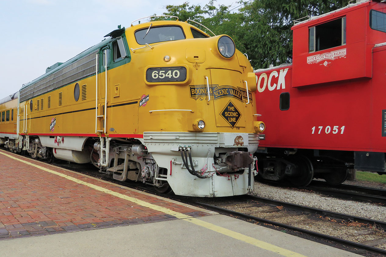
At 10th Street, you can turn left (east) to visit the Boone and Scenic Valley Railroad. This excursion train was started by volunteers and has grown into a fine attraction with an excellent museum. We continue south on Division Street, crossing 3rd Street (Lincoln Highway) and coming to a four-way stop at Park Avenue.
We turn left (east) on Park Avenue and ride through the Honey Creek ravine and enter McHose Park, a great place to stop and stretch your legs. We turn right on Francis Mason Drive and wind our way south through the park, exiting near U.S. Route 30.

We head east briefly on U.S. 30, then turn right (south) on Oriole Road toward the Boone Speedway. Oriole Road meanders its way toward the Des Moines River and the lower entrance of Ledges State Park. The road is smooth and deceptively fast because, before you know it, the speed limit drops and there’s a chicane to slow you down before entering the park. Check out the sandstone ledges, enjoy the park, and then head back to Boone for fuel, food, or a hotel room. Me? I’m ready to gas up and ride another 120 miles to get back home.


