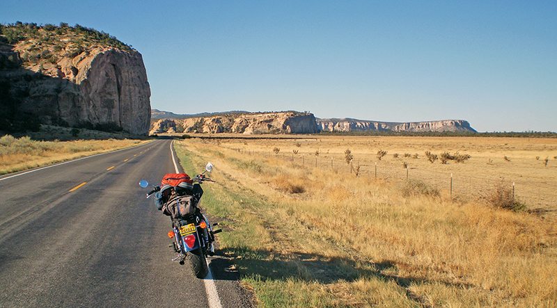
Not caring for Interstate highways, I choose to ride the “blue highways” north and south of Interstate 40 from Grants, New Mexico, where I live. I made this ride in late May on my 2008 Triumph America. This 865cc twin has all of the power I need and is reminiscent of the Bonneville 650 I had in the ’60s, although now my feet can enjoy “pegs forward.”
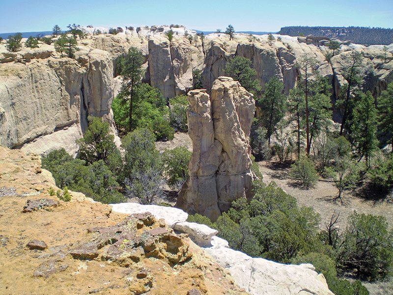
a hike at El Morro near the Atsinna pueblo site.
Taking old Route 66 through town, I headed south on Highway 117 leading straight into the Zuni-Bandera volcanic field, where the immense aa (rugged) and pahoehoe (smooth) lavas look as if they spewed out yesterday. It’s all fascinating to this retired geologist, and this is just the edge of El Malpais National Conservation Area, which extends nearly 40 miles to the south. (The name El Malpais is from the Spanish term Malpaís, meaning “badlands.”)
My custom exhaust system sounded crisp and sharp in the cool air at 6,500 feet while passing the McCarty’s flow, which is just 3,000 years old. Four other basalt flows more than 50,000 years old comprise the volcanic field completely covering the valley, and are bordered on the distant west side by the Chain of Craters (volcanoes) that is about 20 miles long.
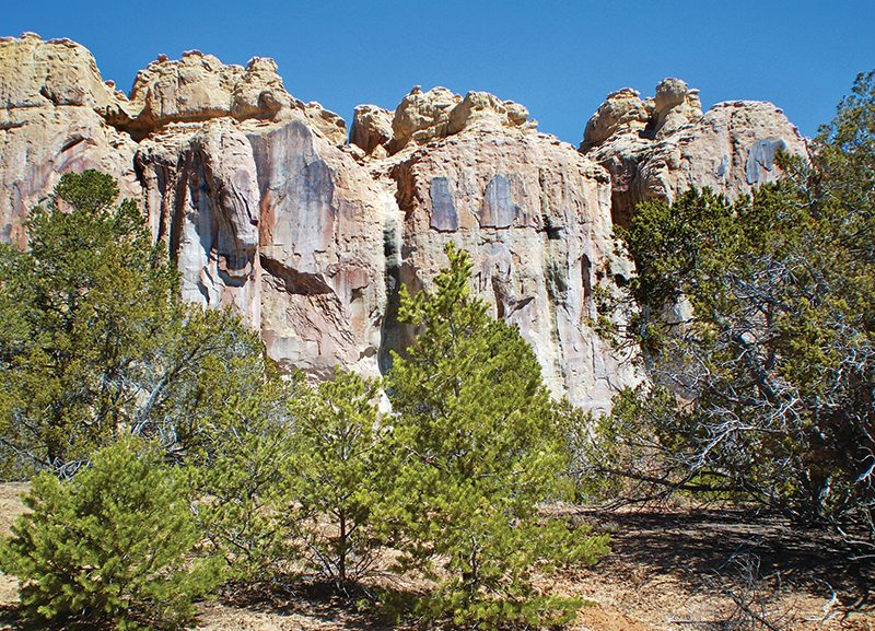
Eighteen miles south is a developed site called La Ventana (“the window”). This refers to the massive arch eroded into the Jurassic sandstone cliff, similar to those in the Moab, Utah, area. Awesome! The line of cliffs is the eastern edge of a faulted, down-dropped basin containing the basaltic lava flows.
Forty miles south, the road turns west across 20 miles of lava flows. Antelope herds are common sights along the lumpy, rolling basalt masses, which make the road like a miniature roller coaster. In the distant south, the older pinkish rhyolitic volcanics are like forearms reaching to the sky.
I came to my first stop, the little cattle-ranching town of Quemado, 21 miles west of Pie Town (good pies there!). It’s in Catron County, the largest county in the state but the most sparsely populated, with only about 3,500 people. This region feels like some of the last of the Old West.
I turned south on Highway 32, leaving the high plains behind and entering the great ponderosa pine forest of southwest New Mexico and eastern Arizona. I encountered all kinds of wildlife in the 40 miles to Apache Creek through the Gila National Forest, some without warning, including a large gobbler that landed right in the middle of the road in front of me. Farther along, I had to wait for two cows and a calf to get across the road, and 10 miles after that a herd of mule deer.
I was glad to get to the county seat of Reserve, my next stop. A small ranching and logging town named for the area’s forest reserve, its 400-plus people seem extremely friendly, and Uncle Bill’s Bar is well known to motorcyclists far and wide. Uncle Bill opened the bar in 1890 and his granddaughter still runs the place. A smothered burrito at Carmen’s Restaurant across the street hit the spot.

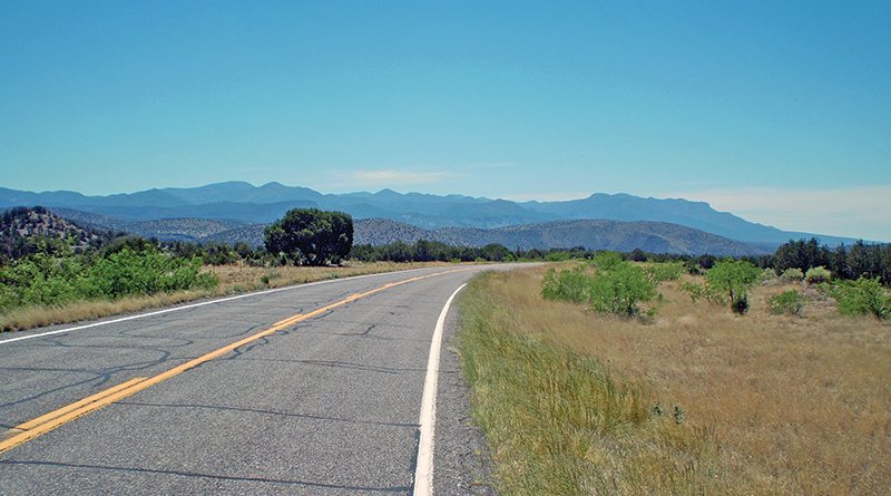
Heading south again on State Route 12 and State Route 180 became a beautiful cruise over mountains and through canyons with jagged rhyolite flows, tuffs and many lahars (volcanic mud flows). The country starts to open up along the San Francisco River and south toward the Mogollon (Muggy-YONE) Mountains that soar up to 11,000 feet.
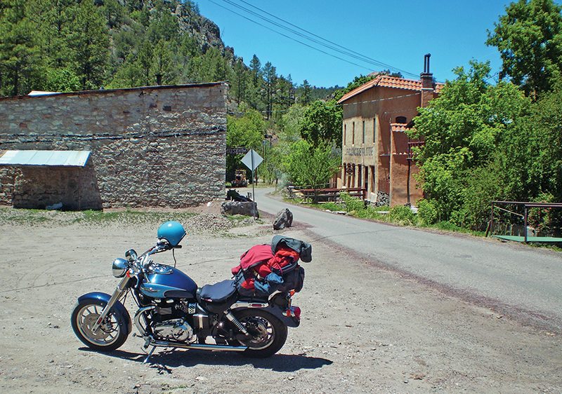
Just north of Glenwood, I took the nine-mile twisty road (10 mph means 5-10 mph) to the mining ghost town of Mogollon, which is in a nice valley with a stream running through it. It has shops, a museum and the Silver Creek Inn B&B (1885), and it makes a great place to visit. The Little Fannie Mine is one of the larger mines visible.
Glenwood is nestled in trees on the flank of the San Francisco River. This is a great place to stay and experience some outdoor adventures. Exploring the Catwalk Trail, hot springs, hiking to the river or mountains, viewing bighorn sheep and camping are all possibilities. I took the beautiful five-mile ride to the Catwalk. Although it was closed until the weekend for restoration, this hike up Whitewater Creek and canyon on a bridge-like pathway over a flume used in the 1890s for mining operations is spectacular and easy.
The Triumph pressed on for another 60 miles of easy, peaceful, solitary riding and landed me in Silver City. Large silver deposits discovered in the late 1800s gave the town of now 13,000 residents its name. The rich silver played out and now copper is king, with a world-class open-pit mine.
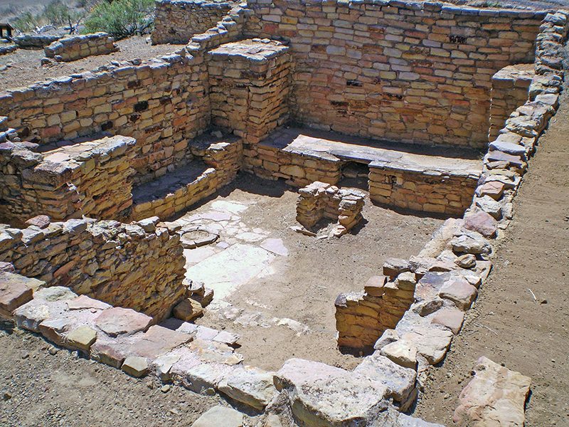
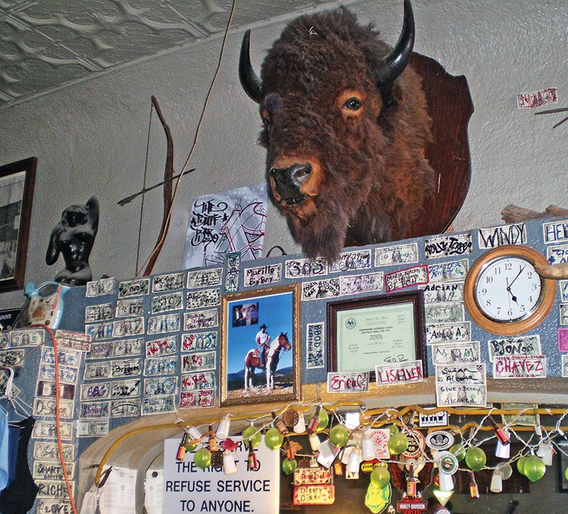
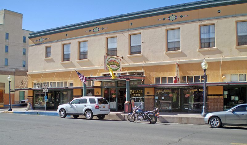
Silver City is a bustling town with a complex mixture of mining folk and college types from Western New Mexico University. The downtown area is funky and authentic. I stayed at the Palace Hotel, which opened in 1882 as a bank. Silver prices plummeted in 1893, and the bank closed only to reopen again as a hotel in 1900. The place is a real trip back in time and has very reasonable room rates. Next to the hotel is the Buffalo Bar, known to riders everywhere in this region. Good rides from here are 20 miles north to the old gold-mining town of Pinos Altos for the sights and some tasty chow at the 1880s Buckhorn restaurant, and 40 miles north to the Gila Cliff Dwellings, where pueblo structures built into a cliff by the Mogollon people date back to the 1300s.
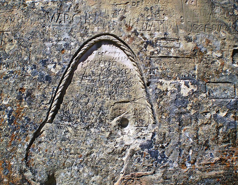
On the way home, I decided to head west at Quemado on State Route 36 to State Route 53 East through the sleepy town of Ramah on the south side of my favorite mountains, the Zunis. Forty miles south of Grants is the El Morro National Monument and Inscription Rock, where a cliff formed of Jurassic Zuni Sandstone has a perpetual small pond at its base that enabled tired and thisty Spanish explorers and members of the U.S. Cavalry to rest and water up. While relaxing, they carved their names and some journals on the cliff face. On top of the mesa, the trail takes hikers to the large Atsinna pueblo site, built by Zuni Indians in the late 1200s. Only a small portion has been excavated but it is impressive.
All in all, this ride is a real gem, and I’m looking forward to doing it again when I return to the Silver City area for the annual Gem and Mineral Show later in the summer.
(This Favorite Ride: Blue Highways in Volcano Country was published in the May 2014 issue of Rider magazine.)
 |
 |
 |
 |


Gotta do this one… I’m putting it on the ride bucket list…
Check your Spanish, bud. El pais means country. La roca means rock. But you got the mal part right!
Thank you for pointing this out John. We have done some checking and adjusted the article accordingly. We apologize for the mistake and appreciate your feedback.