It was the French El Dorado. Iroquois legend spoke of blond men rich with gold and furs who lived north of the Saint Lawrence River. Whether it was based on early Norse settlers who arrived in Newfoundland centuries before, or a fabrication created to appease early French explorers is unknown, but in 1535 Jacques Cartier discovered the entrance to a great fjord and his interpreter claimed that it lead to the Kingdom of Saguenay.
October’s fluorescent reds, oranges and yellows have streamed across my vision for most of a day while riding north through Vermont and the Eastern Townships of Québec. Immediately after crossing the 1.6-mile long Laviolette Bridge over the Saint Lawrence River into Trois-Rivières, it was time to pull into the Coconut Motel so my retinas could rest.
Trois-Rivières (Three Rivers) is located at the mouth of the Mauricie River on the Saint Lawrence River. It’s one corner of the Grand Triangle, a 520-mile Québec motorcycle-touring route, with Saguenay at the apex and the Charlevoix region in the third corner. The downtown area of this old mill town has dozens of cafés and restaurants whose tables spill onto the sidewalks of Boulevard des Forges, making this a popular weekend destination for regional riders.
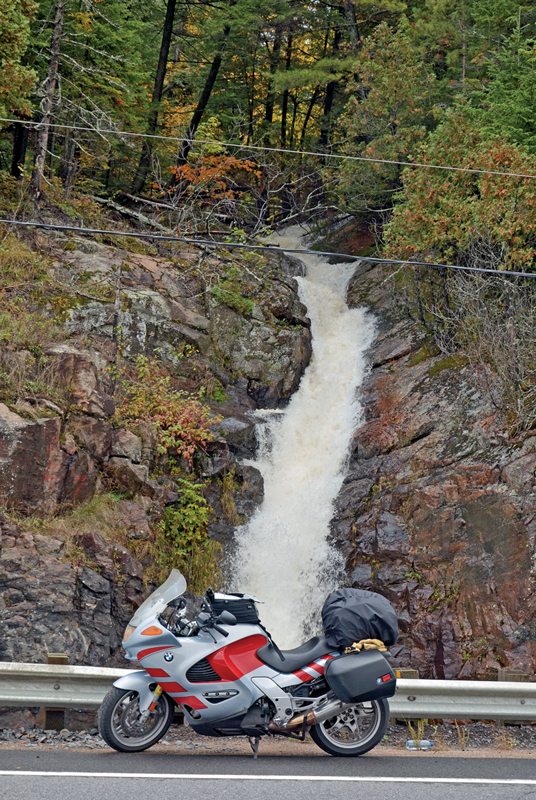
Autoroute 55 becomes the two-lane Provincial Route 155 just north of Trois-Rivières and soon is following the eastern bank of the broad Mauricie River as it winds through the Laurentian Mountains. These are among the oldest on earth, but after 500 million years of erosion and four glacial epochs, these once lofty peaks have been humbled. Yet great cliffs border the broad river, and signs warning of falling rock are frequent along the highway and water cascades from the heights.
A highway sign warns there is no gas available for 156 kilometers, so a left turn into La Tuque was mandatory. The village has several gas stations, a few modest hotels, some restaurants and a downtown strip that is a throwback to another era. The municipal region encompasses 10,849 square miles, making this the sixth-largest town in Canada, but its population numbers less than 11,000.
From La Tuque, the highway leaves the river and winds into the mountains. No houses, farms or cell phone reception for the next 90 miles—just forest and a great, wide road with curves and elevation changes. The fluorescent yellow, orange and red of foliage along the river gave way to dark green spruce, tamarack turning from green to gold and the bright yellow leaves of birch the farther into the mountains I rode.
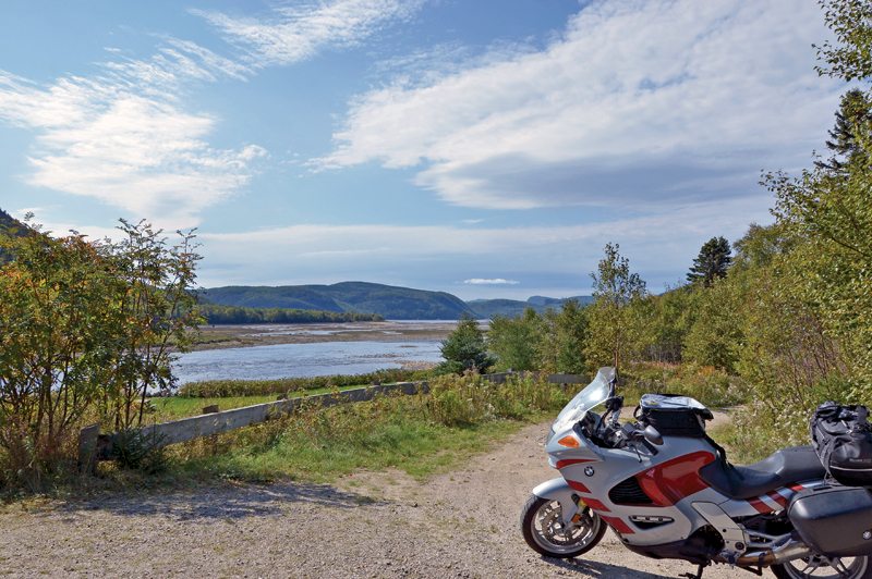
The hamlet of Lac-Bouchette marks the return to civilization. From here I rode down into the graben, where a vast, post-glacial sea once existed and Lac Saint-Jean now stretches to the far horizon. This is an oasis in the wilderness. The lake is large enough to modify the weather, creating a slightly warmer and longer agricultural growing season than one would expect for such a northern location.

Route 155 ends in Chambord and PR 169 encircles the lake for 138 miles. Before continuing east—the route sign says “sud” or south—I turned left and made a 5-mile detour to historic Val-Jalbert, the best-preserved ghost town in Canada. At the end of a box canyon, the roar of 236-foot Ouiatchouan Falls (“clear falling water”) thundered in full spate. When a pulp mill established in 1901 to harness the power of the falls abruptly closed in 1927, the mill village became abandoned. The site has become a major attraction, with several of the buildings having been restored and the old mill transformed into a first-class restaurant. A gondola will take visitors to the top of the falls, but the real thrill is taking the stairs to the glass-bottom observation platform that juts into the cascade.
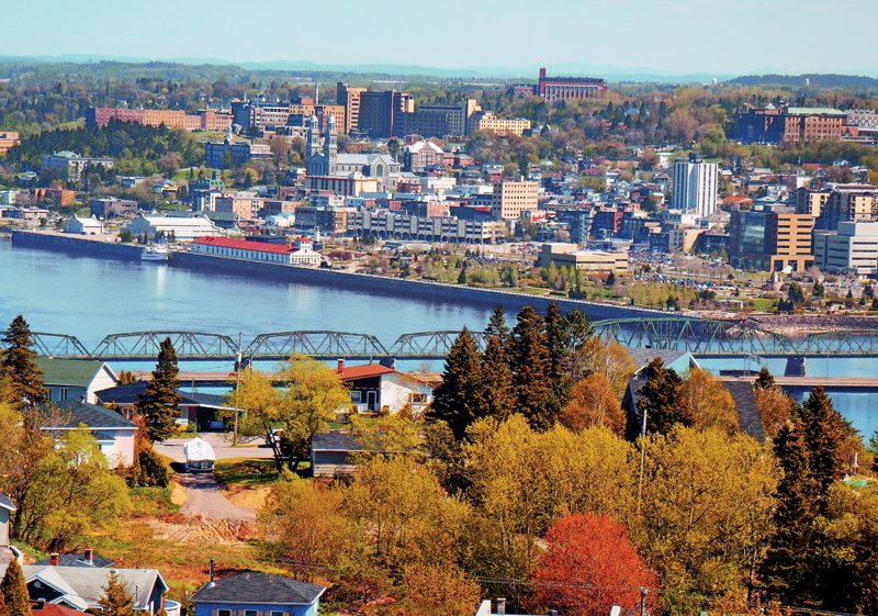
Retracing my path to Chambord I followed Route 169 Sud to Route 170 in Métabetchouen-Lac-à-la-Croix before veering east and away from the lake. Ville de Saguenay is an amalgam of three smaller cities—Jonquière, Chicoutimi and La Baie—but maps can be deceiving. Instead of one sprawling city there are vast stretches of rural landscape around and between the downtown centers.
Continuing on Route 170 was the quickest way to reach my hotel, but Route 372 is a scenic road that leads into the heart of Chicoutimi. It also allowed me to check out the world’s first aluminum bridge by making a short detour on Route des Ponte (Bridge Route). Alcan established its first aluminum smelter here in 1926 and created a company town called Arvida—allegedly built in 135 days—that same year. Vast amounts of power are required to transform bauxite into aluminum by electrolysis, and from the highway the processing plant is almost hidden by a maze of huge electrical transformers and towers.
The Dubuc Bridge in Chicoutimi is the last opportunity to cross the Saguenay Bridge before reaching the ferry at Tadoussac, while Route 175 leads south to Québec City. Chicoutimi’s vibrant local café scene is found in the historic downtown along Rue Racine (Racine Street); Boulevard du Saguenay continues along the river to rejoin Route 372, which ends at Route 170 in La Baie.
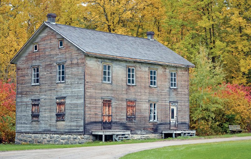
Making a right turn immediately after crossing the little bridge over the Chicoutimi River, I parked my bike below the Little White House. For two days during July of 1996, this tiny residence withstood a flow of water equal to that of Niagara Falls. The Saguenay Flood was the worst in Canadian history and this small clapboard building has become a symbol of perseverance for the residents of this region.
Turning right onto Route 175/Boulevard Talbot, I continued up the hill to rider-friendly Hôtel La Saguenéennee. Most of Saguenay’s major retail stores, gas stations and restaurants are established along this boulevard and my destination was located immediately after turning onto Des Saguenéenne. With an in-house restaurant, saunas, hot tubs and an indoor pool, it has more comforts than home.
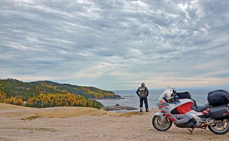
The Saguenay Fjord, like those in Norway, was created by the advance of mile-high glacial walls during the last Ice Age and is hundreds of feet deep. However, the same glacier also cut two other parallel channels, albeit not as deeply. Route 170 follows the glacially gouged trench on the south side, Route 172 the northern one.
the Saguenay Fjord.
I was headed for Tadoussac, but a full tank of gas is essential before leaving Chicoutimi regardless which direction or highway one chooses. Taking the first exit on the far side of the Dubuc Bridge and making a 270-degree tight left sweeper put me on Route 172. The highway soon returns to the river, where it offers distant views of the head of the famous fjord. Beyond St-Fulgence the road climbs into the mountains and out of sight of the Saguenay River. In a few rare places, other rivers have cut narrow channels through the rock walls that separate this trough from the fjord. The first of these leads to Sainte-Rose-du-Nord.

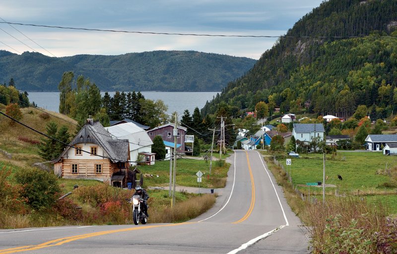
Rue du Quai undulates as it descends the narrow valley to Théophite Cove and the charming little village of Sainte-Rose-du-Nord. The pier offers a stunning view into the fjord while a small restaurant provides a much-needed cup of hot coffee. There was a Ducati rider from Toronto at the quay. Discovering that we had much in common, we decided to ride together for the next several hours.
Route 172 becomes an ideal motorcycle road: smooth pavement, curves, little traffic and fantastic scenery framed between craggy cliffs. The Sainte-Marguerite is a salmon river and the occasional figure standing in the tannin-stained water can be seen casting flies even late in the season.
At the junction of Route 138 I turned west, my companion having already gone ahead while I stopped to take photos. The long hill descending to the mouth of the fjord had a very long line of parked traffic waiting for the next ferry to cross the Saguenay River to the Charlevoix, while a left turn lead into the town and the last gas station until reaching Saint-Siméon.
Tadoussac has a beautiful bay; Jacques Cartier anchored here in 1535, so did Pierre Chauvin in 1599 and Samuel de Champlain in 1603. Chauvin stayed and built the first fur-trading post in North America. The small colony thrived and this town has the distinction of being the oldest continuously occupied French settlement in the New World. Chauvin’s trading post has been reconstructed, a reminder of the days when canoes laden with furs journeyed down the river from the Kingdom of Saguenay.
where whales can usually be spotted.
Heading back to the highway I met up with my companion and we found our places in the line waiting to board the ferry. Québec City was still three hours away.
The Saguenay is often described as being an oasis in the wilderness, yet it is not difficult to find. One only has to follow Interstate 91 north to the U.S./Canadian border at Derby Line, Vermont, where it becomes Autoroute 55, which in turn becomes Provincial Route 155. When PR 155 ends at PR 169 on the shore of Lac Saint-Jean you’re in the Saguenay.
(This article The Kingdom of Saguenay was published in the September 2013 issue of Rider magazine.)
 |
 |


