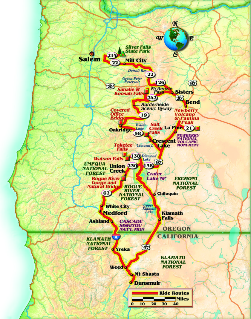
Oregon’s Cascade Mountains were created by volcanic fire and falling water. Today the fire is gone, but the volcanic formations and falling water remain, providing breathtaking natural scenery and motorcycling roads we all dream about riding. This tour crisscrosses Oregon’s central and southern Cascades and is complete with magnificent visual delights and sensual riding pleasures.
From Southern California, we spent about two days pounding Interstate 5 north to reach this riding dreamland. I was traveling with my friend Andy, who is also my family doctor—how often do you have your personal physician along with you? After a long, numbing first day, we treated ourselves to a night in a real caboose at the Railroad Park Resort in Dunsmuir, California.

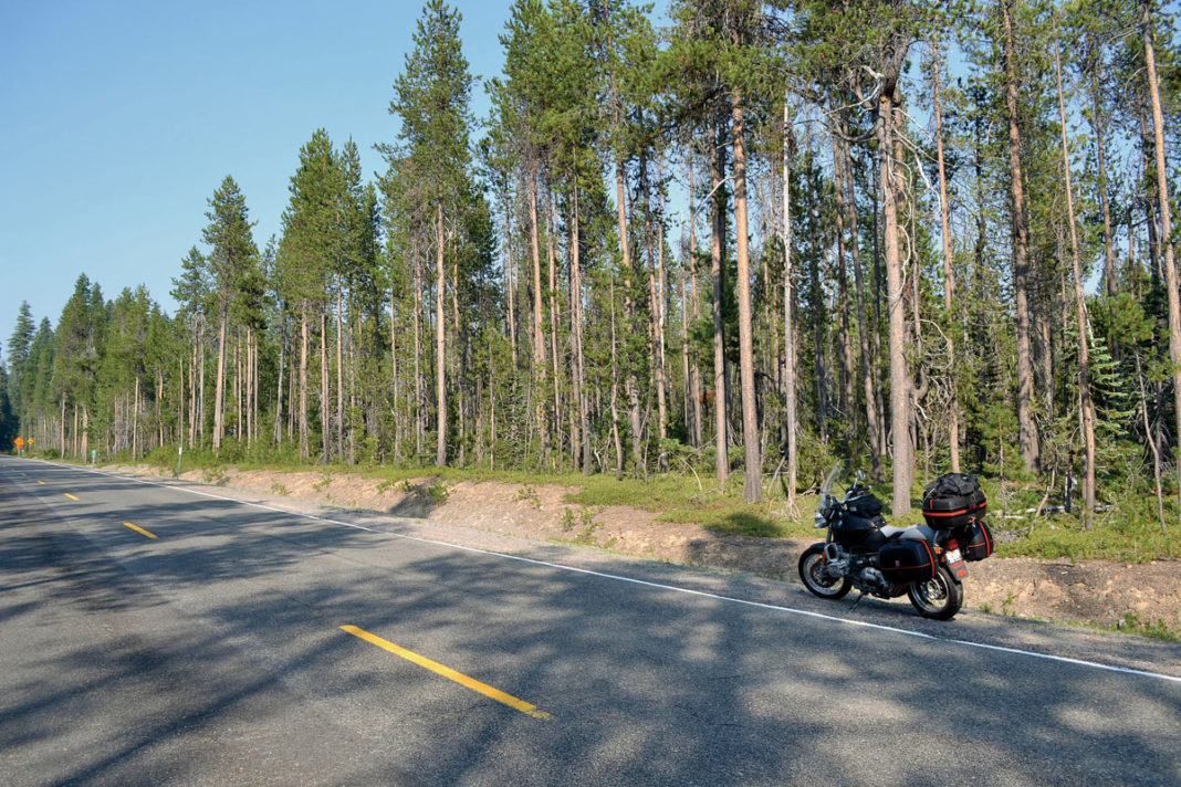
The next morning, we were heading north again on Highway 97 through Weed, California. Since Andy hadn’t been in Oregon, we made the mandatory pass through Crater Lake National Park. Highway 62 and 138 off Highway 97 are pleasant two-laners with gentle rhythmic curves, great forest and volcanic scenery. Surprisingly, the northern faces of the crater still had large patches of snow even in late July—I was getting really chilled in my mesh jacket! Back on Highway 97, we continued north to Bend, Oregon, which was our two-day exploration base. Highways 97 is a wide, straight two-laner with several passing lanes to get around the 18-wheelers and RVs. The highway runs through mostly reforested and logged country. Oregon has very few freeways, so most east-west and north-south roads are two lanes with numerous passing lanes.
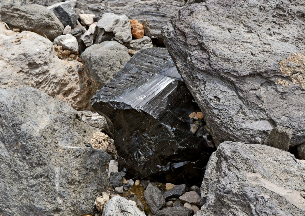
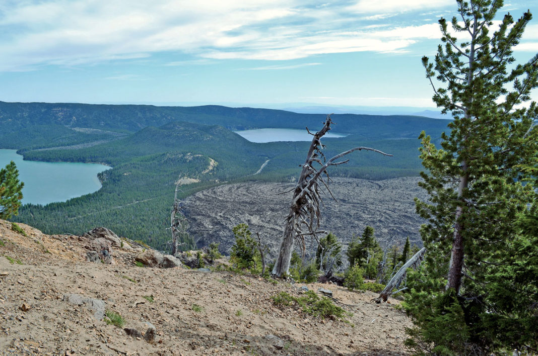
Our first touring day started by heading back south on Highway 97 to take U.S. Forest Road 21 into Newberry National Volcanic Monument. Newberry Volcano is a huge caldera that covers 500 square miles, one of the largest “shield” shaped volcanoes in the contiguous 48 states. It was early morning, so we headed up to Paulina Peak overlook (7,985 feet) hoping to avoid other vehicles, since the road is a four-mile, single-lane, very windy and steep gravel mountain road. I woke up really fast when my rear tire started kicking out sideways over the washboards through the tight curves. On the peak, the view of Paulina and East Lakes is fantastic. These were once a single lake until a volcanic eruption formed a small cone, dividing them into two lakes. Aiming toward the middle of the lakes, you see the vast Big Obsidian Flow resulting from the most recent eruption. Thankfully going down this gravel road is much easier. Reaching a normal heart rate, we stopped to view Paulina Falls spilling 80 feet over volcanic cliffs. The creek actually divides into two falls, a full stream spill and a shear transparent spill.
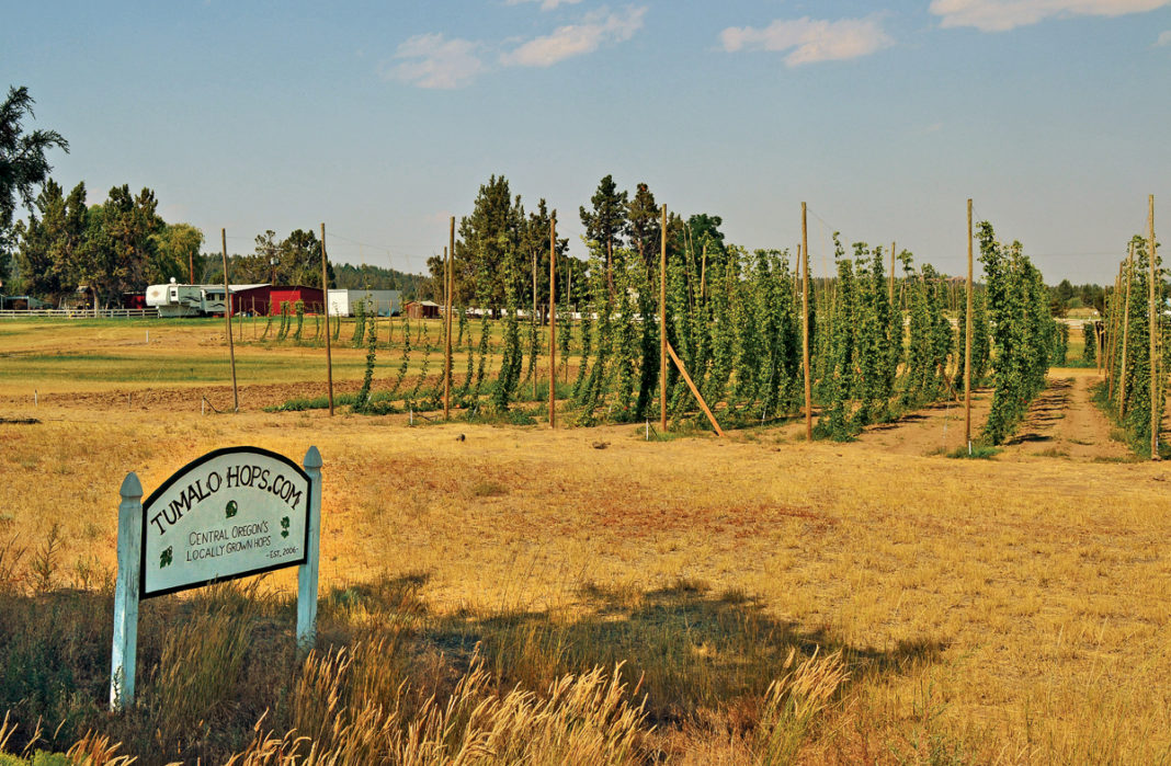
Leaving Newberry, we headed back to Bend for a late breakfast at Jake’s Diner, then cruised northwest out of town on Highway 20, a two-lane road gliding through pastures with grazing horses and reforested stands of conifers. Outside the little town of Sisters, we passed a farm growing hops and a microbrewery offering beer tasting—maybe later. Sisters has a unique modern western motif and no stop signals or signs—people grab a flag from a corner rack, hold it up and venture across the street. Beyond Sisters, we rode into mountainous forest terrain. Around Santiam Pass, we turned northwest onto Highway 22, riding through magnificent dense green forests. Enjoying the gentle curves, we reached huge Detroit Lake, with a capacity of 455,000 acre-feet. It was created in 1953 by the Detroit Dam, which looks like a smaller Hoover Dam and rises 463 feet above the Santiam River. Continuing down the mountain, we transitioned from forests into pastures and fields. Reaching State Route 214 we turned north, passing through Sublimity.
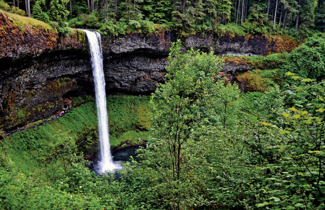
Silver Falls State Park near here is located in a spectacular lush temperate rain forest. This beautiful green wonderland offers camping, picnicking, fishing, hiking and just plain gawking at more than 10 stunning waterfalls. North Falls can be seen from the side of Route 214. Enjoying South Falls requires a $5 fee to enter the park and a short walk on a paved pathway. After this soothing interlude, we backtracked on our route to Bend, stopping for a late lunch at Rosie’s in Mill City on Highway 22. Rosie’s is a great little coffee house and bakery. My croissant turkey sandwich was so delicious I decided to buy two Green Goddess muffins for the next morning, which were so tasty I was tempted to go back for more. Toward the end of Highway 22, we passed fields of barren lava flows that reminded me of huge dirt clods plowed up by a giant tractor.
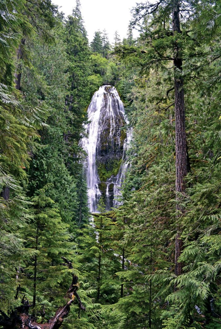
After our final night in Bend, we rode up through Sisters to catch Highway 242 southwest over McKenzie Pass. Most of this route is a comfortable cruise, but over the summit it turns into a writhing serpent that demands your full attention. At the top, we were rewarded with fantastic vistas of 7,794-foot Mount Washington and the Three Sister mountain peaks. Continuing down, we reached the trailhead for a 1½-mile hike to lacy 226-foot Proxy Falls. This is worth the effort if you have the time and energy.
At the end of Highway 242, rejoining Highway 126, we cruised northward looking for 120-foot Sahalie Falls and 90-foot Koosah Falls. Each has a parking area and can be seen after a short walk. A very pleasant, shady 0.3-mile trail along the McKenzie River runs between the Falls. After savoring their awesome beauty and power, we rode back west past Rainbow, watching for U.S. Forest Road 19, the Aufderheide Scenic Byway. This road is a treat, with numerous demanding curves and hardwood tree canopies so dense it feels like being in a green tunnel. We started by passing exposed volcanic formations skirting Cougar Reservoir on a McKenzie River fork. Farther on it’s like being in a primeval forest, where Robin Hood and Little John could rob us at any turn. This road is fairly well maintained, with few rough spots and numerous curves. Toward the south end we could see Constitution Grove, where huge 200-year-old firs have the names and states of U.S. Constitution signers. Reaching Westfir at the end of Forest Road 19, we got a final visual reward—the picturesque 180-foot covered Office Bridge, the longest in Oregon. Amazingly, Oregon has more covered bridges than any state west of the Mississippi.
Gassing up in Oakridge, we motored east on Highway 58 toward Willamette Pass, seeking Salt Creek Falls. This road started out as a wide two-laner with gentle sweeping curves which gradually tightened, giving the BMW a workout. After passing through the tunnel we pulled into Salt Creek Falls’ parking lot and took a very short walk to view the stunning 286-foot plunge of Oregon’s second highest waterfall. Here, the water leaps off the top edge of a magnificent basalt amphitheater and crashes into a waiting pool. Saddling up once again we crossed Willamette Pass, and since it was late afternoon, we took a chance and got lodging at the Willamette Pass Inn and Chalets in Crescent Lake. What a great room—kitchenette, dining and sitting area and a wood burning stove! Topping it off, I had the best cheeseburger I’ve ever tasted at Manley’s Tavern next door.
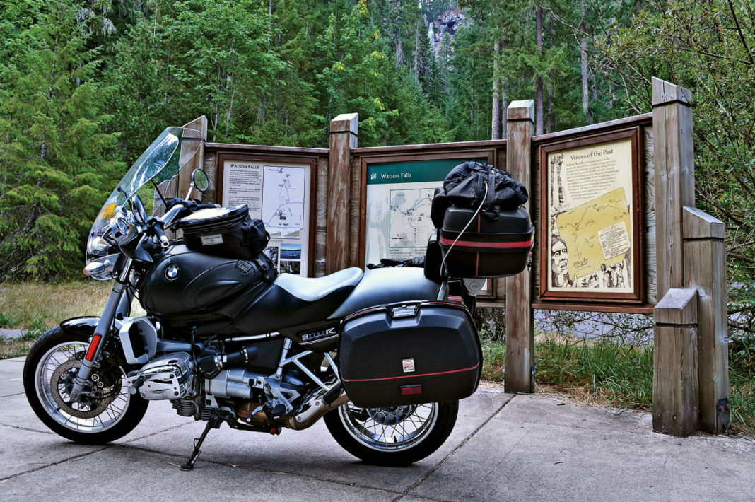
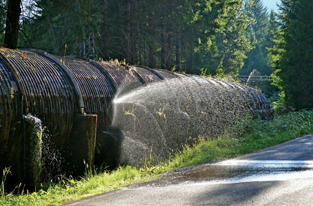
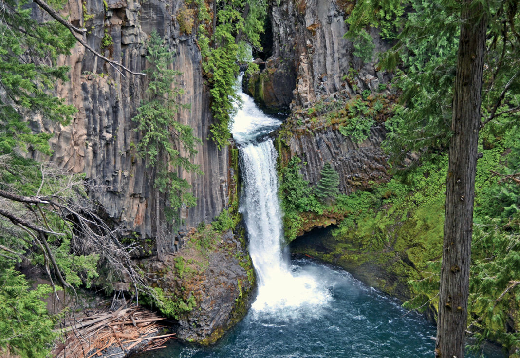
The next morning we continued east on Highway 58, then took 97 south before turning west on Highway 138. Here, we passed stands of reforested trees that looked like Christmas trees on stilts—tall bare trunks with the typical pine tree shape at the very top. Cruising westward about 40 miles, we reached Watson Falls. At 272 feet, this is Oregon’s third highest. You can see the Falls’ spill point from the parking lot information board area, but after just a 0.3-mile hike you can view its full drop. Back on 138, we rode west two miles to Toketee Falls. From its parking lot, the first thing we saw was the historic 1,500-foot redwood-staved (like a huge barrel), 12-foot diameter penstock that feeds a 45-megawatt generator. The penstock’s pinhole leaks gave us a cooling spray. Getting to 120-foot Toketee Falls requires hiking a half-mile trail with 97 steps up and 125 steps down. It’s a bit of a challenge, but Toketee’s unique setting and spectacular beauty will reward you. Turning around, we headed east on Highway 138 to catch Highway 230 southwest, which becomes Highway 62.
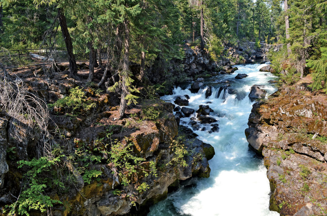
Reaching Union Creek on 62, we found Cones and Company, an ice cream shop that is a stopping point for local riders. Cooled off after a tasty treat, we cruised down Highway 62 through a mature conifer forest and arrived at the Rogue River Gorge and Natural Bridge location. The natural bridges are lava tubes formed when the top of the basalt lava flows solidified and the hot inner lava continued to flow. Eventually this phenomenon created a hollow tube. The Rogue River flows through this huge lava field and disappears into the lava tubes to reappear 200 feet later. The whole area has stunning volcanic scenery and is quite interesting. Mounted back up, we rode down Highway 62, swaying back and forth through gentle curves following the Rogue River toward Medford, Oregon.
Just as I was thinking that we were ready for our first leg home, it seemed I had uncorked the “wild rider genie” in Andy. He didn’t want to pound Interstate 5 straight home just yet, but preferred we take a scenic detour through Lassen National Park. Well, OK! Always happy to ride more dazzling scenery and rhythmic curvy roads!
(This article Fire, Brimstone & Falling Water was published in the July 2013 issue of Rider magazine.)
 |
 |
 |
 |
 |
 |
 |
 |
 |
 |
 |
 |


