story and photography by Clement Salvadori
I am up in Carbondale, Colorado, preparing to head back to California via the Four Corners. The 1,200-mile trip could be done in two long June days. But since I have three days before I’m expected at home, the Harley Ultra and I will dawdle a bit, stop and look at interesting places along the way. Though I have ridden past the Black Canyon of the Gunnison a dozen times, I have never actually made the effort to go and see what the place is all about.
Carbondale is an entertaining town. It got its name a hundred and some years ago because it was a place where carbon, in the form of coal, was mined to fuel the steam engines which hauled the ore from the silver and gold mines in the mountains. Nowadays it is a pleasant little community, with a New-Agey aspect providing housing for some of the workers at the billionaires’ paradise called Aspen, 30 miles upstream along the Roaring Fork River. The mere millionaires have been forced downstream to places like Woody Creek.
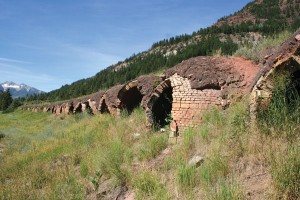
Tire inflation, rear shock pressure and oil level checked, gas tank filled up and I am off, south on CO 133 alongside the Crystal River, what the Colorado Tourist Bureau calls the West Elk Scenic Byway. Rivers are everywhere in the Rocky Mountains, with all that snow melting in the spring. We roll by the beehive coke ovens at Redstone, which is a pretty nifty community itself. This “Ruby of the Rockies” was built about 1900 by a very wealthy mine owner named J.C. Osgood, who made a lot of money in his various operations.
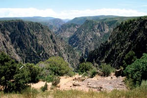
Old J.C. was a man ahead of his time who had a paternalistic regard for his workers, building 80-some cottages at Redstone with electricity and running water to house those who were making him rich. He also had a 40-room mansion constructed, which is now an expensive hotel known as the Redstone Inn. Upriver a few miles are the remnants of the town of Marble, which has an eponymous quarry that is still used. If you happen to have a Buell Ulysses, you could continue past Marble and try to get up the very rugged 10,700-foot Schofield Pass that leads to the vacation town of Crested Butte—but it is a rough go, I promise you. Three 14,000-foot mountains look down on the pass.
No dirt-road scrabbling for the Ultra and me; we are sticking to the smooth pavement of 133, thank you very much, crossing the Elk Mountains over 8,755-foot McClure Pass. As we leave the valley of the Crystal River the road makes a wide 180-degree turn and climbs sharply up toward the pass, with great views. The ascent is not a problem with this big fuel-injected 96-incher. At the top I meet a wobble of bicyclists who have just come up from Paonia and are taking a breather before the trip downhill. I don’t know what would be worse, the misery of pedaling uphill or the terror of going downhill with those flimsy brakes.
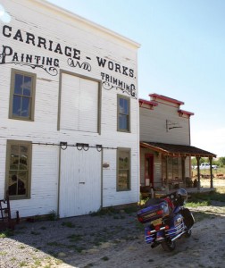
McClure is the divide between the Crystal River and the North Fork of the Gunnison River—both of which inevitably end up in the Colorado River. At the Paonia Reservoir a well-groomed dirt road goes over 9,980-foot Kebler Pass to Crested Butte, but I have another destination, the Black Canyon. A lot of coal is still being mined on this side of the Elk Mountains, as the little towns of Somerset and Bowie show with their coal-loading operations and 100-hopper car trains. A great deal of our nation’s energy comes from coal-fired powerplants.
We take a left turn and roll through Paonia, taking the back way to Crawford. Paonia is in a grape-growing region, and has a barrel-tasting fest every Thanksgiving. A hundred and more years ago a lot of the miners came from Europe and knew how to make their own wines, and today the vineyards produce everything from pinot noir to chardonnay.
But I am looking for lunch in Crawford, population about 400, where one of my favorite singers, Joe Cocker, built himself a less-than-modest house. And also opened up a café in town. Unfortunately the café is closed, and I did not have an invite to Mad Dog Ranch, so I do not get to meet Joe and thank him for the songs that kept me entertained on my cassette player in the highlands of Vietnam all these many years.
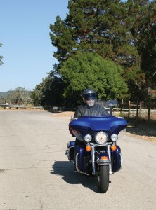
After a sandwich at another restaurant I head off east along Colorado Route 92, which runs on the north side of the Black Canyon. Just beyond the Crawford Reservoir is the north access to Black Canyon, a half-dozen miles of narrow pavement through this high-county ranching, and then a few miles of smooth dirt to the canyon’s edge. No entrance gate and toll collector on this side, though I ride to the little ranger station to ask about the best viewing. One uniformed fellow offers me a capsule history of the place, saying that the canyon got its start about 1.7 billion years ago when two volcanic ridges collided, and then things took a while to get settled. Relatively recently, like a mere 15 million years ago, the river began cutting its way through the rock. Before the advent of the Europeans the Ute Indians lived and hunted along both sides of the canyon.
After my little lesson I go and peer over the edge. The canyon is quite narrow, and very deep. At its closest the two edges are less than 50 feet apart, at its deepest, it is 3,000 feet from the top to the bottom. Riding along the dirt road skirting the edge I roll along very slowly, as most of it lacks a guardrail.
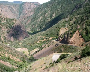
The Black Canyon of the Gunnison National Park is a pretty small park, as parks go, covering less than 50 square miles; it was declared a National Monument in 1933, upgraded to park status in 1999. The entire canyon is about 50 miles long, and the park includes 12 of the most dramatic miles. If you misread your map, you may actually think that the road crosses over the canyon—but it does not; Evel Knievel might manage it, but not me. However, it is an absolute wonder looking down into this chasm, marveling at the work of Mother Nature.
I can look over to the south rim and actually wave at people on the other side, who wave in return, but it is going to take me several hours to get there. I push the Ultra’s button and we head back to CO 92—which is an exceptional ride in itself. From Crawford it runs east about 40 very wiggly miles to Blue Mesa Reservoir, with minimal traffic; I may have passed half a dozen cars and pickups along the way. I keep my eyes on the narrow road, and slow way down or stop to admire the fine views. And finally drop down to cross the Gunnison along the top of Blue Mesa Dam.
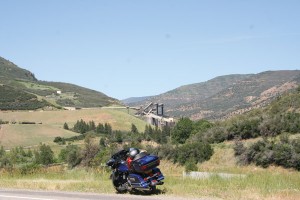
This dam, completed in 1965, was the first major dam on the Gunnison, and the reservoir behind it is part of the Curecanti National Recreation Area. The Ultra and I head west on U.S. 50, a much-traveled road with many tourists, few of whom ever go to this national park. The Denver & Rio Grande Railroad was built along here back in the 1880s, with some very difficult creek crossings along the way. At the wide spot in the road called Cimarron are the remnants of one of the original narrow-gauge trestle bridges—not quite original, as the 1882 version got washed away and was rebuilt in 1892. If you think smoothing out a highway is hard, try building a railroad.
A few miles west of Cimarron, CO 347 goes off to the right, welcoming the traveler to Black Canyon. I have been by this turn-off a dozen times, and never made the turn, always having to be somewhere. Now I do it. A steady climb takes me up to the entrance where an attractive young ranger looks at my Golden Eagle pass—there are advantages to growing older, as the Golden Eagle gives me free entry to all national parks—and then recommends that I take the road to the right and go down to the bottom of the canyon. “Motorcyclists all love it,” she says.
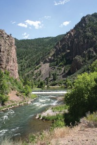
With reason, as it is a well-paved road with a very, very steep descent; I heat up those three brake discs while having a high old time. Down by the river it is a few degrees warmer than at the top, with a small dam and a camping area. The heat from the rear cylinder is making itself felt on my right thigh as I sit there at idle, but as soon as we’re moving it dissipates. I have a look around and then rush back up, which is equally fun and a little less adrenaline-inducing.
The road along the south rim is all paved, and undoubtedly makes nervous viewers in their motorhomes feel somewhat more secure. I stop at the visitor center to find out who this Gunnison guy was. Turns out that John William Gunnison was a New Englander, born in New Hampshire in 1812, a West Point graduate who joined the Corps of Topographical Engineers. He came west in 1849 to explore and map the land, but came to an untimely end during a misunderstanding with some Paiute Indians. However, he did get a river and a town named after him.
The road along the edge of the canyon has many pull-outs, and overlooks to walk to. That’s a long way down, is my constant thought every time I look over the edge. I can imagine the first Spanish explorers coming along 200 years ago and wondering how they would ever get across. The Black Canyon is a good deal smaller than the Grand Canyon, but feels a lot more threatening. While the Grand Canyon is spread out all across the horizon, the Black Canyon is narrowly focused, looking almost like a passageway to the center of the earth.
Musing about the possibility of pterodactyls still living in caves down there, I realize it is getting late. I crank up Ultra and we leave the park, thanking the ranger for her advice on that road to the bottom—now on my long list of superlative rides. We head along U.S. 50 to Montrose, where I finally get the tranny into sixth gear; it is very nice to have that overdrive, but it is not much use under 60 mph. I avoid the motels along the noisy main drag and find a quiet one along U.S. 550, where I would be heading in the morning. Right opposite a good Mexican restaurant.
I wake early and am on the road at dawn, heading south toward Ridgway, then west on CO 62 over 9,000-foot Dallas Divide, and south again on CO 145, past Telluride and over 10,000-foot Lizard Head Pass. In a few hours I would be going by Cameron, Arizona, and the turn to the South Rim of the Grand Canyon.
Do I want to double up on my canyon gazing? No, I’ll let the Black Canyon sink in for a while; you can have too much of a good thing.
[From the January 2008 issue of Rider]


Sweet!