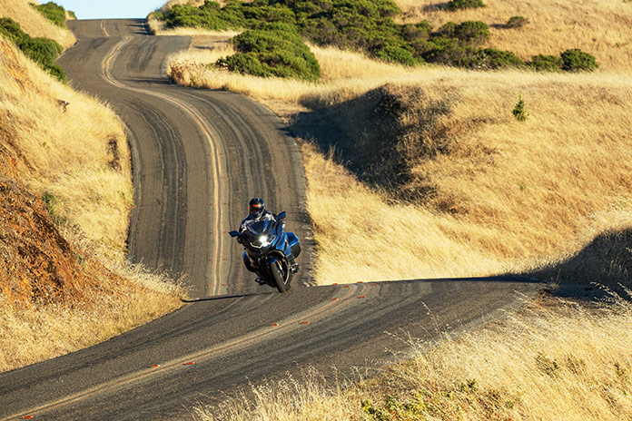
California is known for excellent motorcycle roads. But even in such a target-rich environment, there are special areas that offer a mind-boggling blend of scenery, curves, and variety. The best motorcycle roads in Marin County, California, which occupies a large peninsula north of San Francisco, are some of the best in the state.
Click here to view route on REVER for Best Motorcycle Roads in Marin County, California
See all of Rider‘s California motorcycle tour features
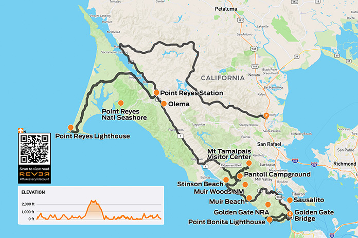
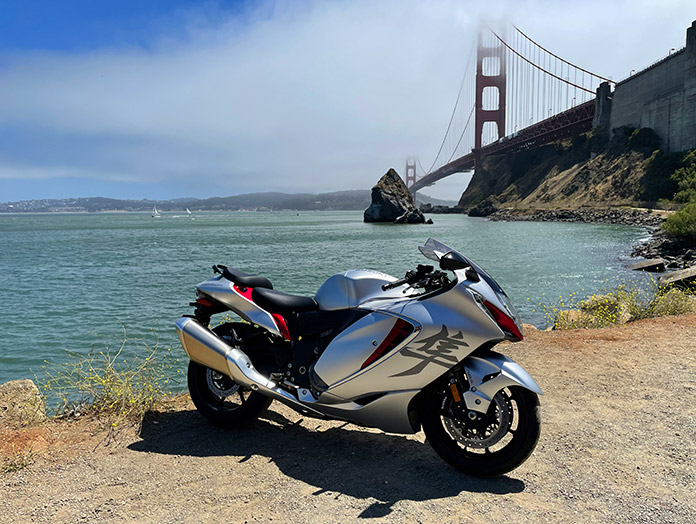
This 140-mile paved route begins at the southern tip of the Marin County peninsula, which is part of the Golden Gate National Recreation Area. Near the northern end of the Golden Gate Bridge is the Moore Road Pier, a perfect location to capture a selfie or a photo of your motorcycle with the iconic red suspension bridge and San Francisco in the background – though both may be hidden by fog, especially during summer months.
From the pier, Bunker Road climbs up to the Baker-Berry Tunnel, passes under U.S. Route 101, and descends into a valley as it enters the Marin Headlands area of the GGNRA. Turn left on McCullough Road to begin a curving ascent to a roundabout, then turn right on Conzelman Road for a scenic ride high above the Pacific Ocean (the road becomes one-way).
This area was fortified during World War II, and stops along the way include Hawk Hill (which once housed the radar and launch control center for the nearby nuclear-missile Nike Site SF 87L), Battery 129, Battery Rathbone-McIndoe, and Battery Wallace. At the end of Conzelman Road, there is a parking area for a hiking trail to Point Bonita Lighthouse.
Related: Suzuki Hayabusa, 1999-2024: Your Majesty for 25 Years
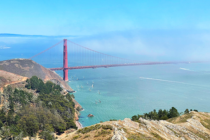
Field Road takes you past the Nike nuclear-missile site and down to Rodeo Lagoon, ending at Bunker Road. A left turn takes you to Fort Cronkhite, a former World War II military post. Turn right and return to McCullough Road, make a right turn, and ride up to the roundabout again. A left turn on Conzelman Road continues the high scenic drive in the opposite direction (the road is one-way) toward Battery Spencer, a popular overlook that puts you at eye level with the Golden Gate Bridge.
Conzelman Road ends at U.S. 101 (known as the Redwood Highway for 350 miles up to Crescent City), and going north climbs up a ridge, through the Robin Williams Tunnel, and past the iconic bayside town of Sausalito. Take the exit for State Route 1 (445B), cross Coyote Creek, and take a left at the next traffic light (there’s a gas station on the corner). SR-1, also known as Shoreline Highway, winds tightly through a residential area as it climbs up to Bolinas Ridge. Near the top, you’ll see signs for Muir Woods National Monument, a nature preserve that protects old-growth redwoods.
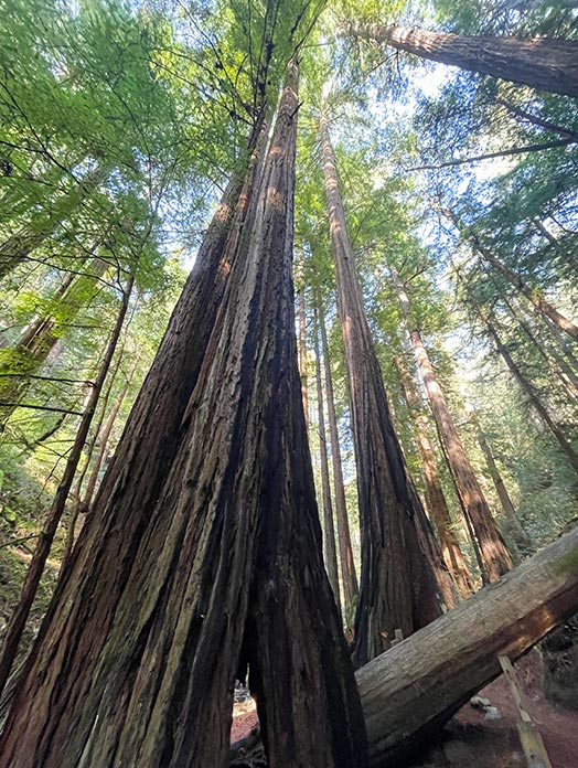
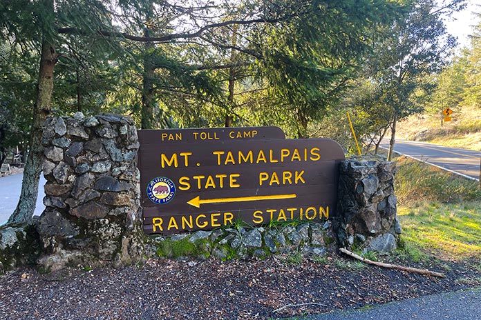
Continue on SR-1 for a wonderfully twisty descent down to Muir Beach. Stay on SR-1, and just before Stinson Beach, turn right on Panoramic Highway, which climbs up through towering stands of coast redwoods along Webb Creek. At Pantoll Campground (a good place for a restroom break), turn left on Pantoll Road for a winding ride along the grasslands of Bolinas Ridge.
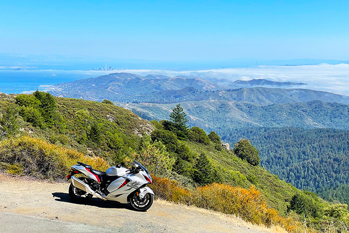
Pantoll Road ends at Ridgecrest Boulevard. A right turn begins yet another winding, scenic ridgeline ride, this one to the East Peak of Mount Tamalpais. There’s a parking area, a visitor center, restrooms, and a trail around the peak that offers 360-degree views from nearly 2,600 feet above sea level. On a clear day, the skyline of San Francisco will be visible to the south.
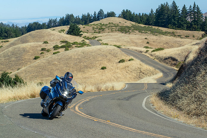
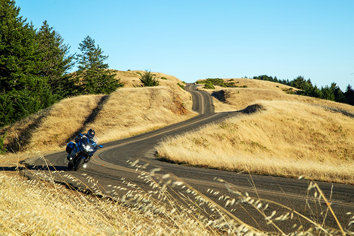
The parking lot at East Peak is a dead-end, so backtracking on Ridgecrest Boulevard is the only way out, but it’s a great ride so no one will complain. When you reach the junction with Pantoll Road, continue on Ridgecrest Boulevard as it bobs and weaves over grassy hills and exposed rock along Bolinas Ridge. This stretch of road has been the setting for numerous car ads and commercials. There are pull-outs along the road, and it’s worth stopping at several to take in the bird’s eye view of the Pacific Coast, particularly Bolinas Bay.

Related: BMW K 1600 GTL Review
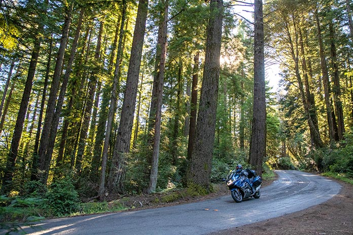
After a few rollicking miles, you’ll enter a tunnel of trees as the grasslands give way to a dark redwood forest and Ridgecrest Boulevard soon ends at Fairfax-Bolinas Road. Turning around and riding Ridgecrest again is perfectly okay; in fact, we recommend it! When you get back to the junction with Fairfax-Bolinas Road, turn left and enjoy a tight, twisty, steep descent back to SR-1.

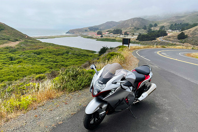
Turn right (north) on SR-1 and take a breather as you cruise alongside Olema Creek. After passing through the small village of Olema, turn left onto Sir Francis Drake Boulevard, which runs along the shore of Tomales Bay before turning inland and climbing up Inverness Ridge.

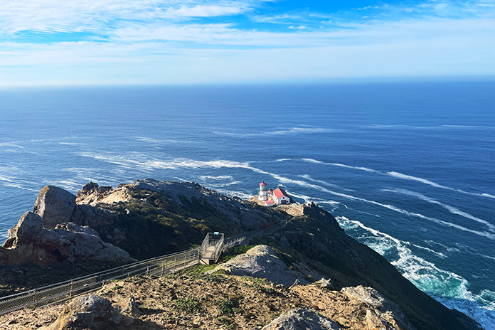
After cresting the ridge (you’ll see a sign for Point Reyes National Seashore), stay left on Sir Francis Drake Boulevard. The next 13 miles are a scenic, rolling ride through farmland and protected parkland. The road ends at a parking area for the Point Reyes Lighthouse, and nearby is an overlook for a sea lion area. On this road we’ve seen deer and coyotes, so stay frosty.

The lighthouse parking area is another dead end, so backtrack to the junction with Pierce Point Road. We recommend turning right, but turning left is a nice add-on spur (18 miles roundtrip) that goes through Tomales Bay State Park and out to the Tomales Point Trailhead near Pierce Point Ranch. The hike out to the point is scenic, and you’ll likely see the herd of tule elk that live out there.

Return to SR-1, turn left, and cross the small bridge into the town of Point Reyes Station, an ideal place to stop for lunch and gas up. Continue north on SR-1 and ride along the northern shore of Tomales Bay, which is known for its briny oysters. At times the road runs right along the edge of the water, and the curves are often delightfully tight.

As soon as the road veers inland, turn right on Marshall-Petaluma Road, a gracefully winding country road. Turn right on Hicks Valley Road, right on Point Reyes-Petaluma Road, and finally left on Nicasio Valley Road near the reservoir. After passing through Nicasio, veer left on Lucas Valley Road, another winding, rural road that will delight you with curve after curve. As you approach the community of Lucas Valley, you enter a residential area and soon arrive at U.S. 101 again.
While these are the best motorcycle roads in Marin County, there are more to explore. Just pull up the area on REVER or Google Maps and look for the squiggly lines.
See all of Rider‘s touring stories here.


You should really warn your magazine subscribers up front that your trip tracks are just an advertisement for another business and not actually available to your magazine subscribers. Without paying money to this third party, I have no access to the tracks.
You can access the route and use the “Export GPX” button to download the track without setting up an account on REVER or paying any fees.
Looking at the map today (8/6/2025) the last half mile or so where Ridgecrest intersects Fairfax- Bolinas Road is closed. Not sure why or for how long, but heads up.
Thanks for the road conditions update!