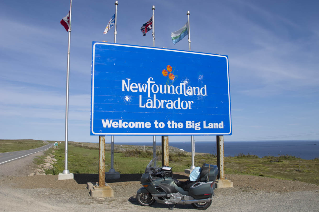
Newfoundland and Labrador, the easternmost province in Canada, fights a losing battle patching its roadways. Realizing it’s a lost cause, the province simply erects signs along the way warning “Potholes Ahead.” It’s a challenging slalom on a motorcycle, let alone in a car. I watch the suspension jolt on the van ahead carrying my wife and two teenage sons. New struts and an alignment are in order upon our return.
This is a cautionary tale about undertaking a “family vacation” when your family is in a van while you expect to experience the freedom of tagging along on your motorcycle. My wife, Nancy, has the notion of taking a ferry across the strait to coastal Labrador on the mainland to drive the mainly gravel Trans-Labrador Highway after we’ve finished our tour of Newfoundland. I, on the other hand, have serious reservations about adventure biking on my 850-pound beast of a BMW K1200LT, now with more than 200,000 miles on it. So, we will part ways after the ferry crossing to Labrador. And soon thereafter I would learn a bit of humility from some Canadian riders.
Meanwhile, we have arrived on Newfoundland’s Avalon Peninsula after a 16-hour ocean crossing from North Sydney, Nova Scotia. We enter fog and wind on our southern loop around the peninsula by way of Trepassey Bay, common weather features in this part of the country. But conditions improve at Lord Baltimore’s Colony of Avalon, the best preserved early English colonial site in North America. Archaeologists continue to dig as we tour the area. At the nearby Tetley Tea Room by the Sea, we sample our first Newfoundland cod and wild berry treats.
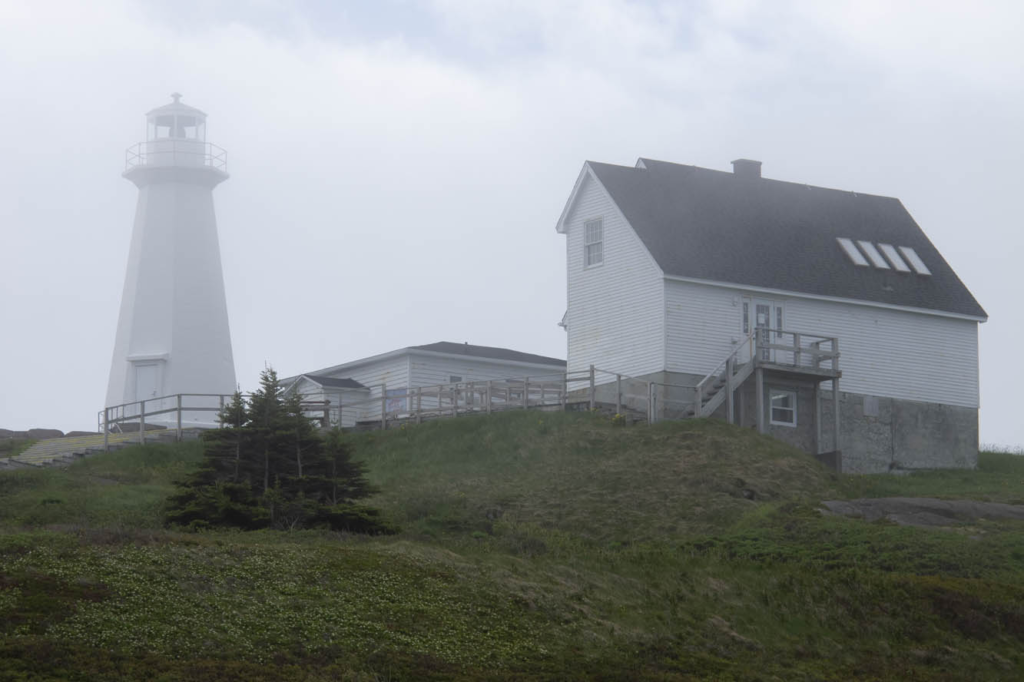
Nearly 100 lighthouses once peppered the shorelines of Newfoundland and coastal Labrador, and we encounter our first ones at Cape Spear, the easternmost point in North America. One, dating back to 1836, is the oldest surviving lighthouse in the province. The more modern one, erected in 1955, houses an adjacent museum. Here we learn there are 23 staffed lighthouses remaining in the area. In the distance we saw Signal Hill, our next destination.
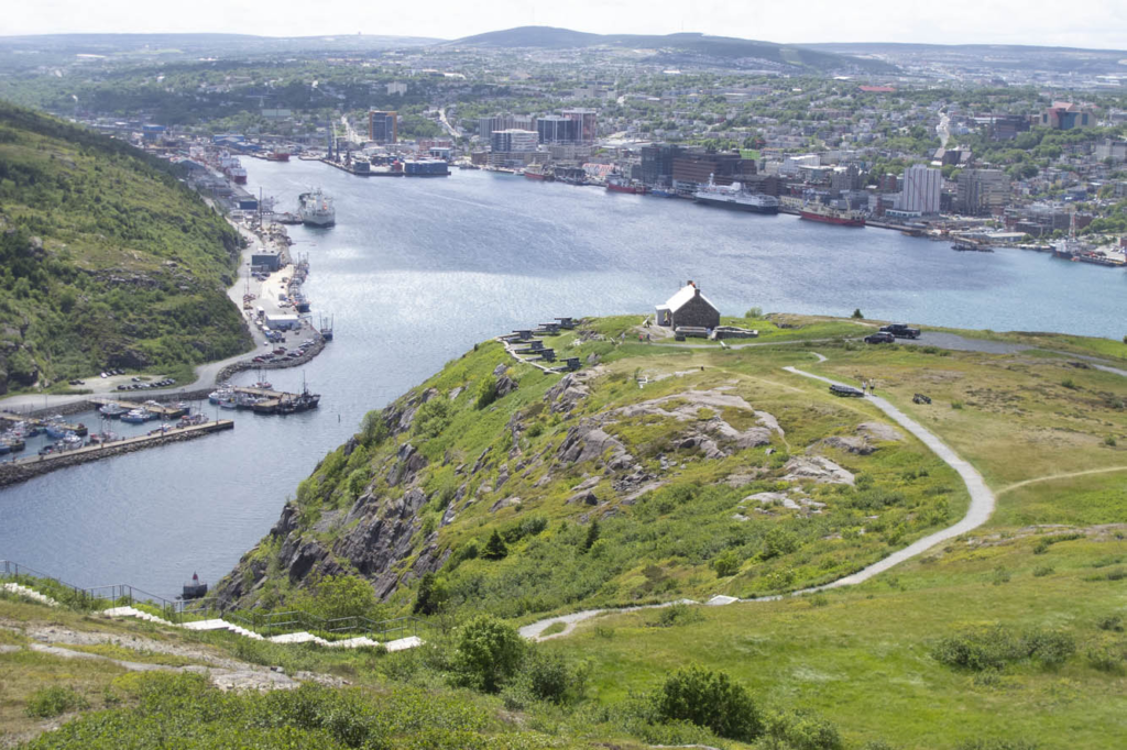
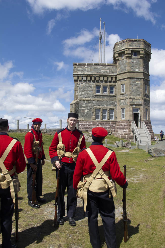
We negotiated the downtown minefield of St. John’s to reach a better perspective of the city from Signal Hill National Historic Site. The narrow harbor entrance drove many a sailing ship to peril. A colorful regiment of signal corps were practicing for their daily tattoo in front of Cabot Tower, a sandstone Gothic Revival structure begun in 1898 to commemorate the 400th anniversary of Italian John Cabot’s discovery of Newfoundland and the 60th anniversary of Queen Victoria’s reign. Marconi received the first wireless transatlantic transmission here in 1901.
Nancy wanted to explore downtown St. John’s, while I desired to escape Newfoundland’s capital and largest city. Changed my mind at lunch in a rathskeller dive where we were served outstanding cod burgers and I discovered Iceberg Beer. St. John’s Quidi Vidi Brewery claims it is enhanced by pure 20,000-year-old iceberg water. I detect crispness in this pale lager that similar brews lack. Our two boys, both crew rowers, were excited to find out from our friendly waitress that the Royal St. John’s Regatta is North America’s oldest continuing sporting event. That’s appropriate, since St. John’s is the oldest English-founded city on the continent.
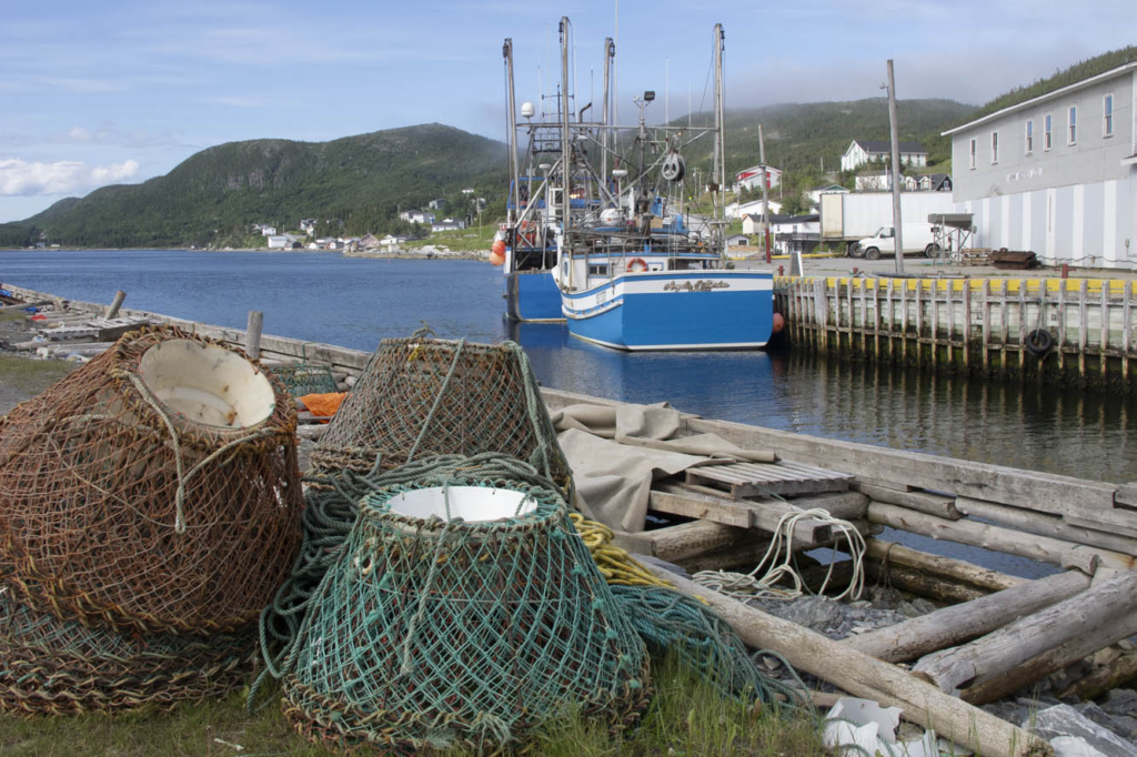
The Trans-Canada Highway leads us inland through the Eastern Region. Insidious longitudinal potholes jar the unwary. Canadians whoosh by, heedless of the hazard. My shocks are taking a beating, and they were leaking even before this trip. We set up camp at Notre Dame Provincial Park in the Central Region, and I take to the van for exploration around Twillingate. At Boyd’s Cove, we visit the Beothuk Interpretation Centre to learn about the extinct native inhabitants of Newfoundland.
In a tiny outpost called Clarke’s Head, I backed the van into a local’s vehicle at a gas station. “See what trouble I get into when I’m off the bike?” I say to my wife. The Newfoundlander was almost apologetic for being in my way, and we parted in friendly fashion. I can’t imagine that happening back in New York.
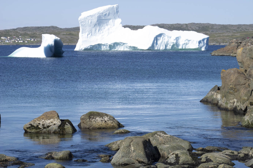
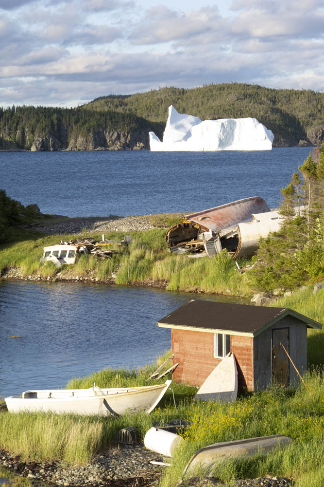
I mounted the bike for our next excursion up the Baie Verte Peninsula. The 50-foot skeleton of a humpback whale was worth scrutinizing at King’s Point. On the way to the tip of the peninsula at Fleur de Lys, we diverted to Smith’s Harbour, having learned that a huge iceberg had settled there. Indeed it had, and a picture perfect little place it was. These bergs drift off from the Labrador Current into nearby harbors, bays, and coves brought here by the wind and tide.
Back in the town of Baie Verte we learned about the peninsula’s rich mining history. Indeed, we passed a huge abandoned asbestos mine on the way to Fleur de Lys, where soapstone was quarried by the Dorset Paleo-Eskimo some 1,600 years ago. After reaching the end of the road, we were about to turn around when a pickup raced up and blocked our way.
The driver turned out to be a friendly local resident who noticed our New York license plates and wanted to chat. Encounters like this were common for us throughout Newfoundland.
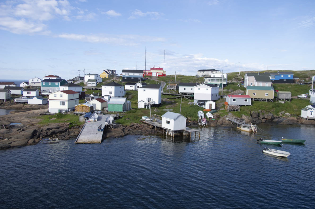
So far, our progress was slow. Stopping frequently and visiting the numerous outport villages didn’t accumulate the mileage. Many were the dead-end roads we explored. I reviewed my mileage log once we were in the Western Region: 70 miles one day, 105 miles the next, followed by 90 miles, 62 miles, then zero, zero. Aaaughh!
I finally rode a 200-mile day from Baie Verte to Trout River campground in Gros Morne National Park. This area is a UNESCO World Heritage Site defined by ancient up-thrust landscape forming the tip of the Appalachian Mountains. The Tablelands region exposes examples of the earth’s mantle. Glaciers carved out a fjord at Western Brook Pond, where we took a boat ride beneath 2,000-foot cliffs. Ice fields cling to crags, offering summer habitat to the caribou and puffins.
If there was a central point to this wilderness, it would be picturesque Rocky Harbour, sheltered by a lighthouse promontory and twin Appalachian ridges dipping into the Gulf of St. Lawrence. The Gros Morne Wildlife Museum in town is worth a look. The Ocean View Hotel displays unique local artwork and hosts the Anchor Pub, where one can be “screeched in” as an official Newfoundlander. The boys were greatly disappointed they weren’t allowed to drink the rum and kiss a codfish. Earl’s restaurant offered moose burgers, moose soup, moose pizza, and any other variety you’d like. We left sated.
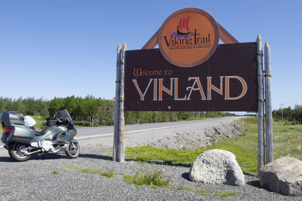
I gave the BMW free reign on Route 430 up the western coast of the Northern Peninsula, a smooth-surfaced road flowing alongside the Gulf of St. Lawrence, with the Long Range Mountains framing the eastern horizon. Felt like being back on Highway 1 in California. This is the Viking Route that would lead us to the first established European settlement in North America at the very tip of the Northern Peninsula. It also has the largest density of moose on the continent, and we had already seen several.
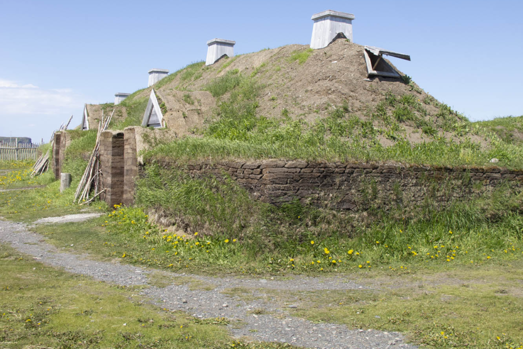
We had fun interacting with interpreters at L’Anse aux Meadows National Historic Site, location of the Viking presence here in 1,000 A.D. We walked through a reconstructed encampment of turf-walled longhouses while re-enactors stayed in character demonstrating the daily life of the Norsemen. Our tour continued at nearby Norstead, a living history site of additional costumed interpreters and a fully replicated Viking ship.
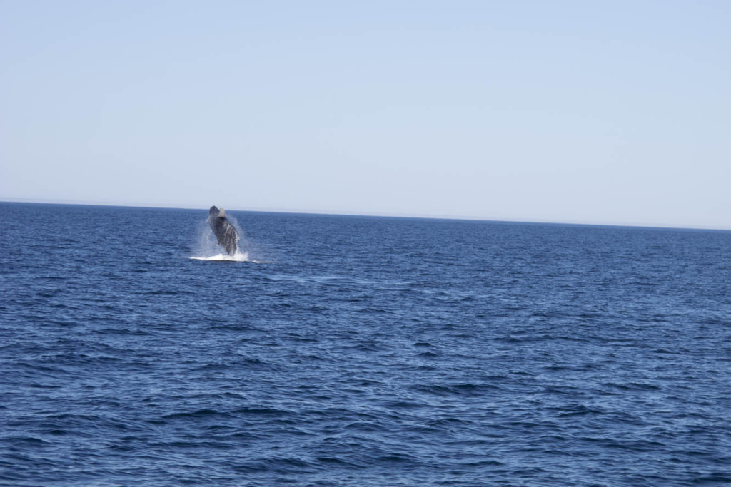
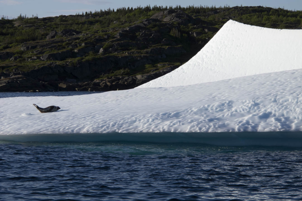
We hit paydirt in St. Anthony, viewing a harbor filled with icebergs. A boat tour brought us up close to these ice cathedrals. A humpback whale breached for us several times. A pod of minkes came alongside the boat. A seal reclined upon his private ice floe. We absorbed the opportunity, because two days later the icebergs had broken up, which can happen quickly we were told. By mid-July any icebergs become a rare sight.
A ferry took us across the Strait of Belle Isle to coastal Labrador. A 50-mile ride brought me along the strait and over the mountains to Red Bay, a 16th-century Basque whaling port. Red Bay also offers access to the Trans-Labrador Highway, and this is where my family and I parted company. I had reservations aboard a supply ship that routinely sails upstream to replenish harbor towns with no connecting roads along the Quebec coast.
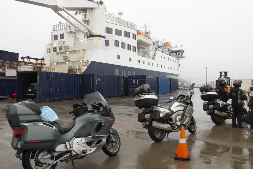
I returned to the ferry landing at Blanc-Sablon, Quebec, and lined up with other motorcyclists early on a rainy morning. The bikes were loaded two to a container, tied down, and hoisted by a mammoth boom crane into the vessel. Two Honda ST1300 riders humbled me because they had just completed the Trans-Labrador trek. We would disembark where the road begins anew in Natashquan. Or so we thought.
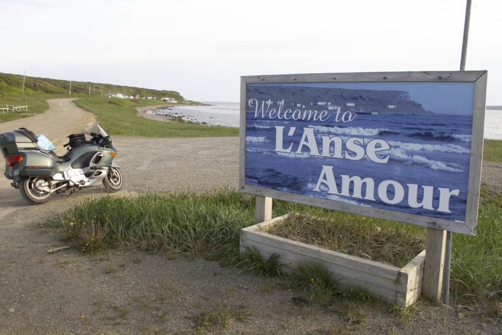
Circumstances changed upon reaching the village prior to Natashquan hours behind schedule. We all had reserved respective B&B inns in Natashquan, where we wouldn’t arrive now until the wee hours of the morning. We learned there was indeed a 20-mile road from the village to Natashquan, but it was all gravel. Nonetheless, all riders, except me, decided they would disembark here and risk the unfamiliar road in the midnight blackness.
Now, I’ve ridden my share of gravel roads, I told them. Even did the 1,200 miles of Alaska Highway when it was unpaved. But I was much younger and more fearless. My concern today was dropping my precious K1200LT, resulting in thousands of dollars in cosmetic damage. But my bike shared a container with one of theirs, and all looked askance at my weak rationalization. To regain self-respect, I agreed to accompany them.
It turned out to be the most anxiety-inducing 20-mile ride of my life. Inky blackness and bunched gravel had me plowing from one side of the road to the other, trying to find a tractable groove. It didn’t help that I was reluctant to get the speed up. One of the Canadians on his Kawasaki Tengai remained behind me for assurance, urging me to stand on the pegs and go faster, while the rest shot ahead. Such humiliation, I thought. When we finally caught up, the group was parked at a pullout on the outskirts of town.
“How’d he do?” asked one of his Canadian co-riders.
After a slight pause and a sly smile directed at me, he replied, “Slow, but steady.”
And with that turn of phrase, my newfound Canadian friend preserved my dignity, eliciting congratulatory backslapping and an acknowledgment of a successful ride all-around by the French-Canadians in a language universally understood.
The next day, while imagining my wife and boys bouncing along the rutted Trans-Labrador – views blocked by boreal forest and swatting at clouds of black flies – I rode 390 blissful miles of coastal Quebec. Open-road freedom never felt so good.



Very enjoyable read!
A very enjoyable read!
While riding the Cabot Trail, I considered the ferry ride to Newfoundland.
I was riding a 920 pound Victory Vision (plus luggage), that was a beast on anything less than the compacted gravel of the ALCAN highway.
I probably made the correct decision, but I do sometimes regret chickening out.
Congrats on your great adventure!