
Buffalo County, Wisconsin, is a hidden gem for motorcyclists. Located in the northwest part of the state, its southern border is the Mississippi River, which is the dividing line between Wisconsin and Minnesota. This is rural farm country, and the entire county has only one traffic light.
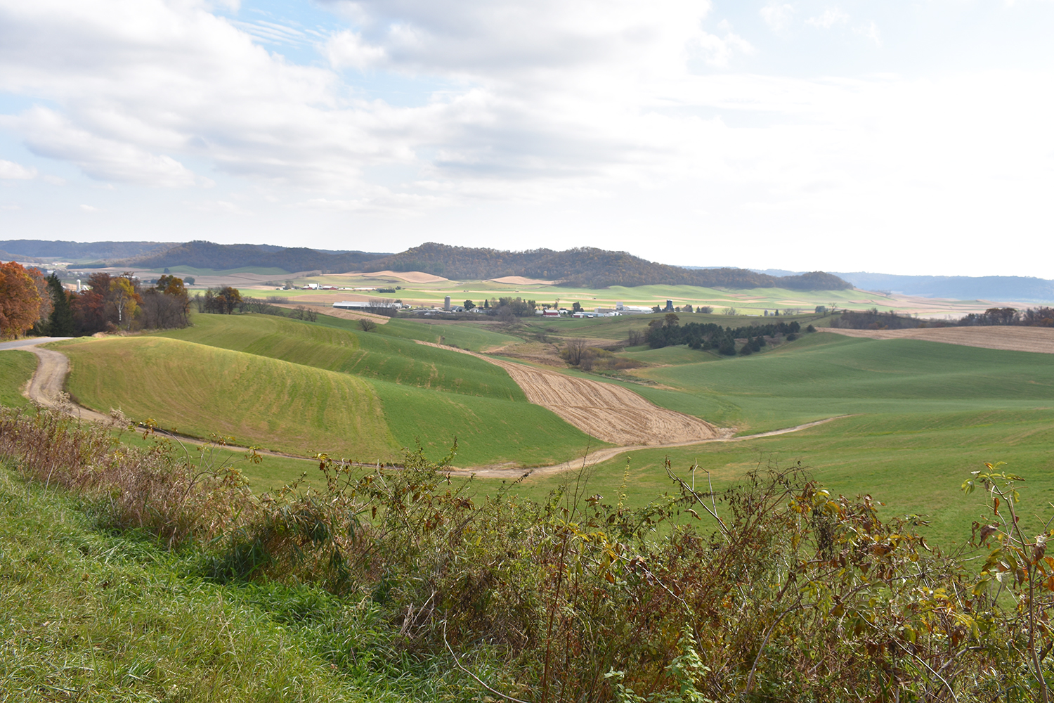
Buffalo County boasts dozens of fantastic motorcycling roads that twist along river banks, climb steep bluffs, dive into coulees and steep ravines, and cling to the edges of sandstone ridges. Numerous creeks and small rivers flow through the Waumandee Valley on their way to join the Mississippi, and they influence the shape and slope of these roads.
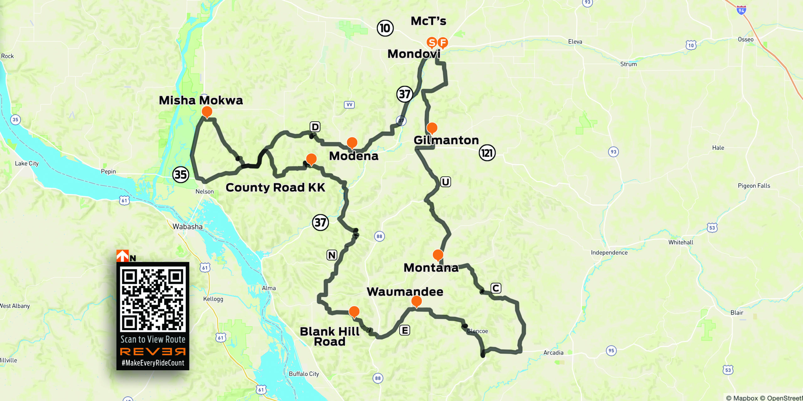
The best starting point is the town of Mondovi, located in the northeastern corner of Buffalo County. A quick fuel and food stop is recommended, as gasoline stations, restaurants, and other amenities are sparse as you head south. After a bite at McT’s Diner we follow County Roads (CR) H and ZZ south to a hook up with State Highway 88 at the Buffalo River.
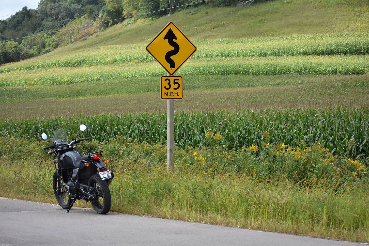
Known as “Black Lightning,” Highway 88 has approximately 130 corners and curves in 40 miles as it runs from Gilmanton to the Mississippi River, making it one of Wisconsin’s highest-rated biker roads. It gives riders — and their brakes — a real workout as they ride the ridges and slash through a sandstone cut north of Praag.
Link to Waumandee Valley River Roads tour on REVER
At CR U, we head east until we reach CR C at a crossroads just north of the village of Montana. CR C dishes up a variety of steep climbs and hairpin curves as we work our way south along Swinns Valley Creek, on our way to State Highway 95 just west of Arcadia. A short jog going west on 95 takes us to CR E, which heads northeast through Pansy Pass and Glencoe to Waumandee. CR E east of Waumandee has such steep hills that many homeowners have large angled mirrors mounted on posts at the foot of their driveways to help provide a view of any hidden oncoming traffic.
The village of Waumandee — Chippewa for “clear and sparkling water” — is worth a stop. It dates back to the 1850s, and Waumandee House, which was built in 1879, is still an active inn and restaurant. Every September the village hosts the Waumandee Hillclimb, a unique event for sports car enthusiasts. A two-mile stretch of Blank Hill Road west of Highway 88 is closed for a day of timed runs up an 18-turn hillclimb road course.
Crossing Highway 88 we take a shot at Blank Hill Road, which is as challenging as advertised. Take care along the section of road that clings to the side of a cliff and has no guardrail. At CR N, we head north along Alma Ridge, which has some white-knuckle descents on its way to the Buffalo River at State Highway 37. A short jog up Highway 37 takes us to Highway KK on the west side of the Buffalo River.
Want a taste of riding the Isle of Man TT? Much like the famed road circuit, the CR KK south of Modena has climbs and descents chiseled into the sides of ridges with few guardrails, testing our binders and our nerves as we plunge down to CR D.
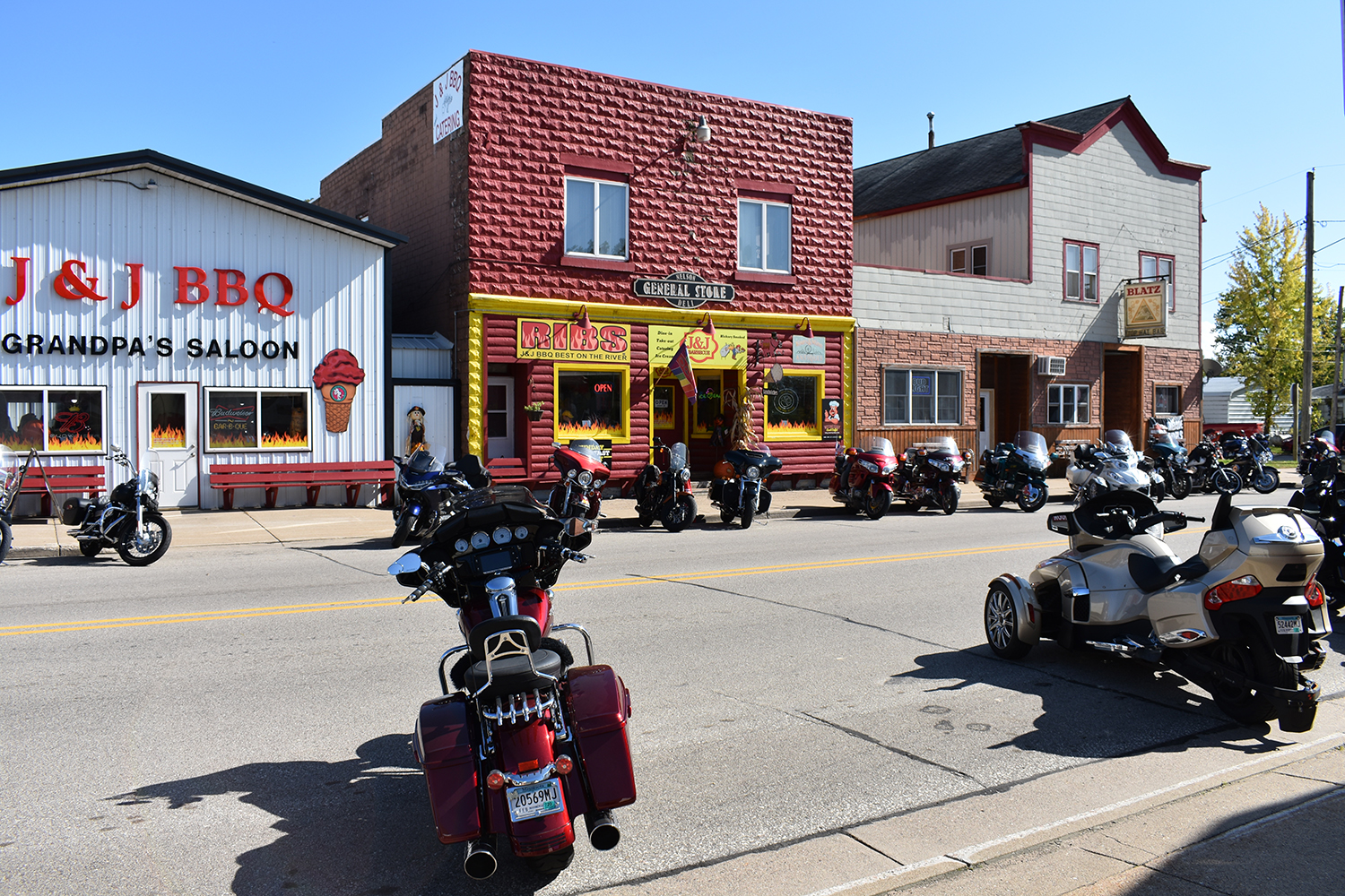
CR D winds west through rolling farm country to its junction with State Highway 35, which is known as the Great River Road and hugs the northern shore of the Mississippi. Overlooking the river, the town of Nelson has several recommended dining stops. On the day of our visit, J & J Barbeque and Nelson Creamery are overwhelmed with two-wheeled customers. We find an empty table at Beth’s Twin Bluff Café, and enjoy the best lemon pie we’ve ever tasted.

We headed north on State Highway 25 along the eastern edge of the Tiffany Bottoms Natural Area. At the village of Misha Mokwa, we turn east onto CR KK and complete the circle at the junction with CR D. Twists and turns command our full attention on our way to the village of Modena. Visit the general store in Modena to see two large motorcycle sculptures made from scrap metal, and pick up some cheese curds for a snack. We continue east on D until it dead-ends at Highway 37, then we follow the Buffalo River north and return to Mondovi.
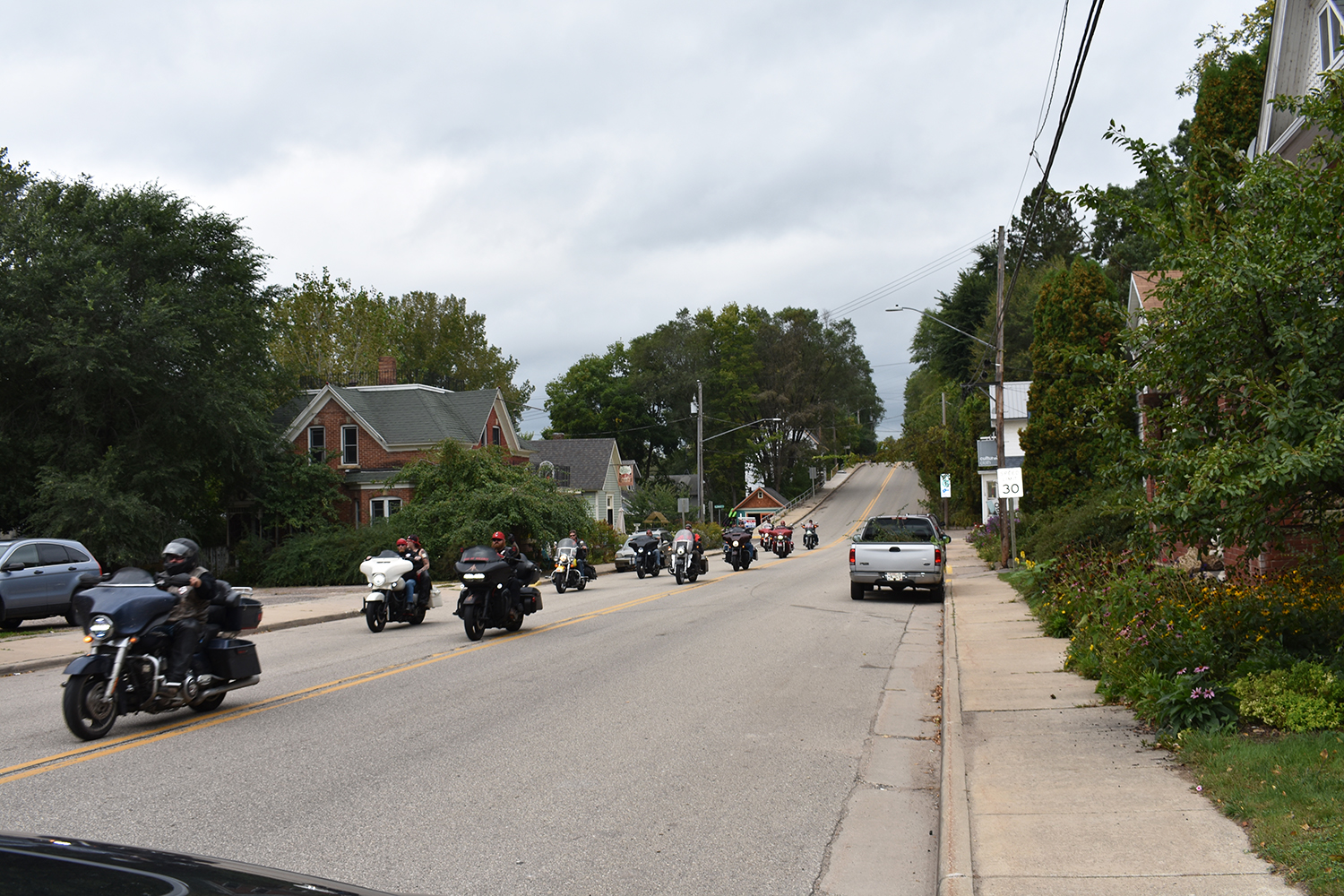
The roads on this 110-mile loop are challenging, but most of the pavement is in good condition (be mindful of gravel in some corners). Part of what makes Buffalo County a great riding destination is the traffic — except for Highway 35, there is none! On a full day of weekend riding we encountered two tractors, two pickups, seven motorcycles, and one corn picker, which was blocking a narrow farm road. The only thing missing for a perfect riding weekend is a motorcycle class at the Waumandee Hillclimb so we can clock our time going up Blank Hill Road!


Mega Dittos to Bruce. Four of us rode this route on Sunday and found it to be outstanding. I’ve ridden through Buffalo County 50 times and managed to miss CR KK, Blank Hill Road, and CR E….. and he was also right on about the pie at Twin Peaks.
Nicely written piece on some of the best roads between the lower Indiana and the Black HIlls. More roads await you by exploring anywhere in the triangle formed by Durand, Madison and Prairie Du Chien. The Small cafes and bars have the best food and if your near the Mississippi it almost impossible to get lost. Ridge roads after the fall harvest offer stunning views and leave watching is fantastic. Named roads are usually tighter and narrow, alphabet roads are slightly more traveled. I stopped giving out my ride maps years ago…
Totally agree with the majority of this route. I live 45 minutes south of MSP and this area is my go to.
The only things I would add for other rides is try adding County V from near Misha Mokwa eastbound to County F. This is a fun part I found recently which is a good changeup for KK in my opinion.
You also should add near Montana the loop between County C, County CC, and Bremer Ridge.
Another gem I’ve found is County Q between Lookout and Independence. Makes me feel like I’m riding through an Italian countryside.
Having grown up in Buffalo County, in Alma WI, I can say even I wasn’t aware of some of these routes even though my ride at the time, the wonderful 1978 Yamaha DT400 Enduro did see a lot of time on the unpaved, unmapped logging roads winding out of the Mississippi River valley to the tops of the surrounding bluff country. One of these working out of Alma to Buena Vista overlook park has been repurposed into a hiking trail, mentioned in the article. I do get back several times each season from my home in the Minneapolis area and I spent two weekends this past July with friends riding this and other routes throughout the county, to several of the establishments listed in the article. Nice job representing the area, the local establishments spread all over the area welcome riders and offer events throughout the summer to attract destination riders. Recommend you map and time your routes so as NOT to get caught in the back valleys after dusk when the burgeoning deer population is quite active, especially important for fall riders when the daylight fades early in the evening. Next run is the Gillette Childrens Charity fall flood run over the weekend of Sept 18th, all are welcome, and weather permitting, it’s normally a big crowd draw up and down the Mississippi River Valley.
Hi Bruce. Looks like you are still riding and the cops are not chasing us.
I lived in this area for 40 years and enjoyed these roads regularly. One important correction, the area is in west-central WI south of I94. Montana Ridge was one of my favorite roads. I had one of my peak riding experiences in this area. I was riding up a steep hill on a township road. There was an eagle eating a carcass on my left. As I approached it took flight. It was little more than an arm’s length away directly to my left as it flew and I road up the hill. I turned my head to look at it just as it turned its head to look at me. We proceeded together as we climbed the hill. At the top, it flew to the top of a tree and perched. I stopped and watched it for a few minutes then proceeded to Montana Ridge.