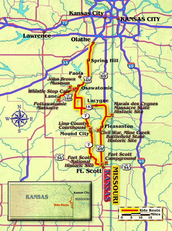
I was about an hour outside of Kansas City heading south on U.S. Route 169, a lightly traveled four-laner, and it was great to finally be on the open road. The big Suzuki V-Strom’s V-twin eased into a rhythmic cadence, sort of like the gallop of a horse, an image that comes to mind whenever I ride lonesome highways west of the Mississippi.
I’d always harbored a mental picture of Kansas roads as straight and dull. True, they aren’t as curvy as some, but the eastern side of the Sunflower State is not a boring ride. Soon, I found myself cruising real estate that roughly 150 years ago hosted a violent border conflict called “Bleeding Kansas.”
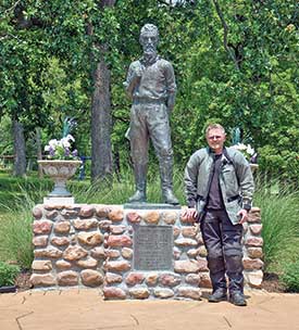
The sign up ahead said Osawatomie, an interesting name, so I geared the Suzuki down and hit the exit to check it out. The frontier town’s title is a combination of Osage and Pottawatomie, Native American tribes that lived in the area. It was also a hotbed of abolitionist activity, and lays claim to one of the era’s most controversial figures, John Brown. His stated reason for coming to Kansas was to help it enter the Union as a free state. But more than that, Brown wanted to eliminate slavery everywhere, in all forms, and by any means necessary. Osawatomie maintains an expertly staffed museum at John Brown Memorial Park, site of the 1856 Battle of Osawatomie. Visitors can learn the fascinating story of Brown’s life, death and place in American history.
Like any good range rider, I saw to my mount first and topped the Strom’s tank with regular. Afterwards I filled mine at The Whistle Stop Café, one of the few eateries in Osawatomie but a good one, offering Midwestern fare at reasonable prices. I loaded up on fried chicken and mashed potatoes at the buffet, and then topped it off with peach cobbler and ice cream. The restaurant’s décor honors the town’s hundred-year heritage as a hub for the Missouri Pacific and Union Pacific railroad lines. A railroad theme is carried all the way down to the tile “tracks” that lead to the buffet. Motorcycles are always welcome, with a bike night and beer garden hosted every Wednesday.
After following a county road out of Osawatomie, I jumped on Highway K-152, a route with a bit of a rollercoaster flare, then turned south on U.S. Route 69, a smooth ribbon of asphalt tailor-made for riders. Designated the Frontier Scenic Military Byway, it traces the path of the old Military Road, a rugged trail used by army and guerrilla riders alike. Progress on my petroleum-fueled steed was a bit speedier than theirs.
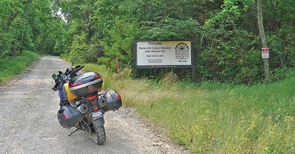
A left turn on K-52 aimed my bike toward the Missouri border and the Marais des Cygnes Massacre State Historic Site. A bit off the beaten path and nearly deserted, its gravel lanes made it perfect to explore on two wheels. On May 19, 1858, pro-slavery forces killed five Free State settlers here. Unfortunately, it is but one example of the violence that plagued both sides. Descriptive pictorial signs tell the story of what transpired that day, and also bring to mind just how deadly a business transforming a territory to a state could be.
Back on U.S. 69, the scent of fresh-cut hay filled the spring air: horse food. An interesting coincidence, since I was close to the location of one of the largest cavalry engagements of the Civil War, Mine Creek Battlefield State Historic Site. There on October 25, 1864, approximately 2,800 Union troops defeated some 8,000 Confederates. Featured are interpretive walking trails, along with an information center that hosts various exhibits and educational programs. Maybe it was the cavalry items on display, or it could have just been the Strom’s exhaust note, but as I rode away I could almost hear the thundering of hooves.
Fort Scott National Historic Site was closing for the evening as I rolled into the parking lot, so I hit the Garmin’s lodging icon. The nearby Fort Scott Campground looked promising. When I got there, however, the place appeared to be abandoned. The owner explained the campground was a recent acquisition, with upgrades proceeding as funds allowed. Fair enough. The shower was hot, Wi-Fi signal strong and cost reasonable. It was also bike friendly, with pool access thrown in for good measure.
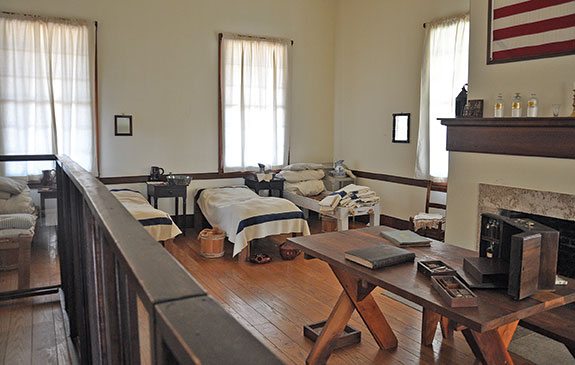
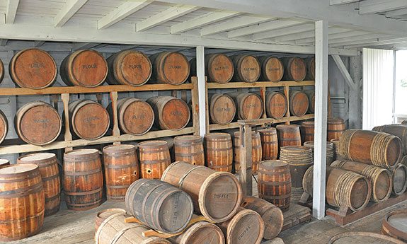
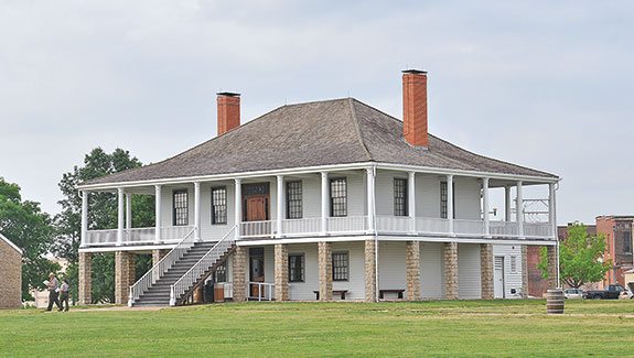
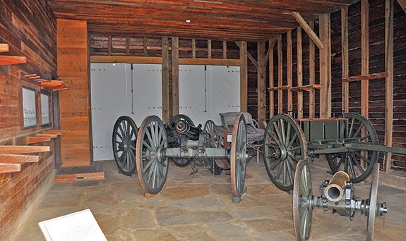
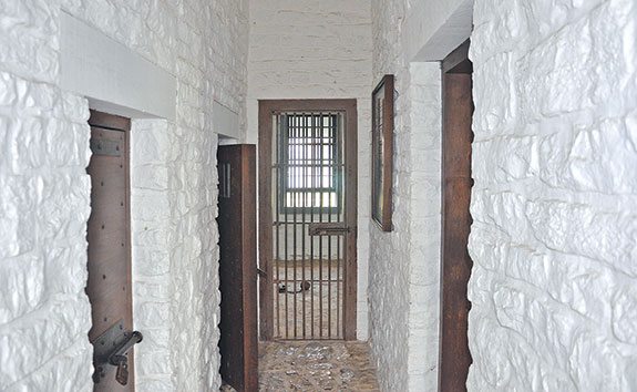
After a night under the stars, I headed back to Fort Scott, which was built in 1842 to police the “permanent Indian frontier.” As the boundary moved west, the garrison was deemed no longer necessary and closed in 1853. The border conflict and Civil War changed all that, and the fort once again became a bustling place. Appearing much as it did during its heyday, the painstakingly restored and reconstructed structures and numerous exhibits are open daily. Admission is free.
Bidding farewell to the fort, I headed west on Highway K-54 then turned north on Highway K-7, originally called the Jefferson Highway. It’s an entertaining route, with ample curves and gently rolling pavement. A friendly lady in the parking lot of Casey’s General Store in Mound City was offering poppies in support of American Legion disabled veterans programs. She also presented a bit of local history, and then directed me to the Linn County Courthouse. There a roughhewn sign tells of how the ballot box was smashed by a Free State man, an act hastened by the claimed deception of pro-slavery forces. This, perhaps more than any other action, represents what was at the heart of the border strife, since as the ballots scattered, so too it seems did the seeds of war.
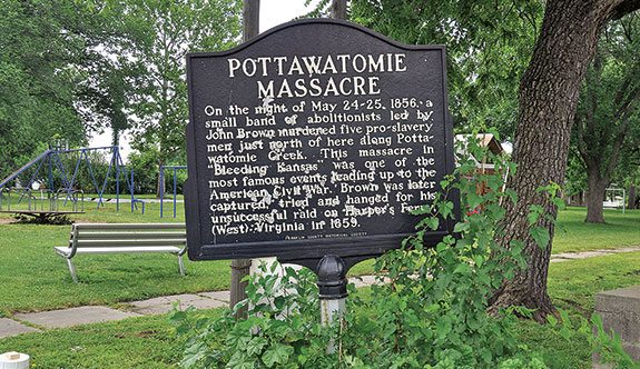
My final destination’s exact spot is unmarked, located on private property, thus inaccessible. What transpired just north of the tiny town of Lane, however, is very clear. The murders of pro-slavery men on May 25, 1856, known as the Pottawatomie Massacre, were carried out on the creek of the same name by followers of John Brown. By some accounts, it was this deed more than any other that burned Brown’s name into the nation’s psyche. He remains a controversial figure to this day, and a ride through the heart of Bleeding Kansas is the best way to decide for yourself what his legacy should be. There you’ll find good roads, welcoming people, and much to see and do. Not a bad place to spend a couple of days riding back into history on your trusty steed.
(This Favorite Ride article Eastern Kansas was published in the May 2015 issue of Rider magazine.)
 |
 |
 |


I’ve been to the Whistle Stop many times for breakfast. The guy who lets me take apart my bike and then helps me put it back together lives in Beagle, about 3 miles south of there.
thanks for the story!
Lucas, thanks for the kind words. I am currently doing some riding in Arkansas and will be in Kansas next week. I plan on stopping by the Whistle Stop, probably for the Wednesday bike night. I like those dollar tacos.
Fred
[…] Here is the link to my latest Rider Magazine story. It was initially rejected for not having a “motorcycle feel.” Not one to give up, I reworked it using creative nonfiction techniques gleaned in Professor Sarah White’s English classes at Purdue North Central. Education does have its benefits. https://ridermagazine.com/2015/05/08/eastern-kansas-time-traveling-in-the-sunflower-state/ […]