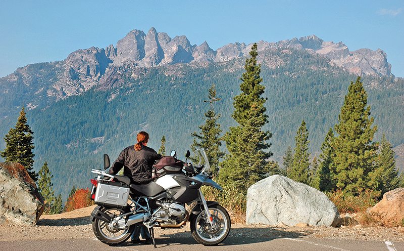
My machine had been idle too long during a busy summer, occupied by matters far less important than riding, so I said to Cookie (Gwen’s father called her that and it stuck and I like it), “Let’s blow out of here on an overnighter to Downieville.”
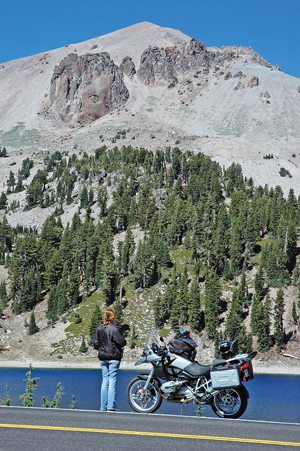
We’re fortunate to live in a place called Big Valley in the northeast corner of California on the Lassen/Modoc county line that has so far managed to avoid overpopulation and overdevelopment. It was late August, only days away from the Labor Day weekend as we departed, yet the entire 30-mile forested corridor of Highway 89 along which Hat Creek flows had very light traffic, and the streamside campgrounds were mostly vacant. We can see 10,457-foot Lassen Peak from our kitchen window 50 miles distant, but the more up close and personal view of it that loomed up huge in a robin’s egg sky north of Old Station never fails to remind of its dramatic volcanic legacy, that it’s one of the largest plug dome volcanoes in the world and that it erupted in 1914, mere milliseconds ago on the geologic time clock. Riding through Lassen Volcanic National Park (one of the least visited, by the way) on a motorcycle lends emphasis to the unthinkable power that lies beneath, because you can feel it as you slide by lava bombs the size of dump trucks, and smell it as you pass the bubbling mud pots and steaming fumaroles of Bumpass Hell, the largest of Lassen’s hydrothermal areas.
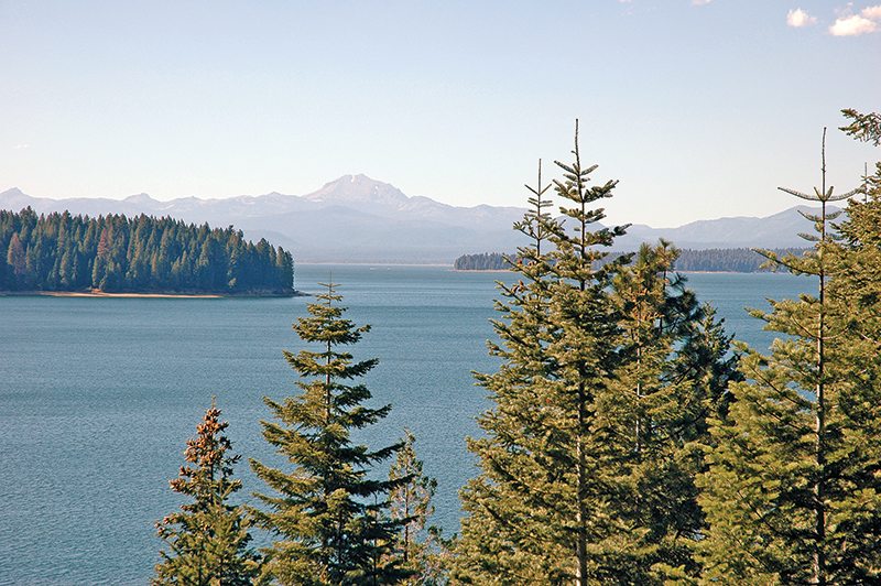
Down the west shore of Lake Almanor we went, a clean beautiful lake in which we’ve swam and waterskied, and into which we’ve plunged during previous mid-summer motorcycle journeys when the sun felt like a blast furnace. Leather and helmets came off and the cool water felt like the embrace of a lover; great memories with best riding friends. The distant view of Lassen Peak framed by towering pines, from the south shore of Almanor, is another of many scenes on this route that require pause. Then we cruised south on Highway 89 deeper into the glorious green majesty that is the floor of the Sierra Nevada Mountains, pausing in Indian Valley in the small country town of Greenville for lunch at a natural food store and café right on Main Street. The lady who owns the place tells us she was born and raised here and nothing has changed, that Mall Land is far away and there are many mountains in between. As a historical note, our county’s namesake, Peter Lassen, had a trading post here in 1851 before he moved to Honey Lake, where he resided as a farmer and miner until he was killed in an ambush in 1859.
Just south of the resort town of Greagle on Highway 89, we made a right turn at Gold Lake Forest Highway. It’s hardly a “highway,” but rather a two-lane mountain road on a roof of this region aptly called The Lost Sierra, because the extremely rugged terrain hasn’t been amenable to population growth and development—the whole of Sierra County has less than 3,000 residents, in fact. Just before Gold Lake Forest Highway converges with Highway 49 at Bassetts Station, there’s a viewpoint where we paused to gaze westward at the stunning 8,600-foot splendorous panoramic curtain of volcanic pinnacles and cliffs known as the Sierra Buttes. It was getting late in the day as we turned right on Highway 49 at Bassett’s Station to negotiate the final 20 miles to our destination in Downieville, and a fetching 20 miles it is as the road traces the curvaceous elegance of the Yuba River.
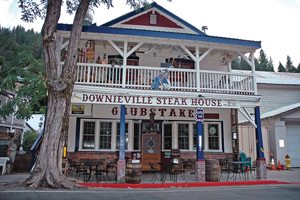
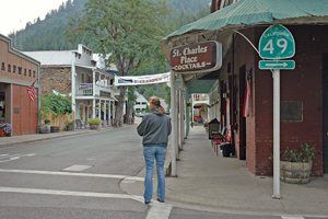
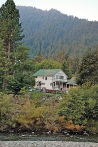
In Downieville, we rode across the bridge over the river and pulled up to my favorite lodging place, The Downieville River Inn and Resort, where I know from priors one lies in bed and is lulled to sleep by the sonorous riffles of the river. It’s also just a short walk to my two favorite venues in town, St. Charles Place, a classic old western bar with an antique firearm collection, and Grubstake Saloon, or Downieville Steak House, as it’s also known. Again, I know from priors that there is no better place to eat in America than the steak house here in this jewel of a historic 19th century gold mining town that is so lost on what might as well be the moon in the isolated empty northernmost wilderness gorge of the Mother Lode.
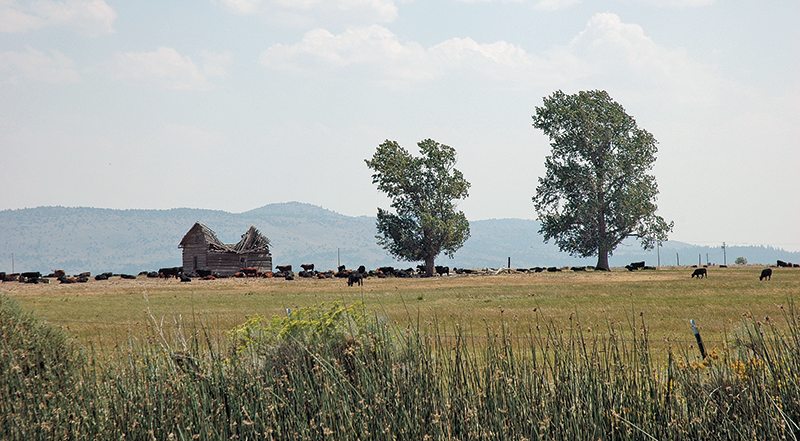
In the morning, we retraced our route homeward except, refreshed by awesome vittles and a fine sleep, we followed fetchingly circuitous Highway 49 east all the way over 6,708-foot Yuba Pass to reconnect with Highway 89 at Calpine in Sierra Valley, one of the largest alpine valleys in the world, where the aerial view of it from the summit recalls Steinbeck’s The Pastures of Heaven, and where ranches date back to the early 19th century and chances are good that pioneer family relatives are still running them. Then it was north on Highway 89 all the way back to the north shore of Lake Almanor, where we proceeded east on Highway 36 to the Lassen County seat of Susanville for our final leg back to Big Valley on Highway 139, 70 miles through the high country of old Lassen County, where hoof prints continue to outnumber footprints a thousand to one.
(This Favorite Ride article Down to Downieville was published in the February 2014 issue of Rider magazine.)
 |
 |


