The year was 1806. After traversing the flat plains of what is now eastern Colorado, Zebulon Pike saw a smudge on the horizon. The next day the smudge became a bump. By the third or fourth day, Pike realized he had a mountain to climb.
I had the same feeling as I cruised westward on State Route 24, headed for Colorado Springs. Interestingly, Pike never made it to the top of the mountain that bears his name. But I knew that I would thanks to my BMW and the Pikes Peak Highway.
After spending the night in Colorado Springs, I returned to Route 24 in the morning and headed west past Manitou Springs. The North Pole is an amusement park at the foot of the mountain. Find it, and you’ll find Pikes Peak Highway.
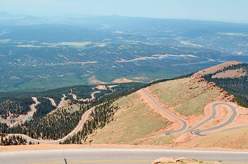
The Highway is a paved two-lane road first constructed in 1915 at a cost of about $500,000. Paving of the uppermost roadway was completed in 2012. The road is measured as much in elevation as in miles. The 19.5 miles of highway rise more than a mile, with an average grade of about 7 percent. It is a rider’s nirvana, a mostly smooth asphalt snake replete with more than 160 turns ranging from sweeping curves to hairpin switchbacks. There are no gas stations on the Highway, so fill up before starting the climb. And, if your bike is equipped with GPS, be sure to set the display to include altitude.
This is a ride that will (literally) leave you breathless. The air at the top contains 40 percent less oxygen than air at sea level, and some experts claim that your engine loses about 30 percent of its horsepower on the way up the hill. The lack of oxygen is not the only thing that will make your head spin. The vistas are stunning. But don’t get lost in the view—the road features few guardrails, precipitous drops and lots of loose gravel. Let your eyes wander, but never lose your concentration.
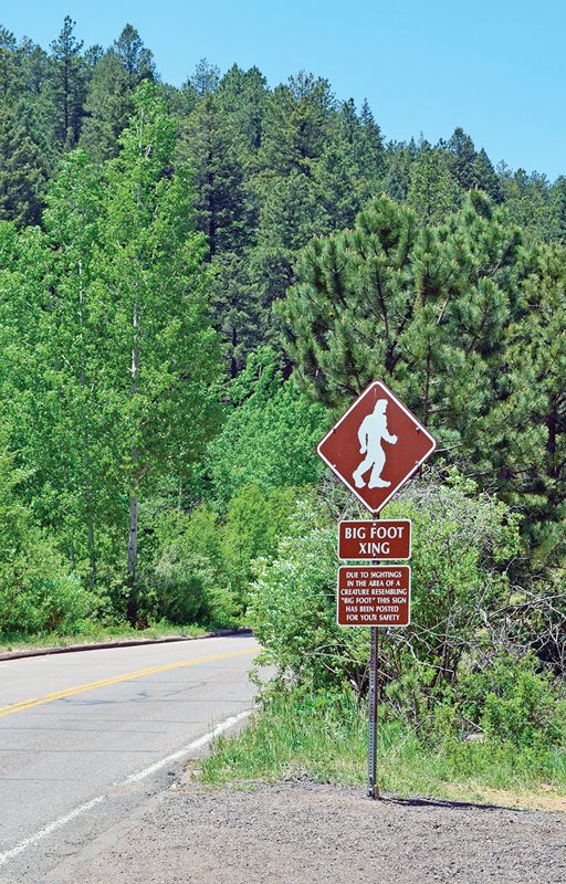
I stopped at the ranger’s kiosk (7,750 feet), paid a $12 admission, and began the upward trek. At about mile 3 (8,562 feet), I encountered a whimsical “Big Foot Xing” sign. Farther up the road, at mile 6 (9,230 feet), it traversed a concrete dam holding back scenic Crystal Creek Reservoir. I was all smiles at mile 7 (9,390 feet) as I passed through the starting gate for the Pikes Peak International Hill Climb.
The Hill Climb began in 1916 as a stunt to encourage tourism. Organizers billed it as the “Race to the Clouds.” This year’s competition, held on June 30 (10 days after my journey) saw 82 motorcycle riders tackle the course in nine classes, ranging from vintage to experimental. It was a watershed year for motorcycle racing. Carlin Dunne captured overall motorcycle honors riding a Lightning electric motorcycle to victory in 10:00.694 minutes (nearly 72 mph average), besting the next quickest rider by nearly 21 seconds, and beating all but eight of the fastest four wheelers. Dunne is no stranger to the Peak; he captured the overall motorcycle record in 2012, riding a gas-powered Ducati Multistrada to the top in an unbelievable 9:52.819.
I’ll admit that it was fun to navigate the racer’s course, but I simply cannot imagine running these tight, dangerous corners at 10/10ths. Each of the major corners of the Highway is named, and I felt blessed to make it up and down the hill without having some hairpin named in my memory.
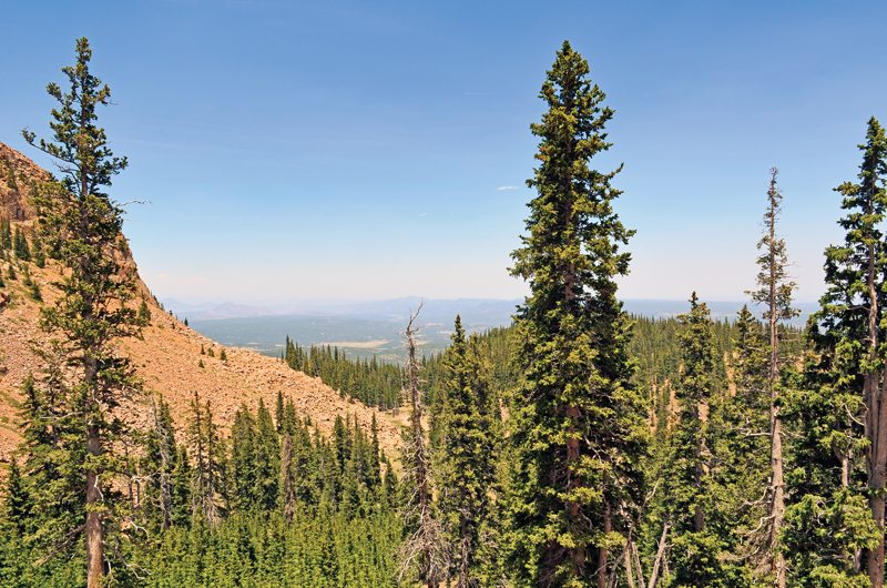
The Highway began to get technical at about mile 11 (10,600 feet). Just before mile 13 (11,440 feet) I rode past the Glen Cove Inn, which offers a restaurant and lessons on rock climbing and panning for gems.

Drivers must stop at Glen Cove while descending the hill for a brake check. The stretch between miles 13 (11,400 feet) and 16 (12,780 feet) keeps the rider very, very busy. Turn in, apex, accelerate. Turn in, apex, accelerate. Over and over, with an occasional glance up the road to ensure that the oncoming minivan full of gawkers stays in its own lane. These are first- and second-gear corners, even for my torquey K 1600.
Don’t get me wrong: The Highway is not a road for canyon racers. There are no run-off areas so the penalties for off-course excursions are huge. In any event, you’ll be constantly frustrated by the creeping rubberneckers. Take heart, though, because there are occasional passing zones, and plenty of paved pullouts.
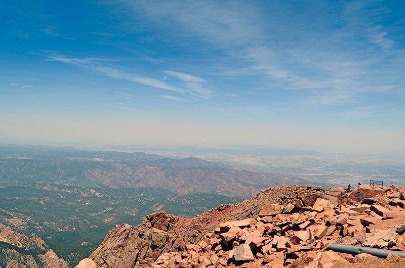
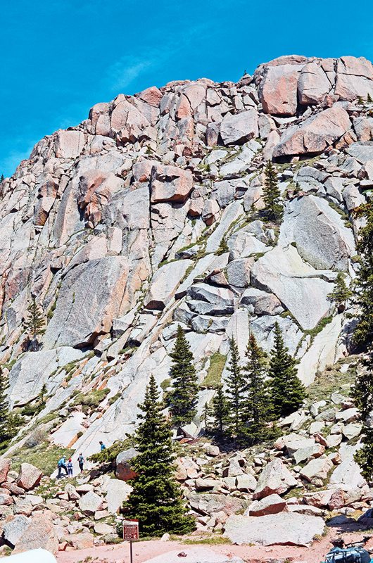
The trees disappear at mile 14 (11,870 feet) as the forest gives way to a rocky, barren landscape. In essence, Pikes Peak is an enormous hunk of pink granite. Mile 14 also marks the onset of a series of sharp switchbacks called “the Ws.”
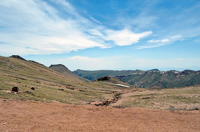
The final five miles following the Ws are less twisty, but no less interesting. The area around mile 16 is known as the “Devil’s Playground” for the way that lightning bounces from rock-to-rock during severe storms. Be careful here, since the quality of the pavement begins to degrade due to winter weather conditions, and keep your eyes open for the native Rocky Mountain bighorn sheep.
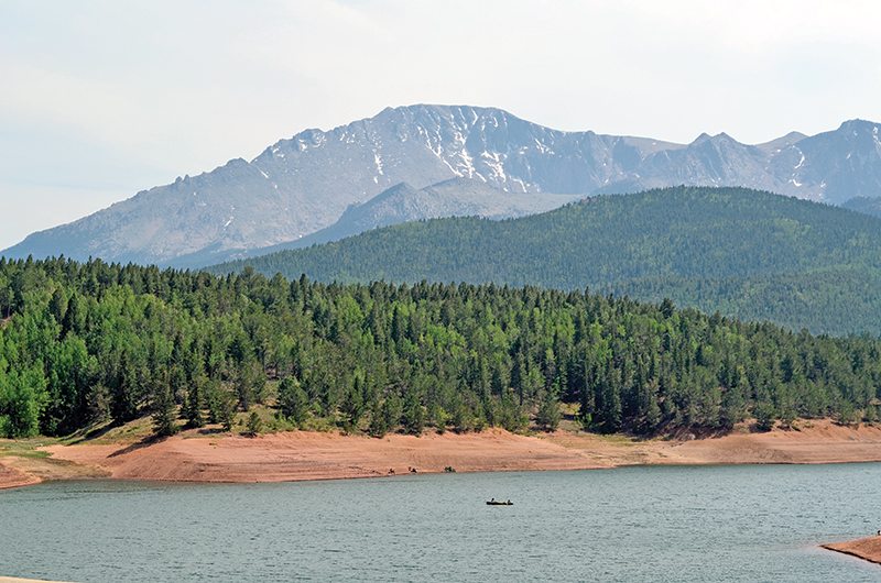
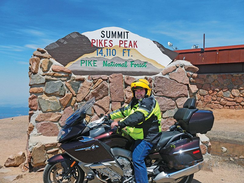
The summit (14,110 feet) offers a weather-beaten gift shop and café/oxygen bar. Views are awesome. In the distance, three crystal blue reservoirs line up perfectly. I grabbed a soda with a group of other riders, and we all agreed this was a ride that could be repeated over and over.
At the top of the mountain, the temperature was 50 degrees cooler than in Colorado Springs, and the wind was howling at about 40 mph. I zipped my jacket liner in for the ride down. Plan the timing of your ride carefully, since you could encounter snow, gale force winds and frigid temperatures, and pick a weekday to avoid the long weekend parade of four wheelers.
The ride down is the big payoff. Riding up the steep mountain, you tend to focus on pavement directly ahead. The road falls away from you on the downhill run and the mountain vistas break wide open. It’s a constantly changing panorama of breathtaking beauty, which earned the Pikes Peak Highway an honored spot on my personal list of favorite rides.
(This Favorite Ride: Onward and Upward was published in the December 2013 issue of Rider magazine.)
 |
 |
 |
 |


Sounds like a great ride. Definitely on my “Bucket List”. Hopefully will do it Summer 2018.
Great review! Hopefully I’ll be able to ride Pikes Peak this year, 2018!
Rode the peak in 04 on a brand new Honda VTX 1800, before they paved the last few miles to the top. Was definitely an experience I’ll never forget an absolutely awesome ride right up there with the Tail Of The Dragon, Deals Gap, NC.