At an overlook near Cumbres Pass (elevation 10,022 feet) north of Chama, New Mexico, I parked the 2011 Victory Cross Country to take a break. Soon I was joined by a man in a cowboy hat who had climbed out of his pickup truck to stand on a granite outcropping and peer through binoculars. He explained that he grazed his cattle here, and had set out salt licks to entice them back from their summer grazing lands in the high country. When a train whistle interrupted us, eerie and keening on this cool September morning, he indicated that a station for the Cumbres & Toltec Scenic Railway was just over the next rise.
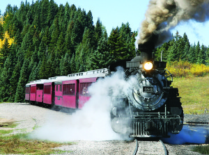
I pulled into the station just as the train whistle sounded again, and was delighted to find an antique steam locomotive chugging and belching smoke. I soon learned that the adventuresome here can board these trains for a scenic ride into the mountains. The child in me suggested I pull a coin from my pocket and set it on the tracks. Once the train had lumbered past, the quarter was reduced to little more than a thin, elongated grease spot with a serrated edge. Ah, what an enchanting place!
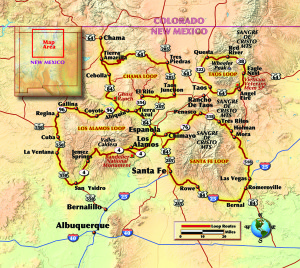
Or, of course, the really adventuresome can ride a motorcycle up here as I had on this fall morning to watch the aspen turn. Northern New Mexico’s rocky high country stretches north and east from Albuquerque, and is a delight to ride with stunning enchanted loop roads featuring mountains above 8,000 feet, an extinct volcano, a huge helping of history and art and, of course, some excellent riding. Let’s break the area down into successive loops.
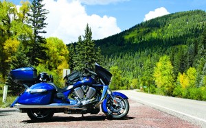
The Chama Loop
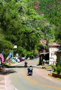
Located just below the Colorado border at an elevation of 7,800 feet, Chama exudes the flavor of an Old Western town and is eminently suitable for a motorcycle vacation. I spent the night there at the Elkhorn Lodge, a charmer with log cabins set among aspens, cottonwoods and blue spruce out front, and the Rio Chama trout stream with its hiking trails out back.
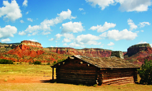
Head south out of Chama on State Route 84 and you’re now in Georgia O’Keeffe (1887-1986) country, where remembrances of the artist are everywhere. She lived and worked at Ghost Ranch, her summer home, starting in the mid-’30s, and today the ranch is open to the public and accessible by riding several miles on a well-maintained gravel road. I had lunch there, where the traveler can also indulge in golf, lodging, horseback rides and tour the museum. On the way out I pulled off the road briefly to appreciate the surrounding rock walls and formations that inspired the artist in her work.
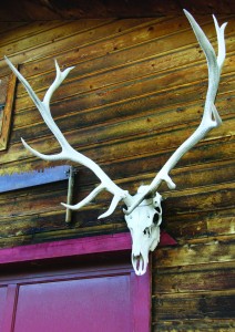
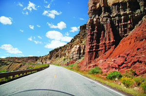
From there heading south State Route 84 drops through great vistas of red rock cliffs before it skirts the dusty little town of Abiquiú, which was O’Keeffe’s winter home beginning in 1945. She is known for her paintings of bones, flowers and rock formations, and once stated, “The bones do not symbolize death to me; they are shapes that please me.” I toured O’Keeffe’s home and studio and found it very basic, with simple white walls, a fireplace, the studio lit by large windows and skylights.
I then turned onto Highway 554 east, a tight little road twisting upward past El Rito as it skirts the Ortega and La Madera Mountains. Here are rustic cabins beside poplar-shaded trout streams, but when the route joined Highway 285 and followed it north the area became wide-open high desert. I completed the loop by heading back west on Highway 64, a fast, open two-lane with grand vistas falling away to the north.
The Santa Fe Loop
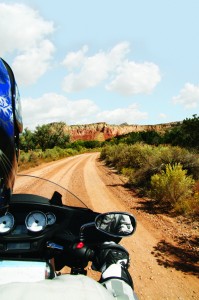
Santa Fe is the epitome of Southwestern style, and probably encompasses more art galleries per square mile than any other city in the United States. Because it sits at 7,200 feet elevation, it will often be cooler than the ride it took to get there. From Santa Fe I rode the 25 freeway which started southeast of the city, then rolled north, rising into pine trees lining smooth pavement. Past the town of Las Vegas (no, not that Las Vegas) I left the four-lane and headed up backroad 94 toward Mora, then squired the Victory onto 518 leading west to Holman and Tres Ritos. Here the road is a delight as it rises in elevation, twists and turns, and the air crisps and cools. Against the backlit mountains yellow patches of deciduous trees stood out against the pines, their leaves already changing colors in mid-September, signs of the coming winter.
Traffic was light through Penasco as I next turned south on 76. At times a stream flowed beside the road, swift-running and sun-speckled through the elms and oaks. In the high country the small towns have a hard-scrabble look and consist mostly of mobile homes, pueblos or small cabins scattered seemingly randomly on the rocky hillsides.
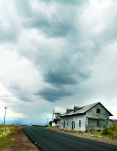
I headed south on 76 now, and coming out of Truchas noticed a billowing battle line of dark clouds dropping a filmy veil of rain on the distant hillsides. “Man, I’m gonna get it,” I thought. But my route took me on 503 south toward Santa Fe, a road so tight that the first few miles were all first and second gear, and the storm passed harmlessly to the north.
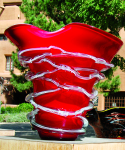
Back in town I availed myself of a walking group tour conducted by Barbara Harrelson, author of Walks in Literary Santa Fe. She met us at the historic plaza at the heart of the old city, which is ringed by the oldest public buildings still in use in the United States. Harrelson pointed out the obelisk at the plaza’s center, which was erected in 1866. On it is carved, “To the heroes who have fallen in the various battles with (see below) in the territory of New Mexico.” Its original wording was later considered inappropriate, and there is now a blank space where the word “savages” was ceremoniously chiseled out by Geronimo’s grandson and replaced by the word “Indians.”
At 109 East Palace, Harrelson showed us a nondescript doorway. She told the group that through it passed Edward Teller, Enrico Fermi, Robert Oppenheimer and the other scientists who worked on the Manhattan Project during World War II. They were processed here before traveling to the laboratory at Los Alamos, where they developed the atomic weapons that would bring the war in the Pacific to a swift end.
The Los Alamos Loop
To continue this thread I rode north out of Santa Fe on 285 and then west on 502 and 4 to the little town of Los Alamos. Today, the Bradbury Science Museum includes full-size replicas of the bombs and chronicles the story of the secret atomic project, beginning with a 16-minute video, “The Town that Never Was.”
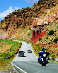
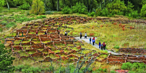
For more good riding and a glimpse of primitive native life I headed back east on Highway 4 to Bandelier National Monument with its 70 miles of hiking trails within 33,000 acres. Here, in this arid valley, native peoples have lived for close to 10,000 years. I took the short hike to the Long House, and while the structures are now in ruins most fascinating today are the “cavates,” literally small caves carved into the cliffs of the Pajarito Plateau. Most are a few dozen feet square, their low ceilings blackened by generations of cooking and warming fires. Climb the log ladders and squeeze inside for a glimpse of what life was like before furnaces and wide-screen TVs.
Some of the sweetest riding in northern New Mexico was my reward for heading back west on 4 as the road rose and twisted through forested hills, with several turns posted for 15 mph. Then it opened up and I found myself at the south rim of the Valle Caldera, one of three super calderas in the United States. A few million years ago a monster volcano erupted here, forming the Jemez Mountains; it then collapsed and left this 12-mile-wide caldera. It filled with water, then overcame its walls and the resultant slide and flood carved out San Diego Canyon. Today the caldera is a wide grassland; those dots in the distance are the Rocky Mountain Elk that inhabit the area.
This is the longest loop, and when Highway 4 ended I headed north on 550 toward Cuba (no, not that Cuba), where the road rises and straightens to high plains. Past Cuba I took Highway 96 that headed north and then turned eastward, a long, fast two-lane flanked by fantastic rock formations in the distance. Here, to the south, I
recognize the slanted-topped peak that was the frequent subject of Georgia O’Keeffe paintings.
The Taos Loop
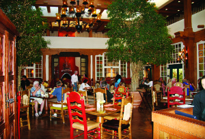
I reached this shortest loop by riding east on Highway 64 from Tres Piedras toward Taos, but before reaching it, I turned north on 522 and east on 38. This brought me to Red River; its mile-long main street has retained its frontier-style storefronts. Over a thick steak in The Timbers that evening I enjoyed a décor that featured dozens of cowboy hats hanging on the walls. My stay was at the bike-friendly Golden Eagle Motel, which offers its own blends of flavorful coffees in the lobby.
Back on the Victory dresser, a ride over 9,820-foot Bobcat Pass brought me past Eagle Nest and, up on a hillside, to the Vietnam Veterans Memorial State Park near Angel Fire. This white, winglike structure offers solemn tribute to so many who gave so much.
Taos, of course, is a jewel, situated at an elevation of nearly 7,000 feet on a high-desert mesa at the foot of the Sangre de Cristo Mountains. As home to more than 80 art galleries it could give Santa Fe a good run for its money. From there, Highway 68 is the quick way south.
Back in Santa Fe I relaxed at the luxurious Inn and Spa at Loretto before enjoying breakfast at the recently refurbished dining room of the La Fonda Hotel. I am told it sits on “the oldest hotel corner in America.” Then I saddled up and started pounding pavement for home. It was then I recalled that the license plates here carry the legend “Land of Enchantment.” And with its high peaks, turning aspens amid the conifers, hardscrabble land and frequent historic sites New Mexico truly is an enchanting place to ride.




Nice Trip.
Good good…..like Pacet, yaa…
Great Rides! As a long-time Texan with friends in Los Alamos and relatives in both Santa Fe and Las Vegas, I’ve visited all these places and love them.