photography by Bill and Susan Dragoo
[Arkansas Motorcycle Rides: Ozarks Dual-Sport was originally published as a Favorite Ride in the December 2009 issue of Rider magazine]
I glance in my rear-view mirror, watching headlights emerge from the gloom…one, two, three. I look at the road ahead, back at the mirror…four, five, six. Repeating this over and over I ride on, a two-wheeled mother duck verifying the presence of her ducklings. Ducklings?
These armored riders on powerful KTMs, KLRs and BMWs would be surprised, and perhaps in their hearts dismayed, at being characterized as tiny yellow-feathered creatures. Yet I can’t help translating this sense of responsibility into a barnyard metaphor. We are in the Ozarks and it seems fitting.
My “ducklings” and I are among 75 riders here for the Sixth Annual Hillbilly Dual- Sport Ride, an officially “nonorganized” event growing in popularity. Headquartered in Eureka Springs, Arkansas, the ride draws dual-sport enthusiasts from a half-dozen surrounding states for a long weekend exploring dirt roads and trails in these rugged old mountains.
The Ozarks form the most significant mountainous region between the Rocky Mountains and the Appalachians. For motorcycling residents of the central United States, they offer a convenient and scenic destination graced by miles of twisty asphalt. Established in 1879, artsy and eclectic Eureka Springs has an Old World feel. Its Victorian structures of wood and native limestone cling to the mountainside along the steep, winding lanes of the village. This “Little Switzerland of the Ozarks” is worth a visit regardless of one’s mode of travel.
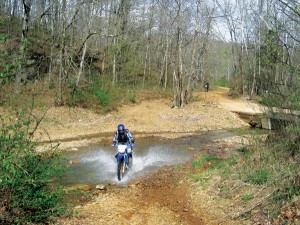
But our objective is to get out of town, charming as it is, and the asphalt is only a means to an end…dirt! Riders are here to get “off the beaten path” on a variety of dual-sport machines.
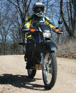
Most of the guys on KTMs and the like head south down Highway 23 to the Ozark National Forest, where they can enjoy fast fire roads and gnarly trails, testing their skills against ravines, boulders, deep rushing streams and fallen trees. I, on the other hand, have devised a route around history and scenery. A group of like-minded men and women join me and my Yamaha XT225, ready to explore in spite of temperatures in the 40s and a steady rain. Our ride will follow the route of the historic Eureka Springs Railway. In 1880, the nearest railroad was at Pierce City, Missouri, 55 miles north. Those seeking the medicinal qualities of the natural springs had to travel a grueling nine hours by wagon from Pierce City to reach Eureka Springs. The Eureka Springs Railway began operations in 1883, connecting the village with Seligman, Missouri, 18 1/2 miles away. Twenty-first-century tourists can still take a 4 1/2-mile round trip on the short length of remaining track via the dinner train at the Eureka Springs end of the line.
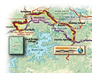
We leave the parking lot of the Travelers Inn in a downpour, heading north on Highway 23. After four miles we veer left on Highway 187, which takes us into Beaver, Arkansas, for a crossing of the White River. Having heard that the bridge is underwater as a result of heavy spring rains, we consider a detour, but forge ahead in hopes that conditions may have improved. Descending into the river valley we discover that we are in luck. The river is brimming but has receded enough to make crossing possible. The bright-yellow bridge, known locally as the “Little Golden Gate,” is one of the few remaining suspension bridges in the state and a popular tourist attraction. We rumble across the wooden planks of the narrow span, only a few feet above the roiling surface of the river.
After riding another 2 1/2 miles on 187, we find County Road 232 and turn northwest. We are now in Missouri, riding through the lovely Butler “Holler,” and finally find ourselves off the pavement. A smooth dirt road with just enough stream crossings, curves and gravel takes us through a half-mile-wide swath of flat green land between two ridges. Our road, built atop the old railway bed, runs along the eastern edge of Butler Creek, through pasture land dotted with grazing cattle. Standing up, I ride rally-style through the beautiful isolation of this motorcycle nirvana. I imagine myself in another century, seeing the same vista from the window of a moving train. I have to remind myself to check on my flock which, I notice, is enjoying this as much as I am.
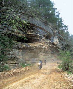
Leaving the hollow after about 4 1/2 miles, we veer west on a forest road (we are now in the Mark Twain National Forest) and skirt a ridge of spectacular limestone bluffs, where we notice some ruins. Oddly, old buildings are nestled into the base of the cliff. We agree to explore these on our return trip. Emerging from the forest after about five miles, we cross Highway 37 at Seligman and ride west on Highway DD through an increasingly heavy rain. As ducks we should love this, but in truth the raindrops feel like needles on my exposed skin at highway speeds. We thankfully touch dirt again after almost seven miles when we cross back into Arkansas on Old Wire Road. This road has served as an Indian trail, military route and mail road, and eventually was dubbed “Wire Road” for the telegraph wires strung along its length during the Civil War period. We travel south five miles and intersect Highway 62 just east of the entrance to Pea Ridge National Military Park.
Pea Ridge preserves the site of an 1862 Civil War battle that gave the Union total control of Missouri and led directly to the federal occupation of Arkansas. The park encompasses 4,300 acres and features a reconstructed Elkhorn Tavern, a visitors’ center, a museum, self-guided tours and a 2 1/2-mile segment of the “Trail of Tears.” Cold, wet and hungry, our group dries out, warms up and lunches on burgers in the nearby village of Garfield. Restored, we start back to explore those cliff dwellings.
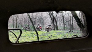
The rain has let up, the way is familiar and we arrive quickly at the ruins. Approaching the structures under the bluff, we pass the metal shell of a truck cab, circa 1950. We drift farther back in time as we walk, finding the remains of a 19th-century wagon, its fragments scattered about the site like weathered old bones. We know something of Arkansas’ prehistoric bluff dwellers, but these relics are of more recent origin. What went on here?
Water drips from the bluffs overhead. Large square-cut timbers create stout walls…some obviously for people, others apparently for livestock. Concrete bulkheads were built into the cavity to provide shelter. The area is strewn with broken furniture, plumbing parts, rusty farm implements and, strangely, a vacuum cleaner.
I later read that early settlers established temporary homes under these cliffs, and that, like us, travelers on the railway were surprised to see these habitations along their route. The rest will remain a mystery for now. My ducklings and I return to Eureka Springs well satisfied, eager to share a report of the day’s adventures, and already looking ahead to what mysteries we might explore on next year’s ride.
References:
Eureka Springs Railway
The Eureka Springs Railway:
An Automobile Tour into the Past, author H.G. Cragon (2005), Dallas, Texas, Cragon Books
Eureka Springs, Arkansas
www.eurekasprings.org
The Travelers Inn,
Eureka Springs
(ride headquarters)
www.travelersinn.com
The Grill
(inside) The Shortstop Conoco
Highways 62 and 127
Garfield, Arkansas 72732
Ozark National Forest
www.fs.fed.us/oonf/ozark
Beaver, Arkansas
www.beavertownrvpark.com/about.htm
Pea Ridge National Military Park
www.nps.gov/peri


Do you have any GPS files for the ride shown above?
Do you have GPS files you can share for this?