story and photos by J. Joshua Placa
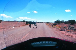
In the Great Basin of the ancient Southwest, nothing is as it seems. Infinite expanses of petrified sand and rusted rock, cacti and eternal sky spread out before you, seducing the unwary traveler with the matchless excitement and wonder of an undiscovered frontier. Beware its sweet, deceitful kiss. The high plains desert is as engaging and beautiful as it is cruel and deadly. It will beguile you; bend your mind with unearthly colors and contorted shapes of tortured stone. These are the remains of another world and eons of hidden time. They can betray reason and good sense. Anything can happen here, and it usually does. Like when a rare, giant white jackalope attacked my Suzuki M109R.
Quickly as it came, the crazed “werebunny” was gone. Other than some teeth marks on its right downtube, the Suzuki didn’t even flinch. No hard evidence could be found of this elusive species, surely the result of nuclear bomb testing, or the now-discontinued uranium mining. The unprovoked assault must have been driven by starvation, or perhaps the mutant little furry guy was just nuts with the, you know, need to breed. It was, after all, mating season and I could see that in the hot glare of desolation anything moving looks pretty good.
The corners of Arizona, New Mexico, Colorado and Utah meet in a haunting badlands. This little-known territory invokes the explorer in everyone. I gathered the Brothers Gibbs—Tom, and his older brother, Bobby Valerie—to form the expeditionary team. This was an undiscovered world to my compatriots, an otherworldly place we would glide across on swift desert ships. The M109R, the Yamaha Royal Star Venture and a Honda ST1300 were equal to the challenge. We had begun as a force of four, but sadly had to leave a third brother, Greg, behind. It’s OK, we’ll be back for his bleached bones later, when we can get to them, maybe, if they haven’t been eaten.
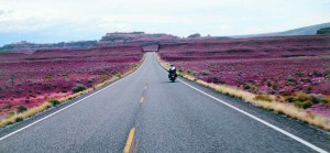
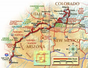
We rolled north out of the red rock wonderlands of Sedona, Arizona, up Oak Creek Canyon, one of the prettiest stretches of road in the country, then a jog east along Route 66 through Flagstaff, continuing north to the old trading post at Cameron. This little village stands as the doorstep to the great Navajo Nation, the largest Native American reservation in America. We stopped for some souvenirs and the fry bread and mutton stew, a local favorite.
With our bellies full and our pockets lighter, we turned north on 89 to Route 160, then rolled east through the twisting blacktop, craning our necks toward the Painted Desert on our right and the petrified red and white reefs to the left. A signpost up ahead signaled something unfamiliar: “Dinosaur Tracks Next Left.” This was a wonder. Just a few miles before the busy reservation town of Tuba City lie the exposed claw prints of creatures that roamed what was a tropical shoreline tens of millions of years ago, buried under tons of sand and silt long since turned to rock. Erosion finally unearthed the tracks, which can be seen everywhere.
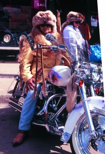
The Navajo Reservation is vast. Hundreds of square miles are laid bare and naked for you to see in its stark, unabashed beauty. Neither brush nor tree stands in the way of the boundless view. There’s no better way to experience such a primeval place than aboard a bike. As senses heighten and awareness climbs, it seems natural to feel connected to these surroundings in an almost spiritual way. Each corner and curve offers something before unseen, or even understood. If you ride long and far enough through this desert, shapes seem to shift, bizarre rock formations appear then disappear, and creatures that should not exist dwell in the shadows. This is not impossible; some prehistoric sea and shore life that lived then, live now, but refitted for landlubber living, such as scorpions, which will probably live forever, and cacti that evolved from marine species.
Public treasures famous for a time-stilled vision of Earth’s past preside nearby: Arches, Canyonlands, Bryce and Zion national parks in Utah; Canyon De Chelly and the Grand Canyon in Arizona, Monument Valley, which crosses Arizona and Utah, and the San Juan Mountains and Mesa Verde in Colorado, among others. They offer optical delights of ethereal beauty, the exploration of ancient dwellings and a taste of modern Native American culture.
Whoever coined that old-school sentiment, “It’s not the destination, it’s the journey,” probably was talking about the Four Corners. At the Navajo National Monument, you can practically pull right up to the four-pointed brass marker imbedded in the cement and stick your butt in Arizona while your hands and legs dangle over three other states. Take a picture; kiss somebody across four states.
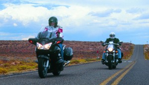
With an adequate number of cornball photos and more Navajo jewelry and T-shirts stuffed in our saddlebags, Bobby Valerie turned to us and asked, “Boys, shall we putt?” Landscapes looking more like the surface of Mars than any sight we’ve seen before radiate out in every direction. In fact, there are so many scenic roads we couldn’t pick just one, so we rode in a general direction, thinking of the mapped route as more of a suggestion rather than a rule.
Some 85 miles beyond the Corners is the cool college town of Durango, Colorado. The city doubles as party central for the Rally in the Rockies, held annually nearby over the Labor Day weekend. Political and business wrangling has turned the rally into an annual drama. In 2006,
it was cancelled the night before the doors opened. The rally attracts tens of thousands, not so much for the event’s dusty goings on, but for the scenery surrounding it. There are stunning rides in every direction. We warmed up with a 240-mile loop starting and finishing downtown. Tom, Bobby Valerie and I pointed the three bikes north on Route 550, riding smack into the mighty chilly San Juan Mountains. The San Juan Skyway climbs sharply in elevation, topping the wintry-even-in-August 10,910-foot Molas Pass before you get to the first warm stop.
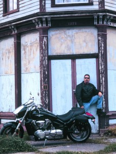
The ST1300 handled the dips, hairpins and twisties of the big loop with aplomb. The Honda has a smooth and seamless powerband that delivers in all gears, which makes it hard to remember, sometimes, exactly how damned fast you’re going. The M109R handles better than it looks like it should; its behemoth rear tire always eager to scrub off rubber in nice, billowy puffs. But the Suzuki is a tough guy on the outside, kind-hearted on the inside, like the boulevard bad boy it was born to be. The bike’s massive torque can yield to quiet manners; it just depends what kind of day it is. The Venture is the comfort cruiser of the pack, plush and luxurious. The Yamaha is built to ride happily all day. Could use a CD player, though, and a radio search station switch that worked better. Other than that, this is a hard machine to put away.
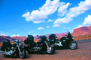
The first stop on the big loop was Silverton. At 9,318 feet, it is a cozy and welcome niche in the mountains. The old mining town looks and feels like it’s been forgotten in the 19th century. Aside from the paved main drag, Greene Street, most of the clapboard Victorian town lies on dirt roads laid out in a grid. There are plenty of places to cool your heels while getting some warm food and drink into your belly. Just understand that no matter how warm it is where you started your day, there’s always a fair chance you may get a little snowed on in the mountains. Dressing in layers is a good idea when elevations vary dramatically. Last time I did the route, I got lucky and only got pummeled by rain for the last 120 miles. The very next day, snow hit the skyway. Lots of it. A narrow-gauge scenic railroad connects Durango and Silverton in case you get snowed in.
Continuing on Route 550, we rode up and over 11,008-foot Red Mountain Pass. The road skirts the Animas River, now stained a yellowish orange (pretty, and tastes like rust) with mineral run-off from the mines. Ouray beckons with soothing hot springs and mountain outfitters—if you’re short on pickaxes and buffalo coats, which I usually am. Before we got to town, we stretched our legs at Box Canon (pronounced “canyon”) Falls and Park. The high bridge trail is a half-mile roundtrip and gains 200 feet in elevation. It was a hardy walk, especially in leathers, but worth the view.
Turn left at Ridgway onto Route 62 and head southeast toward Placerville. Left again on Route 145, heading south. Another suggested stop is the ski paradise of Telluride, where the offerings run to wine tasting, quaint eateries and upscale boutiques. Since we don’t do anything quaint or boutique we saddled up and rode out of town through Rico, Stoner and then Dolores. Immediately after Dolores we headed east on Route 184, making a beeline for Mancos, then west on 160 for a short scoot to the entrance of Mesa Verde National Park. If you have any interest whatsoever in ancient native cultures, Mesa Verde is a must. The national park deserves at least a full day, two if you can spare the time.
Pueblo Indians inhabited the area for several hundred years, and then mysteriously vanished in the 13th century. Of course, a few particularly nasty years of drought when you’re already living in a fragile desert might encourage you to relocate to friendlier climes. Spill some bucks for a guided tour. To ride to where people lived without ever inventing the wheel is not only ironic, it’s bewildering. And you thought this was going to be just another lovely mindless ride….
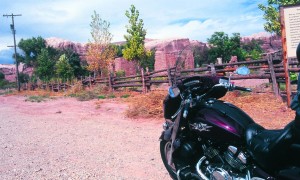
We filled our brains to capacity, rolled out of the park, turned west on 160 heading to Cortez, Colorado, continuing on 160 back toward the Four Corners, ground zero for our desert wonder tour. A few miles before the monument’s entrance we leaned right onto 41, which turns into 262. Now in Utah, the land of Mormon and many natural enchantments. At Montezuma Creek, a wee dot on the map, we crossed over into another world and onto Route 163.
This emptied us into Bluff, Utah, an appealing little town where the road gathers all those little scenic dots and stretches them out as far as the eyeball can see, maybe farther. To the north is the old Mormon outpost town of Moab, now an international mountain biking, hiking and river rafting destination, and Canyonlands and Arches national parks. Saving those for another trip.
We motored south/ southwest toward Mexican Hat. Just past this town on the San Juan River is the northern end of Monument Valley, one of the great wonders of the natural world, or any world. If the Navajos wanted to give us a glimpse into their spirituality, they picked a good place for it. No human heart could still beat and not be moved by these stone giants. The entrance to the park is paved, but the road through the valley is made of dirt; nice, sandy, deep red dirt. Not recommended for bikes but what the heck. The buttes seem as if they erupted from the earth, and now stand sentinel over this ancient place.
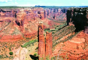
There is one more hidden treasure: A few clicks before Mexican Hat, off Route 26 there is an easy-to-miss, nondescript sign for Goosenecks State Park. Don’t miss it. The sheer grandeur awaiting you at the end of the road is perhaps the Four Corners’ greatest secret. Until now.
For more information:
Durango, Colorado • www.durango.org
Four Corners area
www.utah.com/play grounds/four_corners.htm

Mesa Verde National Park, Mancos, Colorado
(800) 449-2288 • www.visitmesaverde.com
Monument Valley Tribal Park, Monument Valley, Utah
(435) 727-5874
www.navajonationparks.org/htm/monumentvalley.htm
National Parks pass
(888) ASK-USGS, Ext. 1 • www.store.usgs.gov/pass
Navajo Nation • www.navajo.org
WildWind Motorcycle Tours
www.WildWindMCTours.com
 |
 |
 |
 |


