With its towering riverside mountains, lush farmland, 19th-century-style towns and large mansions, New York state’s Hudson River Valley region has been described as America’s own Rhine River Valley. But instead of castles guarding the German countryside, we have the former estates of such American aristocrats as the Roosevelts, the Livingstons and the Vanderbilts.
The Hudson River Valley region encompasses numerous parks, scenic overlooks, small towns, vineyards and mountain wilderness areas. Most important, however,
it has hundreds of miles of great motorcycling roads, offering riders a diversity of experience and excitement.
Just after sunrise, my riding partner Gerry “Mad Dog” Romanowski and I fired up our machines and headed north. As we rumbled into Harriman State Park, our lungs filled with pine- and lake-scented air. We sailed slowly through the park on its two-lane roads, passing one glistening lake after another. At Perkins Memorial Drive, we took the bumpy road to the summit of Bear Mountain for a panoramic view of the lower Hudson River Valley, the New York City skyline and the rolling mountains of Harriman State Park. On a clear day, you can see over 65 miles away to the monument at High Point State Park, New Jersey, where this granite monolith plunges into the belly of the heavens like a giant spear.
“Let’s ride, we’re burning daylight,” the forever-on-a-schedule Mad Dog said. We flew over the Hudson River on the Bear Mountain Bridge and rolled north on Route 9D, a two-lane road enveloped in greenery. We stopped briefly at Cold Spring, a national historic district, which has numerous antique stores, several fine restaurants and a waterfront park with views of West Point and Storm King Mountain on the western shore. Visiting West Point and riding over Storm King Mountain are both worthwhile.
From Cold Spring, Mad Dog and I continued north, connecting with SR 9 above Wappinger Falls, and rode into Poughkeepsie. Routes 9D and 9 are mostly scenic two-lane roads until Poughkeepsie, but from there until you leave Hyde Park, Route 9 is more of a suburban-urban highway with four lanes.
We stopped at the 200-acre Roosevelt estate, which overlooks the Hudson River. Franklin was born here in 1882, grew to adulthood and lived on the estate with his wife, Eleanor, who was also his cousin. To the consternation of the other visitors, Mad Dog let loose an astonished “howl” when I told him that bit of information. “The rich really are different, aren’t they?” he observed.
The Vanderbilt mansion with its Italian Renaissance-style structure and 50 rooms is even more impressive. It was built in 1898 at a cost of $2,250,000, when the average wage was a dollar a day. From Hyde Park we continued north on SR 9, now two lanes and surrounded by countryside. We stopped briefly at Mills-Norrie State Park to view the Mills Mansion and to walk the grounds. Then we continued into Rhinebeck, home to the Beekman Arms (1766), one of the oldest inns in America.
On weekends, the Old Rhinebeck Aerodrome (www.oldrhine beck.org) conducts air shows reminiscent of the barnstorming days, with biplanes and triplanes. Plane rides are also available. The museum is open weekdays and has over 50 antique aircraft and nearly 40 vintage vehicles—including motorcycles—from 1900 through 1940.
From Rhinebeck, we rolled north to SR 9G, a curvaceous two-lane road through farms, forests and small towns. Although there are numerous side roads, additional historic sites and vineyards to visit, Mad Dog’s attention span was waning. I knew if I didn’t get him into the mountains soon, he might start howling some more.
Heading west toward Catskill Mountain State Park, we turned onto SR 23 and crossed the Rip Van Winkle Bridge. In the town of Catskill we took SR 23A and sailed west, snaking our way up a former Indian trail and climbing thousands of feet. The road is a bit rough, with steep mountains rising rapidly on both sides, and the views offer a joyful but dangerous distraction.
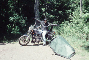
The Catskills have both public and private campgrounds, as well as numerous motels and country inns. We camped at North-South Lake Public Campground at Haines Falls (518-589-5058). The campground has nice sites, great hiking trails, clean facilities and scenic overlooks.
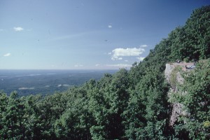
After setting up camp, we took a short hike and then swam in the lake. There are trails to the famous Kaaterskill Falls, Catskill Mountain House site (former resort hotel), and North Point, which offers a 360-degree view of the Catskills, the Hudson River Valley, the skyline of Albany and the foothills of the Adirondacks. Don’t miss this hike.
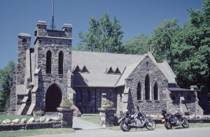
Later, we started a fire and relaxed in front of the dancing flames, bathed in soothing warmth and pulsating light until crawling into our sleeping bags and falling asleep. After breakfast, we fired up our cycles and headed for Tannersville, one of the many small Catskill towns with a 19th-century feel to it. We took CR 23C and headed deep into the Catskill back country. Bouncing along this hilly and serpentine route, we stopped at the All Denominations Church. This late 1800’s stone church sits on a hilltop and is one of many rustic churches found in the Catskills.
From the church, we continued our journey. Gerry’s 750cc Kawasaki Vulcan and my Honda Shadow 1100 Spirit handled the road well, allowing us to drink in the scenery. We cruised through Bleecher Corners, West Jewett and North Lexington, towns so small we were surprised they were even on the map. At Prattsville, we discovered a natural swimming hole on the Schoharie River. It’s just before the Oakland Rifle and Pistol Club. We watched the locals swim for a while before jumping in ourselves. The water was warm and clear, and we stayed for several hours swimming and “copping some rays.”
Riding down Main Street (SR 23) Prattsville is like taking a step back in time. It is turn-of-the-century Main Street America, with a few stores and homes. I almost expected to see a Ford Model T or a horse and buggy.
From Prattsville we planned on riding along the Schoharie Reservoir, but Lillian told us the bridge was out, so we took CR 10 instead, which starts by the post office. This route is even more rustic than CR 23C as it wanders its way by country homes, farms and forests. At the turnoff for Windham (CR 21), we headed for Henderson and took CR 40 to Maplecrest, a former small resort town with several hotels, restaurants and stores. Today it’s practically a ghost town, with many boarded-up businesses and homes.
This is not uncommon in the Catskills. In its heyday, this region was a major destination for the New York City tri-state area. It attracted various ethnic groups, and even today there are areas known as the German, Irish, Jewish and Italian Catskills. Over the years, with the exception of several ski resorts, the region has fallen on difficult times, but that’s what makes it so interesting to explore. One minute you can cruise by a $300,000 yuppie-skier log cabin and the next minute see a rusty, broken-down old mobile home with a chicken coop.
We rode into Batavia Valley, parked the bikes at a trailhead, took a short hike, and then headed back to our campsite. Later we dined on Bison Burgers at Selina’s Diner, a 1950’s-style establishment with great service and food.
The next morning we headed for Hunter, a ski resort town, and took CR 214 south. On weekends you can take the 5,500-foot Skyride to the summit for spectacular views. Hunter Ski Center also hosts various fairs throughout the summer. Our bikes ate up the road as we wound our way through mountain passes and rolled into Phoenicia on the banks of famous Esopus Creek, home to the Town Tinker Tube Rental (845-688-5553). You can tube the Esopus Creek and on weekends take the Catskill Mountain Railroad back to Phoenicia for additional runs.
From Phoenicia, we headed west on SR 28 to Margaretville to SR 30 surfing this rolling, curvaceous road along the northern shore of the Pepacton Reservoir until it crosses a bridge over the reservoir to the southern shore. The large shoulder of the bridge allowed us to stop midway to enjoy blue water of the reservoir and lush green mountains.
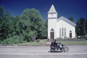
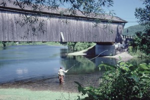
At Downsville, we took SR 206 to Walton and a bison farm, but first we stopped at the Downsville Covered Bridge Park. The bridge was built in 1854 to span 174 feet of the East Branch River at a cost of $7,800. It was restored in 1998 at a cost of $1,000,000.
At Walton, we had lunch at a local pizzeria and obtained directions to the Cody-Shane Acres bison farm about eight miles outside of the town. From the pizzeria, we took a right onto Main Street, then a left onto North Street and another right onto East Brook Road. We followed East Brook Road until we spotted a small sign advertising Bison meat. On a hillside above the farm is a newly built log home where the owners Don and Lynn Tweedie live.
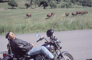
The bison seemed as interested in us as we were in them. We snorted back and forth to one another while we marveled at their beauty and grace. Bison, once 50 million strong, were slaughtered en masse in the late 1800s as part of the genocidal wars against the Plains Indians. Now bison are making a comeback as farmers, ranchers and the public realize their superiority over cattle. Lynn Tweedie told me they have been raising bison since 1994, have two herds numbering 49 head, but only sell meat locally.
With the day growing late, we headed back the same way we came until CR 7, which we took to Roscoe (Fly Fishing Capital of the Catskills) and Livingston Manor (two covered bridges, one at Beaverkill Public Campground). From Livingston Manor, we decided to ride through the wildest region in the Catskills. I don’t recommend taking this route unless you have an innate sense of direction, a full tank of gas, a reliable machine, several hours of daylight left and a sense of adventure.
From Livingston Manor to the turnoff for Mongaup Pond (CR 81 to CR 82), the road is in good shape, but from this point on, it’s bumpy, poorly paved or not paved at all. We rolled through forests, around ponds, past a few houses and the Willowemoc Campground and Covered Bridge. It seemed like an eternity from Willowemoc until we connected with CR 47. Fortunately it was in much better shape and easier to follow. The road took us to Frost Valley YMCA Camp, the Slide Mountain Trailhead (highest peak in the Catskills), Giant Ledges Trailhead (a short hike with great views) and finally to SR 28. From there we sailed along SR 42 to SR 23A back to our campsite.
The next morning we packed up the bikes and headed home. What a great ride—the region gave us a diversity of motorcycling roads to explore and a variety of activities and adventures to experience. I knew it wouldn’t be long before Mad Dog and I once again took another Hudson River Valley ramble.
(This article Hudson River Valley: Bear Mountain, New York and the Catskills was published in the January 2004 issue of Rider magazine.)


