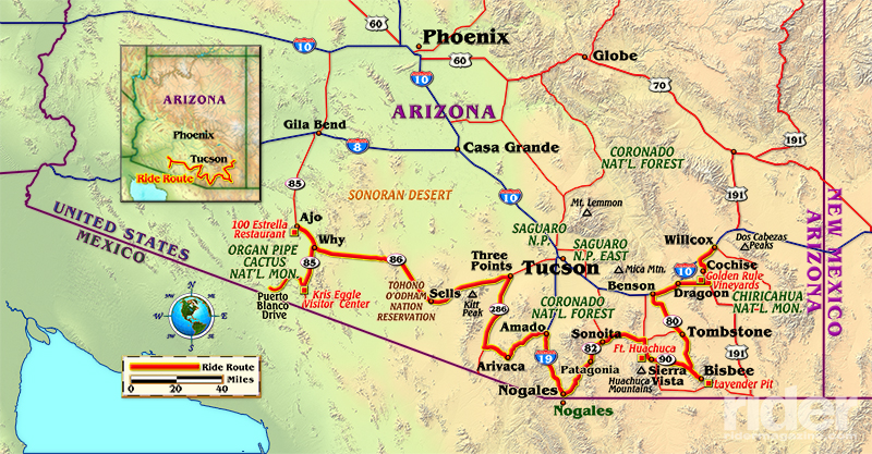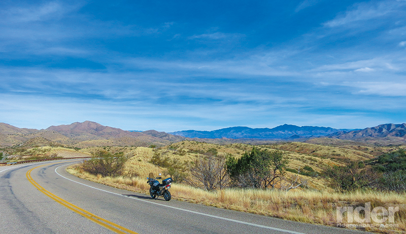
Most motorists cross southern Arizona in cruise-controlled oblivion via the super slabs known as Interstates 8 and 10. However, sandwiched between the freeways and the Mexican border is a motorcycling mecca replete with great historic towns, curvy roads and wonderfully moderate temperatures for most of the year. The region has the added draws of an emerging wine industry, several national monuments and the romance of the Old West.
From Grapes to Gunfights
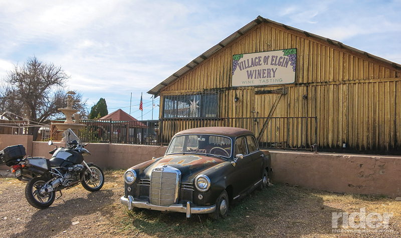
Sonoma, Tuscany, the Rhine Valley—these regions conjure images of rolling vineyards, succulent grapes and fine wines. Not coincidentally, all are popular motorcycle tour destinations. It is logical that motorcyclists gravitate to wine regions—many of the same geographical traits that make for delicious wines contribute to fantastic motorcycling roads. Southeastern Arizona is no exception to the rule of the vine.
I start my tour in the real epicenter of this Arizona vineyard region. The area south of Willcox is fertile ground (literally) for the Southwest’s wine industry. To find out why, I chatted with Jim Graham of Golden Rule Vineyards. He told me that much of the region’s winemaking success is attributable to its higher elevation and wide temperature swings, with daytime highs in the 90s and nighttime lows in the 60s.
While those wide temperature swings create great grapes, they also necessitate riding gear preparedness on the part of touring motorcyclists. Like most of the Southwest, southern Arizona is climatically diverse. My winter ride begins in crisp 40-degree morning temperatures and morphs into the 70-degree range in the afternoon.
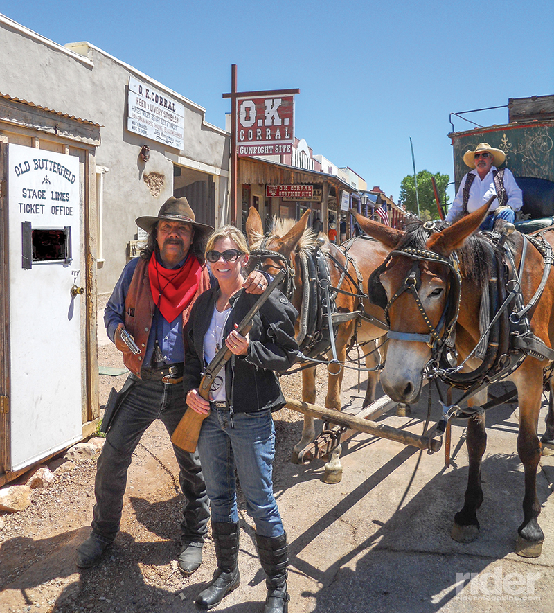
I leave the Willcox wine region with a carefully packed bottle of 2013 Lucky Prospector red wine and motor southwest on my BMW R 1200 GS through the vineyards, grasslands and ranches. The road is a delightful mix of long, sweeping curves and view-filled straights. The ribbon of asphalt traces through grasslands and high desert. The endgame of this first leg is the historic Wild West town of Tombstone. The famous site of the gunfight at the O.K. Corral is a fun stop on the tour. The town unapologetically caters to visitors’ fascination with the historic event. Characters in period costumes roam the streets and gunfight reenactments are frequent and entertaining.
Mine Country to Wine Country
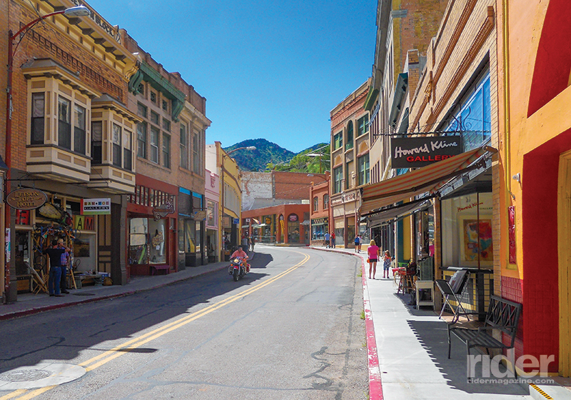
The ride south of Tombstone is twisty and beautiful. The terrain transforms from open grassland to rugged mountains and canyons. After carving through this stone majesty for miles, I find the historic mining town of Bisbee. The picturesque community has a very different feel from that of Tombstone. It is a thriving art and tourism hamlet of wonderfully narrow streets lined with turn-of-the-century brick buildings. Near Bisbee, the massive Lavender Pit Mine site is both an awe-inspiring and somewhat unsettling sight.
The ride out of Bisbee on State Route 92 parallels the Mexican border in close proximity for several miles before a turn to the north toward Sierra Vista. The road is rolling and the views are panoramic. The traffic on the route is light. In fact, aside from Border Patrol trucks and SUVs, I pass only a handful of private vehicles.
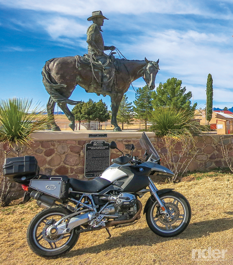
West of Sierra Vista sits the historic Fort Huachuca. The Army fort was home to many of the “Buffalo Soldiers” in the early 1900s and is still an active military installation. I have to show identification to ride through the military reservation to the west toward Sonoita. State Route 83 is one of the best motorcycling roads in the area so the minor hassle of military check-points is a small price to pay. The road skirts the Huachuca Mountain Range and is an amazing roll through low trees, grasslands and forever views. Ultimately, the winding road leads to Sonoita and Elgin, the last of the southern Arizona wine regions on the tour. Half a dozen wineries and more than 10 tasting rooms dot the area and each has its own flair and ambience.
Byway to the Border
Leaving Sonoita spells the end of southern Arizona’s wine country, but certainly not the end of great roads. State Route 82 takes me southwest over more beautiful terrain via sweeping corners and topographic variations. The quaint town of Patagonia is a great rest stop on this leg, and later Patagonia Lake State Park is a worthy side trek. Continuing south, the environment becomes more desert-like as I roll toward the international border.
The bustling border town of Nogales offers a cultural mix that is rich, colorful and vibrant. Multihued buildings and multilingual residents make a stop near the border crossing a lesson in the true nature of a transition zone. I walk the streets and stop at an authentic Mexican restaurant for lunch before starting the next leg of this tour.
Observatory and O’odham
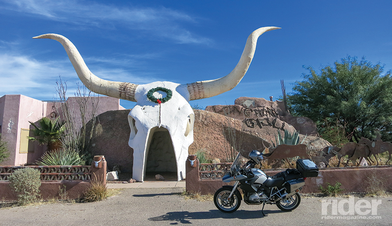
After leaving the border, I start my circuitous path west. The first leg north of Nogales is a jaunt on Interstate 19. After a few leg-stretching miles on the freeway, I head west on Arivaca Road at the tiny town of Amado. This stretch begins at the largest steer’s skull I have ever seen, which is actually the stylized entrance to a saloon. The road proves to be a twisty, lightly traveled, sometimes sandy, but always entertaining ride.
The next community on the path is Arivaca, which is a small ranch town built amongst the remains of a former Pima Indian village. Again, aside for Border Patrol vehicles, there is only the lightest of traffic in this area. Not only is the road nicely winding, it is also undulating in rollercoaster fashion which makes it a blast to ride.
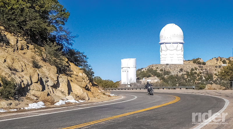
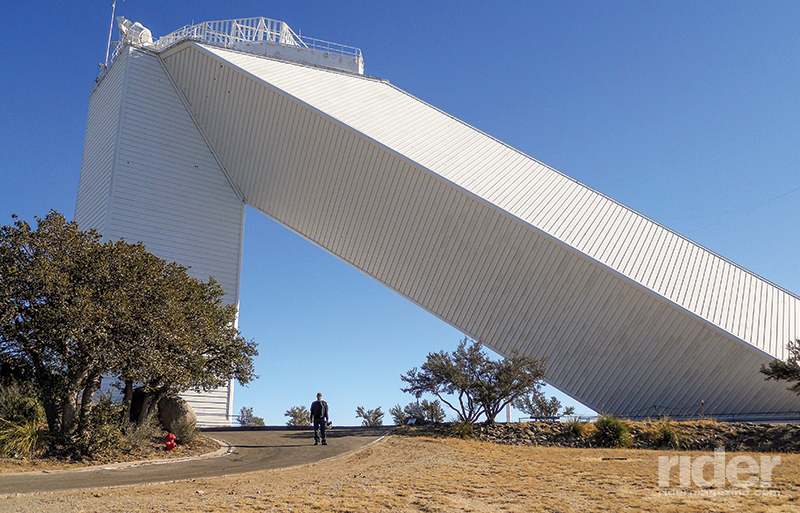
After a ride north on State Route 286, my route takes a direct westward bend at Three Points. After a gas-up, the road is relaxing, scenic and relatively straight. The most remarkable scene on this stretch is towering Kitt Peak and the glowing white domes and structures of the Kitt Peak National Observatory. The road to the observatory is serpentine and fun as it leads up the mountain. Both the road and the historic facility are worthy of the side trip.
After the excursion to Kitt Peak, I resume my ride on Route 86. The road ultimately cuts through the Tohono O’odham Nation Reservation. It is a barren and beautiful ride. I come to a Y at the aptly named Why, Arizona, and it’s time to take a short northern ride on Route 85 and rest.
I roll into the only real civilization in this region; the small, former mining town of Ajo. The home of many of the active Border Patrol agents in southern Arizona, Ajo is undergoing a metamorphosis. Historic buildings are being renovated, walls of local businesses are decorated with vibrant murals and the palm-treed town center is quaint and attractive.
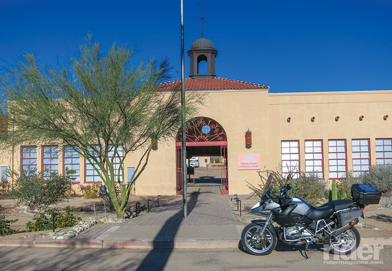
I find an historic public school that has been transformed into The Sonoran Desert Inn and Conference Center. It’s a delightful hotel just off the main drag. After settling into my comfortable, well-appointed room, I walk back to the highway and enjoy a great hamburger and craft beer at the 100 Estrella Restaurant. Ajo has much more to offer than the dot on the map would hint.
Off-Roading at Organ Pipe
After a good night’s sleep, it’s time to head toward the border for the grand finale of this southern Arizona tour. A few miles into my due-south ride on Route 85, I am welcomed to the area by a pair of low-flying fighter jets. The roar of F-16s is a reminder that I am now riding near an active Air Force bombing range. The ride begins as a lonely and barren desert ride, but transforms slowly into a visually stunning roll through a full palate of desert foliage in the shadows of impressive rocky outcroppings.
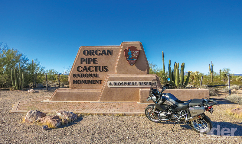
Fittingly, saguaros stand like massive exclamation marks as I near Organ Pipe Cactus National Monument. My plan is to test the dirt chops of the big GS on a 40-mile loop ride through the heart of the national monument. Obviously, riders on street-only mounts will need to don hiking boots rather than dual-sport tires to explore the area.
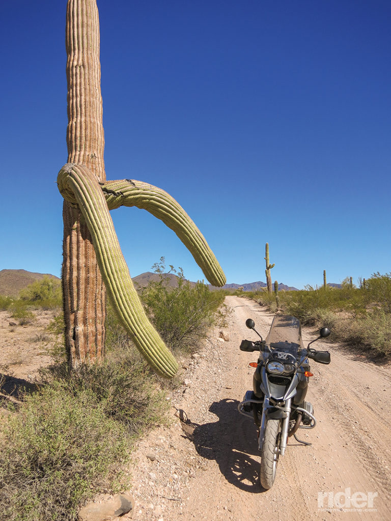
After a quick stop at the park’s visitor center, I check my map, talk to a ranger, drink some water, kick my tires and finally begin my ride on the park’s Puerto Blanco Drive. The majority of the road is a one-way loop in a counterclockwise direction. My ride begins as a fun paved wind through a small portion of the national monument, and then the road becomes an intermittent mix of pavement and graded dirt for a stretch of several miles. It is as if the road engineers designed a warm-up section for guys on big dual-sports.
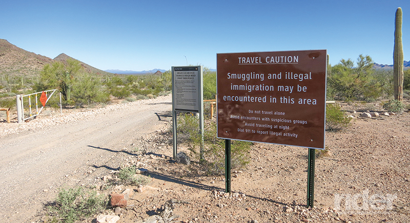
After the last small paved stretch is history, there are signs that remind me that I am in an area that requires vigilance. Sadly, the monument’s proximity to the border makes it an active drug and human smuggling zone. In fact, until relatively recently, the loop on which I am embarking was closed for years due to the threat of border violence. It has since been deemed safe enough for ingress and exploration.
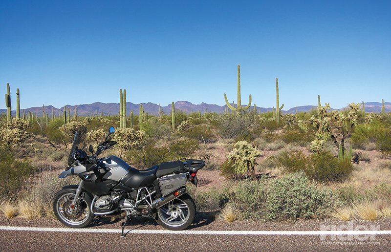
The ride is beautiful. Towering saguaros, whimsical organ pipes and a myriad of other desert plants punctuate the multi-hued environment. The northern and western portions of the loop ride prove to be moderately challenging for the big GS and its street-biased tires. However, care and due diligence make the rocky and sandy sections fun and passable. Historical sites and geological wonders dot the route.
The final stretch of the loop on Puerto Blanco Drive is a sandy ride that parallels the U. S./Mexican border. For miles, concrete-filled iron pipes line the border to my throttle hand. Just past the border barrier is Mexican Federal Highway 2. As I negotiate the sand and rocks, Tecate beer trucks carry the Mexican-brewed libation along the highway just a long stone’s throw away. It is a surreal juxtaposition.
Almost without notice, my dusty BMW rolls back onto Highway 85 just one mile from the border. The 40-mile dirt loop was a sometimes challenging, always beautiful and thoroughly memorable ride. The same could be said about the entirety of the southern Arizona tour. This is a ride to be enjoyed in all seasons except the dog days of mid-summer. It is a diverse and amazing region.
