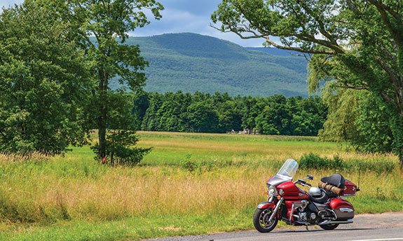
Nothing is more exciting than taking off on a motorcycle trip for several days, and nothing adds to the adventure and challenge more than camping along the way. Motorcycle camping offers you a more intimate experience by adding a total immersion in nature. One great place for both beginner and veteran motorcycle campers to experience such a trip is the Greater Catskill Region in New York State, which is home to Catskill Park.
Catskill Park encompasses more than 600,000 acres of private and public land, including 287,500 acres of the Catskill Forest Preserve with its wilderness areas and miles of hiking trails. The Greater Catskill Region adds hundreds of thousands of additional acres, including farmland and forest, campgrounds and small villages to explore. Most importantly, the Catskill Region has hundreds of miles of twisty, rolling two-lane roads through valleys, farmland, mountain passes and forests for riders to enjoy, making it the perfect location for a multiday motorcycle tour. For non-campers, there are numerous motels and bed-and-breakfasts throughout the region, as well.
Superslabs give you easy access to the Catskill Region, but I prefer a mostly backroads approach. This was the maiden camping voyage for my new Kawasaki Vulcan Voyager 1700, so I was traveling light (small tent, no stove or cooking gear) and only had to strap my sleeping pad on the seat—the rest of my gear fit into the hard bags.
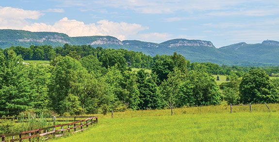
After riding alongside the sparkling waters of Ringwood, New Jersey’s reservoirs and the west shore of Greenwood Lake, my Voyager easily climbed State Route 17A over a mountain. A panoramic view of the farms and hills leading to the Catskills rolled out before my eyes like a lush ocean of green. Even fully loaded, the Voyager handled the twisties with ease.
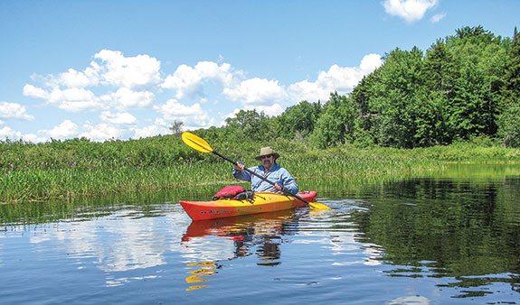
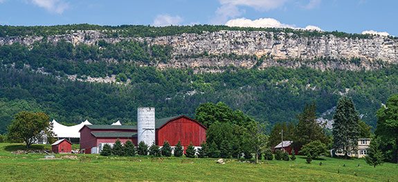
I cruised through farmlands and towns on two-lane Route 17A and State Route 17 before reaching Exit 115. A friend had told me about Route 7, which runs through farmland along the base of the Shawangunk Mountains (the Gunks). I think of the Shawangunks as the beautiful offspring of their more impressive parents, the Catskills. Known for their rocky cliffs, the area has become a magnet for rock climbers and mountain bikers, who enjoy riding the trails along the ridges and forests of the plateau. Minnewaska State Park is the crown jewel of the Shawangunks and worth a stop.
Crossing the Gunks on serpentine State Routes 55/44, the road overlooks an expansive view of the Catskill Mountains rising into the clouds. Descending from the Gunks, I turned onto State Route 209 to State Route 3 and headed into the Catskill backcountry toward the Ashokan Reservoir, which covers 8,300 acres and is ringed with mountains. Circumnavigating the reservoir takes you through woodlands with several spectacular views of the Catskill Mountains rising from the shoreline.
If you have a taste for ’60s nostalgia, cruise over to Woodstock (namesake for the festival site 60 miles away in Bethel). Though only a shell of its former self compared to its hippie heyday when the counterculture washed over the town like a tsunami, it still has the aura and look of a “Colony for the Arts,” as it has been known since 1902. Bob Dylan lived here during his “Country Bob” phase as did quite a few other 1960s musicians like John Sebastian of The Lovin’ Spoonful.
I chose to rumble west on State Route 28 to the village of Phoenicia, with its massive population of 309 individuals. Nevertheless, it has several nice restaurants, country stores, the Catskill Mountain Railroad and Town Tinker Tube Rentals for trips on Esopus Creek. With its Class I and II rapids, the Esopus provides quite an adrenaline rush when the water level is high, or just a relaxing scenic float when it is not. The Catskill Mountain Railroad is still rebuilding much of its line which, like many river areas in the Catskills, suffered major damage from 2011’s Hurricane Irene. Shorter tours are still available and can be arranged from the Mount Tremper depot.
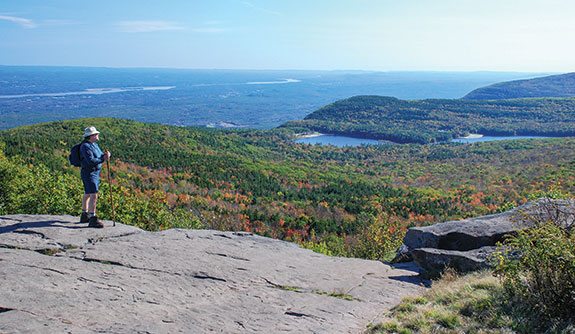
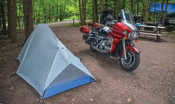
While there are both private and public campgrounds in the Catskills, I usually go public. Woodland Valley Campground is near Phoenicia, but I was going to camp in North-South Lake Campground, the most popular and largest campground in the Catskills. With two lakes (now connected), two beaches, great views, hiking trails and canoe and kayak rentals, riders have plenty to do in addition to touring. For state campgrounds, reservations are essential.
Leaving Phoenicia, we sailed north on rolling State Route 214, heading toward Haines Falls and North-South Lake. The air was sweet with forest freshness and the slight tangy aroma of wood smoke emanating from mountain homes and the primitive Devil’s Tombstone Campground located in rugged Stoney Clove Notch. The “tombstone” is actually a large 7- by 5-foot boulder.
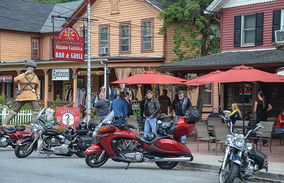
At State Route 23A, I rumbled through Tannersville, which assaulted my historic senses with its 19th century buildings that look like they were painted by Timothy Leary while he was in a psychedelic haze. For a minute I thought I had entered a time warp, but that’s what is great about cruising through the Catskills—you never know what you might see, from wildlife to funky buildings. The Catskills are home to wild turkey, bear, coyote, hawk, bobcat, mink and rattlesnakes, among others.
North-South Lake Campground spreads out from the escarpment that overlooks the Hudson River Valley, which rises up thousands of feet from its floor. A short walk to an overlook of the valley connects with the Escarpment Trail. The trail climbs to North Point, which has a 360-degree view—on a clear day you can see five states. On a previous trip, my friend Tom Mullee and I completed the challenging circular hike to North Point and back. However, even a short stroll along the Escarpment Trail allows excellent views of the Hudson River Valley and beyond. After setting up camp, I decided to ride to Bastion Falls, located off Route 23A. A brief walk along the road from the parking area takes you to the falls. However, seeing the big kahuna, the Kaaterskill Falls, requires a mile hike round trip. After spending most of the day in the saddle, my legs needed stretching, so I asked myself, “Why not?”
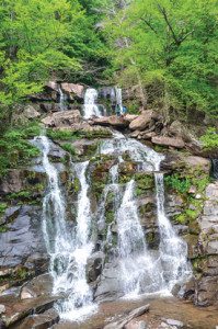
The hike required more effort than I remembered, especially since I was older, wearing motorcycle boots, heavy jeans and a long-sleeve shirt. Nevertheless, it was well worth the effort. Kaaterskill Falls is the highest two-step falls in New York State. The first drop is 167 feet and the second is 64 feet. Looking 231 feet up from the base is quite a sight, especially when you see young adults sitting and walking along the cliffs as if invincible.
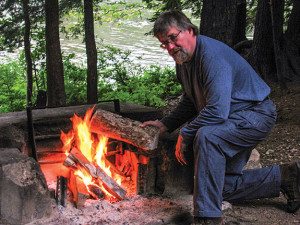
Returning from the hike, I headed to Selena’s Diner for dinner. After chowing down on a juicy turkey burger and drinking several ice teas, I felt satiated, and by the time I returned to camp, fatigue floated over me like clouds across a blue sky. Watching the dancing flames of the fire while enjoying a libation and cigar, darkness enveloped me like a cold wind, but the orange glow of the fire and its sweet scent warmed me like a sleeping bag until I climbed into my own.
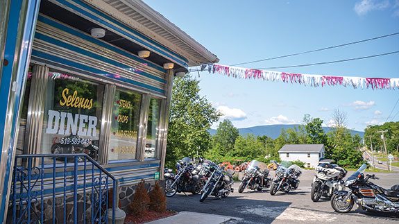
I awoke in the morning to the sweet sound of singing birds, and then it was off to Selena’s again for breakfast. The place was packed with Victory riders attending a rally in Hunter. The Hunter Mountain ski resort is open most of the year with festivals, zip line and canopy tours, and the scenic Skyride to the summit of Hunter Mountain’s skiable terrain. On a crystal clear day, you can see not only the northern Catskills, but also the Berkshire Mountains in Massachusetts and the Green Mountains of Vermont.
After breakfast, I headed west on Route 23A, riding alongside the Schoharie Creek to Prattsville, which suffered major flooding in 2011. Hurricane Irene turned the Schoharie Creek into a raging river that ravaged the town, washing away buildings, trees and cars. From Prattsville, I rumbled east on Route 23, leisurely touring the surrounding roads as well.
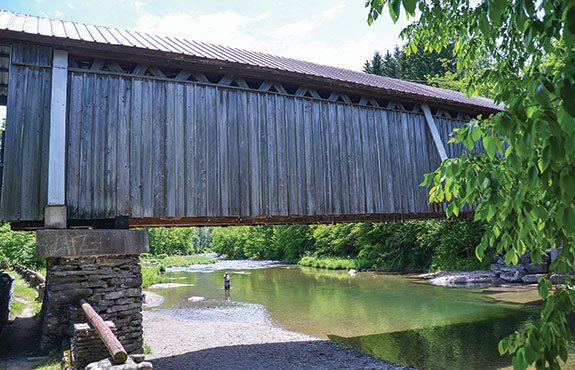
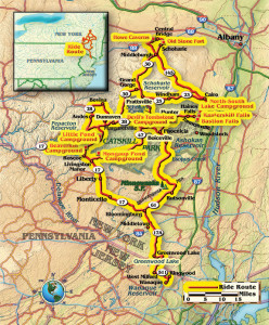
Another ride choice is a larger circular route going east on Route 23A as it snakes down the mountains to State Route 32. Taking State Route 145 to State Route 30, you arrive in Schoharie with its Old Stone Fort Museum. From there it is a short ride to Howe Caverns. Even if you don’t tour the caverns, the view of the surrounding countryside is impressive. Returning via Route 145 to 30 and then 23 to Prattsville is a superb ride. Route 23A to the campground completes the circle.
While enjoying the fire that night, I contemplated my next day’s journey. In the morning, I was heading to the western Catskills for further exploration. There, I had three public campgrounds to choose from, each with its own unique attractions like riverside camping, a covered bridge or wilderness surroundings.
That’s what is so great about cruising and camping through the Catskills—the range of choices. No matter which roads you choose or campground you pick, they all have special qualities that beckon you to return for another trip.
 |
 |
 |


The map on this article appears to be New Jersey, as apposed to the Catskill region….
You are absolutely correct Bill. We uploaded the wrong map by mistake. It has since been updated the the correct map. Thank you so much for noticing out error so that we could correct it.
Awesome man! Was wondering where you parked the bike when you camped. Thinking of doing this. Thank you. Ride on!