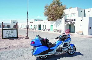
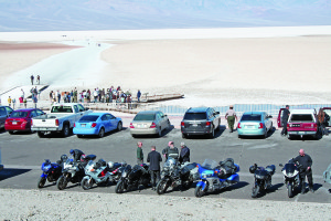
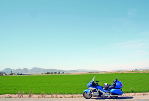
For more than 35 years, a contingent of aging Yuppies that includes Yours Truly has been convening at Furnace Creek Ranch in Death Valley in late winter. Now, after three nights of carousing, retelling oft-told tales and ignoring realities, the DV weekend was over. I cranked up the Honda Gold Wing GL1800 and headed for Las Vegas.
Not that I like Vegas, but it is on the way to the Hoover Dam.
I will say the Gold Wing is a very commendable Death Valley bike—so long as the rider does not try to negotiate a gnarly, rocky, unpaved road like the one through Titus Canyon. On the asphalt, the Wing is comfortable, fairly fast and handles the twisties on Townes and Daylight passes very well. When the fellow on the sportbike looks in his rearview mirror and sees this 900-plus pound behemoth catching up, he is impressed.
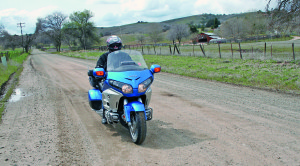
The only instrument the Wing was lacking was a radar detector, so I left the valley at a reasonable pace via Death Valley Junction, and rode on to Pahrump, Nevada—where the gas was more than two dollars cheaper than at Furnace Creek. From there it was less than a hundred miles to the Hoover Dam, skirting around the south of Las Vegas, to where U.S. 93 and U.S. 95 merge temporarily near Boulder City, the town closest to the dam.
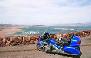
U.S. 93 crosses over the Colorado River at the Hoover Dam, or used to, since the highway (very high!) now goes over the spectacular Hoover Dam Bypass, officially the Mike O’Callaghan-Pat Tillman Memorial Bridge (O’Callaghan was governor of Nevada, Tillman was a U.S. Army ranger killed in Afghanistan). The dam is certainly an impressive structure, creating the huge Lake Mead reservoir, and so is the bridge though they were built 70 years apart.
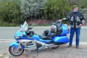
Most rivers start small in the mountains and get bigger and bigger as they flow toward the inevitable ocean, like the Mississippi and the Columbia, and the closer the ocean, sea or gulf, the bigger the bridges. The Colorado is a bit different, as it is biggest in the middle here at Lake Mead, and then gets smaller and smaller as it flows south to the Gulf of California due to the fact that water is constantly diverted to irrigate crops.
The most impressive bridge on the Colorado is the Hoover Dam Bypass, with a single four-lane arch made of a concrete and steel composite stretching more than a thousand feet across the river and some 900 feet above it. It is a 21st century marvel. Except both sides have four-foot concrete barriers to cope with the wind, and from the seat of the bike there was no view. I had hoped to go over the bridge and then circle back via the dam, but with the opening of the bridge, the Arizona approach to the dam had been blocked. Meaning I had to go back over the bypass and then down to the dam, which in itself is a gloriously curvy ride. A pedestrian walkway was built on the upriver side of the bridge, offering great views of the dam.
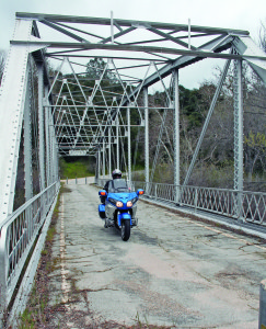
The roughly 450 miles that the river covers between Hoover Dam at the north end of Black Canyon and the Gulf of California is called the Lower Colorado, and it runs through desert and dry mountains. For 50 years, shallow-draft steamboats went up the river as far as the Black Canyon, but railroads and dams put the boats out of business more than a century ago.
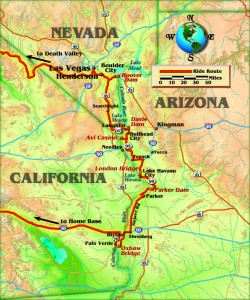
Heading south, I took U.S. 95 on the Nevada side of the river. For the 70 miles south of the dam, the river flows through a deep canyon between Nevada’s Eldorado Mountains and Arizona’s Black Mountains, and the roads on both sides are well away from the river. No bridges, until one comes to Laughlin, Nevada, and the Davis Dam, the most recent major dam on the river. It was finished in 1951 and backs up the water to create Lake Mohave. This does have a road across the top connecting with Bullhead City, except it was closed to motorized traffic when I was there. Pedestrians and bicycles were welcome, and rumor has it that things may stay that way.
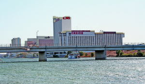
Which is OK, since in 1987 Don Laughlin, a real-estate and casino mogul, fronted the money to build the Laughlin-Bullhead Bridge a mile or so downstream of the dam so that Arizonians could have better access to his casinos. It’s essentially a flat, functional concrete bridge which has way too much traffic between dawn and dusk. After the 9/11 attack, truck traffic was barred from the Hoover Dam and had to come down U.S. 95 and cross back into Arizona over this bridge.
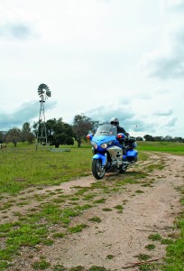
Laughlin is best known these days for the motorcycle extravaganza held every April, when thousands of bikers show up and fill the 10,000-plus rooms at the hotels and casinos. Very profitable. But I was not into gambling, only riding, so I moved on. The Wing does have an excellent GPS system, but since I did not know how to program it for “every bridge across the Lower Colorado River,” I had to rely on maps. Not a big problem.
After crisscrossing the L-B Bridge, I cruised 10 miles down the west side of the river to the Avi Casino, where the Fort Mojave Indian Tribe sensibly built a 450-room hotel and a huge gambling den, as well as an inexpensive bridge over the river. With both the Hoover and the Davis dams backing up water, there is not much of a torrent any more. Back in the 1850s, a ferry crossed near here; the ferry business was a good way to make money, but a trifle risky as the spring floods could wreck everything. No vehicle ferries cross the Lower Colorado these days, and I think the only vehicle ferry left on the entire 1,450 miles of river is on Lake Powell, upriver from Lake Mead.
We crossed back into Arizona on the two-lane Veterans Memorial Bridge, built in 1996 to attract customers to the casino. The river is thoroughly tamed here, with the two upstream dams and irrigation systems that bring water to the fertile valley land. Back in 1944, a treaty with Mexico said that 10 percent of the river’s water flow would reach Mexico—that is more like two percent today.
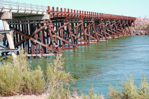
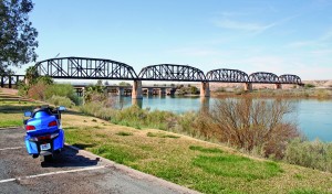
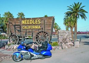
The Wing and I headed south along Arizona State Route 95 toward Needles and the Needles Bridge. I set the Wing on cruise control at a legal speed and kept a happy eye on the views rather than on the local police and highway patrol, intent on keeping the roads safe and the local coffers well filled. Needles became a real town in 1883 after the railroad built a bridge a few miles downstream by Topock. The railroad still crosses the river at Topock, as does I-40, that concrete bridge being finished in 1967. The Old Trails Arch Bridge, opened in 1916, is a truss design made of steel girders and still stands. Anyone who has read John Steinbeck’s book, The Grapes of Wrath, will recognize this as the bridge the Joad family crossed during the Depression.
Downriver some 20 miles is Lake Havasu City, best known for the London Bridge and the huge Lake Havasu. These Colorado River lakes are all man-made, this one by the construction of the Parker Dam back in 1938, and the U.S. Army Air Force had a base on the east side in World War II. In the early 1960s a real estate type, Bob McCulloch, created an island and bought the London Bridge to connect the island to the Arizona shore. Buying, shipping and reconstructing the bridge cost McCulloch a cool $10 million—when a million dollars was actually worth something. Nowadays, the place booms as a tourist and retirement community.
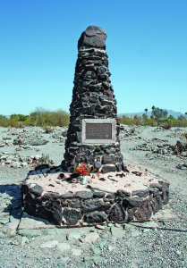
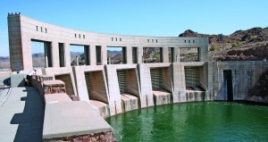
Another 20 miles down Route 95 and we reached Parker Dam, with a road going over the top. Big trucks continue down the Arizona side, but the Wing and I curled around to California and came down onto Parker Dam Road, probably the most delightful 15 miles of curvy road alongside the Lower Colorado River. This is perfect GL riding, with minimal use of fifth gear. Coming into the tiny town of Earp, we went under the west end of the railroad bridge and then crossed over the river on a two-lane bridge to Parker, Arizona, with much construction going on as a parallel bridge was being built.
From Parker, I headed south on Mohave Drive through the flourishing, well-irrigated Parker Valley, mostly owned by the Colorado River Indian Tribes. Then down to Ehrenberg and I-10, where the Flying J gas station had long lines, as the gas was about a buck cheaper than across the river in Blythe, California.
Back in 1877, an English-born prospector named Tom Blythe was poking around these parts, and got the town named after him. The city has over 20,000 inhabitants, working either in the tourist industry or in the fertile fields of the Palo Verde Valley south of town. My original intent was to head west on I-10 to spend the night in Palm Springs, but my map showed a couple of little bridges down in the valley only 25 miles south.
Getting to the first bridge, which my map called “Farmers Bridge,” a large sign read, “This bridge constitutes a danger. Use at your own risk.” As I looked at the sign a passing farmer in a pickup stopped and asked if I needed help. “Why the sign?” I asked. “That’s because us farmers built the bridge to help get our crops to market, and the state said that if the state didn’t build it, the sign would have to go up. Don’t worry, it’s safer than many government bridges.” I crossed over into Cibola Valley, Arizona, which backs on to the Pentagon’s Yuma Proving Grounds…and bombing range.
Not wanting to run over any live ordnance, I had a look at the map which showed the Oxbow Bridge—where the Oxbow Lake was cut off from the river many years ago—crossing back to California, with less than a mile of unpaved road connecting me with the village of Palo Verde and State Route 78, which went back to I-10. The Oxbow Bridge, compared to the Hoover Dam Bypass, was as rustic as an old Ford Model A, with wooden supports hammered into the river. But it was solid.
Not bad. In the past two days I had crossed the Lower Colorado on nine bridges and two dams. Too bad there aren’t any ferries left.
(This article Crisscrossing the Lower Colorado: The Hoover Dam to the Oxbow Bridge on an Electric Blue Gold Wing was published in the February 2013 issue of Rider magazine.)

