When I go on an extended motorcycle tour, I like to ride back roads with plenty of twisties to challenge me, in an area with forests, mountains, lakes and rivers to stimulate the senses. That’s why riding the reservoir roads of the New York southern highlands makes for a fantastic motorcycle tour. Much of the region is protected watershed land and parks. This area supplies New York City with its water needs and is home to great roads, quaint little towns and even a bison ranch.

On a crystal clear day with the warm sun gently embracing me, I rolled out of Ringwood, New Jersey, on my Kawasaki Nomad 1600. I sailed along Sloatsburg Road to Long Meadow Road (County Road 84) through the Sterling Forest watershed to Route 17A and then Route 17. This journey offers a diversity of riding experiences, with everything from back-woods country roads to a superslab to hone your riding skills.
Although Route 17 is a four-lane highway, it was named one of America’s most scenic roadways in 1960; I would return to different sections of it several times during my trip.
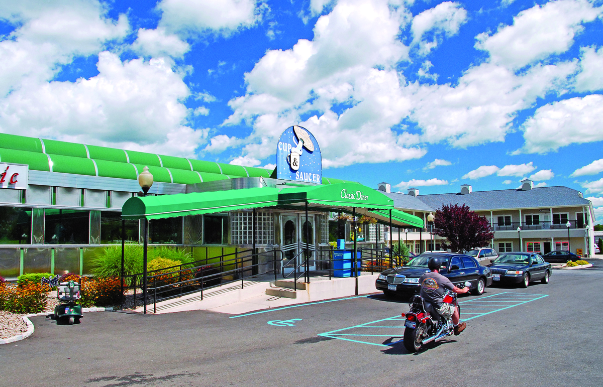
Blasting along on Route 17 to Route 302, I rumbled north toward the highlands, stopping briefly at the Cup and Saucer Diner in Pine Bush. This is “…widely regarded as the UFO capital of the East Coast…with claims of alien sightings, abductions and encounters dating back to the 1960s.” Hmmm, the “turn on, tune in, drop out” 1960s; could that explain the Pine Bush phenomenon?
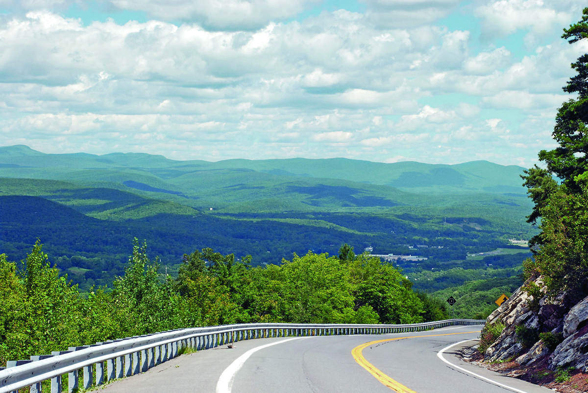
From Pine Bush, my Nomad climbed the curves of Route 52 into the Shawangunk Mountains. There are several overlooks with panoramic views of mountains cutting across the horizon like a jagged knife, which make it worthwhile to stop and savor the superb landscape. If you’re lucky, you might see hang gliders launching from the mountainside and riding the air currents to the valley below, like hawks hunting the fields.
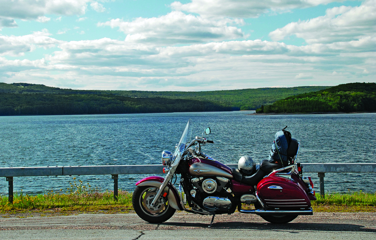
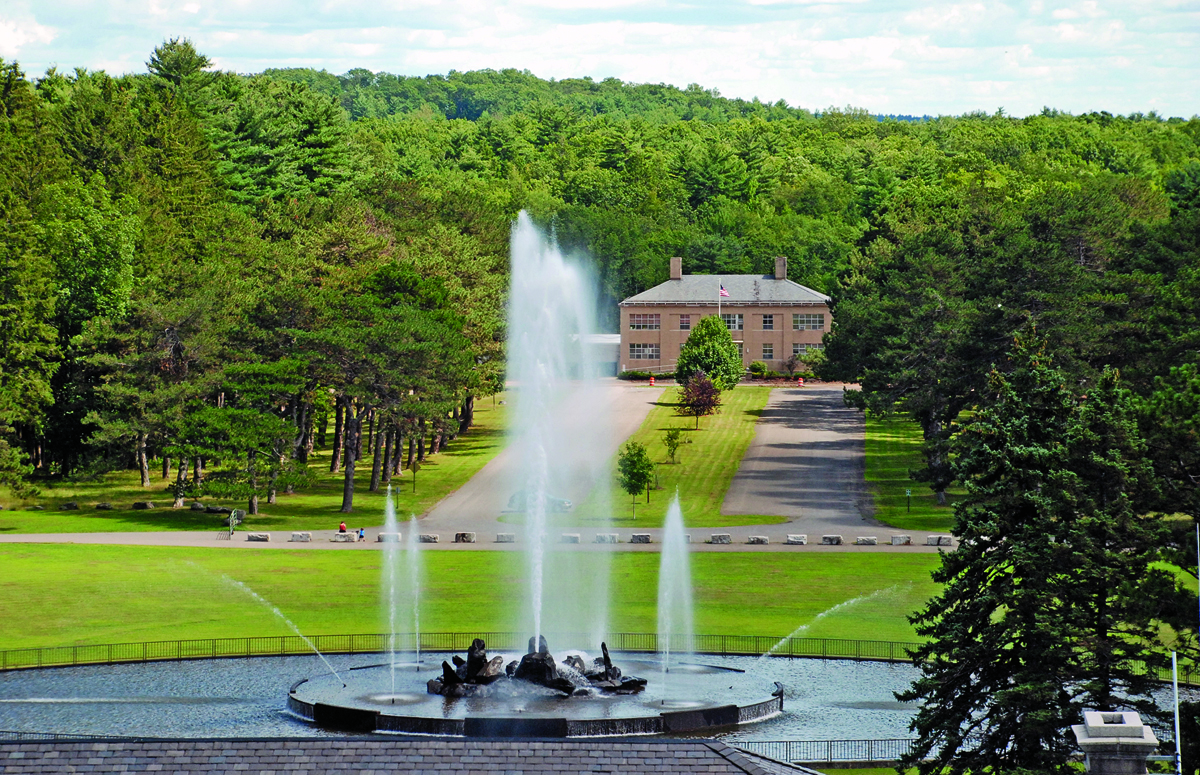
At Ellenville, Route 209 North heads toward the Ashokan Reservoir. This section of 209 can be slow going, especially if, like me, you get stuck behind a driver who thinks he’ll be struck dead if he even approaches the speed limit. Finally, Route 209 opened up and I flew to Route 28 West to 28A, which snakes through the lush woodland of the reservoir’s southern shore. The Ashokan Reservoir is 12 miles long, with a water surface area covering 8,300 acres. Completed in 1914, it caused the removal or drowning of nine villages and the relocation of over 2,800 remains from 32 cemeteries. Many of the skeletons were of Revolutionary War soldiers.
Riding Reservoir Road to the parking area just after the dam, or walking on Spillway Road off 28A, provides panoramic vistas. Spillway Road is now a pedestrian walkway and bike path. Tethering my iron steed, I explored the spillway and was rewarded with impressive views of the reservoir and the mighty Catskill Mountains rising majestically into the heavens.
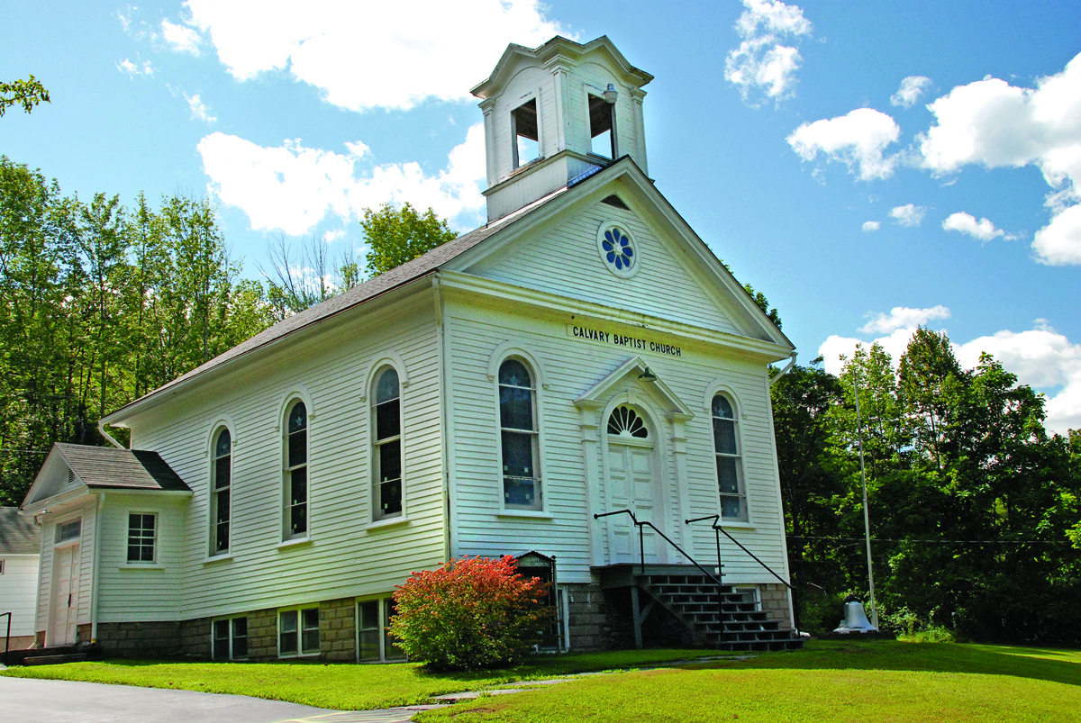
Just before the turnoff from Route 28A to Route 42, I spotted the Calvary Baptist Church. Opening the church, Pastor Schulz informed me that it is over 200 years old and was relocated here in 1914 to save it from being drowned by the rising reservoir water. Forests envelop Route 42, a back road bordering a Catskill wilderness area. Passing a few country homes, hiking trailheads and a waterfall, it parallels Roundout Creek. The aromatic woodland and road isolation made me feel as if I was galloping through the 19th Century rather than rumbling through the 21st.
Route 153 to 55A brought me to Roundout Reservoir. I visited the eagle observation area, but unfortunately, spotted none. From Grahamsville, I rode to the Neversink Reservoir Dam causeway. Stopping for a looksee, the lake-scented breeze blew across the blue water while the waves lapped strongly in the afternoon sun. The Roundout and Neversink reservoirs are not as impressive as the Ashokan, but are still captivating. By the time I reached Liberty, the day and I were almost spent. So, I jumped on Route 17 and superslabbed it to Hancock over the hills and valleys of the highlands.
Hancock, known as “The Gateway to the Upper Delaware,” sits at the confluence of the East and West branches of the Delaware River. These two waterways form the renowned Delaware River—the longest free flowing river in the Northeast. Hancock, an old river town, makes a convenient location for additional explorations of the reservoir roads and other activities such as fishing, hiking and river trips. I stayed at the Hancock House Hotel, which was completed in 2007. It’s fashioned after the original Hancock House Hotel built in 1848. Both the restaurant and bar serve food, and the hotel offers a complimentary breakfast; its rooms are spacious and clean. After a libation and dinner at the bar (Honest Eddie’s Tap Room), I hit the hay early.
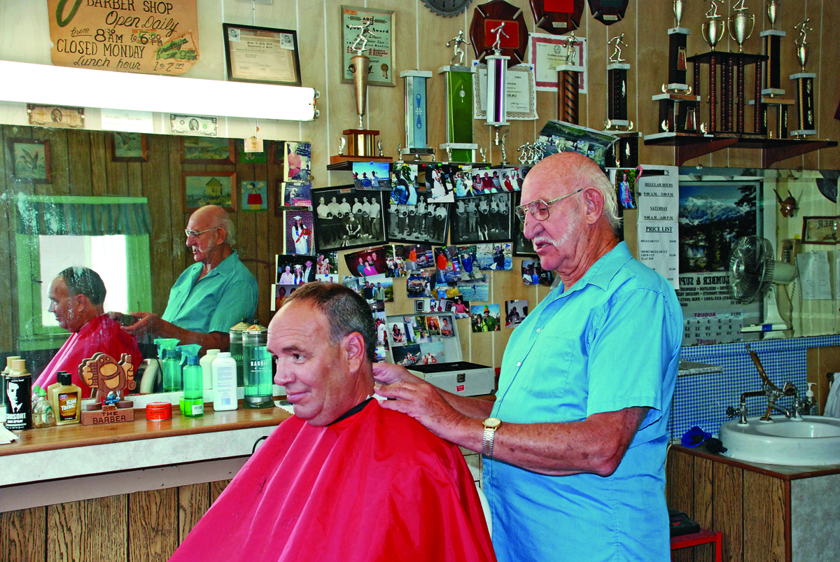
Before taking off in the morning, I stopped in at Jerry Leonard’s one-chair barbershop. This is no modern day salon, but rather an old 1950s-style establishment. I asked, “How long have you been cutting hair in Hancock?” “Fifty years,” Jerry said proudly. “I started in 1961 right out of barber school and have been here ever since. I plan on cutting hair for another 50 years.” And I wouldn’t be surprised if he did; Jerry is one tough old bird. Next door is Marino’s Outdoor World. With its stuffed animal display, extensive gun collection, non-yuppie outdoor clothing and décor, you’ll feel like you walked into the 1950s.

Soon after, I fired up my Nomad for another day of riding the rural and rustic reservoir roads. I planned a big loop ride encompassing three reservoirs, swimming in the Schoharie River and returning to Hancock for another night’s stay. Again taking Route 17, my Nomad roared west to Deposit where I picked up Route 10, which serpentines alongside the Cannonsville Reservoir and then caresses the West Branch of the Delaware River to Stamford.
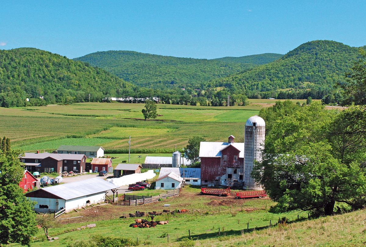
When completed, the reservoir covered nearly 20,000 acres, inundating 94 valley farms and five villages. Riding alongside this beautiful flooded valley, I longed to see its rural splendor before the Big Apple drowned it with its lust for water. Weaving and dancing through the northern tier of the southern highlands, with impressive views of farms, mountains, villages and the river, makes Route 10 a rider’s nirvana.
At Walton you can take a 20-mile round trip detour to the Cody-Shane Acres Buffalo Ranch. Call first to confirm the herd is available for viewing (607-865-4913). The owners, Don and Lynne Tweedie, are most gracious and enjoy showing the herd to visitors as well as highlighting their bison operation. Once 30 million strong, bison were exterminated en masse as part of a government policy to destroy the Indian nations of the West and open their land to settlers and ranchers. Now with other farmers and ranchers demonstrating the superiority of bison meat over beef, the bison are making a comeback.

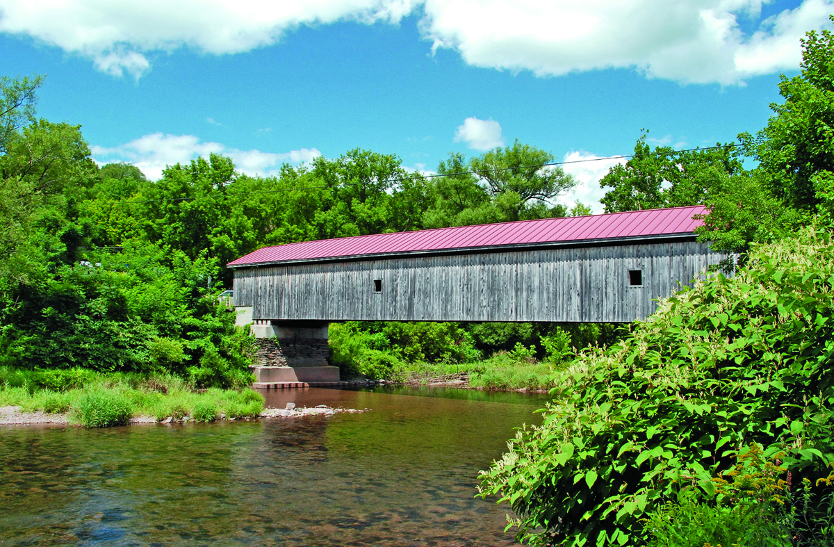
My Nomad navigated Route 10 to Hamden, where I rode across the Hamden Covered Bridge. Built in 1859 for $1,000, its 128-foot-long expanse leads to eye-pleasing farmland and country side roads. From Hamden, I continued north through the countryside and several small villages. At Stamford, Route 23 travels south to the Prattsville swimming hole and my long anticipated dip in the Schoharie River. I dove into the cool, clear water, had a refreshing swim and then napped on the rocky bank.
With the day growing late, I decided to skip the Schoharie Reservoir and rode sinuous Route 30 to the much larger Pepacton Reservoir. The bridge that traverses the lake has a small shoulder just large enough to park a motorcycle. However, when a passing “county mountie” ordered me to move on or be ticketed, I realized the builders didn’t design the narrow shoulder just for the benefit of motorcyclists to conveniently view the scenery. From here, Route 30 runs along the eastern shoreline of the reservoir to Downsville and then snakes alongside the East Branch of the Delaware River back to Route 17.
It’s one fantastic ride, with vistas of the reservoir and the mountains, and there are enough twisties to get your heart pumpin’ and jumpin’. Continuing on Route 30 to East Branch, I glided onto Route 17 and headed back to Hancock. In the morning it was time to return home, but my trip was far from over. Route 97, a scenic byway, runs 75 miles from Hancock to Port Jervis. Paralleling the Delaware River, 97 is a rollercoaster ride with nice scenery and recreation opportunities.
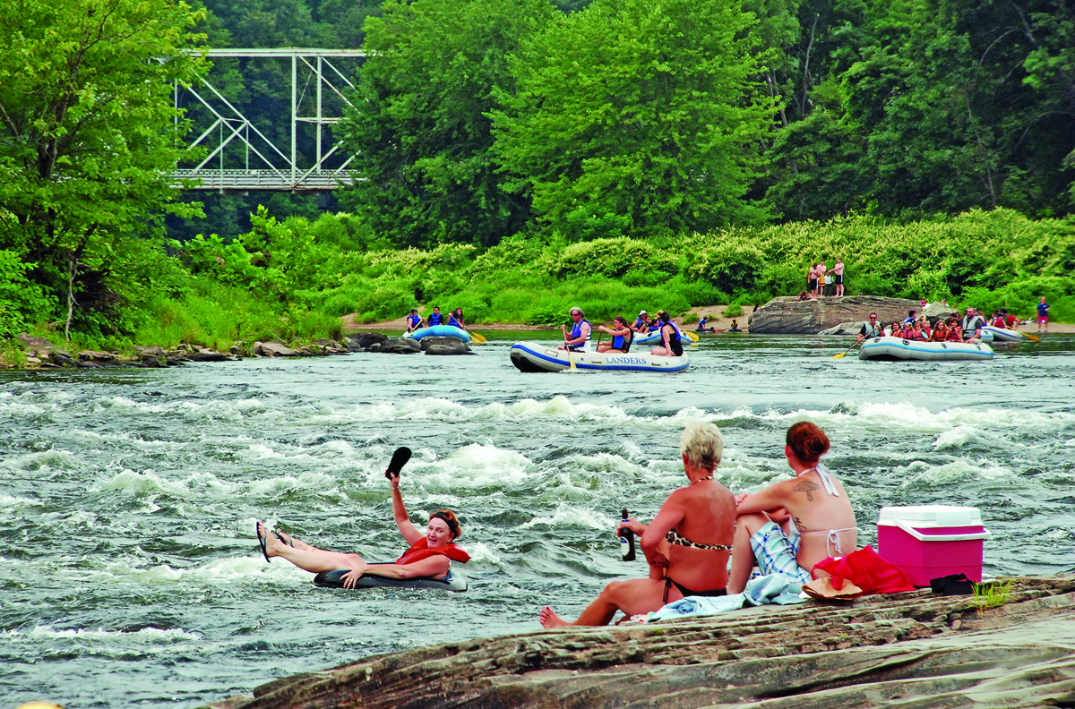
While riding south on 97, I stopped at Skinner’s Falls, which also has plenty of recreation opportunities as well as people watching from the rocks overlooking the rapids. After enjoying the show for a while, I sailed on to Port Jervis, taking Route 6 to Route 1/1A toward Waldwick, New York, and on to New Jersey.

Riding contentedly across the expansive black dirt farmlands of Pine Island brought a big smile to my face. I contemplated the extraordinary things that cruising the reservoir roads had bestowed on me: panoramic views, wilderness riding, rushing rivers, quaint villages and challenging twisties. This was one spectacular road trip that I can’t wait to do again.


