A cool, dry breeze blows in from the northwest. It’s a welcome change. Rainfall totals this summer are setting records, and my riding buddies and I wonder if the monsoon has come to New England. But now, for the first time in months, there is nothing but sun in the forecast—perfectly aligning with our plans to explore the back roads of eastern Ontario’s Lake Country.
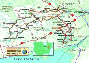
At first light, we put the sun at our backs. Our destination: 500 miles into that northwest breeze. Calabogie, Ontario, is situated in the Lanark Highlands about an hour west of Ottawa. The tourist brochure pitches Calabogie as a four-season destination for people “who favour the outdoors.” For sport-touring motorcyclists like us, the attraction is roads that meander around hills, along lakefronts and through small towns.
One of these roads is Lanark County Road 511, which delivers us to Calabogie from the southeast with curves and elevation changes that are continually entertaining. I relish the thought that this two-lane blacktop is included in several routes we have planned.
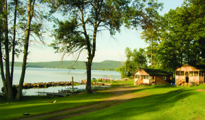
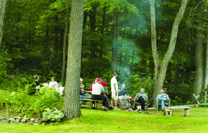
We check in at Jocko’s Beach Resort, which has cabins on Calabogie Lake plus a motel on the hill across the street. Other riders begin to trickle in from several U.S. states and Canadian provinces, and we gather around a campfire to wash down hot chili with cold beer. The fire burns to coals as coyotes sing to a waning gibbous moon.
Morning brings blue skies and growling stomachs. I normally subscribe to the “50-Mile Rule” on breakfast rides, but today I am persuaded to ride just 39 miles, for pancakes. We snake southeast on CR-511, then at Lanark turn southwest onto CR-12. In McDonalds Corners, a sign directs us down 9th Concession A Road toward Wheeler’s Pancakes. Just beyond the highway department garage, the pavement ends but more signs guide us to breakfast.

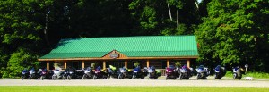
Around the last bend, two impressive log structures come into view. The sugar shack/restaurant, built in 1996, is constructed with lumber harvested on the property and with cedar logs reclaimed from hay barns built a century before. We park in front of the other building, Wheeler’s Maple Heritage Museum, which claims to be one of the world’s most extensive collection of artifacts used in making maple syrup.
Inside the restaurant, we place our orders for the specialty of the house. The pancakes are delicious—and huge. I struggle to finish two. Of course the syrup is the genuine article, boiled down on the premises from sap tapped from maples on Wheeler’s 730-acre sugar camp.
Returning to paved roads, we stop to top off our tanks. A young man appears at the gas station riding an ATV; I notice his sidearm and realize he’s an officer of the Ontario Provincial Police. His quad sports OPP insignia and shows signs of off-road use.
Turns out he has a partner who rides off-road, too. Under a mile from the gas station, another ATV suddenly appears at the shoulder. The rider quickly draws a bead on me with a radar gun. I’m not over the limit and give the officer the slightest nod of acknowledgement as I pass by. A couple minutes behind me, however, Chris and Sam get a chance to chat with the OPP. Being honest and respectful proves its worth; despite going 10 over the limit, they move along with a warning.
West of Calabogie on CR-508, a scenic lookout called Eagle’s Nest rewards a 20-minute walk with a panoramic view of the region we’re riding through. Continuing west, we set our sights on Centennial Lake Road (CR-65), which undulates between the lake and surrounding hills. I make a mental note to include this road in a route coming the other direction.
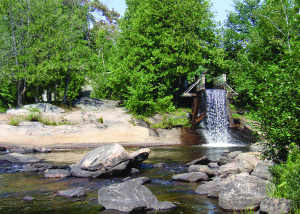
Merging onto Matawatchan Road (CR-71) we wind through Griffith, then highways 41 and 28 take us to Hardwood Lake where we bear right on CR-514 toward Combermere. Three clicks beyond Combermere, along Old Barry’s Bay Road, we take a break at Crooked Slide Park. The crooked slide is a log chute, a reconstruction of the original chute built on Byers Creek a century ago. Loggers, who wanted to prevent logjams caused by bends in the creek, built a control dam to raise the water level. Directed into the chute, logs moved 220 feet and then dropped 10 feet back into the creek below the dam. From there they flowed straight and easy to the Madawaska River. Today, the chute adds character to a riverside rest area.
Refreshed, we press forward along Old Barry’s Bay Road. In the afternoon sun, a pair of timber wolves runs purposefully along the fence line of a farmer’s field. They glance our way but never break their stride.
Those pancakes are finally wearing off as we reach Wilno. Signs proclaim the town as the first Polish settlement in Canada, and the menu at Wilno Tavern reflects this heritage. While waiting for my pierogi to arrive, I look at photos of historic Wilno displayed throughout the dining room.
With lunch sticking to our ribs, we point east on county roads through Foymount, Eganville, Renfrew and Castleford. To add the province of Quebec to one rider’s “been there” map, we detour left on CR-1 and right on highway 301, across the hydro dams on Lac des Chats to Portage-du-Fort. (Bienvenue `a Québec, Monsieur Jeff!)
Back on our original route, CR-1 offers a water view along the road to Braeside, where CR-54 and then CR-508 return us to Calabogie. After a long day in the saddle, I walk down to Calabogie Lake for a swim. The distinctive profile of a loon gliding on the surface, then diving below, then resurfacing some distance over completes a splendid view from the water.
This evening, burgers fill our dinner plates and a mix of Canadian and American motorcyclists again gathers around the campfire. I am reminded of my claim that I know all the words to O Canada and am challenged to prove it. I have heard Canada’s national anthem performed before the opening face-off at countless hockey games, and I sing the song with appropriate reverence, in English (je ne chante pas français). My Canadian friends approve and Ray grants me Canadian citizenship.
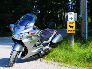
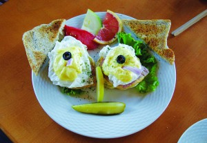
Next morning, the 50-mile rule is disregarded in favor of breakfast in Calabogie at Polly’s Little Shanty. My bacon and eggs are accompanied by perfect toast that reminds me how much I enjoy Canadian brown bread.
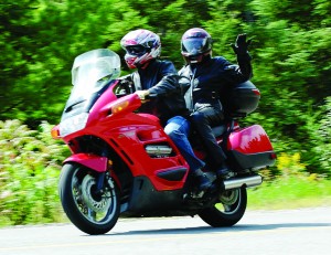
Bellies full, we ride southeast to Lanark, southwest on CR-12, and south on CR-36. We roll into Maberly as a parade is getting underway. An oompah band is playing already, but members of the fire department wave us through. The bikes become the first “floats” in the parade. Motorcyclists in full-face helmets and riding suits look a bit like racers, and kids lining the parade route wave to us with enthusiasm.
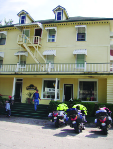
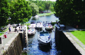
At the edge of town we accelerate above parade speed and continue south through Boling Broke, Westport and Buck Lake. At Inverary, just beyond Loughborough Lake, a left on CR-12 and another on CR-11 take us to a planned stop in Jones Falls. We park by Hotel Kenney (c. 1877), pass on lunch for the time being, and walk across the footbridge to the locks on Rideau Canal.
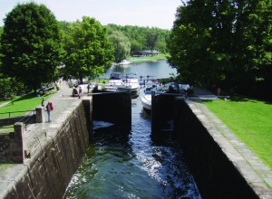
Completed in 1832 and in continuous use ever since, Rideau Canal runs 125 miles from Lake Ontario at Kingston Harbour to the Ottawa River in Ottawa. The canal was conceived to provide the British army with a safe route for supplying inland garrisons in Canada. The idea was to avoid the exposed route along the St. Lawrence River, which had been threatened by American forces during the War of 1812.
At Jones Falls there are four gravity fed, slackwater locks—each 130 feet long—that raise or lower boats 60 vertical feet in 15-foot steps. The trip up these four locks takes about an hour; down takes about 45 minutes. Navigating the canal end-to-end requires four to six days as boaters pass through 47 locks at 24 lock stations.
The locks are maintained and operated by Parks Canada and the public is invited to have a look, cross walkways atop the lock doors, and even help turn the crabs (hand winches) that open and close the sluice gates and lock doors. The best part? Observing married couples navigate within tight quarters shared by several boats. (“Just tie off to the bow cleat, OK?” “OK, dear. What’s a bow cleat?”)
Lingering at the locks means we miss lunch at Hotel Kenney, but a local source suggests lunch at the Cove. Steve finds such a listing in his GPS points of interest database and we set course for lunch. GPS guidance leads us off the county road and two dirt roads later we are riding down a steep, narrow hill that dead-ends at water. This isn’t lunch—it’s launch. We have found the Cove Marina. A curious onlooker clues us in to the Cove Country Inn, a few clicks up the county road in Westport. We laugh at ourselves, execute some impressive 180s, and ride on to a proper lunch.
Stomachs filled again, we ride north before dropping down around Otty Lake. At Perth we reconnect with CR-511 and finish the day on that twisting band of asphalt to Calabogie. Tonight the feast is sausage and our “caveman TV” burns long after dark.
Morning delivers clear skies for a ride through remote areas in counties to the west. At Combermere, a left on CR-62 puts us at the eastern terminus of The Peterson Road. The original road, built in the mid-19th century, was part of a network intended to help colonize the region and promote agriculture. The rocky landscape proved too large an obstacle for 19th-century farmers, but 21st-century motorcyclists find plenty to enjoy.
We choose the roads less traveled through Maynooth, Harcourt and Wilberforce, then at Gooderham turn south on CR-507 toward Buckhorn. Empty stretches of road with long sight lines tempt riders to test their bikes’ legs (guilty), but keep in mind that in Ontario speeding 50 km/h (30 mph) over the limit does more than earn you a stiff fine: It gets your bike impounded. Radar detectors are illegal and confiscated on the spot.
At Buckhorn, our route turns east. Wherever possible, we branch off Highway 28 onto county roads through forests and beside lakes. Though it’s still August, some deciduous trees show signs of fall’s approach. By Griffith we are Calabogie-bound on Centennial Lake Road. (Yeah!) The campfire is already blazing when stacks of pizzas arrive for our final Calabogie supper.
The next morning, my sidestand is up before first light. Thirteen hours and 524 miles of back roads later, I savor a welcome home from my family and catch up on everything I’ve missed these past five days. As the day winds down, it feels good to crawl into my own bed. Eyes closed, I re-ride those Lake Country roads in my mind…time for Calabogie dreaming.
(This article Calabogie Dreaming was published in the June 2009 issue of Rider magazine.)

