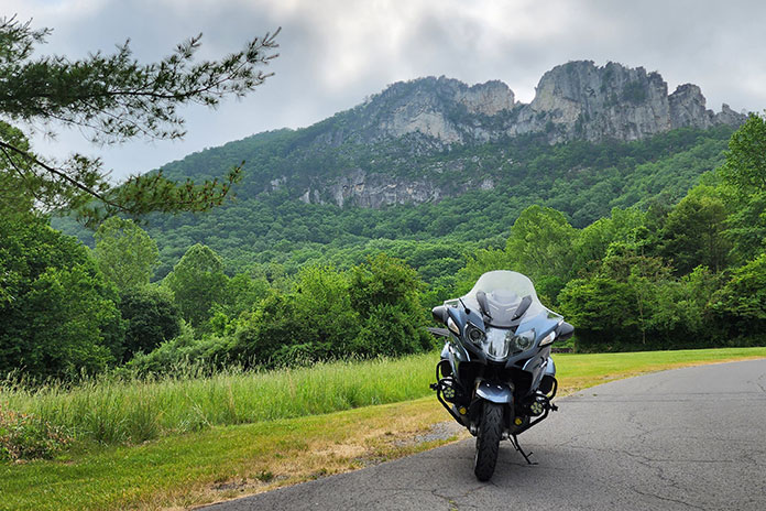
What I like most about motorcycles is that they lean, a trait I describe to nonriders as “dancing with a machine.” A motorcyclist can select a dance partner ranging from a svelte sportbike to a big‑boned tourer, but how well that partner performs depends on the quality of the dance floor: the road.
My favorite motorcycle dance floors are smooth asphalt ribbons that snake over mountains and along waterways, and some of the best I’ve found anywhere are West Virginia backroads. Appropriately called the Mountain State, it’s where the Allegheny, Blue Ridge, and Appalachian mountain ranges converge. With the highest average elevation of any state east of the Mississippi River, the roads curve over and around a rugged, varied landscape. The quality of road surfaces in West Virginia is generally superb (see sidebar at end of article). For riders who love to lean, it’s idyllic.
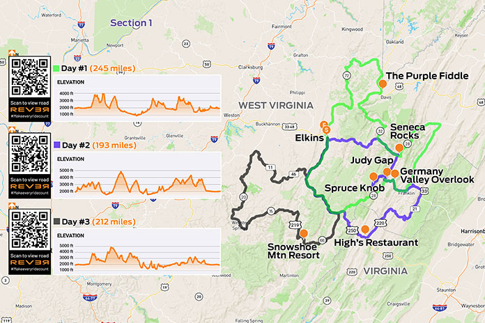
Scan QR codes above or click “Day 1,” “Day 2,” or “Day 3” to view routes on REVER
As I made my way south into West Virginia on these great winding roads, a familiar anthem played in my head, albeit somewhat revised: Asphalt heaven, West Virginia, Blue Ridge Mountains, Shanandoah River….
No disrespect to John Denver, but your humble scribe gives top billing to the West Virginia backroads. I was headed to Elkins, a small city at the edge of the Monongahela National Forest in the heart of Randolph County where a group of riders had bivouacked at the Holiday Inn Express. This location offered easy access to the region’s fantastic roads and a short walk downtown to multiple options for post‑ride dinner and libations.
See all of Rider‘s West Virginia touring stories here
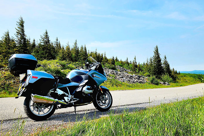
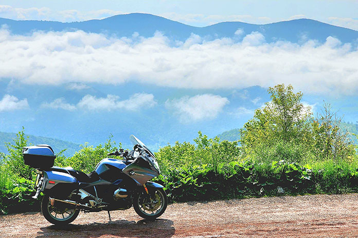
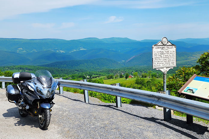
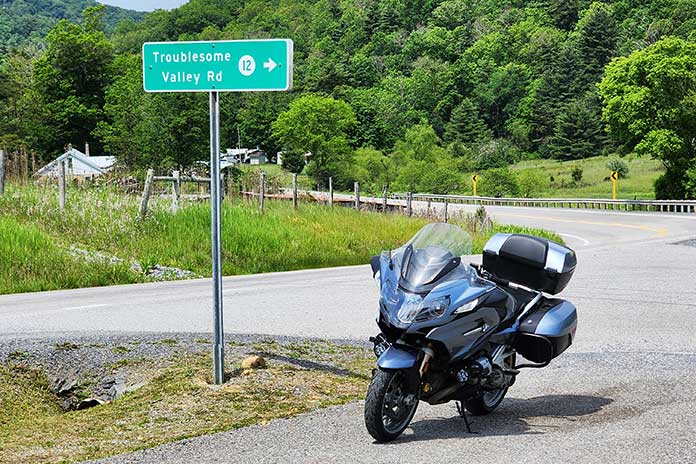
Next morning, I mounted my BMW R 1200 RT and joined routemeister Ed Conde for a well-planned 245‑mile loop through the Allegheny Highlands. In morning fog, our group rode south on U.S. Route 250, then turned north on State Route 28 at Thornwood. The road was fantastically curvy, though a low‑pressure warning for my rear tire was a cause for concern. After turning east on U.S. 33 at Judy Gap, we stopped at the Germany Valley scenic overlook, which was fogged in but had room for several bikes to safely pull off the road. I discovered a screw in the center of my tread, but the right tools – and folks willing to help – made for a quick repair.
At Franklin, we turned north on U.S. 220. Just past Upper Tract, we continued north on Smoke Hole Road. This very narrow, winding two‑way road has continuous blind corners, elevation changes, and no center line, with several curves signposted at 5 mph. In one curvy section, we had to get past a farmer whose tractor was pulling a trailer with implements sticking out the side. He pulled as far over as he could, and we squeezed by and acknowledged his effort. The pavement was not as smooth as most roads that day, but the adrenaline meter was pegged. Smoke Hole Road isn’t for the faint of heart.
We rejoined SR‑28 near Cabins and wound our way south along the North Fork South Branch Potomac River to Seneca Rocks, where ragged rock ridges reach skyward 900 feet. During World War II, American soldiers trained on these cliffs, and many applied the skills they learned to scale the cliffs of Normandy on D‑Day. These days, the rocks are popular with climbers and photographers.
Our ride had been largely within the Monongahela National Forest, and we were back in the heart of it. We rode west on U.S. 33, north on SR‑32, north on SR‑72 (Dry Fork Road, another winding, single‑lane gem), and east on U.S. 48, part of the Seneca Trail, to the hip little town of Thomas in Tucker County. At The Purple Fiddle, where “Live Music Lives,” our lunch break included a performance by a physician-musician who sang about a strained relationship with his one‑eyed grandmother: “We don’t see eye‑to‑eye.”
Lunch cravings satisfied, we rode north through Silver Lake and Aurora, over to Macomber, and down to Parsons. A growing part of West Virginia’s energy industry is powered by wind, and we encountered giant turbines spinning atop ridgelines. Later, riding south on deliciously winding U.S. 219, a wide‑load pilot vehicle stopped all traffic so a tractor‑trailer hauling a giant windmill blade could get through a section of tight turns. The impressive rig rolled by as we waited. The long blade had wheel‑trucks attached directly to it, turning the blade into a trailer transporting itself. As the afternoon sunshine grew warmer, we eased back to Elkins.
Out of several local restaurants near the hotel, I picked C. J. Maggie’s and joined other riders for supper at the bar. Later, as we socialized on the hotel’s back patio, the mayor of Elkins, Jerry Marco, paid us a visit. Hizzoner was gracious and welcoming, genuinely pleased to have dozens of motorcyclists staying in his city.
In the morning, I hit the road early and solo, with more twisties and high elevations being my key goals. As I pulled my bike up off the sidestand, I felt some soreness across my chest. Rowing the handlebars of a 630‑lb sport‑tourer at a quick pace over hundreds of miles of tight curves had proved a workout.
Aiming the RT east along winding U.S. 33, I made rapid progress toward Alpena, Harman, and Onego. Asphalt heaven, West Virginia repeated in my head as smooth, curvy blacktop unfolded like a roller coaster. It was worth the 600‑mile ride from my home in western Massachusetts to ride these roads. And here’s some down‑home irony: The primary author of John Denver’s hit “Take Me Home, Country Roads” is Bill Danoff, who revealed in an interview that the song was inspired by his upbringing…in western Massachusetts! Danoff felt the word “Massachusetts” didn’t sound musical, so he wrote the song about West Virginia.
I turned north on SR‑28 for a view of Seneca Rocks, then back south to U.S. 33 and Briery Gap Road, where a right turn revealed a view of wickedly serpentine asphalt ahead. Time to apply those trackday lessons on body position.
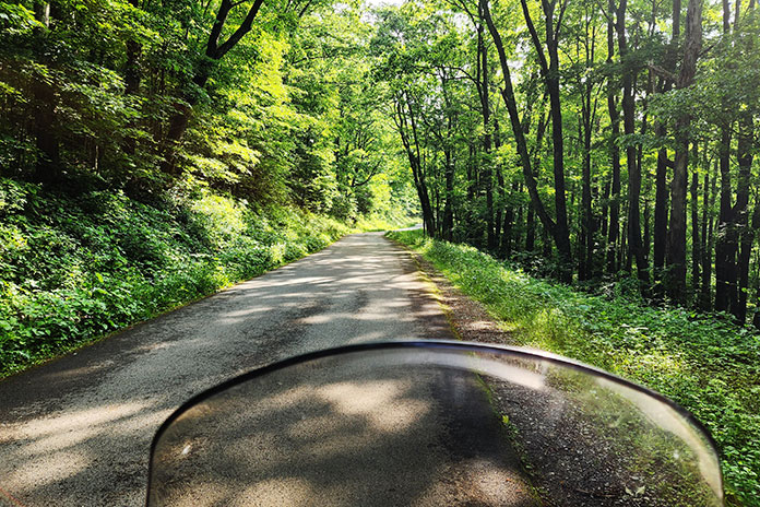
Farther on, a right onto National Forest 112 took me through a tunnel of trees. This road was fairly smooth, suitable for a spirited but reasonable pace. Sight distances were short, and at the crest of a blind rise, an oncoming car reminded me to be wary of oncoming traffic.
A few switchbacks added excitement, but it was repeated deer sightings that quickened my pulse. A doe suddenly appeared in the road ahead, and I hit the binders. She trained her big ears on me and then looked behind. Moments later, a wobbly, spotted fawn appeared at her side. It was captivating to see two beautiful road hazards step effortlessly up a steep incline and vanish into the woods.
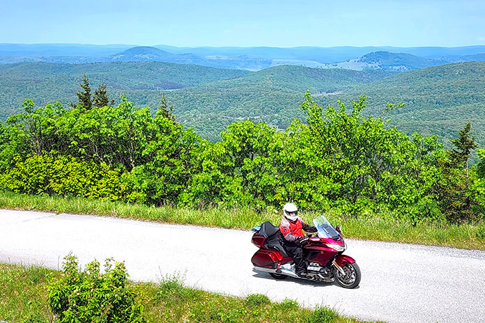
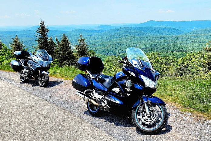
Turning right onto NF 104 took me to the summit of Spruce Knob. At 4,863 feet, it’s the highest ridge in the Allegheny Mountains and the highest point in West Virginia. On this clear day, the view from Spruce Knob was spectacular.
Reversing course, I again savored those wicked twisties descending Briery Gap Road. My ears popped as I reached U.S. 33, now 3,000 feet below the summit. I stopped again at Germany Valley, this time enjoying a fog‑free view and no flat tire, then rode all the way to Brandywine in Pendleton County. I turned south on County Road 21 and rode past Sugar Grove Station, a National Security Agency communications site that reportedly intercepts all international communications entering the eastern U.S. Since I wasn’t expecting any illicit communiques that morning, I turned west to enjoy curvy Moyers Gap Road.
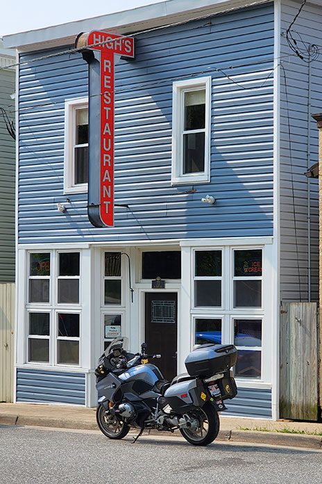
At U.S. 220, I turned south and briefly entered Virginia (what a young boy there called “regular Virginia”). At U.S. 250, I cut right and stopped in Monterey for a late lunch at High’s Restaurant. This venerable eatery now holds the distinction of serving me the best fish sandwich I’ve ever had: rainbow trout, sourced from a local creek, fileted and grilled to perfection, and piled on a brioche bun. “Delicious” can’t do it justice.
As I continued north and east on U.S. 250, I rode up and down ridges and leaning through a succession of tight curves that had me laughing inside my helmet. And it was clear the instant I crossed the state border and entered Pocahontas County: Virginia’s road surfaces are good, but West Virginia’s are superb.
From Thornwood, the ride back to Elkins reversed the beginning of the previous day’s route. A fun road in the opposite direction was its own fun ride. Back at the hotel, I connected with other riders and walked downtown to another local eatery, Mama Mia Pie & Pasta. Over Italian entrees and local craft beers, we compared notes from our day’s riding.
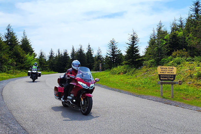
Morning presented another opportunity to ride glorious West Virginia asphalt, this time with my long‑time riding partner Steve Efthyvoulou. Temps started cool, and the previous day’s crystal blue sky was now tarnished gray with smoke from massive wildfires in Canada. We went south on U.S. 250, a now‑familiar route out of Elkins. Turning south on SR‑28, we saw signs for the Green Bank Observatory, home of the world’s largest steerable radio telescope. Astronomy nerds will want to stop, but today we were observing asphalt, laid out before us in smooth, banked curves.
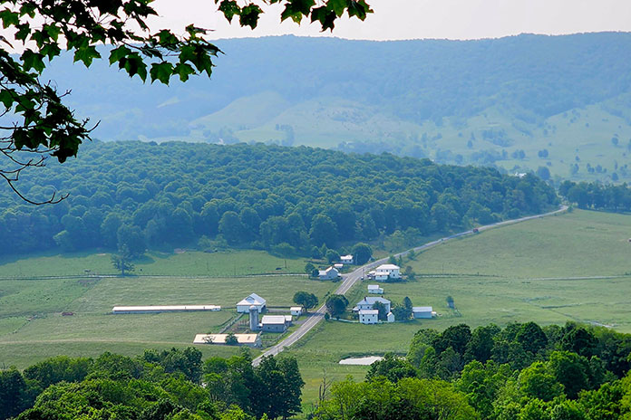
At SR‑66 we turned west toward Snowshoe, one of West Virginia’s premier ski resorts. It was June, so the slopes were green, and we stopped for lunch at Kickin’ Chicken. Loaded with protein, we paralleled the Tygart Valley River on U.S. 219 north to Valley Head, where a left onto SR‑15 set us up for an afternoon twist fest. The road presented often tricky curves to Webster Springs, where we picked up SR‑20 for more fantastic curves. Flat light due to the wildfire haze softened the contrast between sun and shadow, improving visibility on these technically challenging roads.
Near the West Virginia State Wildlife Center, we turned right onto Alexander Road. This narrow, curvy two‑lane is full of tight corners and elevation changes, all the way to U.S. 250, where we turned north on a familiar route back to Elkins. Another amazing day was in the books. Though I had previously ridden through West Virginia several times on the way to other riding destinations, this was my first dedicated trip to ride the Mountain State – and I just scratched the surface. Without a doubt, there’s asphalt heaven on West Virginia backroads.
See all of Rider‘s touring stories here
West Virginia Backroads Resources
- West Virginia Tourism
- Elkins-Randolph County
- Pendleton County
- Pocahontas County
- Tucker County
- Webster County
Sidebar: Why are West Virginia Backroads So Good?
Randy Damron, a liaison between West Virginia’s departments of Transportation and Tourism, clued me in. Damron rides a Honda Gold Wing and a Kawasaki KLR, so he understands the motorcycling community. He explained that the improved quality of the state’s roads in recent years owes much to “Roads to Prosperity,” a road construction and maintenance initiative to support West Virginia residents, industry, and tourism.
Transportation and Tourism partnered to create four West Virginia Mountain Rides (with more on the way) that are in excellent condition, have good shoulders and guardrails, and run through beautiful scenery. The Seneca Skyway, for example, is a signposted 300-mile loop that includes several roads covered in this story. Go to the West Virginia Department of Tourism website and click on “Road Trips” to learn more.
And check out Episode 150 of the West Virginia on the DOT podcast, where Damron and co-host Jennifer Dooley had me on the show. Visit the West Virginia Department of Transportation website to listen.



So much to digest! Had you continued South on US220, you would have encountered a large health spa built on a hot spring. I used to go past there on my way to Covington every February.
I’ve been to Green Bank. During the week they give a really good tour, but they don’t have many visitors and they appreciate the ones they get. For about 10 years I had a maintenance contract at a coal mine a few miles west of the Mount Storm power station on WV93. The best days were the ones that I was able to ride there from Pittsburgh.
Enthusiasts love the Isle of Man, but know that we’ll never get to ride the Mountain Course. But, starting in Oakland, MD, there is another Mountain Course. Fill up your bike, and ride with me!
Beginning at the intersection of US219 and MD135, go east a few miles to Loch Lynn, turn right on MD560, cross the tracks, turn left up the hill, and enjoy the ride. Your next intersection is US50. Here, you too can throw a dollar across the Potomac River. Go east on 50 to Mount Storm, then turn right on WV42. Follow it to WV93 West. It becomes the new Corridor H, or US48. Between here and Davis, the bear to human ratio is sharply in the bears’ favor. Pick up US219 in Thomas, and head back to Oakland.
Trust me, you won’t be disappointed.
Sounds great, Dave. Thanks for sharing local knowledge.