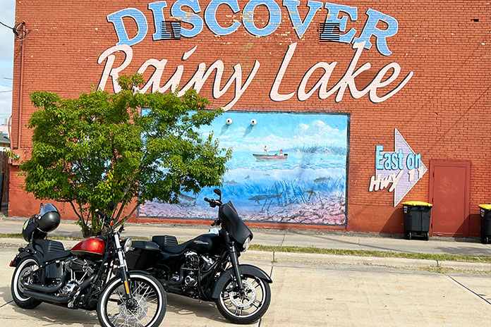
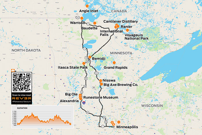
Most of us love the feeling of anticipation leading up to a multiday motorcycle trip. This particular Minnesota motorcycle ride one was more memorable than most because my son, Chad, was able to join me on a trip that would take us north from Minneapolis to the Canadian border at International Falls. We had three days for the ride and only a loose plan. We had a direction, and we knew we wanted to check out some towns that were new to us, but otherwise we’d make it up as we went along.
Scan QR code above or click here to view the route on REVER
We were mounted on our Harleys – I was on my 2017 Street Glide Special, and Chad was on his 2011 Softail Blackline – and we were evaluating some new gear: Highway 21 gloves and boots for me and a sissy bar-mounted backpack and Shinko White Wall SR777 tires for Chad’s Blackline (see Chad’s Shinko White Wall SR777 Tires review).
Starting the Minnesota Motorcycle Ride: Rain and Runic Artifacts
As we pushed off on our mid-August ride, the skies were unsettled. A check of the weather showed we might be able to avoid some rain by heading west for a while before heading north to our first destination, the town of Alexandria. By following my Harley’s navigation system, we took a backroads route to get there, but our slower pace meant we didn’t outrun the rain entirely. After a few missed turns, Chad gave me “the look” – what we call the Head Wag of Shame – but we were out to ride, and we were riding!
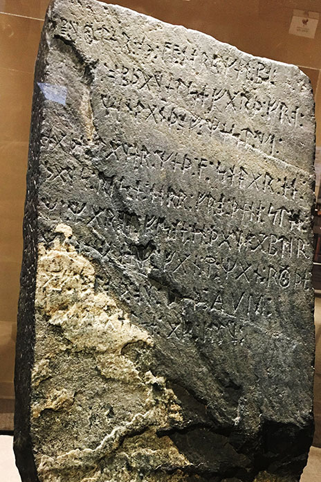
Alexandria, which is nestled between lakes with names like Darling, Victoria, Geneva, Latoka, and Le Homme Dieu, has resorts and activities that make it a popular destination for tourists year-round – and full-time residents too, since the town is one of the fastest growing areas in the west-central part of Minnesota. The town was named after Alexander Kinkead, who established the first townsite in 1858 along the stagecoach road. A Viking artifact from 1362 was unearthed in 1898 in the nearby town of Kensington and is exhibited in Alexandria at the Runestone Museum.
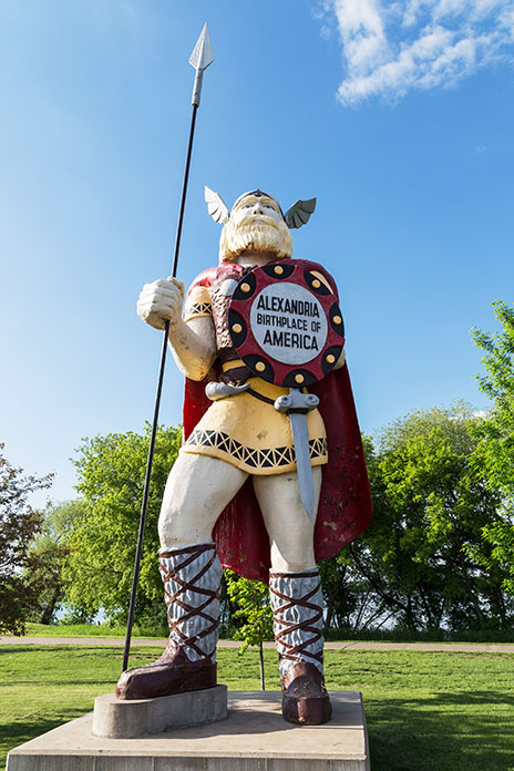
Just a runestone’s throw from the museum, towering over Broadway and 2nd, is Big Ole, a 28-foot-tall Viking statue originally built for the 1964-65 World’s Fair in New York City. This was the first stop on our ride, and we were already surprised by what we were seeing. That’s what I love about motorcycle travel: encountering – and enjoying – the unexpected.
See all of Rider‘s Minnesota motorcycle rides here.
From the Heartland to the Headwaters
From Alexandria, we followed State Highway 29 – part of the Viking Trail – north through towns such as Miltona, Parkers Prairie, and Deer Creek to Wadena. We continued on U.S. Route 71 to Park Rapids, a town in the Heartland Lakes Region. The Heartland State Trail, a multiuse paved recreational trail that was one of the first “rails to trails” projects in the U.S., runs for 49 miles from Park Rapids to Cass Lake. Park Rapids is also a popular destination for camping and fishing, and there are many seasonal cabins nearby.
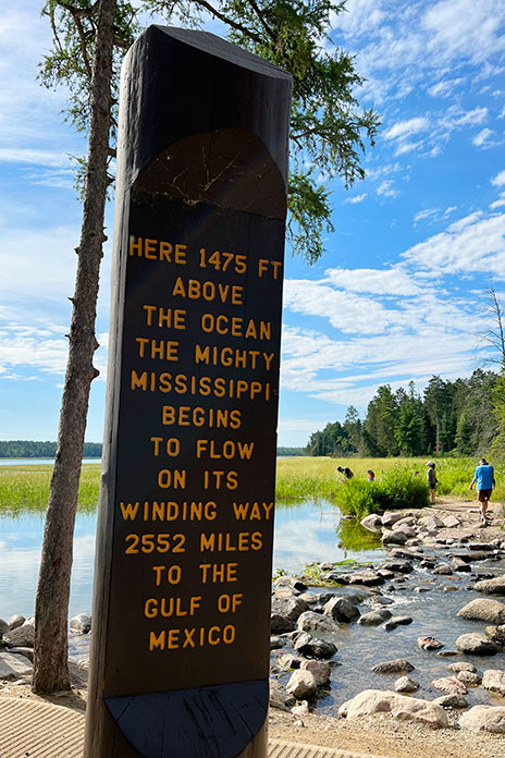
Another 20 miles north of Park Rapids on U.S. 71 is Itasca State Park, Minnesota’s oldest state park, which was established in 1891. There are more than 100 lakes within the 32,000-acre park, and its most famous feature is the headwaters of the Mississippi River. For anyone visiting the park, the headwaters area is a must-see, and it has a visitor center with educational exhibits and a cafe.
Walking down the trail toward the official headwaters, you can wade across the foot-deep babbling trickle that has an average flow rate of just 6 cubic feet per second. After draining much of the U.S. between the Appalachians and the Rockies over the course of 2,552 miles, the Mississippi River ultimately discharges more than 593,000 cubic feet of water per second into the Gulf of Mexico.
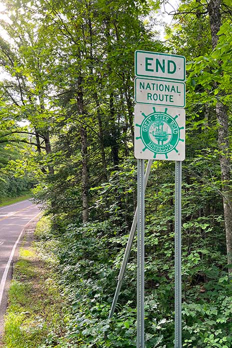
Itasca Park is also the northern terminus of the Great River Road, which runs the length of the Mississippi River for more than 3,000 miles through 10 states. It’s an epic journey that I did with a few buddies in 2021.
On the way out of the park, we hopped on a 10-mile one-way road called Wilderness Drive, a scenic road that winds through woods and meadows and passes by several lakes. Our relaxed approach to discovering the area was paying off, but we couldn’t help feeling a little guilty as we thundered past the occasional cyclist or hiker on our rumbling V-Twins.
From Bemidji to the Border
We ended our first day’s ride in Bemidji, where we stayed at a hotel right on the shores of Lake Bemidji, the northernmost lake feeding the Mississippi River. I stayed in Bemidji at the start of my Great River Road run, and it was good to be back in such a fun town. By this time, we had a couple hundred miles under us and were a bit cold and soggy.
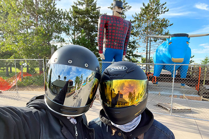
Bemidji, a name derived from an Ojibwe expression, Buh-mid-ji-ga-maug, meaning “a lake with crossing waters,” is known as the “First City on the Mississippi.” It is also the curling capital of the U.S. and the alleged birthplace of Paul Bunyan. After the wilderness of Itasca State Park, the city of 15,000 felt like a modern metropolis. Bemidji is also home to Bemidji State University, and students were moving in during the weekend we were there. Lots of loud co-eds and tired-looking parents. We were ready to get back on the road and away from the crowds.
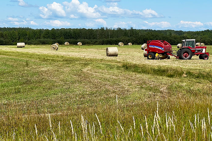
With the hotel’s complimentary breakfast under our belts and a blue sky above our heads, we followed a northeastern trajectory on U.S. 71, known in Minnesota as the Voyageur Highway, passing through towns like Blackduck, Northome, Big Falls, and Littlefork. In Pelland, the road makes a sharp turn to the east as it follows the southern shore of the Rainy River, which serves as the border between the U.S. and Canada. Voyageur Highway, though fairly straight and flat, was in good condition, and we enjoyed the rolling fields with farmhouses and barns.
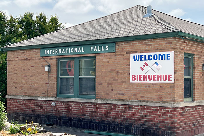
Although Chad is a Minnesota native and I’ve lived in the state for more than 30 years, neither of us had been to International Falls, a city known as the “Icebox of the Nation,” with an average of 109 days per year with a high temperature below freezing.
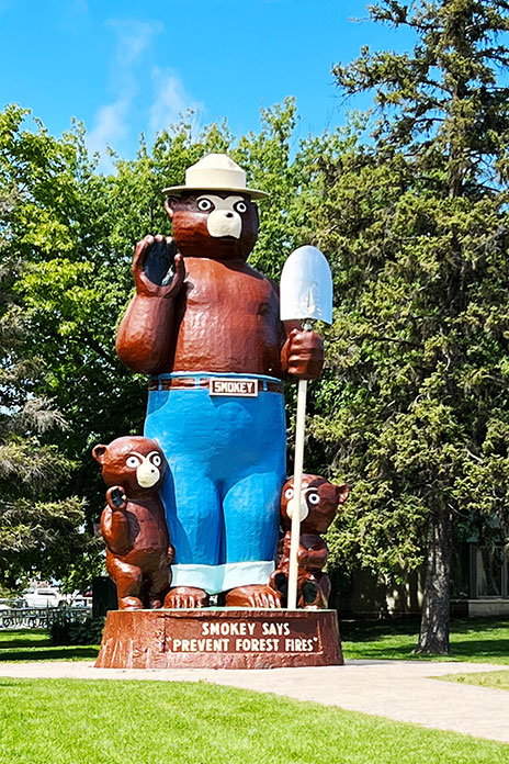
International Falls has a border crossing to Canada – on the other side of the river is Fort Frances, Ontario – and it serves as the gateway to Voyageurs National Park, which is situated on the southern side of the 360-square-mile Rainy Lake. It’s also home to Smokey the Bear Park, where there’s a 26-foot statue of America’s favorite forest advocate made by fiberglass sculptor Gordon Schumaker, who also made Big Ole.
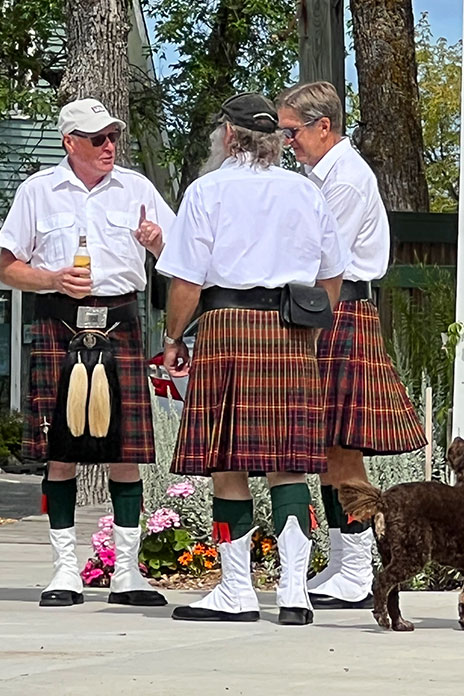
After checking out the long lines of cars waiting to cross into Canada, we were ready for lunch. An online search led us to the small neighboring town of Ranier and the Cantilever Distillery. Sitting outside in the sun with great food and service really hit the spot. While eating, we began seeing men in kilts, some toting bagpipes. Little did we know it, but the annual Ranier Days parade was about to begin.
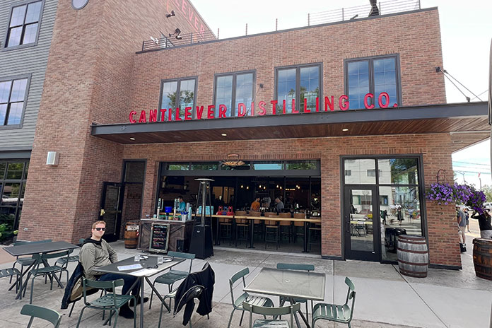
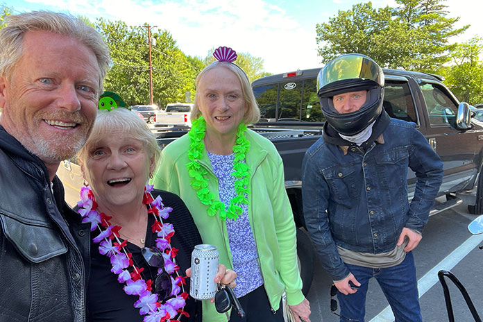
On a beautiful summer afternoon, the people-watching was great, and it was heartwarming to see the enthusiasm and community spirit that still thrives in small-town America. Evidence of this being a close-knit community was obvious with neighbors greeting neighbors. We struck up a conversation with some longtime residents who were surprised we had never been there before and encouraged us to make it a regular stop.
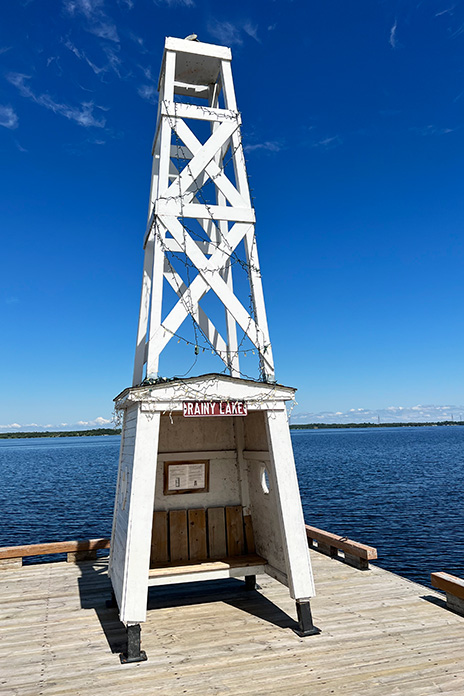
After the parade, we took a stroll down to the lakefront to check out one of the dockside light towers. Put in operation in the 1940s, towers like this provided needed navigational assistance on this international waterway.
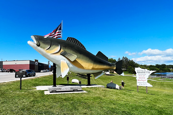
Back on the bikes, we returned through International Falls with the goal of following the Rainy River west through Baudette up to Warroad. From State Highway 11, Canada was almost always in sight to our right. In Baudette, we were greeted by the giant Willie Walleye statue and a sign proclaiming the town the “Walleye Capital of the World.”
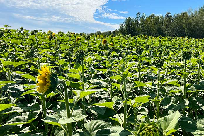
Somewhere along the 40 miles from Baudette to Warroad, which breaks away from the Rainy River, Chad thought I had lost my marbles because I kept stopping to wander into fields of sunflowers that were more than 6 feet tall. My son is very patient, and eventually I got my fill of the flower forests. Warroad, a small town of 1,900 residents on the western shore of Lake of the Woods, is known as “Hockeytown USA” since it is the hometown of several Olympic, NHL, and collegiate hockey players, and the Warroad Lakers have won several boys and girls state championships.
From Warroad, you can take a side trip to the northernmost road in the lower 48 states in a place called Angle Inlet. However, to get there, you must ride north on State Highway 313 and cross into Canada, so be ready to show a passport or other form of approved border-crossing identification. You then need to cross back into the U.S. to reach Angle Inlet, and then back into Canada to return to the U.S. Not including the time it takes to pass through border security twice in both directions, the route is a 2.5-hour roundtrip. We didn’t have the time to do it on this trip, but we plan to go back next summer.
Another Lake of the Woods adventure that’s on our radar for next summer is charter fishing. Rods, reels, bait, tackle, and a licensed charter captain provide everything that’s needed for a fun, relaxing fishing trip, so all we’ll have to do is drop our kickstands and climb aboard.
For our return ride to Bemidji, my navigation system routed us onto a couple of roads where the pavement ended, and we had to backtrack to tarmac, eliciting a few more Head Wags of Shame from Chad. Eventually we connected with State Highway 1, which runs along the southern shore of Red Lake, the largest lake in Minnesota, and through part of the Red Lake Reservation, home of the Red Lake Band of Chippewa. The road around the lake is beautiful, and we welcomed the cooler air. We were greeted with a couple of friendly waves as we thundered past various homes along the route. Rounding the bend on the southern shore, State Highway 89 returned us to Bemidji.
See all of Rider‘s Midwest U.S. touring stories here.
Heading Home
We wanted to take an interesting route back to Minneapolis, so we followed a different part of the Voyageur Highway: U.S. Route 2 south of Bemidji and over to Cass Lake. Continuing east on U.S. Route 2 would have taken us through the Leech Lake Reservation and over to Grand Rapids, another cool, motorcycle-friendly Northern Minnesota town with breweries, wine bars, and all sorts of recreational activities. The town’s website provides route info for seven scenic rides featuring rolling hills, sparkling lakes, and deep woods.
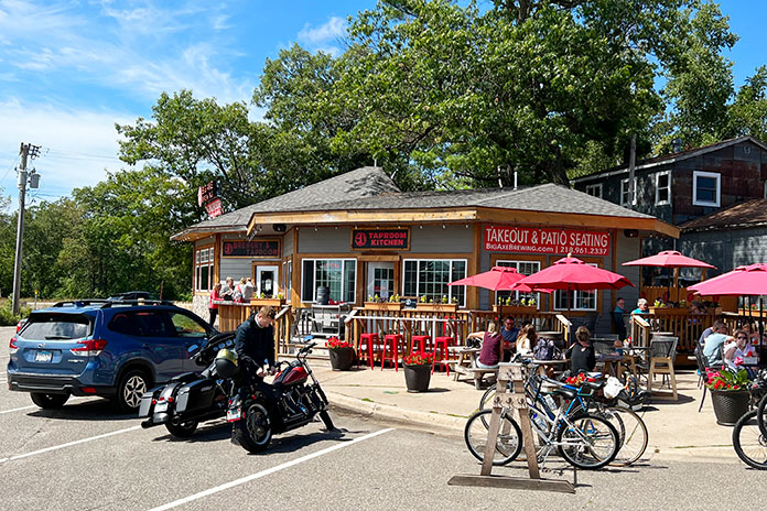
But our long weekend was running short, so we continued south on State Highway 371 through an area that is quintessential Minnesota – a recreational paradise of lakes and lakeside cabins, some of which would qualify as mansions. Down around Nisswa, we stopped for lunch and a cold one at Big Axe Brewing.
This town holds special meaning for Chad and me. Our family has spent many Fourth of July holidays there fishing on Gull Lake, playing golf, and staying at Grandview Lodge. In Little Falls, we picked up U.S. Route 10 – still part of Voyageur Highway – and rode through Royalton, Sauk Rapids, and Becker. The trip home reinforced what I love about living in Minnesota. Our license plates boast “Land of 10,000 Lakes,” but the true figure is 14,380, and they all showcase the beauty of the great outdoors. From the friendliness of the people to the interesting history and boundless recreational opportunities, Northern Minnesota has something for everyone.
See all of Rider‘s touring stories here.
Northern Minnesota Motorcycle Ride Resources:
- Explore Alexandria
- Runestone Museum in Alexandria
- Itasca State Park in Park Rapids
- Great River Road
- Bemidji maps and guides
- International Falls, Ranier, and Rainy Lake
- Cantilever Distillery in Ranier
- Voyageurs National Park
- Warroad maps and publications
- Lake of the Woods
- Grand Rapids motorcycle tours
- Nisswa Chamber of Commerce
- Big Axe Brewing Co. in Nisswa
- Little Falls Convention and Visitors Bureau



Have you tried heading north from Duluth along lake Superior to Illegen. Turn on voyageur hwy thru Ely,tower, to hwy 53 south of I falls. Voyageur hwy was built for motorcycles, or the surveyor was drunk!