Georgia’s Highway 52 has something for every rider: long, relaxing straightaways rolling over tall Appalachian foothills, scenic views to mountain horizons, quaint town centers lined with historic buildings and miles of well-maintained mountain highway that includes everything from mellow curves to challenging hairpins. Highway 52 runs east-west for 125 miles between the towns of Maysville and Dalton, but the best riding is the 64-mile stretch between Dahlonega and Chatsworth.
Leaving Dahlonega, State Route 52 west begins as mildly curving country highway before making a right turn and splitting from Route 9 around the five-mile mark. For the next 35 miles, the road follows the southern border of the Chattahoochee-Oconee National Forests, with sweeping curves over tall mountain foothills through forest and farmland.
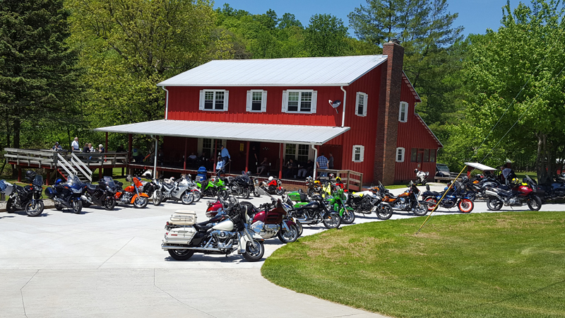
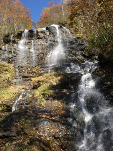
Amicalola Falls State Park & Lodge is located at about the midway point between Dahlonega and Ellijay. The park’s namesake waterfall is a magnificent 729-foot cascade that’s one of the highest in the southeastern U.S. and a not-to-be-missed stop on this ride. Within the park is a spectacular lodge that’s a short hike from the top of the falls. Its restaurant offers buffet-style meals, and its rooms and cabins are great places to stay if you want to do some hiking (the southern terminus of the Appalachian Trail is nearby) and or zip-line through the forest.
Between Dahlonega and Ellijay you’ll find many apple orchards and pumpkin patches. Across from Amicalola Falls State Park, stop at Burt’s Pumpkin Farm and stock up on pumpkin breads, butters, jams and other locally produced treats. Further west, B.J. Reece Orchards offers locally-grown apples and freshly-squeezed ciders.
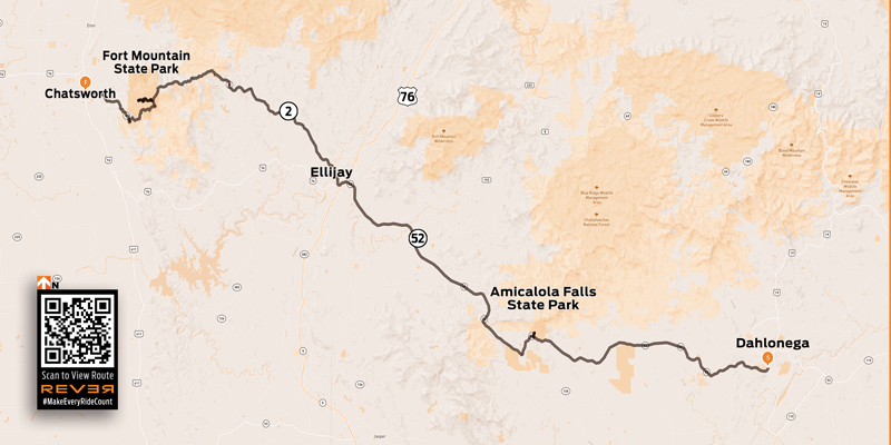
At the midway point of the ride are the connected towns of East Ellijay and Ellijay. East Ellijay, the commercial area with grocery stores, gas stations and fast food outlets, is the place to fuel up. Further west is historic Ellijay, where Highway 52 comes into town at the “three o’clock” position on the town center roundabout. Quaint and beautifully preserved, Ellijay features historic buildings, restaurants and local shops, and a leisurely stroll on a beautiful Georgia day will illicit many a “how-do” from passing locals.
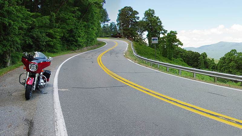
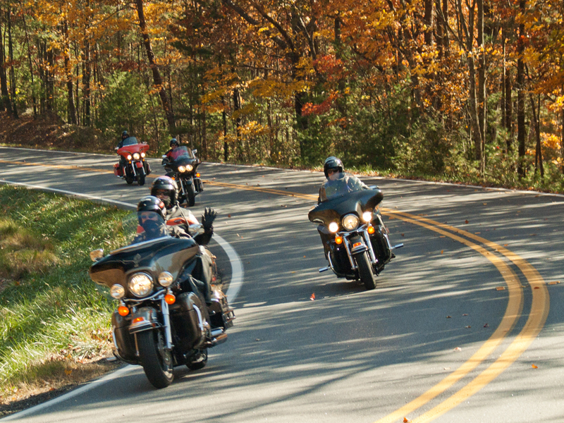
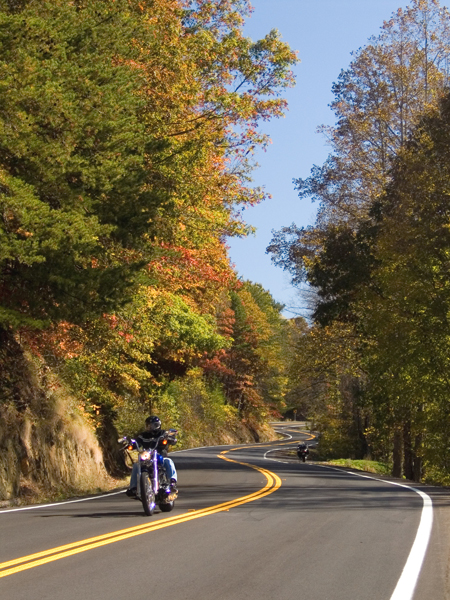
Highway 52 makes a discreet exit from Ellijay via Dalton Street, heading northwest at the “eleven o’clock” position on the roundabout, and directly into a national forest. For the next 25 miles, the highway begins a twisting, 1,500-foot climb to Fort Mountain State Park, where you’ll “rock and roll” through curve after curve. Stay alert and resist the urge to gander too long at the valleys below and Appalachians beyond. Roadside pullouts at overlooks offer excellent places to take five and snap photos. Autumn makes this ride simply spectacular, with the iridescent yellow, orange and red colors from every tree bathing the highway in warm golden light.
Established in 1936, Fort Mountain State Park has a rich history, some of it mysterious, with a long rock wall said to have been built around 500 A.D. Some attribute its construction to the Cherokee, but early historical reports from tribal leaders claim the wall was built by a Welsh explorer named Madoc, who brought a company of men from Europe and traveled in America a thousand years before Columbus. Another legend claims it was built by the extinct “moon-eyed people,” who were said to be short in stature, light-skinned, red-bearded and with light or gray-colored eyes. The history is interesting and the park is beautiful, certainly worth a stop.
West of Fort Mountain State Park, the road descends quickly from 2,850 to 745 feet in seven miles, leading to the small town of Chatsworth. It is a good place to take a break and refuel, as once away from town, opportunities become fewer and farther between. For a longer loop, take the camel-backed U.S. Route 411 north into Tennessee to U.S. Route 64/74. Turning east, the tan-colored highway, also called “Old Copper Road,” meanders along the cobalt-colored Ocoee lake and river on its way to State Route 68 at Ducktown. Going south leads back into Georgia on State Route 60, one of the best-known and most exhilarating roads in the state. You’ll pass the Two Wheels of Suches motorcycle lodge and campground on the way back to Dahlonega, where you’ll find lip-smacking, family-style country cooking at The Smith House.
In North Georgia, all roads lead to a great ride, and Highway 52 is one of the Peach State’s best.

Favorite Ride: North Georgia’s Highway 52 Photo Gallery:


 | Ep. 69 Rider Magazine Insider Podcast")

