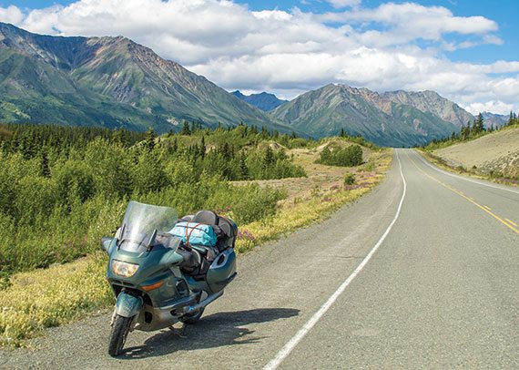
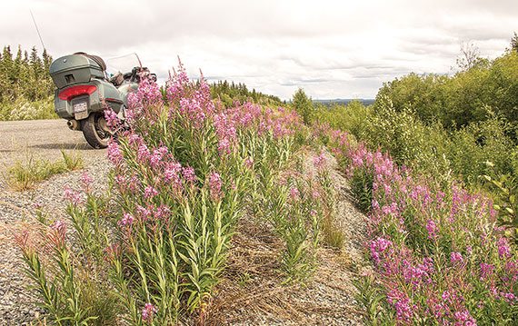
Mosquito hordes clustered around me as I sat on my Suzuki Water Buffalo contemplating how to extricate myself from the damnable predicament I found myself in. I’d committed the cardinal sin of removing my eyes from the gravel roadway boring through the Yukon wilderness. The front wheel had entered a rut and pulled me down a broken embankment into a quagmire. I’d traversed 1,200 miles of treacherous road without mishap, and now this…practically in sight of the Alaskan mainland and paved road. I found a short board and shoved it under the rear wheel by tipping over the bike. I then mounted and slipped the clutch to propel us forward a foot or so, and repeated the process numerous times until I regained traction and reached the road surface.
This occurred in 1975. The Alaska Highway, or Alcan (Alaska-Canada Highway), is paved now, but it doesn’t necessarily improve matters, as I was discovering anew. Alaska’s guidebook, The Milepost, describes road conditions as “…not unlike road conditions on many secondary roads in the Lower 48.” No kidding. Gravel breaks appear without warning. Fly along at Interstate speeds and the unwary motorcyclist could be upended by hitting a washout or chuckhole, not to mention the frost heaves. Temperance is the rule.
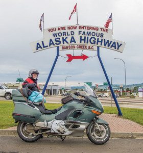
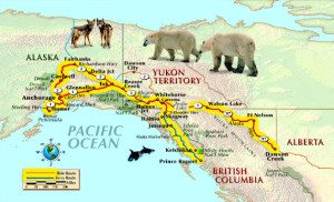
Long distance travel lured me to the Frontier State yet again to see what change has wrought. It’s taken me 3,500 miles to get to Dawson Creek, British Columbia, from Albany, New York. A marker here at mile zero of the Alaska Highway gave scale to the distance that still lay ahead: Whitehorse—918 miles; Delta Junction—1,398; Fairbanks—1,523. Was I truly entering the Last Frontier, or had paving the highway taken all the adventure out of it?
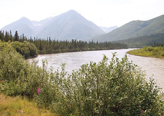
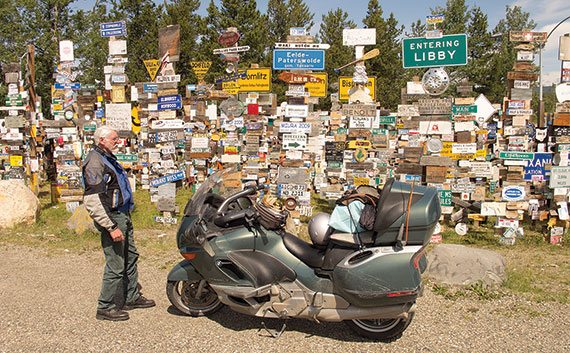
Pristine Muncho Lake embellishes the scenery on the way to Watson Lake, the first Yukon community encountered on the Alcan. Its famous Sign Post Forest has increased to some 72,000 signs. A homesick GI planted the first during the road’s construction in 1942. Low mountain passes and river valleys bring me to 75-mile-long Teslin Lake. My BMW LT squirms over the grated surface of the long iron truss bridge entering Teslin. The Teslin River flows to the Yukon River, along the foaming rapids of which lies Whitehorse, the capital city of 27,000 where two-thirds of the Yukon’s population lives.
North of Haines Junction I encounter ongoing road repairs, or “reconstruction,” due to frost heaves caused by the underlying permafrost melting and refreezing. Stretches of this broken pavement are composed of gnarly, gravely, wet dirt. The flag person waves me to the front of the caravan to join other riders. Two have crashed earlier on this section, we’re told. The pilot car driver is knowledgeable enough to speed up so that we can remain stable. Stay in the left tire track and avoid the shoulder is what I found works.
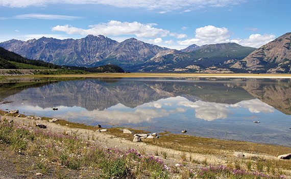
The mountain-rimmed turquoise shore of 50-mile-long Kluane Lake presents a spectacular diorama. I have learned to stop at various turnouts to gawk. On my first trip to Alaska in 1971, I lifted my eyes to the encompassing view while crossing the concrete surface of the Slims River Bridge. Past the bridge, while still engrossed in the scene, the Norton I was riding abruptly lost traction in ankle-deep sand, and I was thrown onto a scattering of rocks. After cursing out the lone driver who passed me by, I righted the bike and found it wouldn’t start. I ended up pulling the slides on the Amal carburetors to clean out the sand, and eventually got the machine running. While attempting to remount, I then noticed the torn pant leg and a ragged gash on my left leg along the tibia.
I had little choice but to backtrack 10 miles to a maintenance depot I had passed and hope it had the services I required. I discovered this was also a Canadian National Telecommunications Camp, and there was a doctor available who was manning a shortwave radio to help coordinate efforts to locate mountain climbers lost on the face of 19,551-foot Mount Logan in the Kluane Wilderness. The good doctor, actually from Vermont, was stationed here temporarily as part of the Arctic Institute Ice Fields Ranges Research Project. After that mouthful of introduction, the doctor sewed me up and recommended I not continue, but seek medical attention on my return home, as it was not advisable to keep my leg in a prolonged “dependent” position with such a wound.
I had arrived here by taking the Alaska Marine Ferry System to Skagway, Alaska, and then loading the Norton into a boxcar of a train that steamed its way over the White Pass to Whitehorse. Now I would have to return the same way. Only this time I branched off onto the Haines Highway, to Haines, Alaska, and picked up the ferry there. Because of this inglorious retreat, I vowed that I would return to Alaska via the entire 1,227 miles of gravel road out of Dawson Creek, British Columbia. And that’s just what I did upon my return in 1975.
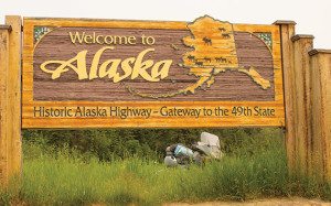
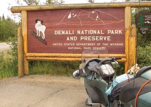
Back in the present, I enter mainland Alaska and begin a gradual descent along what’s called the interior plateau to the official end of the Alaska Highway at Delta Junction. Here the road becomes the Richardson Highway to Fairbanks. I learn Alaska is burning, smoldering under nearly 300 wildfires. In Fairbanks, the sun is a blood red orb peering through the smoke and haze. At Denali National Park and Preserve, the mountain isn’t displaying itself. So much for scenic photo opportunities.
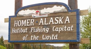
On my last stopover in Anchorage I had discounted a trip to Homer, and what a mistake that turned out to be. This time I ride into an extensive postcard panorama of arctic motifs, encompassing sea and mountain massifs cleft by glaciers and punctuated by volcanoes. I followed the twisting Seward Highway through the Chugach Mountains linking the Sterling Highway, which penetrates the Kenai Peninsula alongside a coastal inlet dotted with interesting villages. Homer sits on the edge of Kachemak Bay, where vessels leave for the world’s best halibut fishing. It’s land’s end at the Homer Spit, so I retrace the route back to Anchorage.
Eighty miles from Anchorage along the Glenn Highway I watched for a familiar roadhouse. It was here, back in 1975, where the transmission on my Suzuki GT750 “Water Buffalo” locked up, shattering the nylon rear sprocket. I hitchhiked back to Anchorage to cannibalize a used sprocket from a crashed bike at the Suzuki shop where I had earlier serviced the bike. I begged a return ride and replaced the sprocket only to learn the bike’s transmission was hopelessly locked in first gear. I had no recourse but to ride back to Anchorage along the shoulder of the road at a maximum speed of 25 mph, arriving four hours later.
The dealership’s owner, Big Jim, allowed me a corner of his shop to tear down the bike, and I discovered a broken tooth on second gear. We “moose” ordered the new part from Santa Fe Springs, California. Moose order meant rush, but Big Jim told me there was no telling how long it would actually take to arrive. He allowed me to stay with his family while I busied myself around the shop, eventually disassembling another customer’s Water Buffalo that had a similar problem. Turns out it had a broken tooth on first gear, so I was allowed to appropriate his second gear and get back on the road after four days. Before I left, Big Jim offered me a job, but I declined, telling him the riding season up here was too short.
Despite my experience that the Haines Highway offers the best scenery along a branch of the Alaska Highway, I bypassed it at Haines Junction and proceeded to Whitehorse. I wanted to ride the Klondike Highway through the White Pass to Skagway. I had already taken the White Pass and Yukon Railroad in 1971, but the highway wasn’t completed until 1978. Both follow the famed Trail of ’98 that stalwart prospectors trudged on their way to the Klondike gold fields in Dawson City.
Halfway to Skagway lays Carcross along the shore of Bennett Lake. Carcross is a word combination meaning caribou crossing. The town was established to maintain the rail line. I remember the train stopping here when I rode it back in ’71, and we passengers disembarked for a sit-down sourdough lunch served on lengthy log tables. I swoop the shores of several lakes on the climb to a 3,000-foot summit and become giddy on the decent into Skagway Valley.
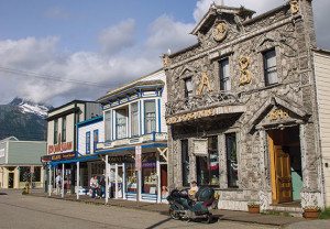
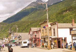
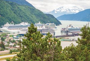
Skagway, boomtown gateway to the Klondike gold fields along the Trail of ’98, is also the northern terminus on the Inside Passage. The town has dwindled from the 20,000 gold seekers of the period to several hundred today who provide for themselves in this frontier setting by regaling us tourists with melodramatic skits about “Dangerous Dan McGrew” and other Robert Service prose-poetry. During my first visit here, I recall bartering during an auction for a garter worn by one of the dance-hall girls; the garter still adorned her gam, and the winner would get to remove it. I lost, however.
I spent my last hours in Alaska at the Skagway Brewing Company, awaiting the ferry that plies the dramatic Inside Passage. What other overland trip could compare to this Alaska adventure, I wondered? Visions of the Trans-Labrador Highway popped into my head. Aw, but I hear they’re paving that one, too. Guess I’d better get there soon.



Thanks for a great ride report ! I am planning on getting to Alaska sometime in the next few years, and this was a great teaser story.
I enjoyed your writing and your story – many thanks. Sounds like you’ve had a history of interesting machines and some good adventures.
Thanks for sharing your trip back to Alaska with us. That must have been quite a ride on a motorcycle. I grew up i the Northwest. I bet Alaska would feel like a second home. I grew up fishing, and would love to have an Alaskan fishing trip as part of my experience. It would be fun to catch a giant Salmon.
Thanks for your report. Brings back memories. I stopped at nearly every place you mentioned on my trip from Minneapolis to Alaska and back. 8000 round trip miles. Quite an amazing trip. IMO the number one road trip for anyone living in North America. And….if any of you plan on doing the trip alone, I’d think twice about that. Find another rider to go with you because it is a long, lonely trip.