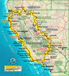
Itching for a Northern California adventure, my longtime riding partner, Patrick, and I mull over the possibilities. It’s too early in the season for the Sierra Nevada, which are still covered in serious white stuff. How about skirting serious elevation by heading east into Nevada, then north into Southern Oregon and taking a coastal path home?
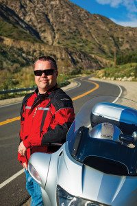
We leave Los Angeles on the superslab, hitting State Route 14 and turning off onto Redrock Randsburg Road, which takes us through the rustic old ghost town of Randsburg. In its heyday, gold miners came from afar to unearth the reflective rocks. Now it’s a haven for off-road enthusiasts. A quick jog onto Trona Road leads us toward Searles Lake (dry), and its long stretch of salt flats creates a brilliant illusion in the desert sun, like ice in a parched land. After a quick bite at the Trails Drive-In in Trona, we motor toward the eastern entrance of Death Valley National Park. As Trona Road morphs into Panamint Valley Road, the valley narrows, penned in by China Lake Naval Weapons Center to the west and the Panamint Range to the east. Telescope Peak is highlighted with a fresh frosting of snow. At 11,049 feet, it provides an incredible contrast to Badwater just to the east, the lowest point in the United States at 282 feet below sea level.
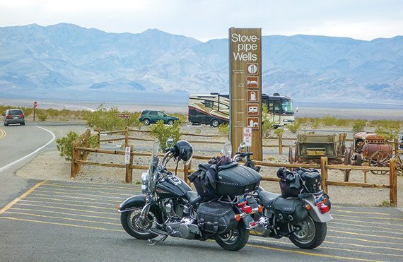
Turning east onto State Route 190 near Panamint Springs starts a long, steady climb east with some surprisingly technical twisties until the grade reverses and gently lowers us into Stovepipe Wells. A quick fill-up and we continue heading east, passing the infamous “sea level” sign. Heading north at Scotty’s Castle Road leads us to the wonderfully eccentric Scotty’s Castle. Walter Scott convinced millionaire Albert Johnson to invest in a gold mine (that turned out to be fraudulent). But Johnson and his wife later bought the land where the castle is located, and Mrs. Johnson encouraged Mr. Johnson to build the Spanish Colonial Revival structure at a cost of over two million dollars in 1922. The colorful Scott lived at the Castle until his death in 1954. Purchased by the government in 1970, the property offers guided tours daily.

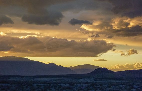
Scotty’s Castle Road turns into State Route 267 at the Nevada border, and we hit State Route 95 going north for a few clicks and meet Silverpeak Road, a silly-string squiggle on the map that promises to be a first-class peg scraper. As the elevation increases, we briefly hit snow pack, though temperatures are still in the mid 50s. After hitting State Route 265 north, the lonely specter of late afternoon on a deserted road hits us. Sunlight and shadows swap places and dance deftly between dunes.
Suddenly, Patrick’s low fuel light starts blinking. As we coast into the town of Mina, a gas station appears. Tanks filled, tensions emptied, we blast into Hawthorne, one of the largest munitions storage facilities in the country and our stop for the night. As the last rippling rays of the setting sun illuminate the foothills behind us, we roll into the El Capitan Lodge & Casino for the evening, savoring the desert memories.
Day two starts with a crisp, cerulean blue sky beckoning us onward. Winding north on Route 95 we pass Walker Lake, an ancient lake blending blues and greens that forms an incredible expanse of water in this parched panorama. Moving north, Pyramid Lake comes into view. Another primeval lake like Walker, its deep blues mirror the morning sky. Slowly, the elevation climbs and an almost alpine flavor follows.
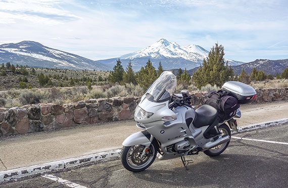
Lunchtime finds us in Cedarville, back on the California side of the border. A quick bite at the Country Hearth Restaurant provides us with big portions at a small price. Food stuck to ribs, we kick up the sidestands and take State Route 299 west over another elevation gain. By the time we reach Alturas, California, acres of green fields surround us. The rich, volcanic soil is prime agricultural land, and the impressive prominence of Mount Shasta, still far to the west, greets our eyes. State Route 139 takes us north through rich sections of fields and forests, leading us directly to the night’s stop, Klamath Falls, Oregon. After checking into the local Motel 6, we take the hostess’ advice and walk to a local barbecue joint. Wubba’s BBQ Shack may blend into the strip mall facade, but its menu is nothing short of eye (and belt!) popping.
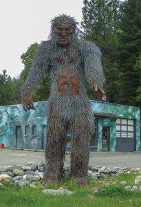
Day three finds us leaving Klamath Falls and bombing down State Route 97 toward Mount Shasta. One of the southernmost peaks of the Cascade Range, at 14,179 feet it’s second in height only to Mount Rainier. Its double peaks are so caked in snow that the snow line disappears below the dense beard of trees fringing it. We connect with State Route 5 just past Yreka and take a true gem for asphalt aficionados: State Route 96. This wildly weaving black ribbon follows a beautifully carved gorge for its start, and is an absolute blast. We alternate marveling at the scenery of lush, temperate rain forest and riveting road. As we roll into the quaint town of Happy Camp, a 15-foot metal Bigfoot greets us; photos with the sculpted Sasquatch are mandatory.
Then it’s southwest back onto the western edge of State Route 299, a more heavily trafficked, but nonetheless exciting stretch of road that majestically drops us into the Northern California town of Eureka. We intersect and take State Route 101 south through dense forest and small towns such as Phillipsville, enjoying this incredibly empty and gently curving gem for many miles as we seek our connection to fabled State Route 1, the Pacific Coast Highway.
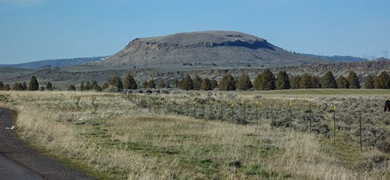
Just past Leggett, we catch our connection and hit possibly the least traveled and most enjoyable leg of this legendary road. While rubbernecking vistas entice you, this is no tourist tarmac—its decreasing radius turns and sand-strewn corners demand intense focus. The canopy constantly dapples the asphalt, flickering and fading, until we near the coast. Way too soon, we part the redwood curtain, unceremoniously slip onto the coast, and just like that, the forest ends.
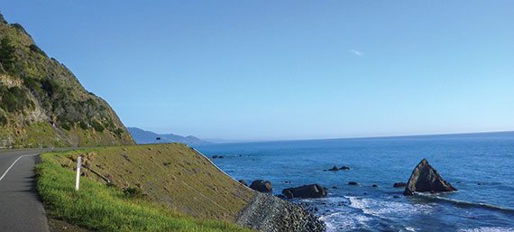
This is the Pacific Coast Highway most people know: plunging cliffs with waves pummeling beaches below. We make the short hop to Fort Bragg, and are quick to notice the waning sunlight. With another hundred miles to go to our stopping point, we grab a quick bite at Taka’s Grill—fresh-fish Japanese fare that satiates these hungry two-wheelers. My aunt’s ranch in Santa Rosa is tantalizingly close—but still more than an hour and a half away. True to form, as we swoop past beautiful Mendocino, a small deer leaps out not 20 feet in front of me. Pulse pounding, Patrick graciously takes the lead as we turn inland and take State Route 128, a truly spectacular road…well, at least during the day. The massive redwoods make the dark night even darker, as ebony becomes ink of India. Thankfully, the gentle undulations of this stretch are smooth and predictable. We reach my aunt’s country ranch, a slice of bucolic bliss with fruit trees and grapevines, and warm beds for the night.
Leaving Santa Rosa and my aunt’s hospitality behind, we decide on the less spectacular route of Route 101 back to Los Angeles. After eight hours in the saddle and a short dinner stop in Danish-themed Solvang for soup and pumpernickel bread at Pea Soup Andersen’s, we’re back at the beginning in Los Angeles, tired but satisfied.
While challenging given our time constraints, the sheer diversity of each day’s geography was intense as well. From snowcapped peaks to dusty desert, alpine meadows to salty seashores, the eclectic scenery kept each day building upon the next until we hit the crescendo of a great two-wheeled adventure.
 |
 |
 |


Another wonderfully well-written article with some great photos. Thank you for sharing. Makes me miss riding that area of the country, it’s very rewarding stuff.