I glanced down at the clock on my GPS and saw the time change from 6:59 to 7:00 a.m. I looked back up and saw Doug Gray pull into our meeting spot. Punctuality is a quality I have long associated with Doug. I’ve also learned to appreciate his ability to combine interesting roads into great routes.
That skill is informed by his experience as both a motorcyclist and an avid bicyclist. He often rides a Doug-powered cycle more miles in a day than many people manage on their petroleum-powered bikes. “A lot of my motorcycle routes are pretty much the same as my bicycle routes,” he told me over breakfast. “There are lots of twists and turns, which doesn’t suit everyone.” (Suits me just fine.)
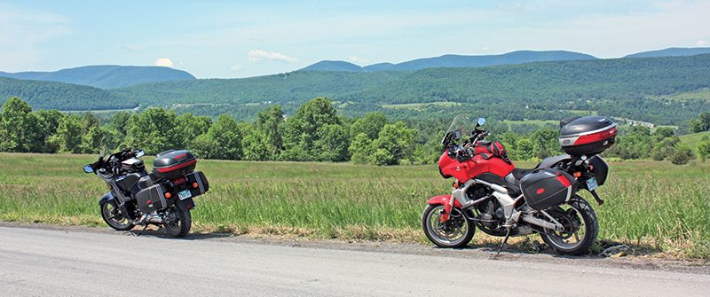
On this particular Friday we skipped work to ride eastern New York State, on motorcycles, and I was anxious to see what Doug had planned for us. His route followed county roads on a mostly rural loop from Catskill to Cooperstown and back. “Last night, I was marking the route in yellow highlighter,” he explained, “and it occurred to me that it looks like a duck.” Doug has a GPS but is still a map guy at heart, and I had to agree—there’s a fundamental appeal to a duck-shaped route laid out on six square feet of paper that’s missing on a 3.5-inch digital display.
Venturing west from Massachusetts, we headed for New York’s Catskills region. Author Washington Irving’s story Rip Van Winkle was set in the Catskills, and the area is home to all manner of things bearing his character’s name, including a lake, a country club, a campground, a hiking club and the Rip Van Winkle Bridge on which we crossed the Hudson River. In the town of Catskill—at the “tail of the Duck”—we began Doug’s Duck Tour.
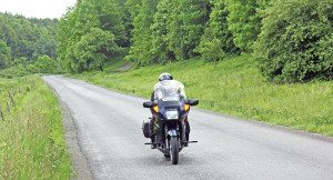
A left turn off State Route 23B put us on Greene County Road 67. In nearly 30 years of riding through rural New York, I’ve learned to seek out county roads. They tend to be roads less traveled, following rivers, splitting mountain passes and rolling over pastoral lands. County roads are ideal for motorcycling, although the New York variety poses certain mental challenges. For example, each county uses its own numbering system, so crossing a county line changes the road number. The asphalt ribbon known as Schoharie County 6 becomes Otsego County 40 and then Delaware County 9, all in just a few miles. Adding to the challenge, signs for intersecting county roads often appear not at junctions but down the road a bit. It’s easy to miss turns.
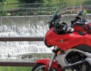
Riding county roads, we saw how Hurricane Irene left her mark when she plowed through the region on August 28, 2011. Even nine months later, erosion, debris and high water marks showed us how far creeks and rivers had overrun their banks. New guardrails and sections of blacktop indicated where roads had been washed out. Substantial new stone retaining walls reflected how civil engineers plan to protect life and property against future whims of nature. Here, along the Duck’s back, stretches of Schoharie County 17 and 13 were still impassible. We followed the detours, which sent us to County 14, and then reconnected with Doug’s route farther along near Jefferson.
As a motorcyclist, I’ve learned that where I most enjoy seeing deer is on a plate. A short stretch of Otsego County 39 presented evidence for that point of view as three of the beautiful menaces crossed our path. There were surely others we missed. Less dangerous were the domesticated four-leggers we saw in pastures, including a number of foals out testing their young legs. Their mothers stayed close by, not quite sure if the guys riding those funny horses with wheels were to be trusted.
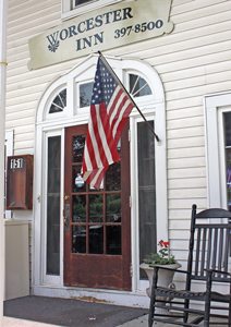
As lunchtime rolled around, Doug delivered us to Worcester, on the Duck’s neck, and the Worcester Inn, circa 1814. The dining room’s interior was delightfully stuck in the early 20th century. In the corner stood a phone booth (remember those?) made from the same woodwork as the dining room. On the wall above our table was an original Western Union Telegram and Cable sign; I chuckled at Doug talking on his cell phone beneath it.
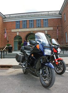
A bit farther along we arrived in Cooperstown, the top of the Duck’s head and more famously the birthplace of baseball. The downtown district is home to the National Baseball Hall of Fame and Museum, lots of restaurants and shops (many sporting a baseball theme), and Doubleday Field where you may be able to catch a game. Cooperstown is also a good place to spend a night. The Lake Front Hotel is a great choice if your budget permits.
Overnight, the weatherman’s “chance of rain” had spread over the region so our day began with wet weather gear. Riding south toward the Duck’s bill, Otsego County Road 33 and 35 provided gentle curves through farmland and occasional views of the Susquehanna River. Deep greens and shades of gray created a placid pallet as raindrops patted my visor.
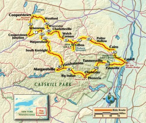
At Cooperstown Junction, a left onto New York Route 7 moved the route along the Schenevus Creek past the hamlets of Maryland and Chaseville. Tight curves and elevation changes added some technical challenge along Betty Brook Road, Roses Brook Road, West Settlement Road and Cold Spring Road.
The route turned left to follow the Duck’s belly at Margaretville, a small town whose quiet streets became raging rapids thanks to Hurricane Irene (if you saw video coverage of Irene, chances are you saw Margaretville). Many of the town’s buildings were damaged or destroyed when the Delaware River, east branch, grew beyond its banks. The rebuilding continues.
State Route 28 dips into Ulster County along the Esopus Creek, a popular whitewater run for tubers. Whenever I’m in this neck of the woods, I visit the quaint town of Phoenicia to eat at Sweet Sue’s Restaurant. Years ago, Doug introduced me to Sweet Sue’s delicious—and gigantic—pancakes. Doug admits he’s never been able to finish two.
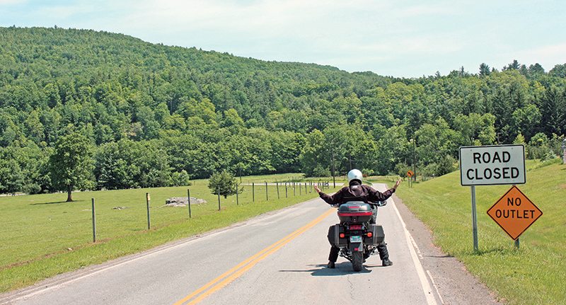
From Phoenicia, the route curved north and east on State Route 214 and 23A through the mountains and small towns in the Catskill Park. Exiting the Park, we returned to the town of Catskill and our starting point at the Duck’s tail. The rain was still coming down, but it didn’t matter. It was actually good weather…for a duck.
(This Favorite Ride article Doug’s Duck Tour was published in the January 2014 issue of Rider magazine.)



Excellent article. Have been meaning to get up that way this year and plan on doing a nice weekend. That route looks fantastic.
As an aside, I rode a 2000 Concours for 4 years and over 50k miles. They’re great sport-touring bikes and their owners’ group (COG) is fantastic.
Thanks for the kind words. Doug had two 1000 Connies and last year he traded up to a C14, which he really likes.