U.S. Highway 50 across the breadth of Nevada is billed as the state’s loneliest road. Having traversed U.S. 50 numerous times, I have to disagree. U.S. Highway 93 down the eastern length of Nevada is nearly 200 miles farther and extends through as much emptiness and lonely towns as the former. But that doesn’t mean the route is devoid of scenery or interest.
On my latest excursion to Nevada, I entered the state from Idaho at Jackpot, a gambling pit stop mainly for Idahoans who are deprived of such decadence. Cactus Pete’s satisfies with a buffet and inexpensive rooms. The Chevron in town once removed and repaired a tire off another BMW I was riding at the time. I top off there because the next fuel is in Wells, an hour away.
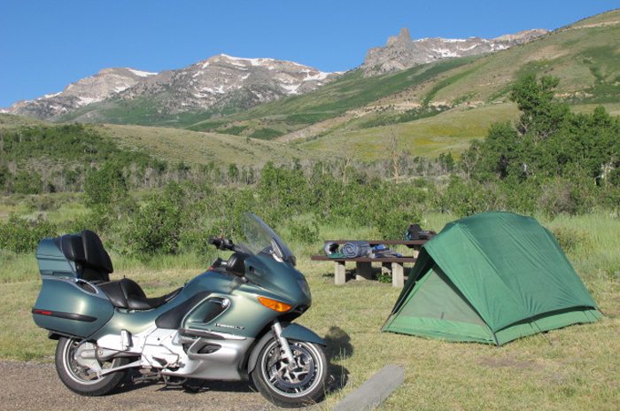
Wells has seen better days, with an abandoned railroad siding and vacant storefronts defining a derelict town. Services are plentiful at the Interstate 80 interchange with U.S. Highway 93. I provision myself here and head to one of my favorite camping sites located in the East Humboldt Range 8,500 feet above Wells. On the west side of town, I locate the sign that directs me eight miles up the road to Angel Creek Campground; another four miles climbs the shoulder of the mountain range past encompassing basin views to Angel Lake, mirroring a rugged peak with snowmelt cascading into the tarn. Camping is allowed here as well, with fishermen taking full advantage.
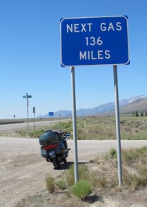
Just south of Wells, numerous signs allude to Great Basin Highway, Next Gas 136 Miles, Lights on Next 55 miles, and Elk Crossing. Shortly appears State Route 232, a loop highway that enters the Clover Valley, a greenbelt that edges the base of the Humboldt Mountains. I prefer the view from afar, later passing State Route 229 disappearing enticingly into the Ruby Mountains. Eighty miles from Wells, I encounter a lonely junction with Alternate 93, a shortcut, of sorts, to Wendover and the Salt Flats of Bonneville fame to the northeast.
So far, the primary vegetation has been sagebrush and the occasional green tumbleweed. The Shell Creek Range looms closer, with its nearly 12,000-foot peaks. Elevation of U.S. 93 averages 6,000 feet. I welcome the sight of a pullout to view the history of what used to be a Pony Express site. The Pony Express trail links up with and roughly follows U.S. 50 across the rest of Nevada. U.S. 50 is also the reincarnation of old U.S. 30, or the Lincoln Highway, and the Nation’s first transcontinental roadway.
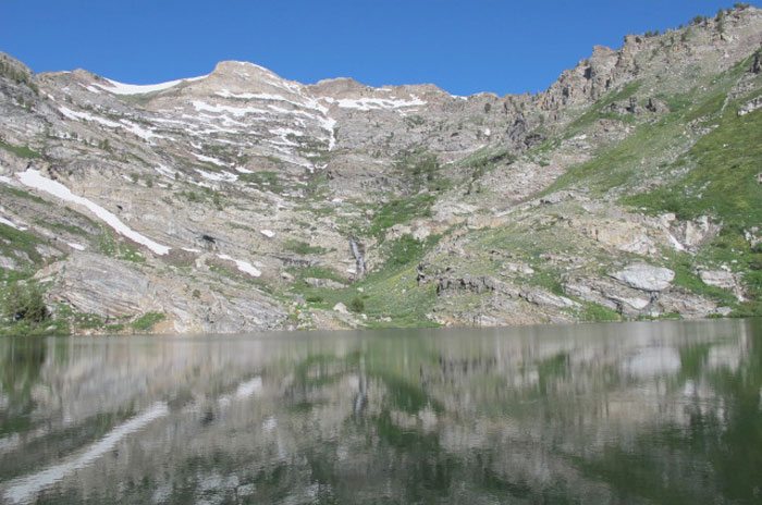
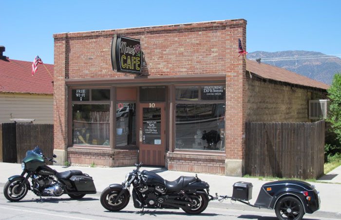
Shadowed by the Shell Creek Range, I enter tiny McGill, a moribund mining town resting on a slope of those mountains. Marie’s Café provides the only oasis, as a pair of Harleys parked out front seem to indicate. Twelve miles later I reach Ely, a major crossroads town with several junctions converging like the strands of a web. Ely is most noted for its open pit copper mine and train tours there via steam locomotive. The town with a population a little over 4,000 was originally founded as a stagecoach stop on the Pony Express, and here also is where Nevada’s other “loneliest road” joins forces with U.S. 93.
Just five miles south of Ely is a turnoff for the Ward Charcoal ovens, down eight miles of smooth gravel road. Lined up six in a row, the beehive-shaped stone kilns were built by Mormons around 1876 to produce fuel for the silver and lead smelters serving the mines on Ward Mountain. Eventually, charcoal was replaced by coke brought in by rail. From this bench land location, I could look across the valley at the imposing focal point of Big Basin National Park, 13,061-foot Wheeler Peak standing lone guard some 30 miles distant.
Negotiating nine miles of curves through a pine and juniper forest over Connors Pass brought me closer to Wheeler Peak, now prominent from base to tip. At Major’s Place junction, U.S. 50 splits from U.S. 93 and continues east into Utah past Lehman Caves and Wheeler Peak Scenic Area. It is now 80 miles of emptiness until the next town of Pioche, although scenic ranges hem me in both to the east and west of the road.
A trucker approaches and flashes his lights; normally, this means cop ahead. Miles later, I spot flashing lights and slow. As I pass I notice two Harleys parked in front of the emergency vehicle and am practically startled out of my saddle by the sight of another Harley upside down in the roadside ditch. Although straight and long, U.S. 93 will reach out and bite if you’re not attentive! A police car soon passed me from the opposite direction.
Pioche hangs on the side of a mountain where silver ore was extracted a century ago by aerial tramway, the remnants of which can be viewed today. About 800 inhabitants carry on, mostly catering to tourism, and a walking tour map is available. The citizens promote their “Million Dollar Lincoln County Courthouse,” built in 1871 to deal with corruption and rowdies in the remote frontier town. There’s even a Boot Hill Cemetery. Main Street retains a rustic flavor, so I hung around in the Nevada Club Saloon, communing with some residents and picking up on local legend. Supposedly there’s a Phantom of the Opera haunting the historic 1871 Thompson’s Opera House. And there are howling echoes emanating from the mines late at night. But these isolated townsfolk love to amuse themselves by spinning tall tales for the visitor.
Nearby Panaca lacks the same timelessness, but serves as gateway to Cathedral Gorge. Mormon farmers founded the town in 1864, attracted by the water of Panaca Spring. The only area of commerce appears to be the single gas station and minimart. I joined two other BMW riders at the superb campground amid shade trees and rock formations of bentonite clay fluted by erosion. My fellow touring riders confirmed what I had seen earlier, saying they had passed the upended Harley as well. We later watched as sunset splashed the cliffs with a golden hue.
I break camp in the morning and venture 10 miles south to seek breakfast in Caliente. The Branding Iron Café has a couple of hogs parked in front, but I’m attracted to the nearby Union Pacific Depot. A sign informs me that it’s a Mission Revival structure built in 1923, now restored to house municipal offices and a local history museum. So Caliente sprung up as a railroad town, I learned. Now famished, I seek out the recommended Knotty Pine Casino and Restaurant. What few restaurants I find along U.S. 93 do feed me well.
Out of Caliente, the highway turns west and jumps two passes alongside a juniper forest. Soon stubby Joshua trees pop up, delineating a transition from the Great Basin to the Mojave Desert. The road kinks southbound once again at the junction with routes 375 and 318. Continue straight onto State Route 375 and you’ll find yourself on the so-called “Extraterrestrial Highway” on the way to Area 51. Or turn north onto State Route 318 and experience 130 miles of emptiness.
Southbound, though, I enter a luxuriant valley rimmed by lakes and marshland that serves as a National Wildlife Refuge. Cottonwoods rim the lakesides; springs and an aquifer support cattle ranching and alfalfa farming. Alamo serves as a convenient truck and traveler wayside. But the road is on a descent now, and the terrain becomes bleak with cholla and scrub as U.S. 93 approaches Interstate 15.
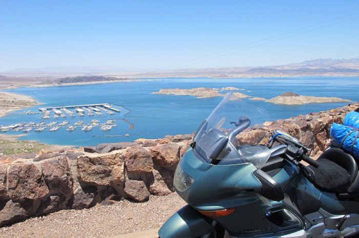
U.S. 93 combines with Interstate 15 for 20 miles into Las Vegas. I have no compulsion to visit. Ever since Dick Blom of Rider goaded me into losing $25 at blackjack years ago, I’ve been averse to gambling. Don’t even put a nickel in a slot machine. I’ve seen the highlights. It’s time to move on. My route branches off here and heads through Henderson to Hoover Dam. This is the end of Nevada and U.S. Highway 93. Finis. From Jackpot to here is 513 miles. Cross over the 726-foot dam and I’m in Arizona.
I’ve visited the dam in times past. What impresses me now is the relatively new Mike O’Callaghan—Pat Tillman Memorial Bridge, a concrete arch design rising 840 feet above the Colorado River just downstream from the dam. O’Callaghan was a former governor of Nevada, and Tillman had forsaken a football career with the Arizona Cardinals to enlist in the Army after 9/11. He was later killed by friendly fire in Afghanistan.
The truth be known, this is my second trip down U.S. 93. I first did it decades ago. Based on my widespread travels through the state, no one can convince me that U.S. 93 isn’t Nevada’s loneliest road.


Great article…After 30+ years living here in Nevada I’m spoiled by riding the roads the author talks about…all of them allow for a solitude not common in today’s world.
I stumbled upon the campground at Angel Lake when I needed a place to stay and it was one of the highlights of my trip. The coolness at altitude was a great respite from the heat down below and the ride up was great, Just watch for free-range cattle hanging out on the corners.There are some steep hiking trails that go up from the campground to give your legs a stretch after a day in the saddle.
This is really an excellent read, but if the writer is trying to pick a fight, he needs to get his argument straight. For starters, US 93 in NV is some 35 miles shorter than he says it is. The actual difference between the 2 routes is about 70 miles, pretty much irrelevant (since some of each are pretty congested). And US 50 and US 30 (different segments) each make up part of the Lincoln Highway. They’re never one and the same. He got that all wrong, too.
One can only laugh that the loneliest highway in NV goes thru Lost Wages. But most notably, he’s mischaracterized the Life Magazine claim. “Loneliest Highway in Nevada?” Phfftttt. US Highway 50 is the Loneliest Highway in America! I’ve pretty much traveled most of the the old US Highways (including these 2). In fact, this spring I traveled US 50 Coast to Coast. Now *there’s* a trip! In my ever so humble opinion, he’s off the mark.
There’s not much to compare to GON2L (GrandOldNumbered2Lane) US 50 from Fallon NV to Grand Junction, CO. And that’s about 700 miles. For the record, Eureka, NV, makes the claim of “Loneliest Town on the Loneliest Highway,” and I’ll give ‘em that, too.
Well John, you sure told HIM!
Looks fun!
I live in Ely, Nevada. I work in, Lovelock, Nevada. Taking; I-80 to Hwy-93 to Hwy-50; Fallon, Nevada… Go 252 Miles to Ely, Nevada. Now, I have, Drove/Rode this hwy-50 Every Weekend for over 2 years with 2 mores years to go. I am starting to think I might hold some kind of record for traveling this LONELY (hwy-50) more then anybody on this planet! I have been on every back Hwy in the State of Nevada and can ASSURE EVERYONE… Without question, HIGHWAY-50 is without a doubt the LONELIEST DAMN HIGHWAY IN THE WORLD…MUCH LESS AMERICA!