Late in the 19th century, in Wisconsin’s far north and on Michigan’s Upper Peninsula, above ground thousands of men hacked out a living logging the state’s vast hardwood forests.
At the same time, thousands of feet below the surface, hard rock miners blasted and hammered out millions of tons of iron ore. Dozens of mines dotted the Penokee Range, where the immense vein of iron paralleled Lake Superior’s south shore.
For decades, the mines went deeper and deeper until the deposits played out and the bottom fell out of the ore market, forcing the last of the mines to close in the 1960s. When it was over, the last mine to close, the Montreal Mine, had plunged nearly a mile deep.
Today, the mix of hardscrabble history and natural beauty makes the all-but-forgotten Iron Range a great touring destination—if you know where to go. Many points of interest and great views are missed by the thousands of motorcyclists that roll through the area on U.S. 2 each summer, only because they don’t know how close they are and which side roads to take. Having grown up there, I feel an obligation to do something about that for my fellow motorcyclists.
U.S. 2 traverses the old Penokee Iron Range as part of its east-west route, entering Wisconsin at the port of Superior in the west and at Ironwood, Michigan, in the east. It then skirts the Michigan-Wisconsin border in the U.P. to Escanaba and east to the juncture of Lake Huron and Lake Michigan at St. Ignace.
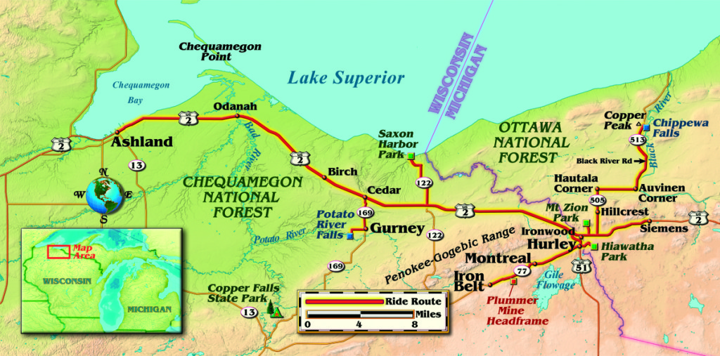
Just after crossing into western Iron County, Wisconsin, State Highway 169 joins U.S. 2 heading south. About three miles south of U.S. 2 lies the tiny town of Gurney, and on its south edge is Potato River Falls Road. The road is gravel, but it’s in good shape and after about two miles will bring you to a quiet little camping area at the end of the road. A short walk on two trails provides superb views of the upper and lower falls, deep in the river’s gorge. Traveling a few miles farther south on 169 will take you to Copper Falls State Park.
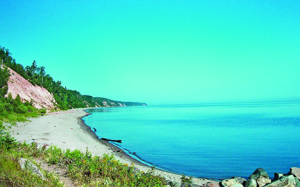
After rejoining U.S. 2 a few miles east, turn north on State Route 122 and left on County Trunk A to reach the beautiful marina and park at Saxon Harbor. The harbor provides a sweeping view of Lake Superior as it forms the north coast of Wisconsin to the west and Michigan to the east.
Lake Superior is stunning to those who have seen only average-sized lakes. Its vast expanse sprawls over nearly 32,000 square miles; some call it an inland ocean. That’s not far off—at 350 miles long and 160 miles wide, averaging over 480 feet deep, it is the largest freshwater body in the world.
Taking State Route 122 east along the lakeshore brings you from Wisconsin—where helmet use is mandatory only for those under 18 and/or with an instructional cycle operator permit—into Michigan, where helmet use and eye protection are mandatory for all riders.
If you opt to head back to U.S. 2 from the lake, then east again, U.S. 2 will take you into the Hurley and Ironwood area. Hurley was a tough town in the mining days, resulting in a lot of Hurley-burly lore that persists to this day. Still known for its nightlife all along Silver Street, there’s also outdoor sports like fishing, hunting, boating, camping, snowmobiling and skiing in the area’s “big snow” winters, and some great restaurants. Hurley hosts its own motorcycle rally, the Hurley Rollin’ Iron Bike Fest, on the second weekend in June each year.
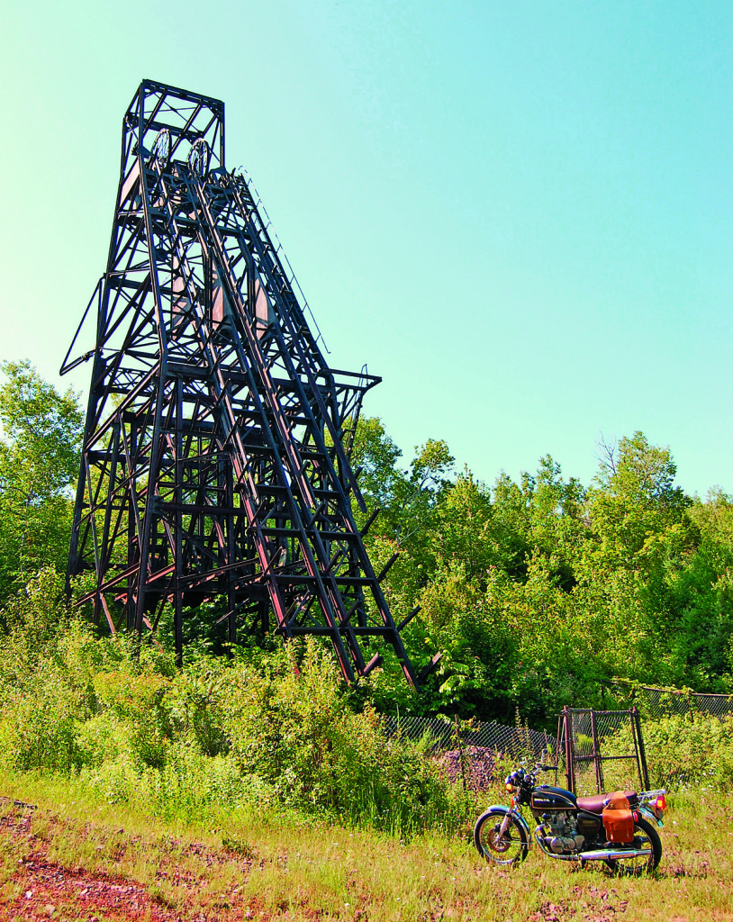
Traveling west from Hurley along state Route 77, just beyond the village of Pence less than an eighth of a mile off the highway, a gravel road brings you to the last vestige of the Iron Range’s underground mining heyday. The Plummer Mine headframe is the last such structure in existence on the Penokee Iron Range, and one of the few of its kind remaining in North America. The 80-foot-high steel headframe formed the anchor point for a cable-operated elevator that lowered miners in and raised both the miners and the ore out. When it closed, Plummer was over 2,360 feet deep.
Traveling east along Hurley’s Silver Street into Ironwood, Michigan, the world’s tallest Indian is only a few blocks off Ironwood’s McLeod Street. Turn south along Burma Road (from U.S. 2/Cloverland Drive, take Douglas Boulevard to downtown and Suffolk Street to Burma Road). Hiawatha is a full-color fiberglass statue of Henry Wadsworth Longfellow’s Hiawatha, and stands 50 feet tall. Built in 1964, the statue was intended to attract tourists to the area—and it does, but you have to ride off the main highway to get to it.
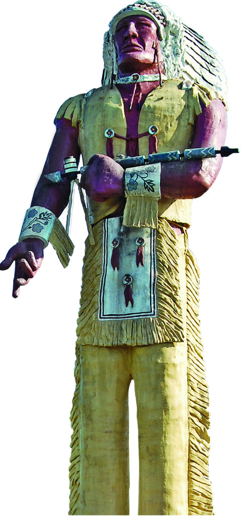
The park at Hiawatha’s feet features examples of vintage rail and mining equipment, but of perhaps even more interest are the deep, steep holes that drop away along Burma Road, known locally as “the caves.” The caves are actually the result of massive subsidence, or caving-in, of the mined-out earth below the old Norrie Mine site. Subsidence continues in some areas to this day.
North across town at the corner of Jackson Road and Greenbush Street lies the campus of Gogebic Community College, my alma mater. Not your typical community college, the campus has its own ski hill—the only junior college in America that does. In the summer, the summit of Mount Zion offers a small, lightly used park with a breathtaking panorama of the rugged land that slopes to Lake Superior about 15 miles north. Find the park by taking Greenbush Street up the base of the hill, and at the apex of the curve where it begins back downhill, take the single lane paved road to the right to get to the top.
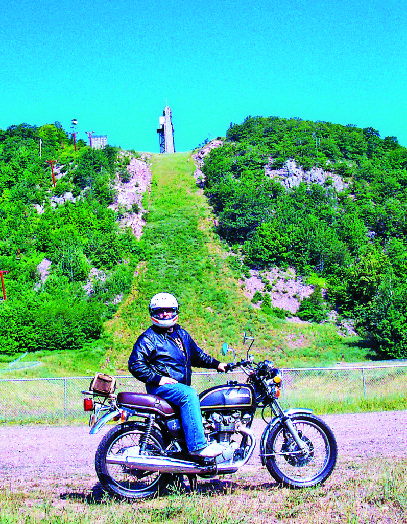
Visible to the northeast from atop Mount Zion is the western hemisphere’s only ski flying scaffold—Copper Peak. “Ski flying” is the correct term for the competition that this steel giant was built for back in the 1970s. The largest hill Olympic ski jumpers compete on is 120 meters; ski flyers at Copper Peak compete on a 170-meter hill, and their flights can stretch to about 700 feet. In the summer, a chairlift takes you up the hill to the base of the scaffold. Then an 18-story elevator takes you near the top, which is gained by climbing a stairway. Once there, you’re 26 stories above the top of the 360-foot-high bluff the scaffold rests on—about 600 vertical feet above the landing.
To get to Copper Peak, take Lake Road north from U.S. 2 in Ironwood, turn right on Airport Road and left on Black River Road. After taking in the view of three states, Canada and Lake Superior from the top, continue along Black River Road to see the five stunning waterfalls along the way to Black River Harbor.
All this sounds like a complete tour in itself, doesn’t it? Yet it’s all there within about a 40-mile stretch of U.S. 2, and worth backing off the throttle a while and turning up a few side roads.
For more information
- Iron County, Wisconsin
- Hurley, Wisconsin
- Gogebic Community College
- Ironwood, Michigan
- Bessemer, Michigan
- Copper Peak, Michigan
- Western Upper Peninsula, Michigan
- Upper Peninsula, Michigan





🙂
Sold. I’ll be up when the salt is off the roads.
This is a very nice review of an area in which I ride each summer. The rugged and undeveloped beauty of the upper peninsula is very special, indeed.