Story and photography by R.W. Ballou
[Vermont Motorcycle Rides: Over the Green Mountains was originally published as a Favorite Ride in the March 2005 issue of Rider magazine]
I live in the southeast corner of Vermont, where the hills are steep, the valleys are narrow and the architecture in the villages is distnctly 19th century Yankee, all clapboards and shutters and stark white paint. This is maple syrup and fall foliage country. It’s certainly easy on the eyes, and when the weather cooperates it’s a great place to ride a motorcycle.
Sometimes I need a change of pace, a fresh perspective on Vermont, and when that happens I head west over the ridge of the Green Mountains to an area surprisingly different from my home turf, despite being only an hour’s ride away. In the area is a network of rolling secondary roads that, woven together, constitute what has become my favorite ride, a meandering 70-mile loop that passes through some of the most beautiful scenery in the state.
The ride always starts in front of the Equinox Hotel in Manchester. Leaving the curbside I follow Route 7A north for a little over a mile, then take a left (west) turn onto Route 30 at Manchester Center. Soon things start to sweeten up. Tourist-town segues into something that looks like real countryside, and the terrain starts to roll a bit.
Past Dorr’s Antique Tractor Farm (a collection of early John Deeres, Farmalls and other brands, most beautifully restored) and a huge old marble quarry that serves as the local swimming hole, Route 30 meanders its way into the village of Dorset, a cute bit of white-painted New England with a long, narrow green and a golf course on its outskirts that offers an amazing mountain view. Northwest of Dorset, with 8.5 miles showing on the odometer, I turn west onto Route 315. Almost immediately the two-lane blacktop tilts upward into a stiff, winding climb as I cross the ridge that separates the Manchester valley from far-western Vermont and the New York borderlands just beyond. Once up and over—the elevation is almost 2,000 feet at the top—there’s a fast, sweeping descent into the village of Rupert, quiet now but famous at one time for the manufacture of Dr. Guild’s Asthma Cigarettes(!). It’s here that the odd feeling of having left Vermont—and maybe even the northeastern part of the United States—first starts to creep in, especially if it happens to be July or August. Kansas is a word that quickly comes to mind as the eye takes in an endless expanse of cornfields stretching in every direction, with the hot summer sun giving the landscape a pleasantly baked look that’s straight out of America’s heartland.
At Rupert I turn north on Route 153, which skirts the great sea of tall corn with just enough curves to make it interesting but not particularly dangerous. Right about where the corn runs out and the houses begin, Route 153 drops down into West Pawlet, once a major slate-quarrying center but now little more than a ghost town in the making. After hooking a right in front of the town fire station I follow Route 153 north, past what was once West Pawlet’s lifeblood, a massive slate quarry that meanders its way uphill for the better part of a mile. Four miles along Route 153 tees into my old friend Route 30; I turn right here and start heading south. After passing more cornfields and a chain of strange, bulbous little mountains, called cobbles by geologists, Route 30 rolls into Pawlet proper, which is West Pawlet’s more prosperous eastern cousin. There’s a cute little railroad station here that’s been converted into an ice cream parlor, and Machs’ Country Store offers a view into the deep river gorge that it straddles through a well in the middle of the floor.
From the four-way intersection in Pawlet, I point the front wheel east on Route 133. The countryside is still corny here but not for long—I’m heading back up into the spine of the Green Mountains, leaving the wide western valleys behind. After a couple of miles, Route 133 goes off to the left but I stay straight, on the Danby-Pawlet Road. Soon I’m downshifting, the revs are up and the bike is pulling harder than it has so far on this ride.
At the top of this climb is Danby Four Corners, which seems like a really odd name for the place because only three roads actually come together here: the fourth road, once a town thoroughfare, is now a two-rut cow track on the far side of the intersection. The Four Corners Store is a real hoot, a combination general store and guitar emporium that also has a selection of western hats and cowboy boots.
A sharp right at the store (no route number here) and I’m passing through a small, bowl-shaped valley (what Vermonters like to call a hollow) nestled beneath the dark flank of Dorset Peak, almost 4,000 feet to its cone-shaped summit and the site of a massive underground marble quarry. Even in the middle of August, when the corn is still standing tall in the fields, you can see the trees start to turn color up there. This is probably the most spectacular scen- ery of the entire ride. As Dorset Peak disappears from view the road starts to drop, following a mountain brook down through a winding, steep-walled ravine. Some near-hairpin turns put me an eye blink away from the jagged, vertical and very hard granite where the road was blasted out in places.
At the bottom of this rollercoaster descent I enter the village of Danby, once the home of author Pearl Buck and the birthplace of Silas Griffith, 19th-century lumber baron and Vermont’s first millionaire. His gaudily painted Victorian mansion, lately an inn, is located at the south end of the village. Danby sits right alongside U.S. Route 7, western Vermont’s major north-south highway; a right turn here would take me quickly back into Manchester. But instead I cross over U.S. 7 into Danby’s sister town Mount Tabor, another wonderfully haunted place with its rusting hulk of a grain mill looming over a weed-grown rail yard and a line of abandoned boxcars.
At the north end of the rail yard I get onto the oddly named Brooklyn Road, which points arrow-straight and due east from its intersection with U.S. 7 toward the massif of Mount Tabor itself. Past a tiny town hall and a row of neat houses, there’s a sign that says, “Entering The White Rocks National Recreation Area.” This is the beginning of National Forest Highway No. 10, which passes through the closest thing to true wilderness you’re likely to find in the southern half of Vermont.
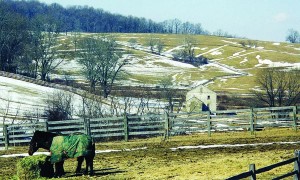
Over an iron truss bridge and around a sharp right-hander the road starts to go up and up; soon the pavement (badly frost-heaved the last time I rode it) quits and the dirt begins. But this is good dirt, well-graded and not too loose. For the next 15 miles NFH 10 traverses high, wild and beautiful country, where moose and bear are often seen beside—and sometimes in!—the road, where huge, jagged outcrops of limestone (hence the White Rocks name) invite a little bit of impromptu rock climbing, and where you can camp, legally and for free, almost anywhere you choose to throw down a tent.
