Each of the previous two years, my three buddies and I have taken week-long trips into the high desert of eastern Washington and Oregon and up into Canada. Both times we were burned to a crisp in the record high temperatures, which hit more than 100 degrees F, even in Canada. Tired of rides where our kickstands sank into hot asphalt like it was soft sand, we sought an equally scenic but cooler route for this year’s ride. The selection was clear: the Oregon Coast. Its unmatched beauty and temperate weather are only marred by the occasional rain shower or fog. This ride, mere feet from ocean waves, promised 65-degree days even in midsummer. The cool days would allow us to wear our full protective riding gear without discomfort, but would also necessitate packing light jackets and raingear just in case. It would be Oregon, after all.
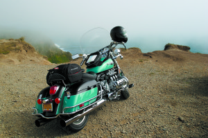
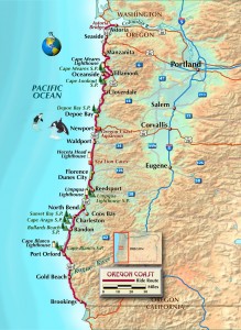
Setting out to do it right, the four of us—two on Harleys and two on Honda Valkyries—rode the full length of Oregon’s Highway 101, which parallels the Pacific Coast. Our starting point was the four-mile-long Astoria Bridge, which spans the Columbia River’s entry into the Pacific, separating Oregon from Washington state. We descended down the span exiting Washington state and skimmed across the water only a few feet above the waves. Nearing the entry point into Oregon we opened the throttle, and climbed 200 feet, rising over the peak of the bridge and descending into the town of Astoria, the beginning of a beautiful 400-mile ride.
The coast highway offers unparalleled beauty on a two-lane road that meanders through seaport towns, alternating between cliff-edged scenic turnouts with spectacular views and pavement only a few feet from the beach. The northern portion of the ride is the most congested, as it’s the most immediate jumping-off point for residents of Portland, the largest metro area in Oregon. However, once you ride south for 100 miles or so, it feels like you own the place.
There’s only the occasional RV, fellow motorcyclists, or a stub-born seagull guarding his meal of roadkill.
The Oregon Coast is a unique environment. The weather is milder, the pace of life slower, the priorities different. Sometimes the biggest news in town is the availability of fresh halibut. We endeavored to soak all this up and couldn’t resist mixing tourist with explorer. Wherever the main road departed the seacoast even briefly, we took the smaller loops that followed the seashore. Speed is not the objective here—fun roads to ride with fantastic scenery are the goal. With more than 80 state parks and scenic waysides, the biggest problem is covering some miles before you stop to explore.
It didn’t take too long for us to find one of our first explorations off the beaten path. We jumped off Highway 101 for a brief loop out of Tillamook that took us to Cape Meares and Cape Lookout State Park. Cape Meares is typical of the viewpoints. Situated 200 feet above the ocean, it provides expansive Pacific views miles out to sea, an old lighthouse and a chance to observe plenty of wildlife such as nesting birds and marine mammals, even migrating whales.
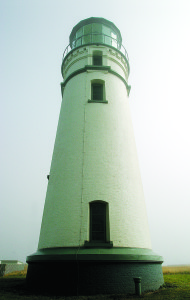
The Cape Meares Lighthouse is but one of several lighthouses which we stopped to explore. The Oregon Coast is home to nine, most built between 1870 and 1896. The U.S. Coast Guard has become the caretaker of the properties and keeper of the lights. By the 1960s, technology had made most of these lighthouses obsolete, and they were replaced with automated beacons. Many of the original lighthouses are gone, but several were transferred to other government and preservation agencies, and restoration efforts have preserved the predominantly white brick towers and frame dwellings that housed the lightkeepers.
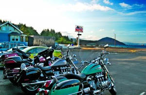
A favorite stop for all of us was Depoe Bay. Billed as the world’s smallest natural navigable harbor at just six acres, the town itself is all of about 300 feet long, so if you blink, you miss it. The harbor may look familiar. This is where Jack Nicholson commandeered a charter boat and skippered a group of mental patients on an impromptu fishing trip in the movie One Flew Over The Cuckoo’s Nest. Here we parked our bikes and enjoyed a fresh seafood meal while we watched the fishing boats navigate the narrow harbor entrance. We were able to park our bikes right next to the seawall that runs the entire length of town, giving us a bird’s-eye view below. We leaned over the guard rail to check out the docks and watch salmon being cleaned and prepared from the most recent charter fishing trip.
We continued riding south and made another stop at Newport, a true commercial fishing harbor, for yet another seafood snack. We avoided the tourist-trap side of the historic district with its Ripley’s Believe It Or Not! and instead ducked into Mo’s, which has been on the locals’ list of best places to eat for several decades. Go for the fresh bay shrimp sandwiches and a bowl of clam chowder, argued to be the best on the West Coast. The restaurant is built over a pier and you can look out the window and watch shrimp boats and salmon trawlers pulling up to the dock. If you have time you can take in the Oregon Coast Aquarium across the bay. This was the former home of Keiko the orca whale (from Free Willy movie fame) before he was moved to Iceland.
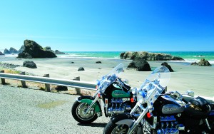
As we rode farther south, the traffic continued to thin out and we had more of the road to ourselves. Most of Oregon’s population is up north, so the seashore just gets less use down here. Not only are there fewer RVs and less commuter traffic, but you can easily find clean, older oceanfront motels for $65 per night that still carry the ambiance of 1962.
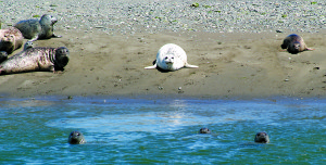
There are more than 28 state parks on this less-traveled section of Oregon’s southern coast, so it’s still a struggle deciding which views and areas of interest to pass by in order to make some headway. One attraction we did skip is Sea Lion Caves 11 miles north of Florence, a natural sea cave 208 feet below the highway and home to wild Steller sea lions. We’d all been here before, and once you’ve experienced the unforgettable noise and smell of hundreds of these creatures in such close proximity, it’s not something you soon forget. Besides, seals and sea lions are pretty common on the coast, and we’ve often seen them sunning themselves on the shores and docks.
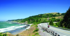
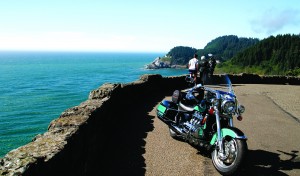
One area of interest we couldn’t resist is Heceta Head Lighthouse. The lighthouse and lightkeeper’s house were both built around 1894 and are listed in the National Register of Historic Places. The lighthouse is still a working navigation aid and one of the most photographed lighthouses in the United States. Perched 205 feet above the ocean, its Fresnel lens casts a beam 21 miles out into the Pacific. If you would like to hang around a while, the old lightkeeper’s house has been restored to its original Queen Anne-style beauty and is now a B&B serving a seven-course gourmet breakfast each morning.
The lenses in these old lighthouses are things of beauty. Invented by French physicist Augustin Fresnel in 1822, they look like giant glass beehives with concentric rings of glass prisms above and below the center lens that bend the light into a narrow beam. The center lens is shaped like a magnifying glass, so the concentrated beam is even more powerful. Tests in the 1800s showed that an open flame lost nearly 97 percent of its light; a flame with reflectors behind it lost 83 percent of its light; but the Fresnel lens was able to capture all but 17 percent of its light and easily throw its beam 20 or more miles out to sea. This was high-tech in 1822!
We continued our run south, passing such interestingly named places as Dunes City, Barview, Sunset Bay, Cape Arago and Bullards Beach before we pulled into Bandon for a break. Here we again parked our rides and walked around the old historic seafront and docks. The locals were passing the time swapping fish stories and catching crab off the dock. Dungeness crab, a delicacy in restaurants, is easily caught with a crab ring and bait of old fish heads or a handy can of tuna. Having neither in our saddlebags, we rode on.
Just above Port Orford, we took a hard turn west and headed out to Cape Blanco, the most westerly point of the lower 48 states. The cape rises over 200 feet above the ocean and thrusts out almost a mile into the sea. Today, like many days, the tip of the cape was engulfed in a fog bank, giving it an eerie feeling of detachment from the rest of the coast. At the tip of the cape is the Cape Blanco Lighthouse, Oregon’s oldest. First lit on December 20, 1870, this lighthouse stands as the oldest, highest, most southerly and most westerly lighthouse on the Oregon coast.
Near the end of our journey we pulled into Gold Beach, known for its jet boat rides up the Rogue River. We took a break, finding an excuse for yet another seafood meal. We also took the time to admire another pack of sea lions basking on the beach across the river as if they owned the place (and we figured they probably do). We finished up our ride in the town of Brookings at the southwest tip of Oregon. And what a ride it had been: perfect weather between 65 and 72 degrees, no rain (we were lucky, even in July), not too much traffic, postcard scenery and a great two-lane ribbon of highway with just the right combination of twisty turns and straight stretches that let you cast your gaze toward the natural beauty. We had to head back to civilization and our jobs, but we concluded the sea lions on the shore had the right idea—here on the Oregon Coast, it’s best to just lie on the beach and soak up the sun, scenery and an occasional seafood snack.
Additional Information:
Oregon Tourism
www.traveloregon.com
Oregon Coast Visitors Association
www.visittheoregoncoast.com
Mo’s Restaurant
www.moschowder.com
Heceta Head Lighthouse and B&B
www.hecetalighthouse.com
(This article Exploring the Oregon Coast: Connecting Seaside Corners and Saltwater Snacks was published in the September 2005 issue of Rider magazine.)
 |


