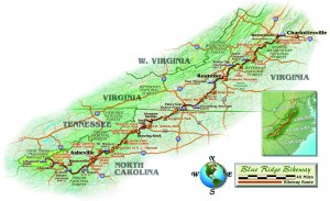
Overlooking the effects of acid rain atop Clingman’s Dome at the foot of the Blue Ridge Parkway, I watched the sun setting slowly over Tennessee in awe. Engulfed by seemingly endless blue ridges, I remembered growing up in the foothills of Virginia, where I had no sooner learned what a motorcycle was than I learned that every weekend local riders cruised some section of the 469-mile scenic Blue Ridge Parkway.
As a grown rider some 25 years later, I knew motorcyclists still flocked to the Parkway connecting Virginia’s Shenandoah National Forest to North Carolina’s Great Smoky Mountains. I knew portions of the Parkway, in fact some sections I considered home. I knew there were countless miles of well-maintained asphalt, a myriad of scenery, excellent twisties, well-banked turns, folklore tapping into the heart of Appalachia and acres of undisturbed nature.
What I did not know was why thousands of riders joined an average of over 20 million other visitors to the National Park Service’s most frequented site each year. Aside from the obvious, there had to be deeper reasons motorcycle enthusiasts across the country made this trek year after year. Simply put, I was here to learn those reasons.
Trying to preserve the land lying between the Shenandoah National Forest and the Smoky Mountains, President Franklin Roosevelt initiated construction on “pieces” of the Parkway in 1935. Under great opposition for designating federal funds to a project seemingly beneficial only to Virginia and North Carolina, a 1936 act narrowly passed the House and Senate placing the Parkway Project under the National Park Service. Almost 67 years later such historic opposition is ironic after meeting over a hundred motorcyclists along the Parkway and only twice encountering riders residing in one of the two states laying claim to it.
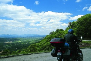
My initial introduction to those cruising the Parkway came soon after the welcome sign, and the first of over 200 scenic overlooks. The four Chicagoans relaxing next to their fully dressed Harleys treated me like the fifth member of their party as I hopped off my BMW R850R and approached them for a photo. After complimenting one another’s ride, and encouragement to keep the “rubber side on the road” we all rode into the most geographically intriguing and technically challenging portion.
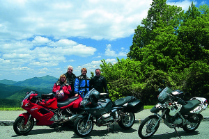
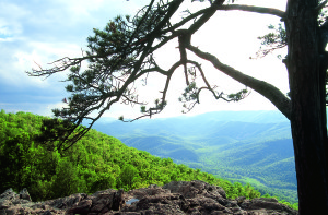
Most will find the Parkway’s 45-mph speed limit generous for the first 35 miles. Starting in Cherokee, North Carolina, at 2,020 feet and rapidly climbing to Richland Balsam Overlook, the highest point along the roadway at 6,047 feet, even if one could handle the barrage of tightly placed twists and turns, the scenery on this stretch is too unique to speed past. With the smell of spruce and pines increasing with altitude, the Smokies, Nantahala and Mt. Pisgah National Forests sprawl out across the horizon below the craggy rock ledges while the road clings to the mountains, offering scenery unlike any on the East Coast.
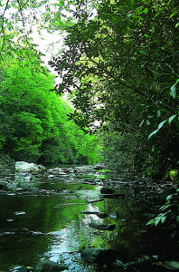
As equally distinguishing as the fir-lined mountain spurs is the strange, but peaceful, solitude residing along the route between Cherokee and Asheville. Counting only two cars and several dozen motorcycle groups, the early morning ascent brought mile after mile in which I was the only vehicle for as far as the eye could see. Stopping at times along the road, waiting, looking, listening for what was coming toward me or approaching from behind, I heard only the wind, saw only rock ridges or distant valleys and felt like the only human being alive. After each stop I reluctantly hit the starter button with eyes fixed on the velvet green landscape some 4,000 feet below rolling out beyond sight.
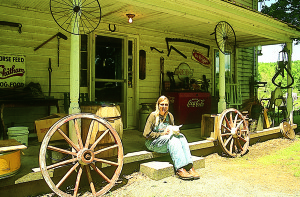
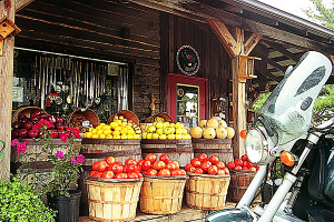
Riding toward Asheville along the Pisgah Ledge, I stumbled upon a lodge and gas station that left me wondering why I had no forewarning. No stoplights, no signs screaming Exxon, no billboards stating “Ice,” “Beer” or “Snacks,” no neon canopy covers over the small wooden building with three lone pumps outside. Instead, just a grandmotherly geography wizard behind a small counter telling the owners of a Moto Guzzi and Honda Magna parked at the pumps that the detour route around the rockslides up ahead was her favorite…her favorite motorcycle route.
The descent from the Pisgah National Forest, which throughout the 1800s was nothing more than several thousand acres of George Vanderbilt’s personally owned hunting grounds, led right past Vanderbilt’s Biltmore Estate and into Asheville, North Carolina. The Parkway around Asheville, much like Roanoke, Virginia, is far more congested than other stretches along the scenic route. However, in early spring congestion is a relative term and as motorcycling goes cars were sparse, bikes were plentiful and I remained puzzled as to where the 20 million visitors the National Park Service records each year could be found.
Crossing the French Broad River and ascending again into the Great Craggy Range, I quickly realized the Parkway fails to run non-stop along the rooftop of Appalachian ridges. Instead, the commercial-free road races up and down, traversing countless ridges before diving into deep valleys and gaps, purposely avoiding cities and towns. In fact, the roadway was as diverse as the motorcycle makes, models and riders found at every other scenic overlook.
Though technically not a Parkway overlook, the five-mile side road at mile-marker 355 showcases one of the Parkway’s crown jewels—Mt. Mitchell. Named after University of North Carolina scientist Dr. Elisha Mitchell, the mountain stands at 6,047 feet above sea level. Mitchell, who died trying to prove the summit’s elevation the highest in the range, would be proud to know his mountain is in fact the highest point east of the Mississippi River. Painfully aware of the elevation, my boxer clunked through the switchbacks, with gears changing two dozen times before sputtering into a parking lot that, to a true Easterner, seemed perched atop the world. With the idle sounding horrible, due to the lack of oxygen I assumed, I parked and took pleasure in meeting another round of motorcyclists, who mostly resided hundreds, or thousands, of miles from where we stood.
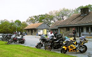
The couple from Minnesota, returning home from a Harley-Davidson Bike Week in Myrtle Beach, South Carolina, crossed my path every 30 miles throughout the day. At each stop we compared motorcycles, discussed preferred seats and highway pegs before bidding farewell, knowing we’d meet again within the hour. The next trio, astride Suzuki cruisers from the horse farms of Kentucky, eagerly recommended bike routes throughout the Blue Grass State. Then I finally met two locals. Reverend Dean, a Presbyterian minister from the nearby Black Mountains, out riding with his daughter, offered in-depth conversation about his Kawasaki Concours, and a fondness for Clement Salvadori’s “tell it like it is” articles.
During another ritualistic and in-depth conversation the night before I departed for the Parkway, my mother suggested, despite the 80-degree temperatures outside, that I pack a sweatshirt. “For what?” I thought. However, recognizing she’d been right more often than not throughout my life, I packed my heated vest, winter gloves and yes, a sweatshirt. After sweating through day one on the Parkway, I broke camp outside Blowing Rock, North Carolina, on day two with fog-draped mountains, light rain, temperatures in the mid-30s and—thanks to Mom—a sweatshirt.
By mid morning, I was desperately trying to thaw my numb and frozen hands at the Bluff Mountain Coffee Shop at Doughton Park. While I contemplated pouring the coffee over my hands, silverware quietly clinked on plates around me, drawing attention to the fact that the restaurant was graciously warming the most diverse group of riders I’d ever seen assembled in one place.
After breakfast and refueling, I walked into the adjoining gas station to pay when I was greeted with, “How are your hands holding up, son?” Startled by both the question and questioner, I told the genteel lady, “To be honest ma’am, they’re killing me.”
Immediately reaching into the cleaning closet, she retrieved a box of latex gloves, and instructed me to put them on under my leather gloves. “These are small but they’ll stretch. I hear they really help.” Indeed they did, and I informed everyone in the parking lot, including the six coworkers from sunny Tampa, Florida, on their Annual May Parkway ride, to see the lady inside for some handwarmers. Riding toward Virginia, and hopefully warmer weather, the lure of the Blue Ridge Parkway became very clear. In addition to “biking brethren” at every stop, those employed along the Parkway seemed to share an interest, passion, helpful knowledge, or some meaningful insight to those on two wheels.
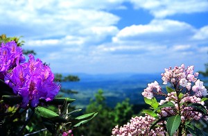
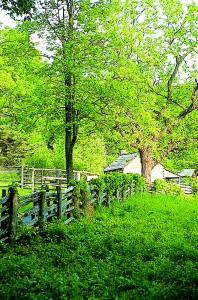
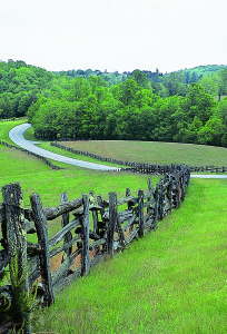
After the third mountain sunrise at Mabry’s Mill welcomed me home to Virginia, I welcomed the change in scenery. In Virginia the Parkway tends to wind through open meadows, roll next to split rail fences, straddle mountains or quietly lie between walls of mountain laurel and rhododendron. Likewise, each change in landscape brought more riders from different settings—Oklahoma, Louisiana, Georgia, Canada and even some locals from South Boston, Virginia. Each on a unique motorcycle, possessing their own style, sharing their favorite riding story and welcoming newcomers like old friends.
Being an area native, the Parkway between Roanoke and Otter Creek reunited me with two old friends, Virginia’s Piedmont and the Great Valley. Once again pleasantly surrounded by solitude, I carefully balanced atop the mountain crests, and sliced through the Jefferson and George Washington National Forests to Virginia’s highest Parkway point at Apple Orchard Falls (3,950 feet). Descending 13.5 miles down Apple Orchard Mountain in topological bewilderment I met an entourage of local Gold Wingers at the Parkway’s lowest point of 649 feet along the James River.
Knowing the James signified my last 60 miles I also knew that if the ride concluded as it began, solitude would be my likely partner until reaching Rockfish Gap. So after introductions to new faces, places and their rides, plus details of the Gold Wing rally being held in the nearby Peaks of Otter, I once again bid my new acquaintances farewell. Then the final search began for a quiet overlook to watch the sun bathe the blue ridges once more before creeping beyond the western horizon.
Alone and watching the sunset at Raven’s Roost, I began to see the Parkway not so much as a static route, but more as a dynamic, traveling, motorcycle rally. Almost like a dance, riders jump in, ride for a while, cross paths several times then depart. The Parkway’s original architects had wanted a route that encouraged people to, “ride a while, stop a while, then ride a while.” For the motorcycle enthusiast the absence of commercial vehicles and stoplights with something or someone worthy of a stop within each of the 469 scenic miles, those architects created a dreamscape.
