Mountains make for good riding. The roads go up and down and around, with all sorts of curves and dips. Some mountains you can ride to the top of, like Mount Greylock, the highest point in Massachusetts at a modest 3,500 feet, with a delightful road going up the north side and down the south. Slightly higher is Pikes Peak in Colorado, topping out at over 14,000 feet, with a turnaround at the top.
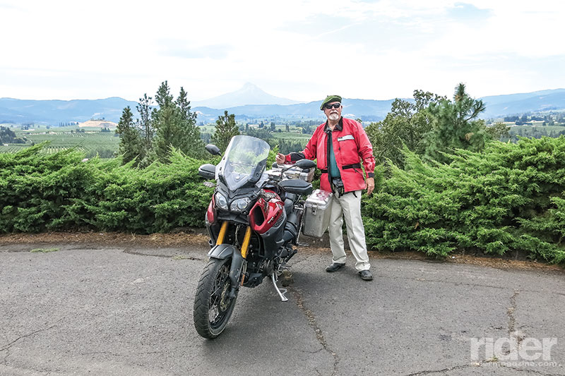
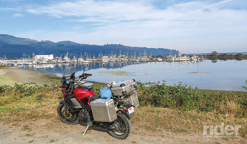
Not all mountains have roads going to the top. I recently rode laps around two of them. One is the 8,000-foot Mount Olympus on Washington’s Olympic Peninsula, a mere 35 eagle-flying miles from the Pacific Ocean. The other is Oregon’s Mount Hood, at more than 11,000 feet, just 200 miles to the southeast of Mount Olympus. Both loops have some dirt and a lot of asphalt, perfect for the new breed of “adventure” bikes. Mine is a Yamaha Super Ténéré ES.
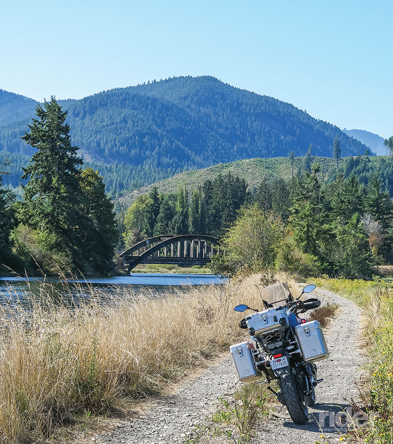
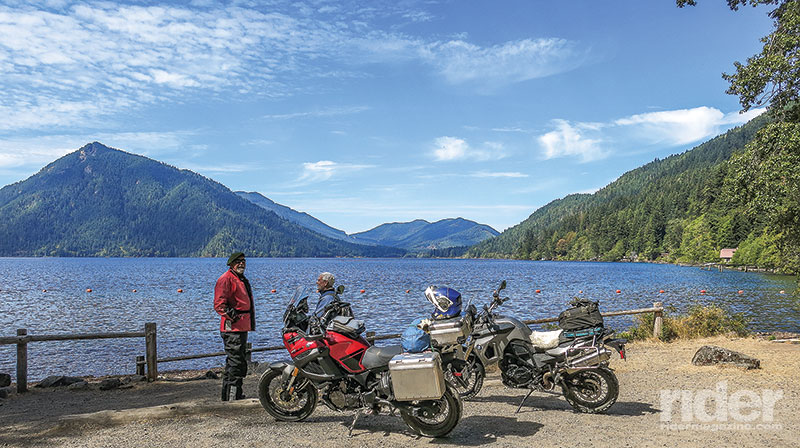
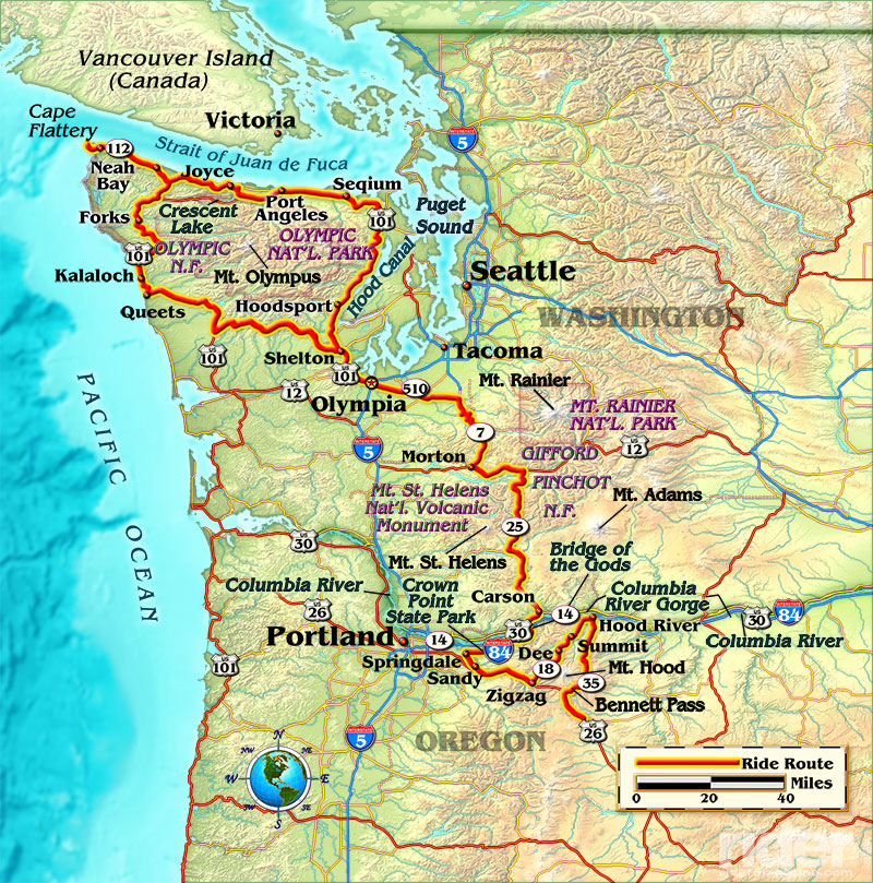
As I wrote in a column a while back, my tour of the Olympic Peninsula had its interesting moments, but this traveler’s tale will leave out the questionable detours. Three of us began from Shelton, on the east side, and then took forest roads heading west across the south side of the peninsula to get through the Olympic National Forest. These gravel and dirt byways are perfect for feeling liberated from the rigors of asphalt, cars and stop signs, puttering along in second gear, maybe third if the road is smooth. Sometimes we were in deep, dark woods, towering evergreens shading the road, or riding through an open wilderness meadow with small shrubbery. Or a previously cut area, done several years ago, now replanted with young trees shining in the sun.
After 50 or so miles we came out on U.S. Route 101, the western side of the two-lane highway, which loops around the peninsula. This is a curiosity for a major U.S. route, as it actually does a 200-mile, 180-degree turn to end (or begin) at Olympia, Washington. Now we were in the Olympic National Park, so designated by FDR back in 1938. At Kalaloch is a sturdy old lodge built in the late 1920s, using lumber milled from trees that floated up on the long beach. The lodge itself has more than 20 rooms, and if I ever stay there I’ve been told to get a View Room, those on the west side overlooking the Pacific. There are also some 40 small cabins nearby, along with 170 campsites. But don’t think you can just drop in and get a room or camping spot, as the place is spectacularly popular.
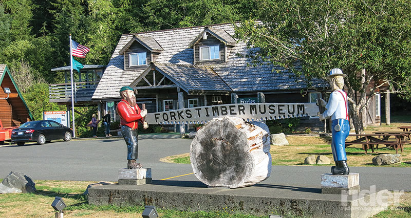
We continued up the road to Forks for the night. In the morning we headed north to Neah Bay and Cape Flattery, the smaller roads well-paved and blissfully curvy. Washington Route 112 is an official Scenic Byway, well worthy of the title. As we rode alongside the Strait of Juan de Fuca (named for an explorer who may or may not have sailed through here in the 16th century), we could see the distant hills of Canada’s Vancouver Island, with the occasional large ship headed into Puget Sound or out to sea.
Up at Neah Bay, the center for the Makah Tribe (one of eight Native American tribes that have long inhabited the peninsula), the boats in the harbor appeared to be equally divided between pleasure and work. From there, the eight-mile road out to Cape Flattery was newly paved and absolutely traffic-free. The cape itself is formed by Bahokus Peak and surrounding hills, with the parking lot being a short walk from the ocean.
Then it was back to Neah Bay and east toward Port Angeles, the only town of real size on the peninsula. We stayed on State Route 112, crossed the Pysht River and an abandoned lumbering town, detoured at Joyce to see the beautiful Lake Crescent, and then on into Port Angeles. The place is home to some 20,000 inhabitants and the ferry terminal is busy every day, being the easy way for Americans to get to Vancouver Island.
At lunch, my riding buddies said they wanted to try the back roads through the Buckhorn Wilderness, but I, having places to be, decided stick to the asphalt of U.S. 101. We parted ways near Sequim, and I heard later that I’d missed a very good ride. Ah, well—maybe next year.
I lollygagged along U.S. 101, stopping for the occasional photo along the Hood Canal. This is not really a man-made canal, but a natural channel running some 50 miles between the Olympic and Kitsap peninsulas. I coulda/shoulda taken State Route 104 and crossed the floating bridge at the north end, but I was looking at my watch, having promised friends I would meet them at a specific time. Got to get rid of those timekeepers when on the road. I rode past Shelton and on to Olympia, where a delightful dinner awaited me.
On my way southeast to Mount Hood are a couple of big mountains that I have seen before, with a road running between them. One is 14,410-foot Mount Rainier, with a national park encompassing the highest mountain in the Cascade Range, which stretches from northern California to southern British Columbia. The other is Mount St. Helens, who blew her top in 1980, reducing her height from 9,677 feet to 8,363 feet—a loss of 1,314 feet. Dead-end roads go up on the east and west sides, giving a dramatic view of the power of Ma Nature.
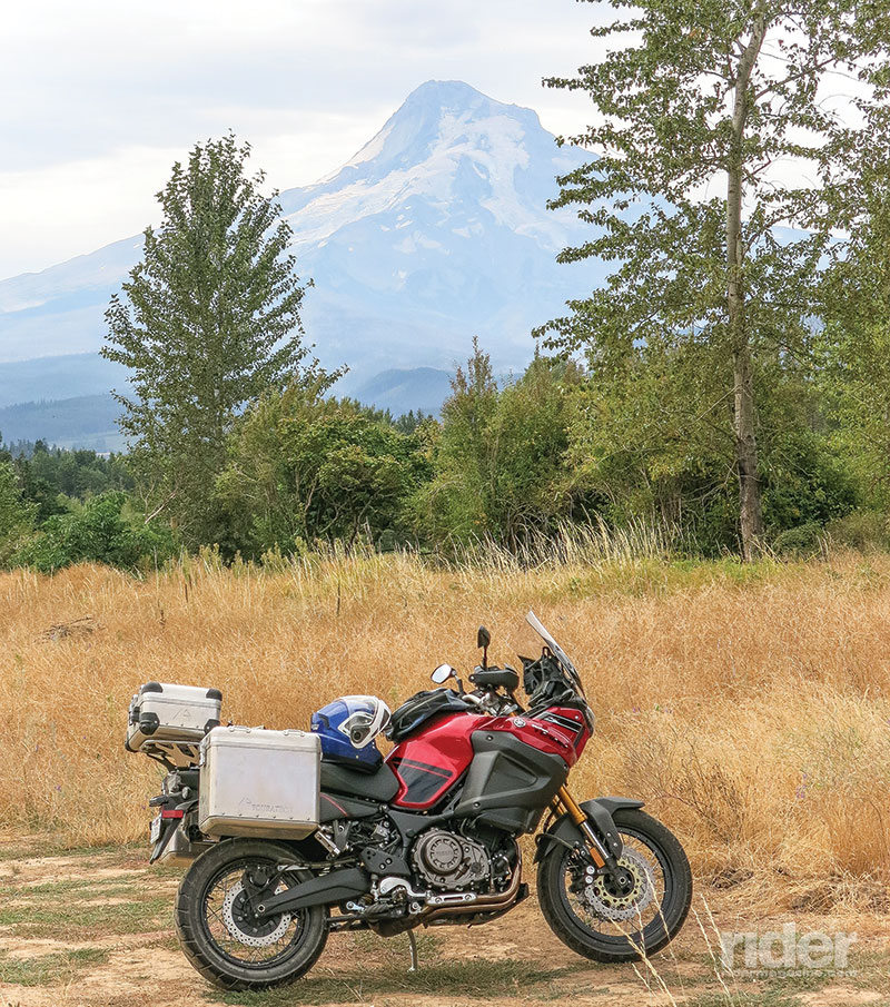
I followed the small roads through the Gifford Pinchot National Forest and eventually came out at the community of Carson, on the Columbia River gorge, but high haze was obscuring Mount Hood, which stands 11,245 feet tall. I could have headed upriver 20 miles and bedded down in the town of Hood River, where I was due to be the next afternoon, but instead I decided to circle the whole of the rugged Hood region.
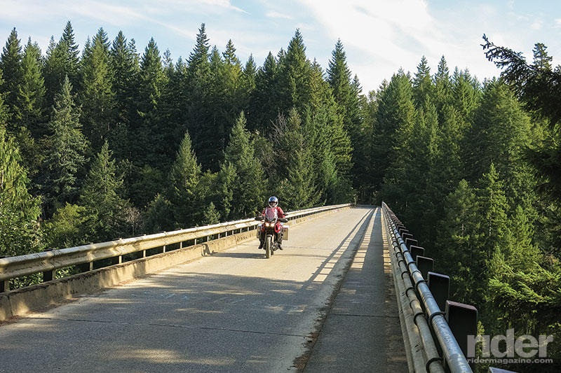
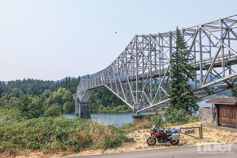
Turning right on State Route 14, I headed downriver a few miles to cross over on the bridge at Cascade Locks, known as the Bridge of the Gods. Apparently in the tumultuous creation of this river, a thousand years ago a natural bridge was created by a great landslide, which was happily used by natives until the river pushed through. A steel truss bridge connected the two banks in 1926, the latest version being built in 1940, and is over 1,800 feet long. A kind lady at the tollbooth asked for a mere half-dollar (pedestrians, bicyclists and motorcyclists) on the Oregon side. I droned westward along Interstate 84/U.S. Route 30 for 10 miles, which is not boring as the views of the river are excellent.
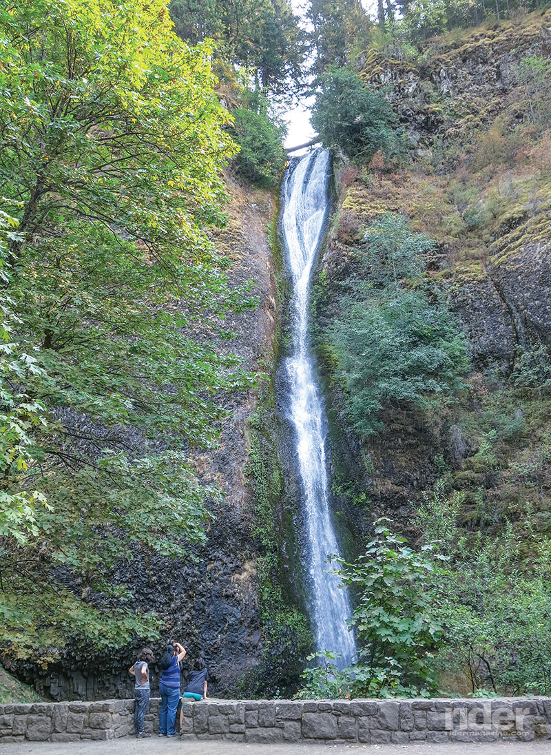
At exit 37, marked Dodson, I turned onto the Historic Columbia River Highway (old U.S. 30) headed west toward a series of waterfalls and Crown Point State Park. That highway, much of it cut into the sides of the mountains, is a magnificent piece of work, especially considering that it was built between 1913 and 1922 and covers 75 miles of the gorge itself. In later years, the use of a lot of explosives allowed a road to be built down at the water’s edge, but the old highway is the one to ride.
At Crown Point was a truly scenic view looking upriver for many miles. The Vista House was built circa 1918, and geologists say that the basalt point on which it stands 733 feet above the river came about some 15 million years ago.
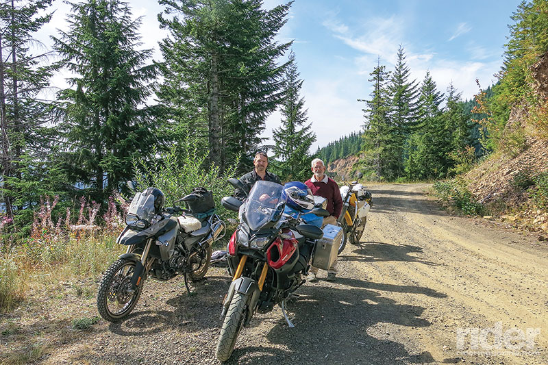
The road descended into the valley of the Sandy River, and after Springdale I crossed over that river and headed south to Orient and the town of Sandy, which calls itself the gateway to Mount Hood. I was on U.S. Route 26 now, which broadened out to a four-laner as we went east toward Zigzag—no idea where that name came from. The highway goes right through the Mount Hood National Forest, but at the little town of Zigzag a forest road heads northeast over Lolo Pass on the western flank of Mount Hood, perfect for a bike like the Super Ténéré. Forest Road 18 is paved up to the pass at 3,415 feet, and on a good day the mountain stands visible in all its magnificence. Then the road turns to reasonably good dirt as it descends, rather steeply, to the West Fork of the Hood River, and follows the river downstream to tiny places like Dee and Summit, and on into the very nice town of Hood River.
I had things to do here, with a presentation at The Rally in the Gorge put on by Sound RIDER!, and spent two very pleasant nights at the Hood River Hotel. It was built in 1911, recently refurbished, and has old-fashioned windows that actually go up and down. It also has a great bar, as the town is noted for its nearby wineries and microbreweries, as well as an excellent museum featuring airplanes, cars and motorcycles—well worth a visit.
The second night, the weather report said that a cold rain would be arriving the next morning, and I was out on the road at dawn, headed south on Oregon Route 35. By the time I got to Bennett Pass (4,674 feet) it was drizzling, and I was very glad for all the raingear. At the intersection with U.S. 26, it was raining in earnest, so I chose to head south rather than complete the full loop around Mount Hood—it was only 10 miles back to Zigzag, but I had done them before. And it was getting cold!
California sunshine, here I come.


 | Ep. 69 Rider Magazine Insider Podcast")

