photography by Chris Wykoff
Living in the lower left corner of California has good points for motorcyclists. Our moderate weather allows a year-long riding season. With that warm and dry benefit, however, comes the issue of our claustrophobic geography. South is Mexico. West is the Pacific Ocean. North is the Los Angeles sprawl. East is our easiest bet for truly empty roads. Arizona is a five-to-six-hour ride from my home, provided we take as many two-laners as possible.
From Ramona, California, we take CA State 78 east through the mountains of San Diego, then catch the 86 to circumnavigate the Salton Sea, the briny result of an agricultural levee mistake in 1905 that allowed the Colorado River to flood the Salton Sink. The Salton Sink is only 5 feet higher than the lowest point in Death Valley; it’s more than 229 feet below sea level. Over the years, drainage from agricultural fields has made the water saltier than the ocean and untenable to anything but birds and tilapia, apparently the hardiest of fish. Downwind, on some hot days, one can sense the Sea long before one can see it.
State 78 wends its fast and vacant asphalt way through the Algodones Dunes, nearly 300 square miles of wind-driven sand. In 1915, in order to facilitate the passage of early cars between Yuma, Arizona, and San Diego, California, a wooden road was built across the shifting sands. The 8-foot-wide plank road could be adjusted as needed to adapt to the drifting, migrating sand. Turnouts were provided every quarter mile since only one car could pass at a time. A small piece of the original plank road is still visible at the Gordon’s Well turnoff. It’s protected by chain link fence now, since most of the wood was burned over the years by campers. We ride past the dune-buggy playground of Glamis, finally crossing the Colorado River into Arizona at Blythe.
Out of necessity, we ride a short span of U.S. 10 among harried commuters, then head out on U.S. 60 toward Wickenburg. It’s straight and flat, and we pass through small towns like Brenda, Salome, Gladden and Aquila. They’re dots on a GPS map, orphaned by the pace of Interstate 10. It left them for travelers like us.
At Wickenburg it’s north to Congress, where we join State Route 89 and follow it up through the Prescott Basin. At an elevation of 5,300 feet, the vegetation of the Prescott Basin is predominately manzanita, juniper and the largest stand of ponderosa pines in the world. We open our visors and inhale; it’s a heady scent in the warm dry air. Sadly, a long drought exacerbated an infestation of pine beetles, which girdle the ponderosa bark and ultimately kill the host trees. Nature can be cruel.
The road becomes twisty above Wilhoit; locals call this section the White Spar. It’s popular with local sport riders and we need to watch our mirrors. We’re in no rush but some folks are.
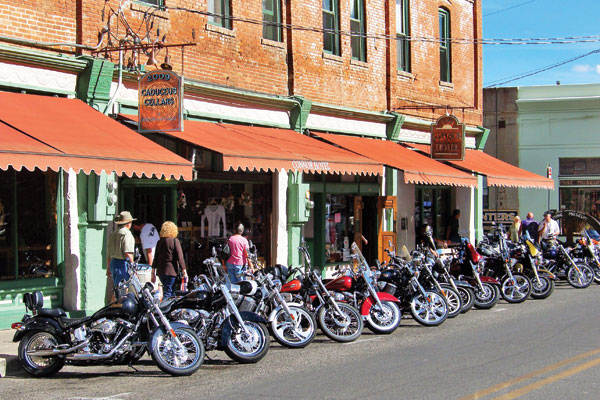
We follow SR 89 over Mingus Mountain and into Jerome, a Hippie mecca in the ’60s. Jerome sits on a 30-degree slope on top of copper mines abandoned in the ’50s. The steep terrain above Verde Valley and the maze of tunneling have caused some buildings, including the town jail, to slip 25 feet downhill.
Parking the bikes for lunch, we stretch our legs in a steep and hilly walkabout. A girlfriend of mine moved here in the early ’70s. I wonder out loud if she might still be around. My riding partner Chris chuckles, “She’s a grandmother by now.”
My nostalgia bubble pops.
Our trip’s hub is the town of Clarkdale, where Chris has a home. Here we can sleep, shower and eat. Cocktails in hand, we step out at night onto the patio overlooking the Verde River and the Tuzigoot Ruins. The dark sky is awash with stars in the black moonless night, a reverent sight for a city boy. We make plans to come back for the Perseid meteor shower.
We have nowhere to be, plenty of time to get there and make decisions daily. This is as good as traveling can get; we’re sampling small town diner food, chatting up the locals and flipping coins at crossroads. Gas is our only concern. Fun stuff, this.
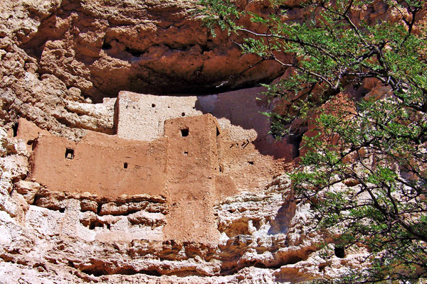
Early the next day, we set out on SR 260 for Tonto Natural Bridge State Park. A side trip takes us to Montezuma Castle, so named by European explorers who wrongly assumed a connection with Montezuma. The cliff dwellings are believed to have been built by the indigenous Sinagua as protection from warring bands and were abandoned around A.D. 1400. It’s believed that access was gained by climbing an ever higher series of notched logs, which could then be pulled up for safety and isolation. Living there makes motorcycle riding seem extremely safe.
Eleven miles from the ruins, a limestone sinkhole called Montezuma Well provides water for irrigation and still exhibits canals built by prehistoric people. Some stone ruins perch inside the cliff below the rim.
Route 260 runs through some big sweepers before we turn onto SR 87. Tonto was closed but it’s all about the journey. No harm, no foul.
We stop in Pine for lunch surrounded by autumn aspens and stand quietly removing our gear. The only sounds are the click and tick of heated motors as they cool and the susurrus whisper of the light breeze that quivers the leaves of the aspen trees. As a city dweller, I’m immersed in constant sound. So constant, I unconsciously screen it out as gray noise, audio clutter, the sonic graffiti of an urban life. Here, the silence is stunning, distinctly a force of nature.
The dichotomy of this natural silence and the manufactured exhaust note of our Italian mounts is not lost on us. I am reminded of the writing of T.E. Lawrence referring to his Brough Superior when ridden at speed: “The burble of my exhaust unwound like a long cord behind me. Soon my speed snapped it and I heard only the wind…” We understand, Thomas Edward, we do.
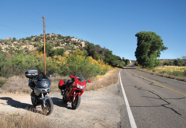
Ducatis are made for such Arizona roads and riding them here is a real hoot. The distinctive L-twin exhaust beat of the ST3 and Multistrada syncopate together at high rpm, their frequency controlled by our right fists and limited only by our clear sight lines through smooth asphalt corners. We see no traffic, the roads are empty, the surface is clean and dry. No music ever produced can rival this four-stroke symphony. We don’t need MP3 distraction, we have bold Italian music. Allegro! Con Fuoco! Faster! With Fire!
Day-tripping, we ride the road to Sedona. New-agers bask in the confluence of the energy vortexes in this famous red rock artist town. We avoid such things and climb the 40 miles of steep uphill switchbacks onto the Mogollon (pronounced muggy-YON) Rim via Oak Creek Canyon. The riding gods (or the vortex) bless us with clear roads and a lack of motorhomes. Touristy drivers are everywhere here; be careful. The views are distracting, the roads narrow and unforgiving, and there are no guardrails in some areas.
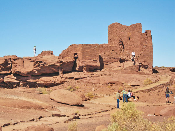
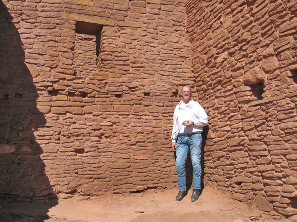
We corner at an easy comfortable pace and ultimately follow SR 89 to the north and the Wupatki National Monument, site of a cluster of pueblos. Archeologists believe that the area, which is within a one-day walk of this Meso-American ruin, was home to several thousand Wupatki. The main building at Wupatki Ruins once held 100 rooms and is the largest of the various ruins in the area. It sits on an immense flat plain and is visible for tens of miles in each direction. Archeologists have found evidence of three distinct cultures, making this area a hub for commerce and society. It seems odd since the area is so inhospitable and lacks both food and water. The pueblo ruins are open to the public and rooms can be explored up close. Wupatki was mysteriously abandoned circa A.D. 1100, and our next stop might provide some information. We’re off to Sunset Crater Volcano National Monument.
Scientists believe its eruption, which destroyed all vegetation for five miles, occurred in mid A.D. 1100 and may have been the tipping point for abandonment of the pueblo.
The volcano sits on a looped two-laner off SR 89, and is worth the side trip. Sunset Crater is a 1,200-foot-tall cinder cone with fields of lava flows, acres of razor-sharp volcanic rock and mountains of pumice. The terrain is alien enough that astronauts trained there for the first moon landing. The area is maintained by the National Park Service and there is a $5 charge.
From Clarkdale, we explore Mormon Lake Road through the Coconino National Forest. This two-laner connects SR 87 in the south to Interstate 17 at Flagstaff. There is no traffic for miles except pickup trucks and campers, most with rifles on window racks. Lunch is at the Mormon Lake Lodge, and this location is straight out of Central Casting for a cowboy roadhouse/saloon. Looking around at the parked quads and camo-clad crowd, we realize that it’s elk season and hunters are everywhere.
Hmmm, elk. I ponder that previously unknown nugget and vow to do less daydreaming on the 50-mile forested and narrow two-laner. Elk are big. We safely end up in Clarkdale for dinner.
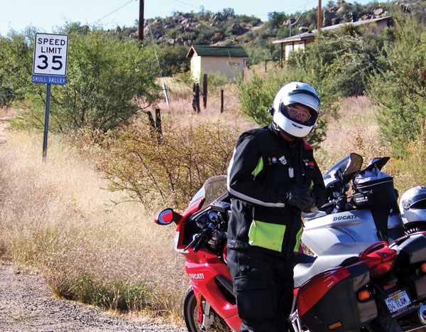
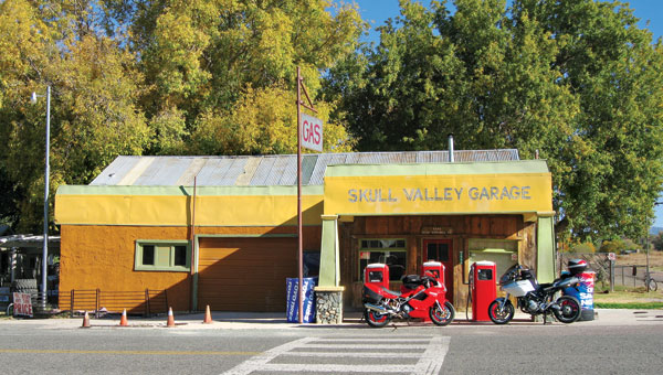
On our last day, we side-trip off SR 89 below Prescott and follow South Iron Springs Road into Skull Valley. Who could pass up a trip through an area with that name? Stopping at a tiny outpost store for a photo op, we happily buy jacket pins. The name came from settlers who discovered bones left to dry in the hot sun, the remains from a dispute among warring tribes. Grim then, but fairly colorful now.
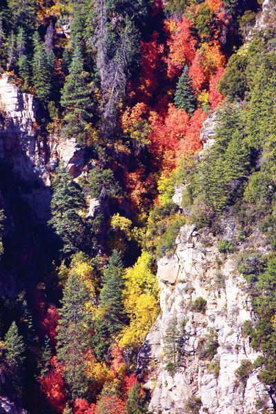
Soon enough, we hit the superslab and drone numbly back to the coast. Arizona in autumn is a delight for motorcycle touring. The weather has lost much of its scorching heat and the fall colors cloak the aspen trees with a bright brassy yellow. Off the main highway, the folks are friendly, the food is homey, and the asphalt is clean and dry. It’s only a day’s ride from the California coast and a world away. Go ride it.


 | Ep. 69 Rider Magazine Insider Podcast")

