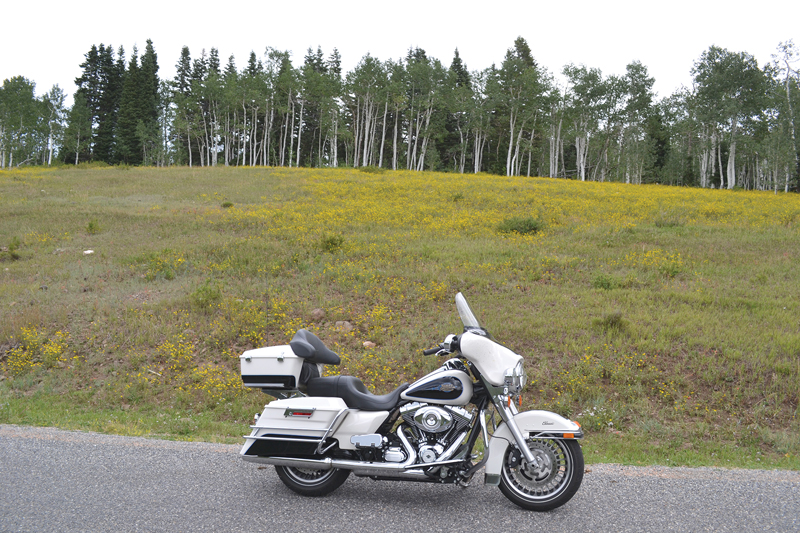
Some of the best roads I’ve ridden were discovered by accident. The Nebo Loop in Utah is a good example. I found it a few years ago during a long-haul pass on Interstate 15, heading back to Southern California. Thankfully, there was no pressing reason to get home, allowing me an impromptu visit to a Harley-Davidson dealership in Lindon, Utah, that I had heard good things about.
Timpanogos Harley-Davidson occupies a 58,000-square-foot building made from reclaimed materials harvested from the remains of the Geneva Steel plant, a World War II-era steel mill that once stood right across the street. Once the largest steel mill west of the Mississippi, it shut down for good near the start of the new millennium, and shortly after that a small consortium of investors moved in to resurrect the building as the family-oriented Harley dealership it is today.
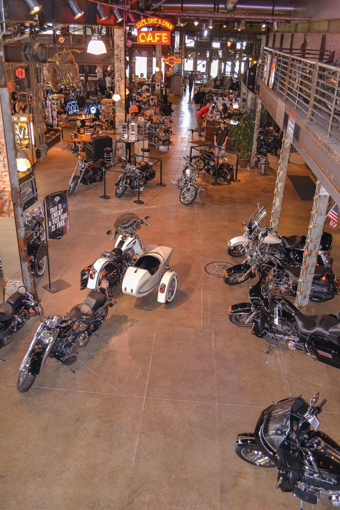
Beyond its unique architecture, Timpanogos H-D includes an on-site restaurant and a random display of vintage motorcycles scattered about the two-story structure. While I was viewing the bikes another visitor struck up a conversation with me, and when he learned I was just passing through town, he mentioned that the northern terminus of the Nebo Loop was only a few miles farther south, off I-15 in the town of Payson. The 38-mile detour, he told me, offered scenic views and smooth, gentle curves. It sounded promising, so I took his advice to ride it.
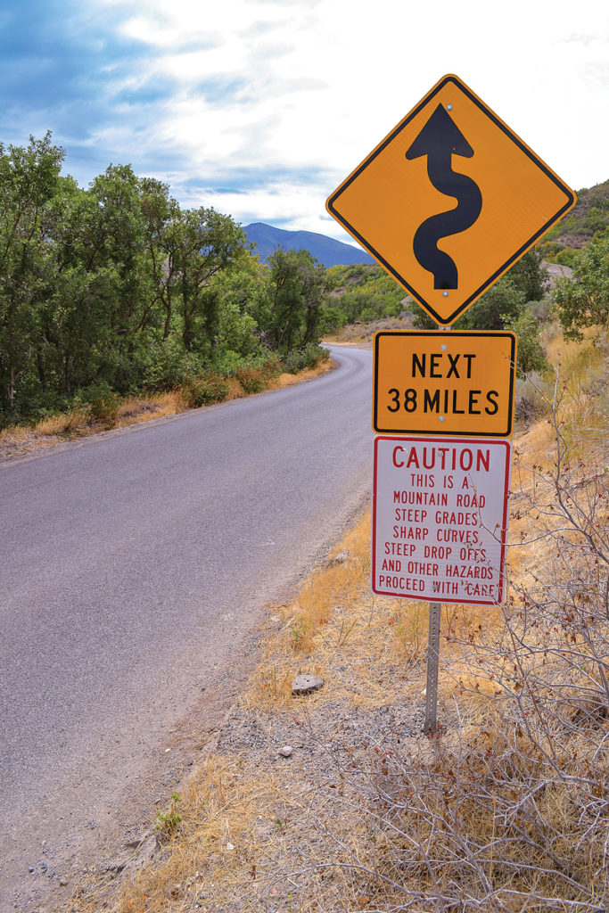
After leaving I-15 at exit 250, I turned left onto Main Street (also known as State Route 77), taking that a few blocks before turning left onto 100 North (State Route 198, and you’ll actually be heading east!) to 600 East, which takes you south and eventually to Nebo Loop Road. Sounds confusing and contradictory, I know, but trust me, it’s an easy route to follow and the yellow road sign indicating curves for the next 38 miles confirms that you’re on the Nebo Loop.
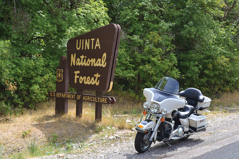
The road is listed as an official National Scenic Byway that extends through the Uinta National Forest. The Nebo Loop eventually terminates at State Route 132 just east of the town of Nephi and I-15, so it’s Interstate close at both ends. More to the point, by the time you finish you’ll have ridden through a variety of elevation changes and ecosystems, not to mention soaking in some unforgettable panoramic vistas, among them a splendid view of Mount Nebo itself. At 11,933 feet it’s the highest peak in the Wasatch Mountains. Mormons who settled the region in the 19th century named the imposing summit after the mountain from which Moses viewed the Promised Land.
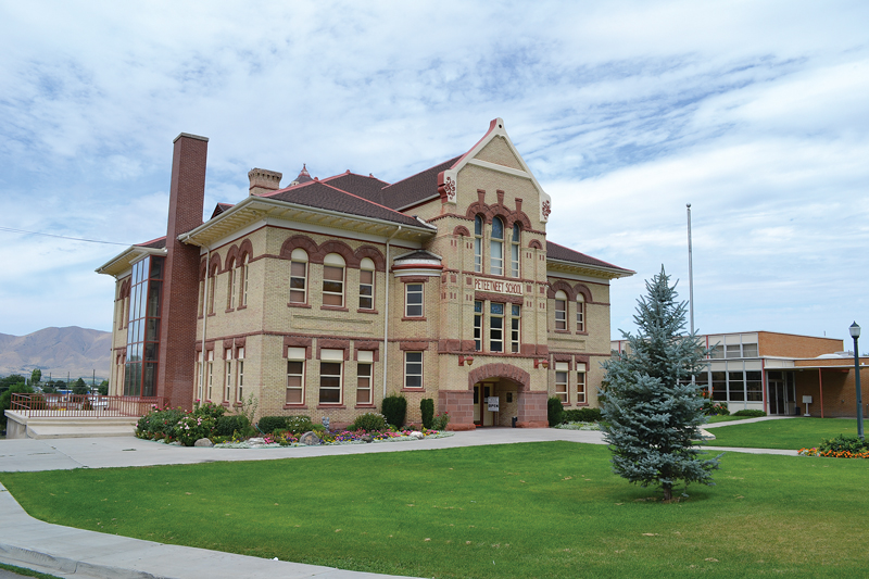
If historic landmarks interest you, there’s a stop worth making just before you begin the ride in Payson. It’s the Peteetneet School, built in 1901 of wood from local forests and red sandstone quarried at nearby Spanish Fork Canyon. The imposing three-story structure has since been converted to a museum and cultural arts center and classes are now held in a more modern structure, but the century-old school’s Victorian-Romanesque architecture remains for visitors to enjoy today.
The city of Payson (population slightly less than 20,000) is at about 4,700 feet elevation; Nephi (population 5,400) sits at about 5,200 feet above sea level, and the Nebo Loop reaches a height of about 9,400 feet so you’ll be climbing and descending regardless of which direction you ride. The landscape at the north end where I entered the Loop is lush with oak trees. The road follows a stream that offers picturesque views similar to places you might find east of the Mississippi River. I stopped one time to inspect an old flood-control dam that diverts water. The road also offers views of stone embankments that shield it from erosion during spring thaws, and there’s plenty of regional flora and fauna to remind you that there’s an abundance of rainfall here.
As the elevation changes leading to higher country, the oak trees give way to pine and other evergreens, until eventually you reach the white birch that shares the landscape with small meadows bursting with colorful wildflowers. If your favorite color is yellow, then you’ll especially appreciate this part of the ride. As you can imagine, early autumn on the Loop offers a passel of colors that mimic the shades of New England.
There’s also plenty of interesting scenery to view from the roadside turnouts along the way. Early on you’ll see Payson Lakes, three lakes (McClelland Lake, Box Lake and Big East Lake) that are ideal stops for picnics, swimming and fishing. Paved nature trails nearby let you enjoy a leisurely stroll if you care to stretch your legs.
Other roadside turnouts offer spectacular views of Utah Lake, Bald Mountain and eventually Mount Nebo itself. There’s also a stop for Devil’s Kitchen, where deep red-colored rocks have eroded into sharp pinnacles, which is why locals call this the mini-Bryce Canyon.
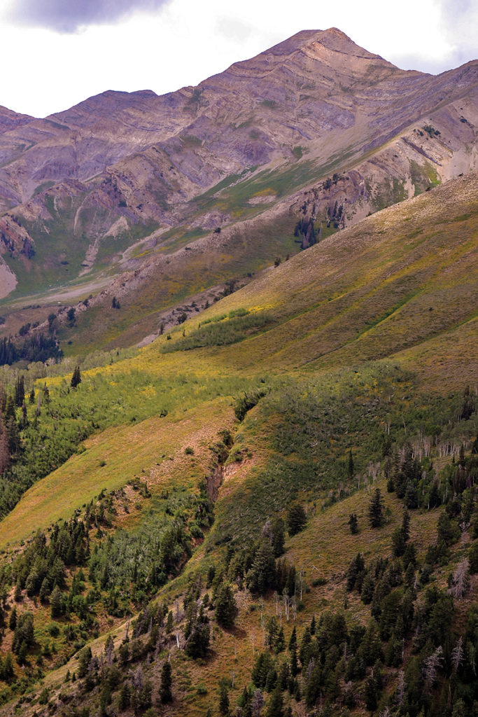
Eventually you’ll hit the timberline, the high point where no trees or major shrubs grow. Throughout your journey to the summit, you’ll enjoy twists and turns in the road. Be careful, though, because the route includes blind corners, so you won’t see traffic coming from the other direction until the last second. You’ll also want to watch for wild game crossing the road, and another kind of moving target—range cattle. Several times I stopped or slowed to a crawl while my split-hoofed bovine companions walked lazily from one side of the road to the other.
Wildlife abounds in the area, too, and I had my first encounter when a doe and her two fawns grazing along the road spotted me as I rounded the bend. About a mile or so later another wild animal crossed the road about 200 yards ahead of me. I didn’t get a good look, but I’m pretty certain it was a coyote. Sorry, no roadrunner, though.
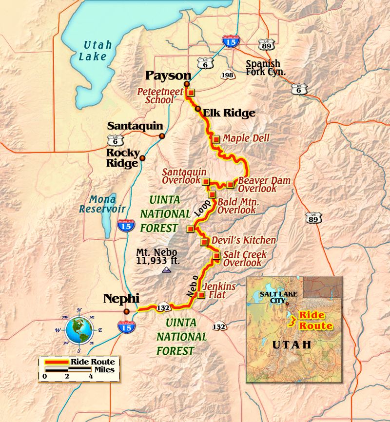
Descending toward State Route 132 reminds you just how varied Utah’s landscape can be. Despite the high elevation, the landscape becomes more arid than what you experienced along most of the Loop. When you arrive at Route 132, you can turn left (southeast) to join U.S. Route 89 (another scenic drive that leads to Bryce Canyon and Zion National Parks), or do as I did, turn right (west) for the short drive into Nephi where I picked up I-15 for the rest of my ride home. My original plan was to visit Bryce and Zion, but rainstorms prompted me to stick to the super slab the rest of the way home. The 38 miles I experienced on the Nebo Loop, though, served as a worthy substitute. And there’s always the next ride!
For more information, visit:
Timpanogos Harley-Davidson, Lindon, Utah
timpharley.com
Peteetneet School, Museum & Cultural Arts Center, Payson, Utah
peteetneetmuseum.org
Nebo Loop, Payson-Nephi, Utah
visitutah.com





Excellent write up