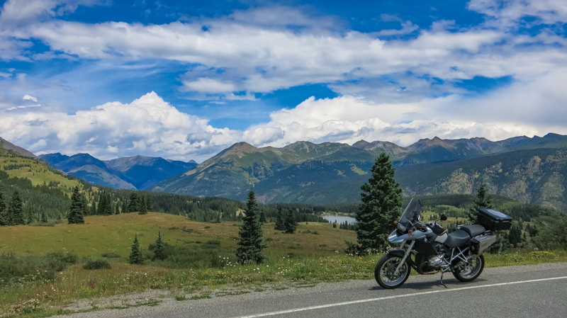
You’d be hard pressed to find two more picturesque towns anywhere in the Southwest than Durango and Pagosa Springs, Colorado. These southern Colorado hamlets are only 60 miles apart, a distance that can be spanned in a little more than an hour. But what’s the fun in that? Motorcyclists are known for seeking routes that combine curves, views and intrigue, even if those paths take us well out of our way. Here is a look at an amazing, albeit indirect route between the two cities.
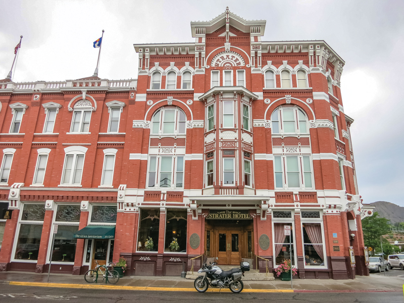
Our starting point, Durango, Colorado, is a magnetic mecca for tourists, active sports enthusiasts, history buffs and motorcyclists. Flanking the beautiful Animas River, the historic mining and railroad town harkens back to the Old West while embracing all that is new and vibrant. There is an impressive variety of lodging and dining options, but be forewarned, mountain chic does not come cheap in this popular destination. One hotel that is worth the splurge, in my opinion, is the historic Strater Hotel. The Main Avenue landmark offers rooms in comfortable classic style in a great location for exploring the town.
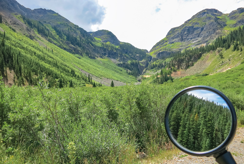
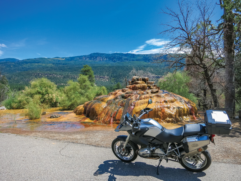
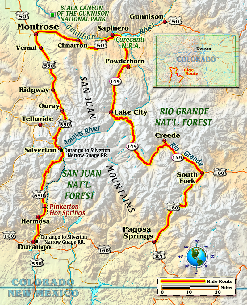
Let’s get to that circuitous route. Pagosa Springs is due east from Durango, but that’s not my path. One of the most amazing roads in the country is U.S. Route 550 north of Durango. The highway climbs into the Rocky Mountains almost immediately after leaving the Durango city limits. I settle into that wonderful rhythm of the road as the curves unfold before me. Then comes my first unplanned stop. A multi-hued gurgling mound of minerals catches my eye beside the road. It’s a spout of the Pinkerton Hot Springs. It looks like something from the overactive imagination of a Disneyland sculptor, but it’s all natural in its sunset palate of colors.
Back on U.S. 550, I continue my climb into the “American Alps.” Not only is the immediate road amazingly twisty, but the emerging peaks on the horizon deliver a promise that there are miles more of the same to come. Mountain passes, dense forests, viewpoints and historic mining structures abound on the ascent. After several stops to just look and breathe, I crest a mountain pass and head down toward another historic town. Silverton sits nestled in a nook in the Rockies and the highway affords a great bird’s-eye perspective of the quaint village. It is with anticipation that I carve the descent to the town.
Silverton is a smaller and less commercialized version of Durango. Interestingly, the two towns are not only linked by the fantastic road that I just traveled, but also a scenic narrow-gauge railroad run. Silverton’s historic buildings and rugged mountain backdrop are well worth my stop.
The next leg on my elongated path to Pagosa Springs is on the section of U.S. 550 known as the Million Dollar Highway. This road from Silverton to Ouray is awe-inspiring, historically significant and more than a little dangerous. As I descend into the valley cradling Ouray, the danger for me is that the views are so astounding that remaining focused on the road is a challenge. My suggestion to all is to slow way down on this narrow stretch of mountainside hairpins and stop often to take in the scenery.
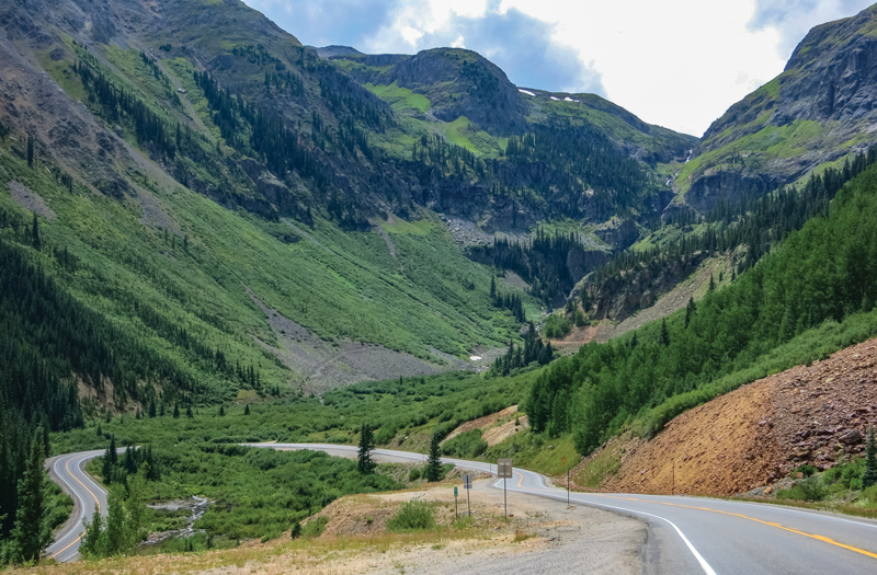
The town of Ouray is another must-stop location, as numerous dining, shopping and sightseeing opportunities are at hand. After the stop, I continue my ride north on U.S. 550. On this stretch, there is a junction with State Highway 62. This is where most motorcyclists take a turn to the left to complete that great ride back south through Telluride. However, that’s not my plan, so I continue north. There will be a great payoff later.
At Montrose, I turn to the east on U.S. Route 50. The road bisects a high plateau region that combines great open views with sweeping corners and open-the-throttle straights. On U.S. 50, I ride through high chaparral vistas and ultimately beside the Gunnison River and the Blue Mesa Reservoir.
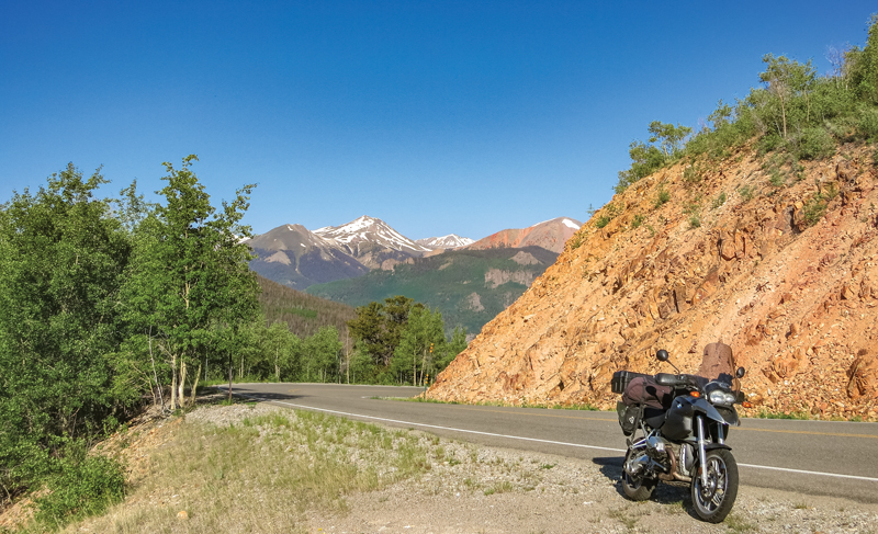
Heading south over the Gunnison River onto State Highway 149, also known as Silver Thread Scenic Byway, I am aware that I am about to embark on the “road less traveled.” Unlike the Million Dollar Highway, this is not one of the famous rides in southern Colorado. I think it should be. My map indicates that Highway 149 follows the Continental Divide closely and is replete with copious curvature. The reality of the road does not disappoint.
Because this highway is devoid of intersections and cross highways and is off the beaten path, traffic is light. In fact, in my hours on Highway 149, I see maybe a dozen other vehicles. It’s not just the light traffic that makes this road a motorcyclist’s dream. There are two 11,000-foot mountain passes in the road’s span and seemingly hundreds of thrilling turns.
An added bonus in seeking out this road less traveled is finding great little towns. One is Lake City, which flanks Highway 149 on both sides of the road. Its historic buildings and boardwalks are a delight. Another gem of a town, Creede, is a rough-around-the-edges, eclectic and fully enjoyable place. The town seems to be carved into a side canyon and is rich with unique and colorful structures and residents. It’s an isolated but vibrant historic setting. As soon as I pull out of Creede I know I will return for a longer visit. It’s that kind of place.
The last leg of this long and wonderful route to Pagosa Springs includes the rest of Highway 149, which follows the Rio Grande for several miles. At South Fork, I make the southwestern turn onto U.S. Route 160, which features the famous Wolf Creek Pass in the middle of the beautiful San Juan Mountains.
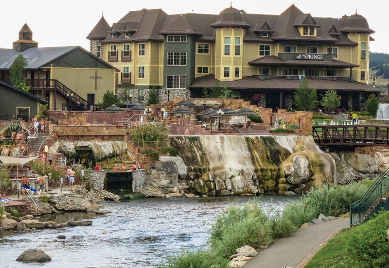
The end game of this spectacularly indirect route is Pagosa Springs. The city clings to and seemingly derives its life from the cool waters of the San Juan River. What strikes me most is how the town teems with life. Bicyclists, hikers, kayakers and motorcyclists are everywhere.
So there you have it, the long road from Durango to Pagosa Springs. Due to elevation, this is clearly a late spring through early fall ride. Yes, it’s miles out of the way…and worth every one of them.


Yup, that is one of the best rides! Done it half a dozen times. Next time, ride on through Pagosa Springs to Chromo, CO then on to Chama, NM. From Chama ride south to Tierra Amarrilla, then catch Hiway 64 to Tres Piedres. From there, North to Antonito, CO (plan accordingly though as there are six places to buy pot in Antonito, but you can’t buy gas there anymore!) From Antonito, ride south over LaManga Pass and Cumbres Pass back to Chama, NM. Another GREAT ride.
We’re planning on checking out that ride late this summer. Can’t wait!
We never get tired of riding gorgeous CO! Suggest you stay in Gunnison and do a few “circle” rides, like spokes on a wheel…make sure to bring your rain gear, as often t storms happen in the afternoon.
One of the best stops is in Montrose Co. One of the best stays in Montrose is the Briarwood Inns they cater to Bikers and also have a free Motorcycle washing station. Eleven miles down the road is the Black Canyon well worth the stop!
Don’t forget to add a few days to your trip while in the area. You won’t be sorry. Ride the Black Canyon of the Gunnison before you head south on 149 off US50. Head north/left a short distance east of Montrose off US50 and loop around. You’ll be back on US50 then head east and pick up 149 south. The loop from Durango to Telluride is not to be missed either! If you do the Million Dollare highway first and think you’re in heaven you are not YET. Awe inspiring. Two very amazing rides you’ll not forget in your lifetime.
While I am not a biker, I am looking for a different route from Durango, and north.
Your wonderful description of the Durago/Pagosa Springs/ Montrose route has been most helpful.
The Pinkerton Hot Springs photo was great; something I missed on our last drive.
Thanks for your input.
How long did this route take you? Our group might do a CO trip next year. Loved your input!!