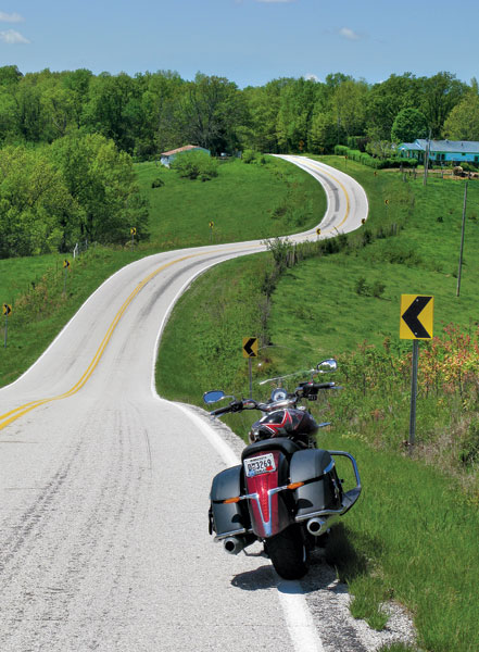
The day could not have been more beautiful. The world was fresh, sparkling, sunlit; the sky a robin’s egg blue, flowers of all colors popping out, cows contentedly grazing on the greenest of grasses in the fields, the occasional faded-red barn a reminder that people had been around here for a lot of generations. The two-lane road was freshly washed, curving left, curving right, over a rise, into a valley, never straight, going on and on through the never-ending hills and dales.
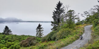
A sign indicated the turn to Beaver, Arkansas, AR 187. Having long heard of the single-lane suspension bridge with a wooden deck that spans 500 feet over the White River at Beaver, here was my chance to ride across it. As I rode into the woods, weaving and leaning, a pair of horses looked up as I passed by. Going down a hill into the river’s valley, I caught a glimpse of the bridge’s towers through the thick trees, but no more than a quick look.
At the bottom of the hill was a trifling sawhorse barricade with a large ROAD CLOSED AHEAD sign. The water covered the asphalt a few feet farther on, and I could not see the bridge for the woods. A fellow walking his dog said the bridge was closed three days ago, when the river, having risen many feet above normal, covered the roadway.
“Should be open in less than a week…if it doesn’t rain too much. We’re expecting a couple more inches this weekend. Bridge flooded back in 2008, but they fixed it up.”
Welcome to a very wet April in the Ozark Mountains, with rivers and lakes cresting higher than ever before, and engineers checking all the dams along the White River. That river, the biggest in the Ozark region, runs over 700 miles from the Boston Mountains (part of the Ozarks) in northwest Arkansas, loops through southwest Missouri, and then flows southeast to meet with the Mississippi River. Back a century ago the process of damming the river began, eventually creating a system of six lakes, used for hydroelectric power, flood control and recreation.
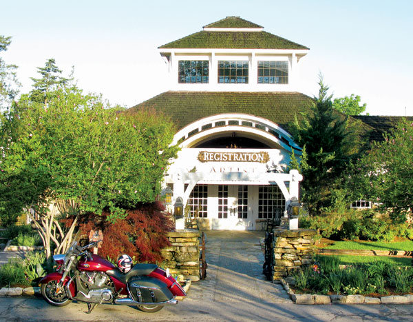
I was staying on one of the lakes, Table Rock, at the Big Cedar Lodge, a sprawling 800-acre resort between the two most popular tourist destinations in the Ozarks: Branson, Missouri, and Eureka Springs, Arkansas. The owner of Big Cedar, who also owns 50-some Bass Pro shops that are dedicated to the outdoor life, thought that motorcyclists would enjoy the place, use it as a base and take day trips through the surrounding countryside. I was invited to fly out and have a three-day, four-night look-see, and the Victory dealer in Springfield, Missouri, would provide me with a Cross Roads model.
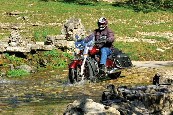
The day before my departure from California the weather forecast for southwest Missouri was less than perfect, but with the fly-or-die tickets that airlines now use I packed my raingear and headed east. I picked up the Cross Roads on an overcast day; the deep red color still stood out, and the simplicity of the windscreen and saddlebags makes it a good choice among cruiser-tourers. The dealership had picked up a certain notoriety when the owners offered a Smith & Wesson .38 with the purchase of any model in the Victory Motorcycles lineup. When I asked if the loan of a revolver was included, Nan (half-owner along with her husband, Tim) said I would need a carrying permit, and that might take a little time. But not to worry, as the Victory could easily outrun any wild pig that might take a disliking to me.
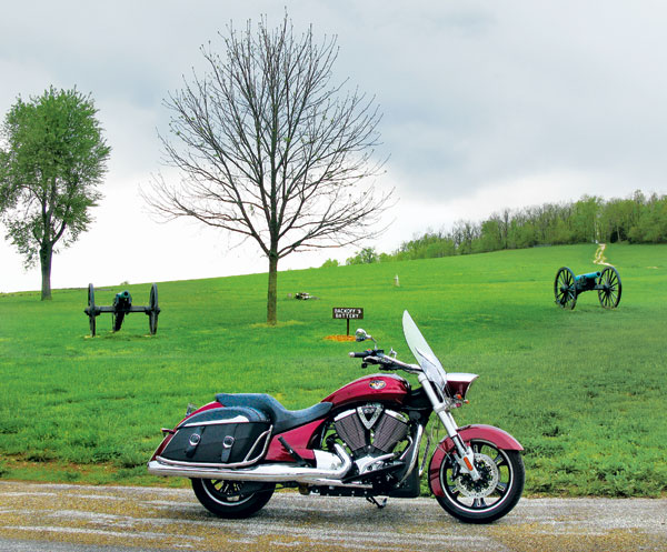
Being a minor Civil War buff I rolled southwest of the field of springs to take a look at the Wilson’s Creek National Battlefield, where a five-mile-loop ride effectively shows how the battle progressed. Few Americans know that Missouri was one of the most fought-over states in that conflict, and Wilson’s Creek was the second major battle of that war, taking place in early August of 1861. Some 18,000 soldiers were involved, and while it was the Union troops who withdrew from the bloody scene, the damage inflicted on the Confederates made sure that Missouri stayed in the Union. I, for one, am glad the Union was preserved.
From the park I headed down toward Branson—but the back way. The Victory Cross Roads is an exceptionally good back-roads cruiser, with that torquey (close to 100 lb-ft) 106ci engine and a commendable chassis. Despite having a long wheelbase, almost 66 inches, it handles quite well; only drawback was doing a U-turn on a narrow two-laner, which could require a little backing up. The bike also has good cornering clearance, and in the Ozarks one does a lot of leaning; with the air-shocks pumped up to 15 psi nothing was scraping.
The afternoon sun was glimmering through the clouds, and I felt that if by keeping that muted golden orb on my right eventually I would get to where I wanted to be. However, at a crossroads church near a place called Jamesville I considered myself sufficiently lost to take a break and bring out a map. I couldn’t find Jamesville on the map; a passing vehicle stopped and the driver asked if I needed any help.
“Need to get to Branson,” I said.
“Well, if you go down thataway,” pointing, “in less’n a mile you wanna turn left, and you’ll be in Branson in 20, 30 minutes. But don’t think you can go thataway ’cause the road’s probably under water. You’d have to go back to Nixa and turn right.”
Which I did.
My Big Cedar digs were quite rustically luxurious, being in a log cabin above the lake. All the makings for a fire in the big stone fireplace were there, but the weather was too warm to justify the blaze. Next day was wet. I was supposed to find out how to catch bass in the morning, but Table Rock Lake was too full of floating debris for that. And in the afternoon a lesson in fly-casting was in order, but the Dogwood Canyon location was flooded out.
Time to ride. Putting on my slicks, the Victory and I headed west along MO 86, crossing a long bridge over Long Arm Creek. The girder bridge was built slightly downhill, about 10 feet above the water at the east end, with the water almost lapping the pavement at the west. An official-looking type was standing by the side of the road, and I asked him what happens when the water goes over the bridge.
“We close it,” he said.
“And if I have to get back to Big Cedar?” I asked.
“Long trip. The Kimberling bridge (MO 13) is already closed, so you’d have to go via Shell Knob (MO 39).”
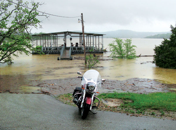
Discretion being better than foolishness, I went back over the bridge and decided to continue along under the light rain to cruise around Branson. Thought I’d have a look at where I was supposed to eat that night, and found the floating restaurant about 40 feet from shore on Lake Taneycomo (aka White River); obviously there would be a change in plans. The rain turned heavy, so I went into the cavernous Bass Pro store close by—and was told by the staff that this was the smallest of all the shops—the biggest was in Springfield at close to 400,000 square feet.
The rain almost stopped after an hour, and I went to take a look at the Table Rock dam. Water was gushing over the spillways, as the lake’s level was too high for comfort, but this meant that houses along the White River were being flooded. Painful, but better than a burst dam.
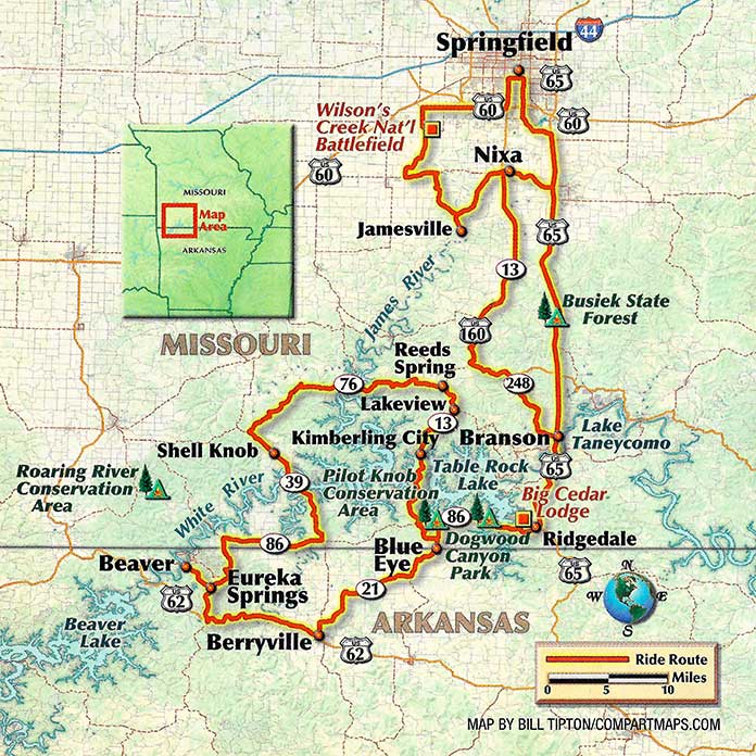
Next morning broke sunny and clear, and I was on my way by 7:30, heading for Eureka Springs down into Arkansas. Blissful. I rode out to Blue Eye, and then southwest on AR 21 over endless rolling hills. The Ozarks cover the southern half of Missouri and the northwest part of Arkansas, about 50,000 square miles. Three-quarters of the area is still heavily wooded, with occasional farms and fields carved out of the dense trees, oak and hickory, juniper and pine. One of the earliest industries in the area was log mills, with the mill-owner building a small dam on a tributary, and running the water through a sluice to power a turbine; this was much more efficient than the old-fashioned waterwheel.
I was only going to get a gander at a small part of the Ozarks, but still have some great riding. The single big road in this neck of the woods is U.S. 65, running from Springfield south to Harrison, Arkansas; not interesting. I stayed on the two-laners, angling down to Berryville, a Carroll County seat (one of two) with some 5,000 residents. The traditional town square features “The Original Ozark Café”—you have a name to be proud of, use it. Two small manufacturing companies build handguns there.
From there a dozen miles on U.S. 62 got me to Eureka Springs, and AR 23 going south—known as the Pig Trail Scenic Byway. I imagine it is a great ride, but that would have to wait until next time. One curiosity about Eureka Springs is that it is the second seat in Carroll County; I have never come across that before, twin seats. The town is definitely a place that any motorcyclist would love to see, as long as the rider is adept at handling sharp uphill turns.
Long ago the Native Americans knew of the healing quality of the warm springs in the area, and would camp in the locale. Then the palefaces came along and decided this could be a moneymaker. First promoted as a health resort in the 1850s, when folk had to travel by horse or horse-drawn vehicles, the Civil War put a temporary stop to all this vacationing nonsense. Things really started happening in 1879 when the town’s bottled water became a hit among the health lovers. The Eureka Springs & North Arkansas Railroad was completed in the early 1880s, and now the genteel folk could travel in relative luxury, and spend some money.
The old town was built on a very steep hill, and the roads are narrow and twisty. Big hotels were constructed, which are still standing. In the heart of “downtown” is the eight-story Basin Park Hotel, and the hill allows for outside entry on each of the eight floors. As I said, steep. The town prospered as a health spa until the arrival of the Great Depression back in the 1930s. The economy was pretty weak for the next couple of decades, but in the 1960s the place become a significant “tourist destination,” with folk flocking in all year-round.
When I stopped at the chamber of commerce to get a little information on the place, an attractive young woman who was dressed in Victorian finery introduced herself as Miss Chastity Decorum and asked if I would like to go on a tour of the town. In a van, not with a horse and carriage, as the paved streets were just too steep for a horse’s hooves to get any grip. Unfortunately, it was a two-hour trip, and time was a’wastin’.
Then it was off on the northern half of AR 23 to get to Beaver Bridge. Failing that, it was back to the turn and then north toward Table Rock Lake. Most of the lake is surrounded by the Mark Twain National Forest, which serves as a great watershed, with lots of landholdings grandfathered in. The lake is not a great big round of water, as some might expect a lake to be, but has dozens of little arms going off into the valleys between the hills, so the bridges are maybe a half-mile long at most. I crossed the lake on MO 39, then headed east along the north side on MO 76 to Lakeview, then down to Kimberling City where the bridge was now open.
Great ride, and a great last meal at the Big Cedar, with steak, corn on the cob, salad and a blackberry cobbler; I ate well in the Ozarks.
A last peaceful night before turning the bike back in the next morning, and then the inevitable airline screw-ups. But the Ozarks were worth it.
For more information on Big Cedar Lodge, visit their website.




I hope Clem got to do the lower part of 23 at some later date. One of the nicest roads I’ve ever been on. Great road all the way down to I-40. Like a roller coaster, with banked curves, and canopies of trees all along it. I saw maybe two cars coming the other way, snd an old hound dog luxuriating just around a turn, right on the middle of the road. Looks like he’s there all the time. Rode right up to him, and he just rolled a sleepy eye up as if to say: I’m ok, carry on! LOL
I can’t believe you did not ride on the Pig Trail !