photography by the author, Larry Kahn and Bob Reichenberg
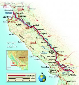
Rivers are good; if there is one commodity more important than oil, it is water. The Salinas River provides a goodly deal of H2O as it moves from its source in Garcia Mountain flowing north 150-odd miles to the Monterey Bay; that is quite unusual, flowing north in California. It is a middling-sized river, quite shallow, with at least half of it running underground during the dry season, the riverbed dry, but water flowing a few feet below the surface.
The river is not navigable, never a romantic stretch of water like the Mighty Miss with steamboats paddling along. But cruising alongside the river on the parallel roads is fun, crossing over the 30-odd bridges, and even a few curves can be found.
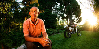
I live close to the south end of the river, about 35 miles from the source. The name of my town is Atascadero, from the Spanish verb atascar meaning “to get bogged down.” Back 100 and more years ago ranchers on the east side of the river would use this place as a crossing point for their wagons, and sometimes got stuck. In 1913 an early property developer decided to build a “planned community” here, since there was good water, and asked what the place was called. When told “atascadero” he thought it sounded like a respectable name, never bothering to find out what it meant.
This river begins at the very southeast end of the Santa Lucia Range, the low mountains of which run along the Pacific coast from a little south of the Monterey Peninsula down past Morro Bay, curving inland past San Luis Obispo. The headwaters trickle out of a spring in the Garcia Wilderness at less than 1,400 feet above sea level, which means the average drop over the 150 miles is about 9 feet a mile, though it is hard to tell that sometimes.
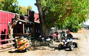
Goldie and I ride out past the Pozo Saloon, once a stage stop on the route from San Luis Obispo to Bakersfield, now a weekend gathering place for motorcyclists of all persuasions, from dirt riders to sportbikers. About six miles beyond Pozo, heading in the direction of the Garcia Wilderness, the paved San Jose Avenalas Road ends at a locked gate with large NO TRESPASSING signs. Being a law-abiding man, I turn around, head back to Pozo for a sarsaparilla—the old name for root beer.
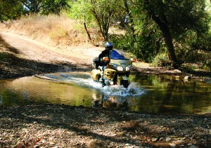
Opposite Pozo I could take the Hi Mountain Road, a rough dirt stretch that goes south, up and over the Santa Lucia mountains—not good Gold Wing country. I do go as far as the shallow ford across the Salinas River, the first official crossing; we splash through, just for the camera.
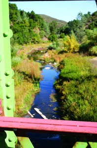
A couple of miles west of Pozo, on Pozo Road, is the first bridge over the river, a very nondescript concrete affair. Then it’s past Santa Margarita Lake, which was created by the only dam on the river, and a turn onto Las Pilitas Road, where one of the original girder bridges still spans the water. A new, boring bridge was put in about a hundred feet upriver, but the scenic 1917 girder was left standing for bicyclists and equestrians; very decent of the bureaucrats not to tear it down.
The river flows beneath another paired bridging, old girder/new concrete, as it passes under CA 58. However, Goldie and I have to go to Santa Margarita, an old railroad town, in order to get on El Camino Real (The Royal Road) to stay alongside the river. The fancifully named road is just a vague approximation of where Johnny De Anza walked as he traveled overland, the first European to do so, from San Luis Obispo to Monterey back in 1776. We cross over a railroad track—which added a new dimension to the river. The Southern Pacific Railroad began laying track in the valley in the 1870s, going south from San Jose, tying up with the line that went north to San Luis Obispo in 1886. This meant that valley people could ship their goods to market easily. The road we are on was originally constructed around 1915, when the internal-combustion engine was taking over from horse-drawn wagons, and has undergone many changes since.
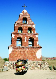
The main highway, U.S. 101, is on the west side of the river in these parts, going past Atascadero, Templeton and Paso Robles—that last is now a center of California’s wine world, competing with Napa Valley. Ten miles north is San Miguel, site of a splendid mission and church built in 1797 called St. Michael the Archangel. That “arc” or arch means St. Mike was the highest form of angel. The Franciscans saw this fertile valley as a good place to grow sacramental wine as well as recruit converts, and decided to overwhelm them with architectural shock and awe. For a native who had been living in rather crude wickiups all his life, to see this huge construction would indeed have made him, or her, question natural selection. Unfortunately a serious 6.5-temblor damaged the high-ceilinged church in 2003, and it is currently closed while getting earthquake-proofed.
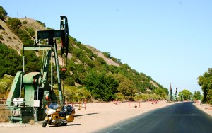
U.S. 101 runs past Camp Roberts, a World War II training center still in use today for National Guardsmen and Reserves preparing to go to the Middle East. Just past Roberts a sign reads BRADLEY, with an exit, and here the old two-lane U.S. 101 crosses a bridge built in 1940 and runs on the east side of the river, the newer four-lane freeway on the west side. Stay east. Not much in Bradley, except an old gas station that closed down when Mobil regular cost 37.9 cents a gallon, the new highway bypassing the town 40 years ago. Another elderly bridge crosses back over to the west side, requiring that I get on the new 101, and along here the valley narrows considerably, down to a few hundred yards. The small oilfield of San Ardo comes into view, pump-jacks pumping away. Goldie relates to this place. The field was developed in the early 1950s and pumps about 7,000 barrels a day—at 60 bucks a barrel that is no mean sum of money.
Thought for the day: Since a person can live a long life without oil, but only five days without water, why isn’t water worth $60 a barrel?
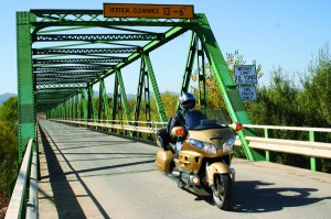
Just beyond the small town of San Ardo U.S. 101 crosses the river on a broad, four-lane bridge—with the old one-way 1920’s girder bridge still in view a half-mile downstream. The trellislike girder construction is still in use, but mainly by farm vehicles going to the fields and by motorcycles escaping the freeway. Next stop is King City, not named for any royalty, but some farmer named Charlie King; it got incorporated in 1886. This is where the real agricultural kingdom starts, with the valley being wide, fields of wine grapes and cabbage as far as the eye can see. This is corporate ag, not family farming.
At King City I get off the freeway and head onto Metz Road (aka County Road G15) which runs along the east edge of the valley on the slopes of the Gabilan Range. When the valley used to flood this road was always OK, and today it is a great deal of fun to ride, waltzing along the hillside. It ends in the town of Soledad, and here the trick is to go over to the west side of the river to the Mission Nuestra Señora de la Soledad (Our Lady of Solitude), which was established in 1791 but was never very successful. Nothing grand was ever built like in San Miguel, and after the secularization of church property by the Mexicans following the expulsion of the Spanish, the place became a shambles and some local honcho took all the roof tiles off the mission, leaving the adobe walls to melt under the rains. However, new buildings were built in the 1950s, the place made to look as it might have in 1800. The mission is less than 30 miles from the Bay of Monterey, and this stretch is the most heavily cultivated in the United States—The Salad Bowl of the World, locals like to promote it. Though recent scoffs have renamed it as E. coli Capital.
When the Americans took over California in 1848, the grass-covered Salinas Valley was considered a cattle-raising paradise, and cow hides were called “California dollars.” Droughts and floods occurred every few years, which the locals learned to live with. Then along came the railroad in the 1870s, and field crops like wheat and barley could be grown and harvested, then trained to San Francisco. In the 1890s irrigation engineers went to work to try to ensure that there would always be enough water, and pretty soon this valley saw hundreds of square miles of row crops, from sugar beets to potatoes.
Back in 1770 the Spanish sailed into Monterey Bay, setting up a small garrison and building a mission on the Monterey peninsula, and anybody walking up the beach a few miles would have come across the mouth of this river. Salt marshes (salinas in Spanish) went inland a few miles, preventing any use by even small boats, so it was not of much interest except as a source of pasturage and fresh water. However, after the irrigation projects were built the valley took on a whole new life, and Salinas City became a burgeoning farming center and seat of Monterey County. This was the 1914 scene set by John Steinbeck in his rather grim book, East of Eden—which did not exactly endear him to the locals. However, time heals all wounds, it is said, and Salinas now has the Steinbeck Center, dedicated to its most famous son.
With improved irrigation techniques the salt marshes got flushed, and fertile land is found all the way to the dunes on the beach. Pass by Castroville, Artichoke Capital of the World, and we should not forget that Marilyn Monroe was crowned the Artichoke Queen back in 1948.
By the end of the 19th century so much water was being used in agriculture that very little found its way to the ocean. Then in 1906, as a side effect of the great San Francisco earthquake, Mother Nature played a little trick and caused a ripple to form along the length of the beach, diverting the remaining water of the Salinas River about four miles north to the Elkhorn Slough, better known as Moss Landing. Today, as the river approaches the beach, it has formed a lagoon and is a wildlife sanctuary, though during the winter storms the river can create enough force and flow to push through the dunes and temporarily back out to the ocean.
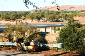
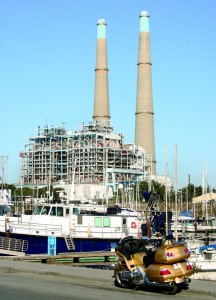
We cross the Moss Landing-bound trickle and park at the Salinas River State Beach, and while Goldie rests I climb the dunes to look out over the bay; Japan is somewhere over the horizon. To my right, over the fields of artichokes, is Moss Landing, where a small fishing fleet harbors, backdropped by a gigantic natural gas-fired powerplant. The church of San Miguel Archangel was a lot more attractive.
[From the February 2007 issue of Rider]
 |
 |


