Who in their right mind would trust a bony New Englander about Southern barbecue? Well, if you were right in your mind you’d be reading National Geographic, so it’s OK, you can trust me. I’ve traveled on motorcycles from Cape Breton to Georgia, so you might also trust me about roads to ride.
With me so far? Head for Franklin, North Carolina. Franklin (population 3,300) is the self-described Gem Capital of the World, owing to the rubies and sapphires found in the area’s mountainside mines. Precious stones not your thing? There are gems for motorcyclists, too. Snaking over, around and sometimes through the mountains surrounding Franklin are asphalt shrines to civil engineering. You won’t find better riding in the East.
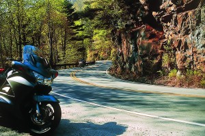
For its size, Franklin is also a prime source of my preferred heart-attack-on-a-plate: barbecue baby back ribs. Kansas City may be the Barbecue Capital of the World, but the Gem Capital trumps KC’s roads any day.
Conveniently, Franklin is also home to my Aunt Muriel, whose newly built digs offer mountain views and a gateway to the region’s roads. With Franklin as hub, my buddy Jim and I explore the region’s byways and rib joints.
To gain local insight, we meet Muriel’s friend Paul, who points out roads he’d ride if he still had a motorcycle. As we consider his road maps (including one in topographic 3D), Paul shuffles through old photographs. There’s his Honda 750 Four, long since sold, and the V65 Magna, his last mount. He’s taken by my ST1300 ABS, fresh from its break-in service.
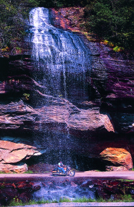
On Paul’s advice, we start south on North Carolina 28. Winding along the Little Tennessee River, the new ST begins to reveal its character. Fuel-injection gives instant throttle response, so there’s a learning curve to dial in smooth revs. The linked binders allow easily controlled throttle-on speed in the twisties.
The intense curves of NC 28 lead to High-lands, a well-to-do hill town with arty shops, galleries and restaurants. Bar Harbor meets Key West in the mountains. For good eats, Hilltop Grill serves a barbecue sandwich with a local twist: Sharing the roll with my beloved barbecue pork is a layer of cole slaw. Very tasty.
We continue through Cashiers (say “CASH-urs”) and Sapphire, picturesque towns dotted with real estate offices and the gorgeous mountaintop homes they’d like to sell you. Just beyond Oakland, Toxaway Falls roars under the road and down the rocks.
A left on NC 215 points us north through Pisgah National Forest. Rock outcrops reach over the switchbacks like fingers pointing to the doom that befalls careless riders. We’re continuously climbing, but the dense forest makes altitude change hard to gauge. As we reach a ridge the broad vista proves the rise. So does the plunge to 49 degrees, and my effort to install heated grips is warmly rewarded.
We enter the Blue Ridge Parkway near Beech Gap and head west along the Parkway’s highest elevation. The easy turns along the ridge strike a contrast with the hairpin turns that brought us to the ridge. The Parkway’s terminus delivers us to Great Smoky Mountains National Park, but we head south on U.S. 441 through the Cherokee Indian Reservation, resist the allure of moccasins and boiled peanuts, and weave gently to our Franklin hub.
To thank him for a first-rate route, we invite Paul to join us for ribs and conversation. We hit Fat Buddy’s Bar-B-Que, where the T-shirts proclaim “I sucked bones at Fat Buddy’s.” I pass on a shirt and go for the baby backs. Bone-sucking good, all right, though more ribs will be sampled in the coming days.
Next morning we venture north on 28.
The curves range from tight to treacherous and the views are magnificent. Curiously, the mapmakers don’t award Route 28 any scenic dots until we’re 51 miles into the Nantahala National Forest.
Sixty miles from Franklin, we stop at U.S. 129 and Deal’s Gap, population six. Most days, many times that number come on motorcycles to attack an 11-mile stretch of 129 known as the Dragon. But first we pull into Deal’s Gap Motorcycle Resort to swap stories with riders who know the Dragon. Their sage advice? Stay on your side of the road. There’s also news of a roadblock in Tennessee with police and cameras.

We grab a bite (alas, no ribs) and a souvenir pin, then head north into Tennessee. Across the border, the tar is flawless and the curves bank perfectly. There’s no shoulder, no guard rail and no margin for error. Missing a turn drops you into no man’s land, somewhere between ditch and ravine. This is called fun.
Eight miles in, where a lay-by overlooks the Little Tennessee, the Dragon’s drawing power is revealed on license plates: Ontario, Ohio, Florida, New Jersey, Massachusetts. Each rider is here for these 11 miles. Some locals are in the mix, and Dragon stories flow: the kid who runs the route in nine minutes; the near-miss with the dump truck; the work crew recovering a recent wreck that found an older wreck and a body missing for two years. (“Whatever happened to Bob?”)
Where the Dragon’s curves ease, the promised roadblock appears but it’s only cops directing traffic around a crew filming a TV commercial. Despite the visual appeal of a new ST and my spiffy riding duds, I’m directed to move along.
Just as well because the Foothills Parkway lay ahead. This 17-mile ribbon is to sweepers what the Dragon is to hairpins, although the officer waiting beyond the “Speed Limit 25” sign isn’t filming a commercial. Or us, fortunately.
We finish the Foothills with a right on U.S. 321, then stay straight on Scenic 73 into Great Smoky Mountains National Park. Softly curving Little River Road offers serenity, if no place to pass for 18 miles. At Newfound Gap Road, the main route through the park, we head south.
On a previous trip (in a car), I stopped at the trailhead for Chimney Tops, the tallest peaks in the park, and made the vigorous two-hour hike to the summit. For a similar view today with less effort, we go on to Newfound Gap, at the North Carolina/Tennessee border. An Appalachian Trail hiker there meets a friend in a car to take on supplies; he plans to reach the Trail’s end atop Mt. Katadin, Maine, in five months.
At 441 in Cherokee as we gas up in town, Jim, a FedEx driver by day, chews the fat with a UPS driver. Local roads? Big Brown’s lived in the area his whole life. He says there’s no joy for truckers, but there’s a route bikers must ride: Wayah Road.
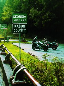
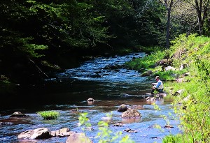
Here’s more advice from a bony New Englander: on the subject of local roads, trust your UPS man. Just west of Franklin, we turn right off U.S. 64 at Mount Hope Baptist Church, then left at Loafer’s Glory onto Wayah Road. This unnamed gray line on our map rates dots and slices through woods and hills along the Nantahala River. Jim becomes selective about which captivating waterfalls to photograph.
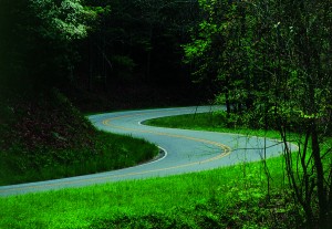
We zig left on U.S. 74, zag right on U.S. 129, then just past Robbinsville follow NC 143 to the Cherohala Skyway. After 38 years of planning and construction the Skyway was completed in 1996, and it just may be the best hundred million tax dollars ever squandered on pavement. It’s 40 miles of esses through wilderness with no stretch that could be labeled a straightaway. Traffic on this April Tuesday is nearly nonexistent. The map’s lack of dots is scandalous.
At the western terminus in Tellico Plains, Tennessee, we find the Cherohala Market. It has the first (or last) gas in 50 miles, and like the sign says, it’s motorcycle-friendly. All-concrete parking means no sunken sidestands. There’s no-cost air, good eats and seating with a clear view of parked bikes. The “Bike Shed” accommodates several bikes under cover. There are rider sundries like rain ponchos, dry socks, ear plugs and tie-downs. It’s worth a visit simply for the helmet hooks in the restrooms.
With benefit of gas, grub and reflection, we reverse course. The Cherohala Skyway is so inviting, the weather so perfect, the traffic so absent, today’s ride becomes an out-and-back. The ST screams, Jim is lost in my mirrors, and the only evidence of mankind is the road.
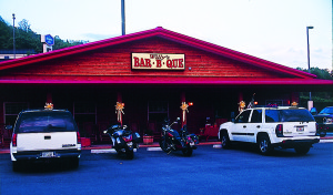
I achieve 40 miles of motorcycle Nirvana. Back in Franklin, we investigate Willy’s Bar-B-Que as rib-joint-of-the-day. It proves the best of our tour and rider-friendly to boot. Before we can get inside, an owner, Gary “Willy” Crawford, asks Jim about his Shadow ACE, tells us of his VTX, and requests details of our ride.
As dinner arrives, the white-haired hostess drawls, “It’s starting to rain, boys. Y’all want to pull your bikes under the porch?” Much obliged, ma’am.
Then another owner, Mitchell “Willy” Crawford, offers a primer on regionalism in Southern barbecue. We learn that Willy’s signature tomato/vinegar sauce is the favorite style in these parts. Willy’s baby backs are smoked, then baked, then grilled; they are gastronomic art, and I achieve one rack of barbecue Nirvana.
Next day climbing toward Highlands on NC 106, wet clay runoff along a blind curve coaxes the ST’s ABS to engage. Skid-free, I stay on my line—and, thankfully, on route for a rib dinner. Moving south on 28 into Sumter National Forest we encounter few motorists, seamless South Carolina blacktop, and signs of thunderstorms. We alter course, heading west on U.S. 76, but by Long Creek a soaking (or worse) is imminent. Preferring to limit cooked meat to the dinner table, we seek shelter in a new, yet-to-open gas station, content to watch heavy weather cross our path.
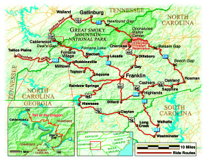
West of Clayton blue skies prevail, but we tire of sharing the Southern Highlands Trail with semis. At Hiawasee we turn north, then east on U.S. 64 toward Franklin. Near Shooting Creek, purple and white wildflowers line the roadside. They are so brilliant we stop to admire them, but only briefly; there are roads to ride and ribs to eat.
For our last night in Franklin, it’s no contest who earns repeat business: We return to Willy’s for another rack of barbecue Nirvana.
It’s been four great days of ribs and roads in the Carolina mountains, and on the way home we begin to plan a return visit.
Resources
Franklin Chamber of Commerce
425 Porter Street
Franklin, NC 28734
(828) 524-3161
www.franklin-chamber.com
Deal’s Gap Motorcycle Resort
17548 Tapoco Road
Tapoco, NC 28771
(800) 889-5550
www.dealsgap.com
Great Smoky Mountains National Park Service
www.nps.gov/grsm
(This article Of Ribs and Roads: Barbecue and Byways in the Carolina Mountains was published in the June 2004 issue of Rider Magazine.)


