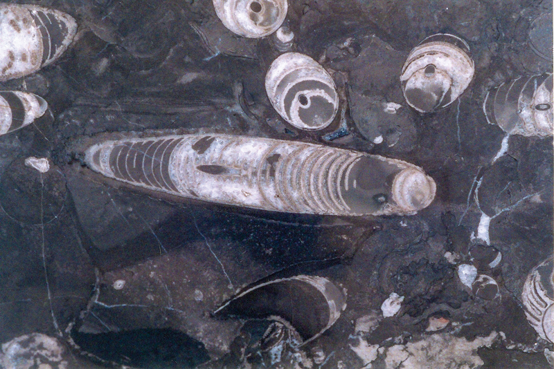
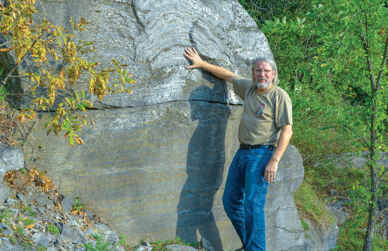
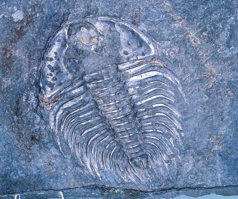
Entombed in this gray rock beneath my motorcycle boots lies the oldest-known coral reef on the planet, yet this island is far from tropical seas. Life flourished here 480 million years ago, but the first European explorer’s boot didn’t stand on this spot until the intrepid French explorer, Samuel de Champlain, arrived in 1609.
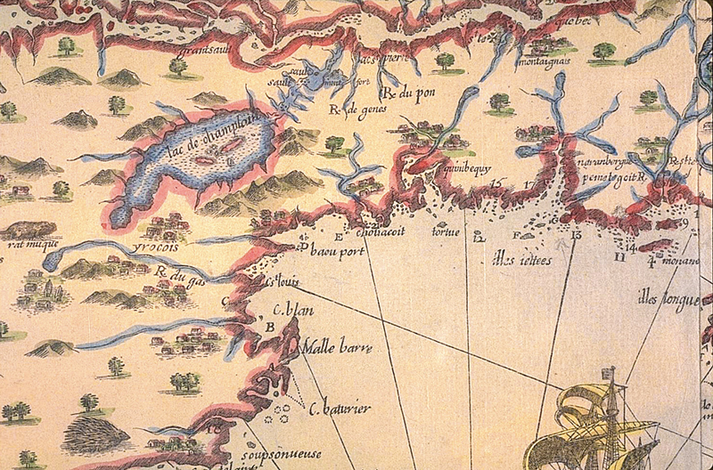
Lake Champlain is the 8th-largest naturally occurring lake in the United States, but its historical importance comes from its geographic position. Maps of the late 17th century appear uncertain where to place this great inland lake, but both British and French military strategists knew exactly where it was located. Squeezed between the Adirondack Mountains of New York and the Green Mountains of Vermont, the widest point of the lake is a mere 12 miles, but it stretches for 120 miles from Canada to Whitehall, New York.
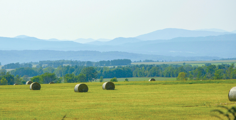
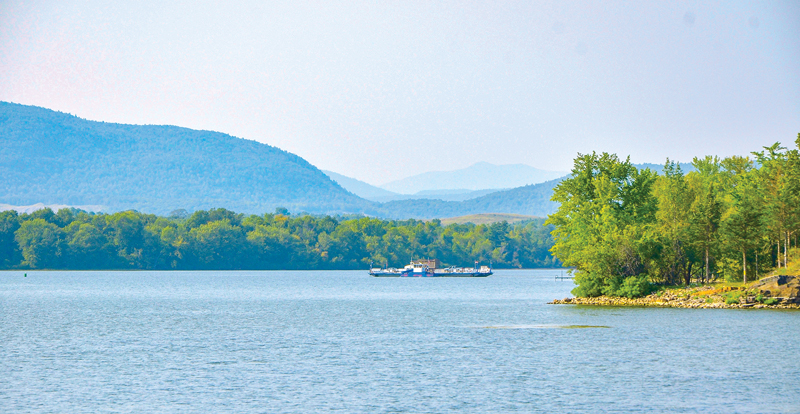
Passing Fort Ticonderoga—originally built by the French in 1755-57 as Fort Carillon—I reach the ferry that takes me across this very narrow part of the lake to Larrabees Point, Vermont. While the Lower Champlain Valley may look flat on maps, the terrain, compressed between mountain ranges, is rippled and every rise affords incredibly scenic views across a bucolic landscape set against the backdrop of the soft-blue Adirondacks. Vermont Route 74 coupled with 22A and 125W are pleasurable touring roads, but venturing onto well-maintained gravel—Smith Street to Lake Street or Basin Harbor Road—is like riding through a landscape painting.
Just as Fort Ticonderoga defended the key portage to Lake George, the forts at Crown Point commanded the southern end of Lake Champlain at its narrowest point. The ruins of the old fortifications and the Champlain Memorial Lighthouse are situated on the New York side of the bridge; the 18th century tavern at Chimney Point, now an historical museum, is on the Vermont side.
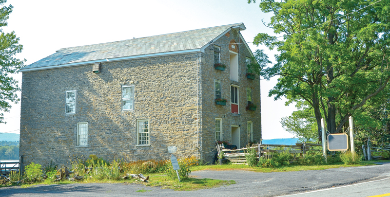
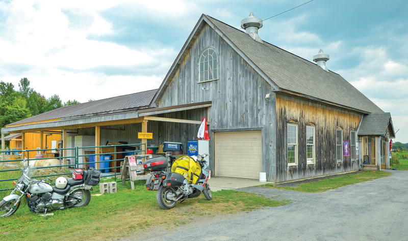
Two miles farther, Vermont Route 17 makes a sweeping turn, but I continue straight onto Lake Street by the West Addison General Store. Dead Creek creates a formidable barrier that nearly isolates these farms and makes the area a haven for wildlife. I must turn left onto Jersey Street and, in the tiny hamlet of Panton, bear right in order reach Route 22A and the smallest and oldest city in Vermont: Vergennes.
Vergennes is where Colonel Benedict Arnold built his ragtag flotilla to engage the British fleet at Valcour Island in 1775, stopping the British advance until 1776. In the basin below the waterfalls—11 miles from the lakeshore—Captain Macdonough secretly built the naval vessels that defeated the British fleet at the Battle of Plattsburgh in 1814. This tiny downtown is a good place for moto-foodies to indulge in farm-to-table fare at the Black Sheep Bistro, 3 Squares Café or Park Squeeze.
Four traffic lights and the mini-city is behind me. U.S. Route 7 is the primary north-south highway on the west side of the Green Mountains, but three miles north of Vergennes and almost opposite to the Rokeby Museum—a famous stop on the Underground Railroad—I turn left onto Greenbush Road. This gorgeous touring road runs roughly parallel to the main highway, and despite the lower speed limit is a pleasure to ride. It was near here that a whale skeleton was unearthed in 1849. Ten thousand years ago this area was 800 feet beneath the Champlain Sea and I’ve been riding on a not-so-ancient seabed since leaving Ticonderoga.
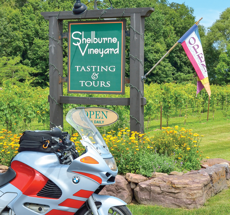
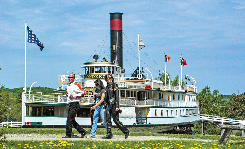
Greenbush Road intersects Ferry Road (to the Essex-Charlotte ferry) at the Old Brick Store and continues to become Bostwick Road into Shelburne. At the traffic light on U.S. 7, Shelburne Vineyards and Fiddlehead Brewing are located immediately to the right, with the Vermont Teddy Bear Factory a half mile farther. To the immediate left is the entrance to Shelburne Museum and one of the finest collections of Americana in the U.S. Besides its other attractions the museum has the Ticonderoga, the last of the great Champlain side-wheel steamships that plied the lake for 140 years.
U.S. 7 leads to the heart of downtown Burlington and its vibrant foodie culture. I choose to avoid dense traffic and continue straight through the traffic light and then, at the second intersection, turn left onto Spear Street to arrive on the UVM (University of Vermont) campus on U.S. Route 2. A left turn would take me downtown and to the ferry dock, but since I’ll be returning tomorrow, a right turn and a quarter of a mile gets me on Interstate 89 north. For those who have flown into Burlington and rented a bike from MotoVermont, this becomes the starting point for an enjoyable day trip.
Exit 17 off I-89 puts me back on U.S. 2. After riding through the wetlands and past Sand Bar State Park, a stop is made on the Sand Bar Bridge, a causeway built in 1850 to connect the largest Champlain island to the mainland. U.S. 2 traverses the islands to Rouses Point, New York, and it offers fantastic vistas, yet it’s not the most scenic of the roads to be found here.
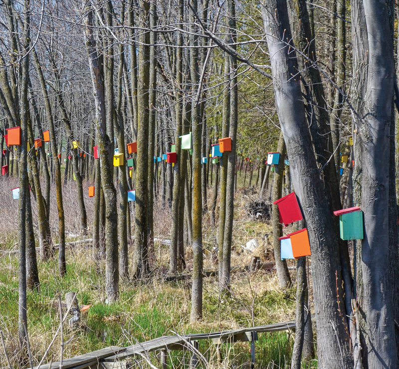
Often incorrectly called Grand Isle, the largest of the Champlain islands is South Hero. In the first village, also named South Hero, I turn left onto South Street by Ebenezer Allen’s old tavern (now a bank) and then right on West Shore Road. The road provides beautiful views of Providence Island (Vermont) and Valcour Island (New York) plus quirky things, such as the colorful birdhouse forest created by Jay Purvis and, in the front yard of the Crescent Bay Farm B&B, one of the miniature stone castles built by Harry Barber. In less than four miles, the road merges onto Vermont Route 314, which goes past the Cumberland Head-Grand Isle ferry dock before returning to the main highway.
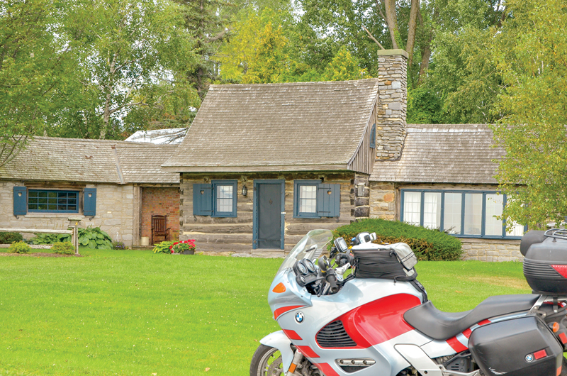
Just after the Grand Isle Post Office is the turn onto East Shore North, a sinuous stretch of narrow pavement that follows the shoreline to the north end of the island while essentially going through the front yards of summer homes. Located on U.S. 2 just 400 yards beyond East Shore North and next to the Grand Isle Elementary School is one of the oldest original log cabins in the United States.
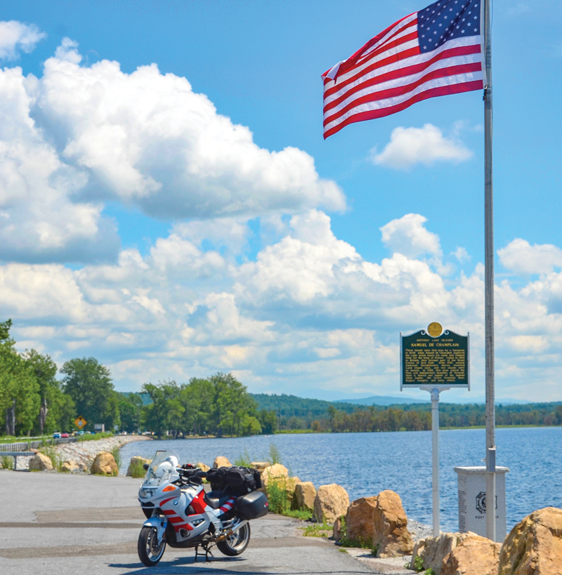
A drawbridge connects South Hero to North Hero, and this narrow channel with its fast current is favored by fishermen angling for salmon, trout, walleye and just about everything else except the famous Champlain sea monster. Despite hundreds of sightings since 1609, “Champ” has eluded capture. President Franklin D. Roosevelt used to brag that he was one of only two civilians who could pilot a Champlain steamer through this narrow passage (his father was president of the Lake Champlain Transportation Company).
Tonight I’m dining and lodging at the North Hero House. In continuous operation since 1891, this is a moto-foodie destination whether for lunch or dinner, and during the summer months it’s rare not to see a motorcycle or two parked in front along the highway. My room overlooks the old stone pier where great steamships once docked. The gentle lake breeze and an excellent supper topped off with a 25-year old Islay whisky promises a good night’s sleep.
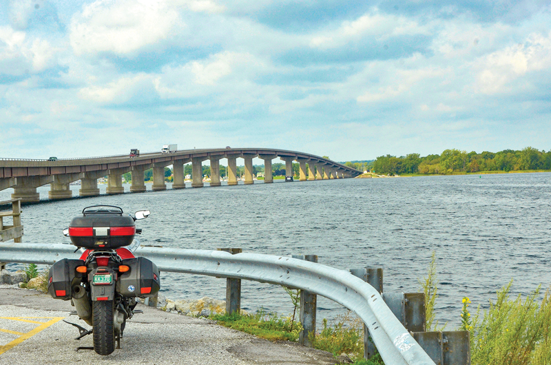
After a sumptuous breakfast, I walk down to Hero’s Welcome General Store. Here one discovers an astonishing variety of goods, including Bacon Candy, a maple syrup grading sampler, Vermont dilly beans and Castleton Crackers. In this region of the country, submarine sandwiches are called “heros” and the deli in this store is famous for them.
I head north and bear right on Lakeview Drive toward North Hero State Park. I lived here once-upon-a-time and looping back along Bridge Road evokes a bit of nostalgia.
Slowing down to second gear at the far end of the bridge to Alburg, I lean right through the blind curve and attentively turn left onto Vermont Route 129. This is one of my favorite touring roads and it’s filled with curves and undulations. Crossing the sinuous causeway onto Isle La Motte, I follow the signs to Saint Anne’s Shrine. This is where Samuel de Champlain first set foot on what would become the state of Vermont, and where Fort Saint Anne became Vermont’s first European settlement in 1666. Today it’s a beautiful outdoor chapel and popular picnic spot.
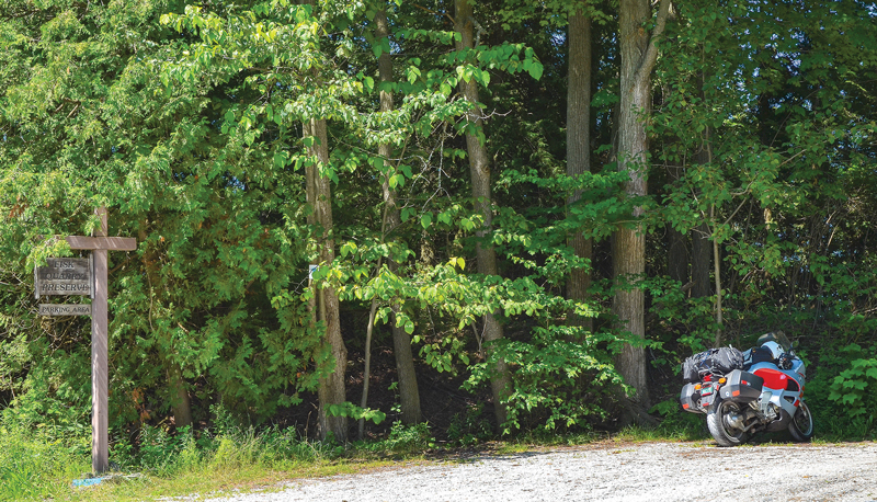
A bit farther down the road is the Fisk Quarry Preserve. Now protected as a National Natural Landmark, this is part of the world’s oldest-known coral reef. Walking over rock one sees the very beginnings of life on our planet. It was here, at the home of Lt. Gov. Fisk (Fisk Farm) in 1901, that Vice President Theodore Roosevelt was informed that President McKinley had been shot.
After re-crossing the causeway, I continue straight for another four miles on another West Shore Road and ride along the Alburg peninsula. On a beautiful summer day this road is almost dreamlike, but when a storm rolls across the lake it’s best not to be on it.
Crossing the Rouses Point Bridge from Vermont to New York provides a view of Fort Montgomery. Constructed with a garrison for 800 men and placements for 125 cannon, the fort was outdated as soon as it was completed in 1871. It’s now for sale! Know of anyone in the market for a 19th century ruin with a moat and scenic lake views?
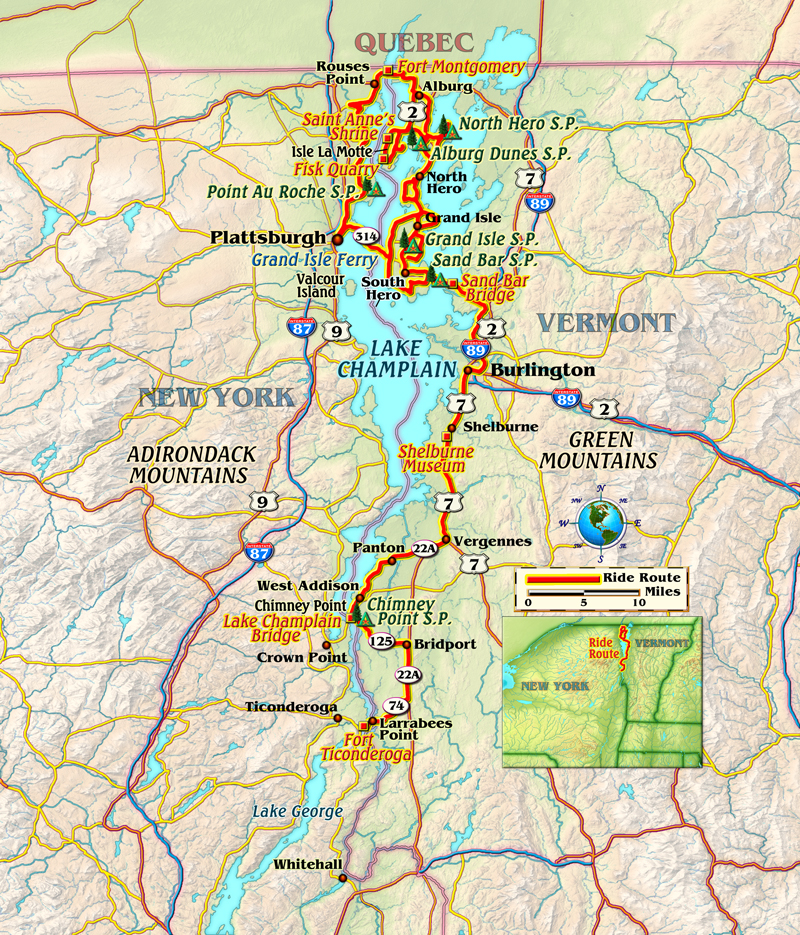
U.S. 2 ends in the village of Rouses Point. Lake Street begins as U.S. Route 11 and continues as New York State Route 98. I ride past King Bay and cross the Great Chazy River, then immediately turn left onto Lake Shore Road. This gorgeous, narrow touring road follows the Great Chazy River until reaching the shore, where it provides expansive views of the western shore of Isle La Motte that’s only a mile distant. After cutting across a headland and riding past Point Au Roche State Park, I arrive at U.S. Route 9 and turn south.
Just north of Plattsburgh, a left turn onto State Route 314 leads to the tip of Cumberland Head and the Grand Isle ferry to Vermont Route 314 on South Hero. This quick, convenient water crossing back to Vermont covers less than two miles, but the next one south, Port Kent-Burlington, is the most scenic as it crosses the lake at its widest point. Either one is a nice finish to this gorgeous tour of the region.




Being a Montrealer, this neck of the woods was less than an hour away. Over the last three decades, perhaps over a thousand times, we crossed the border with the utmost of ease; we thoroughly enjoyed Vermont and made many American friends. Recently, however, Canadians crossing the border is more like Russian Roulette than knocking on a neighbors’ door. Even if you’re lucky enough to avoid being rudely interrogated or rejected, the angst of the crossing still remains. Just a month ago a friend and fellow biker (retired school teacher) was denied entering the USA because of a misdemeanor that was settled over twenty years ago. This is not to put down the good Americans I’ve grown to love as great friends, and the beautiful riding opportunities in Vermont. But, it is to say that things have changed recently, and from where I stand, they sure haven’t changed for the better.
Maybe nobody reading this cares, but I sure do . . .
We’re sorry to hear of the difficulties you’ve experienced at the border and do hope that you will continue visiting Vermont. We value our friends in Quebec and enjoy having you visit us.
I want to reiterate that of the thousands of times I’ve crossed from Canada to the USA, it’s only recently, and only a few times, myself my friends and a few people I know have had a bad experience. That said, my truly great American friends will forever be in my memories and the stunning vistas and roads of the USA will continue to call to those from around the world to visit. To the degree that we will be welcome is the only matter under debate. Your comment certainly helps – thank you.
Sounds like a great itinerary. At Shelburne Vineyard, we’ll welcome one and all. We’re open 7 days a week, 11-6 (May-Oct) and 11-5 (Nov-April).
A friend and I recently spent a weekend riding in this area, truly some of the best roads, scenery and food the northeast has to offer.
I love the way you write.I know I have waited a little late to ride the way I want to.But you and Clem take me when you write about these places you ride to.Yes I do still ride and camp….but this should have been done right after Nam.Thank y’all so much.