There are rides we’ve ridden only once and they became favorites, and then there are favorite rides we’ve ridden over and over again. This ride falls into the latter category. I’ve lost track of how many times I’ve ridden Rim of the World Scenic Byway, but I’ve done it on pleasure rides, solo tests, comparison tests and press launches, on cruisers, sport-tourers and adventure bikes.
RELATED: 2021 KTM 890 Adventure R | (Off) Road Test Review
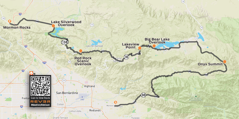
Click here for the REVER route shown above
This route is entirely paved, but it goes through California’s San Bernardino National Forest and provides easy access to many unpaved forest roads and OHV routes. And although I describe the route from its eastern end in Redlands to its western end at Mormon Rocks, it’s just as enjoyable when ridden the other direction. The route is about 100 miles and can be ridden in just a few hours, or it can serve as the main artery for a weekend of adventure, from camping and hiking to boating, fishing or relaxing in mountain communities like Big Bear and Lake Arrowhead.
Redlands is part of the Inland Empire, a vast metropolitan area east of Los Angeles that covers parts of Riverside and San Bernardino counties. State Route 38 begins in Redlands, at the junction with Interstate 10. Rim of the World Scenic Byway begins as Route 38 starts to climb into the foothills of the San Bernardino Mountains. The escape from civilization happens quickly as the road starts to gently curve its way up Mill Creek Canyon, with slopes rising steeply on both sides of the road.
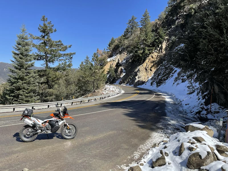
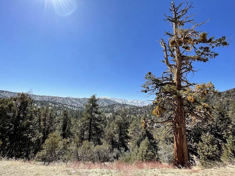
Following a 180-degree, constant-radius sweeper, the road begins a much steeper climb into the mountains. Now we’re talking! Route 38 winds its way through beautiful mountain scenery on its way to 8,443-foot Onyx Summit. Due to the high elevation, snow and ice are common during the winter and early spring, so proceed with caution. On the flip side, the thinner air makes this route a wonderful escape from broiling heat down in the valley during summer and early fall.
The Pacific Crest Trail passes just east of Onyx Summit, and beyond that high point, Route 38 begins a gradual descent with sweeping views of the desert valley to the northeast. As you begin to see residential areas, be mindful of posted speed limits. Route 38 takes an abrupt left as it becomes Big Bear Boulevard and heads west. After the intersection with Greenway Drive you’ll be on Route 18 (Route 38 turns off to the north) and travel through a heavily trafficked area. Some folks who work down in the valley live up in Big Bear, and it’s a popular weekend destination with many rustic cabins available to rent. There are plenty of options for gas, food, supplies and lodging.
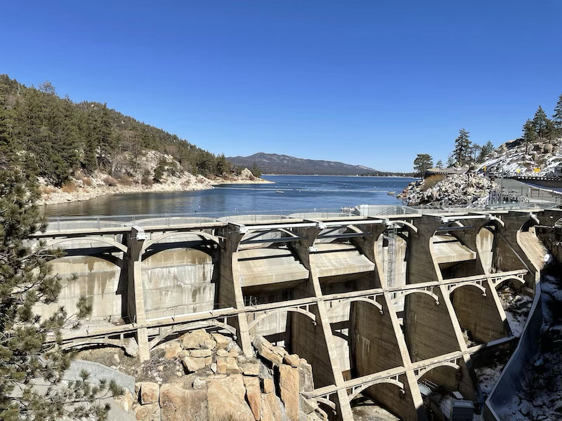
Route 18 roughly follows the southern shore of Big Bear Lake, an expansive blue reservoir. (Route 38 runs along the northern shore and typically has less traffic.) After navigating your way through town and a tight, winding section of road through trees and big lakeside houses, you’ll see Bear Valley Dam. There’s a parking area where you can stop to check out the dam and snap photos of the lake.
From Bear Valley Dam to Lakeview Point, Route 18 hugs rugged cliffs and offers up a delightful — and at times challenging — series of curves. Beware of rockslide debris and fine gravel used for traction in the winter, and commuter and tourist traffic can add their own hazards. Lakeview Point (7,100 feet) is a scenic overlook with great views of the mountains and a peekaboo view of Big Bear Lake off in the distance.

What follows is a tight, technical section that will put your riding skills — and the limits of your cornering clearance — to the test. After passing through the community of Arrowbear Lake, you’ll come to the town of Running Springs. Pay attention to the road signs and stay on Route 18, which follows an off-ramp to the right. It’s easy to end up on Route 330, an absolute blast of a road that winds its way back down to the valley; it’s a fun down-and-back-up spur if you want to extend your ride.
West of Running Springs the route offers up some of the most scenic views on the entire byway, as Route 18 follows the spine of the mountains. There are many turnouts where you can enjoy the view, particularly Red Rock Scenic Overlook, but from the westbound lane be careful crossing the eastbound (valley side) of the road on blind corners.
As Route 18 starts to make its way down to the valley (another fun one), at Mount Anderson Junction you’ll turn onto Route 138 (another off-ramp to the right) toward Crestline. Roads are well marked, so if you’re paying attention or following the route on REVER, you’ll be fine. After winding your way through tall trees and densely clustered cabins, Route 138 becomes a rollercoaster of tight turns, hairpins, dips and rises. This is my favorite section of the entire route, but it’s also the most challenging.
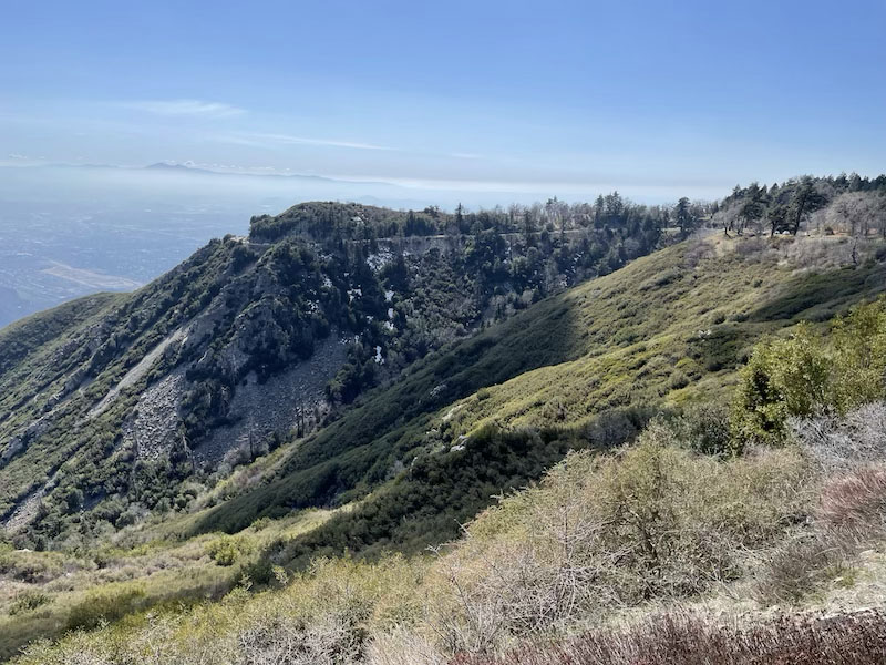
As you come out of the forest, the road opens up as it approaches and rounds Silverwood Lake. No more hairpins, just big sweepers, a few rollers and some straights through sandy desert landscape. After crossing over I-15 and railroad tracks at Cajon Junction, you’ll see Mormon Rocks, a dramatic wind-eroded sandstone formation, rising up in the distance.
That’s the end of the scenic byway, but it doesn’t have to be the end of your fun. Right across from Mormon Rocks is Lone Pine Canyon Road, a lightly trafficked back road that goes to Wrightwood and Route 2, better known as Angeles Crest Highway, a legendary favorite ride.
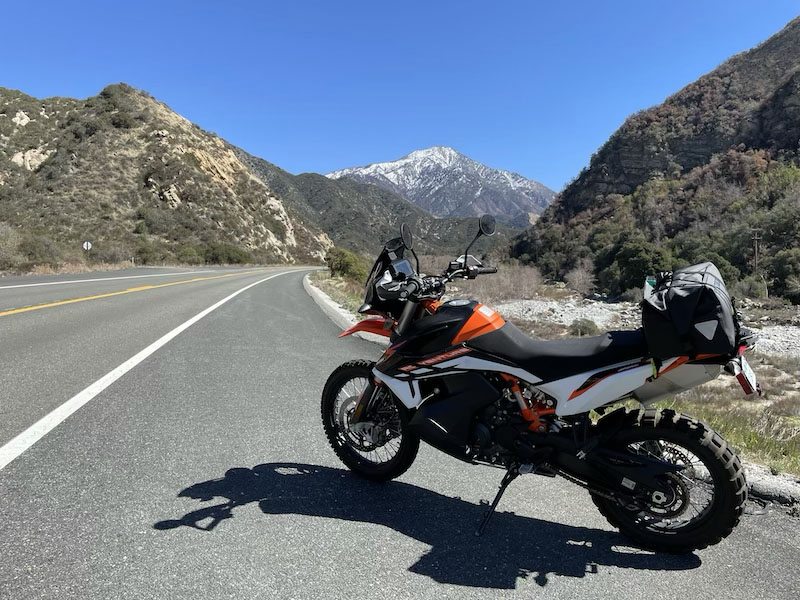
RELATED: Nelson-Rigg Sahara Dry Duffle Bag | Gear Review (shown in photo above)


 | Ep. 69 Rider Magazine Insider Podcast")


I used to ride this route back in the late 60’s only going the other direction. I would leave Norton AFB in San Bernadino and head up to Big Bear on my days off. Then end up back in Redlands. Just loved it!!!