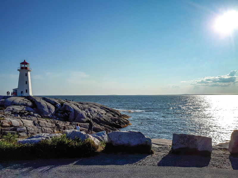
At just 360 miles, you could probably ride the entire length of Canada’s second-smallest province in a day, including Cape Breton Island on the north end. Having said that, you could also spend a good 3-4 weeks exploring the coastal roads that encompass Nova Scotia. But despite the appeal of the many lightly-traveled roads along the coast, the main allure for me and many motorcyclists all over North America are the legendary roads on Cape Breton Island.
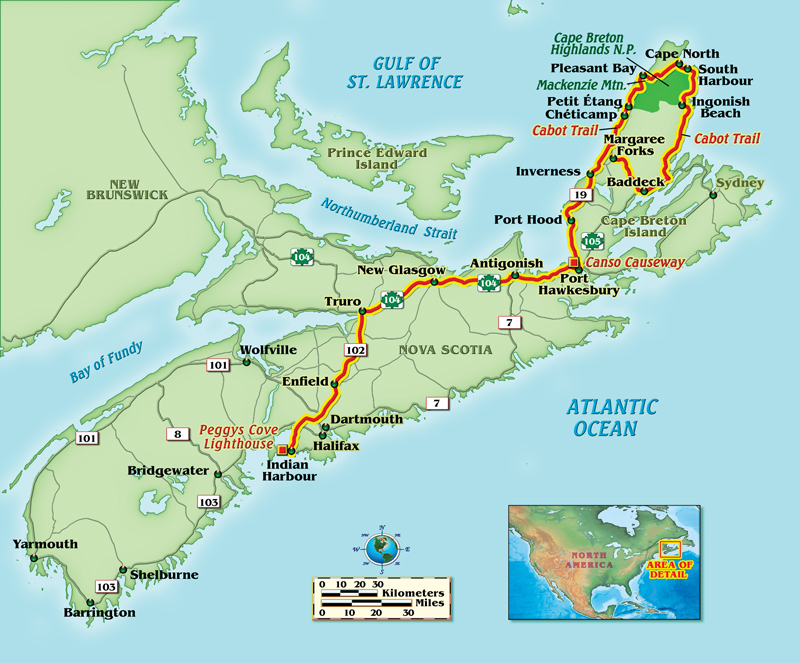
My first stop in Nova Scotia was along the South Shore. From here, the ride was about 190 miles to the Canso Causeway, which joins Cape Breton Island to the mainland. As soon as you are within a couple miles of Port Hastings, the first town you enter once you cross over the causeway, you will immediately notice an increase in the bike-to-car ratio.
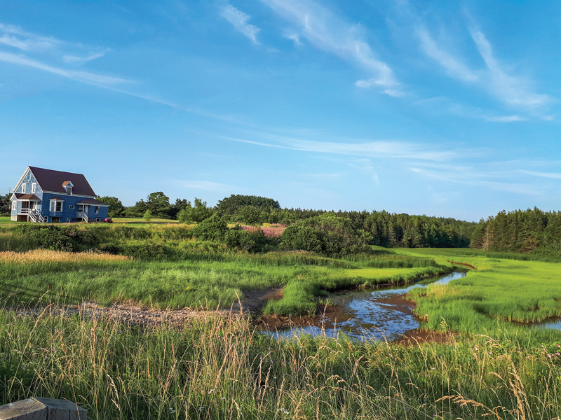
Although the Trans Canada Highway runs up the middle of the island and is the more direct route to the Cabot Trail from Port Hastings, you would be doing yourself a disservice by cutting out Trunk 19, also known as the Ceilidh Trail. It is a 66-mile scenic road that rims the Gulf of St. Lawrence, starting at Port Hastings and ending at Margaree Forks, which is a southern point on the Cabot Trail. The paved road passes through quaint Scottish towns offering reasonably priced accommodations that are more accessible than the lodgings on the Cabot Trail.
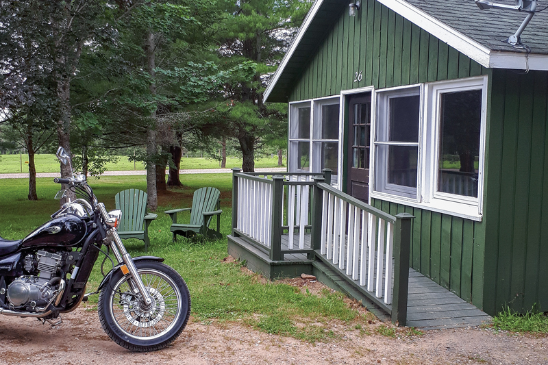
Up until this point in my trip, I would use my last fuel stop of the day as an opportunity to pull out my phone and assess the availability of the local motels. This strategy will not work on the Cabot Trail, especially if you are planning your trip over a weekend in the summer, because everything seemed to book up really fast. However, there is an abundance of B&Bs in the towns along Trunk 19, a perfect location since it is less than an hour’s ride to the Cabot Trail.
Although you could probably ride the entire trail in 5-6 hours, it took me nearly eight with frequent breaks due to the heatwave conditions in early August. On the advice of the locals, I filled my tank in Chéticamp, a small Acadian village with a main street lined with cafés and restaurants. It is a good place to fill up your tank and grab a bite to eat since both fuel and food start to become scarce after passing this village. Chéticamp was bustling with tourists when I arrived, but this is not a reflection of what your ride will be like on the trail. Because of its vastness, I oftentimes felt as if I had the road to myself, despite the fact that it was a Friday afternoon on a beautiful summer day.
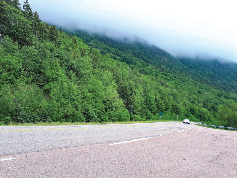
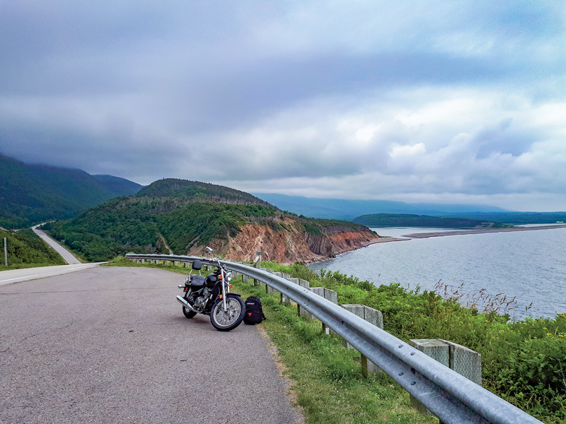
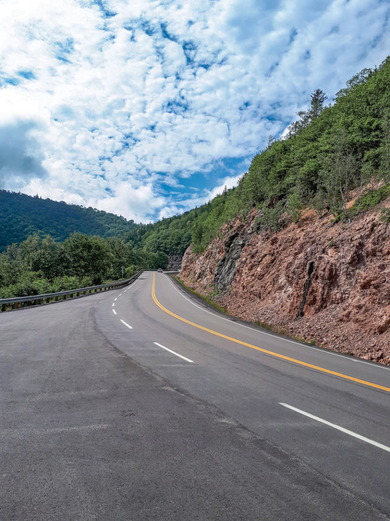
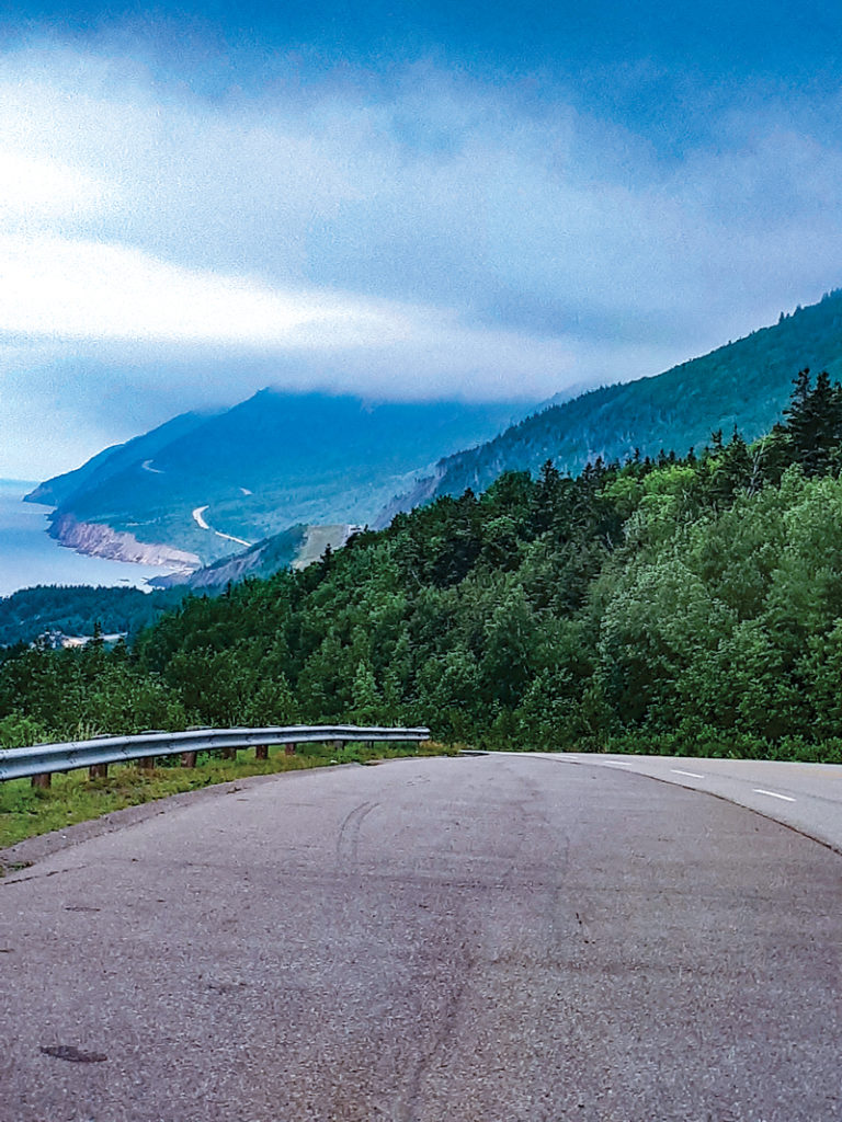
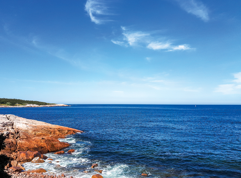
The ride between Petit Étang (which is less than two miles north of Chéticamp) to Ingonish was probably my favorite part of the trail. I enjoyed everything from the spectacular view of the coast north of Petit Étang, to the long sweeping turns around the mountain, to the challenges presented by the switchbacks before descending down the coast to Pleasant Bay. There are many excellent lookout points along the trail, presenting a good opportunity to stretch your legs, snap a few pictures and take in the stunning view of the coast from the mountain.
There is a longstanding debate among the locals over the best way to ride the trail, clockwise or counterclockwise. Although riding counter will put you in the lane closer to the coast, a few of the locals have told me that riding it clockwise is more enjoyable, as you experience the steep descent down MacKenzie Mountain. This was probably the highlight of my entire ride, so I have definitely become biased toward clockwise.
After reaching Cape North, the northernmost part of the trail, you will approach South Harbour. Just past this point, taking a left turn onto White Point Road will bring you down a narrow, paved road along the coast to a small fishing town. It was recommended to me by some locals, and it was a nice 7-mile venture off the trail. It’s a great place to dismount, stretch your legs and take in the beautiful scenery as you listen to the waves crashing against the rocks. The road eventually turns into New Haven Road, which will connect you back to the Cabot Trail.
I ended the loop by riding back to Margaree Forks just before the sun started to set. As a precaution, you may want to time your rides so that you are parked by dusk. Moose are known to frequent Cape Breton Island, and I was told they usually come out around 7:30 to 8:00 p.m. each evening. Not feeling too great about my chances of survival against a moose, I tried to limit any potential exposure to them.
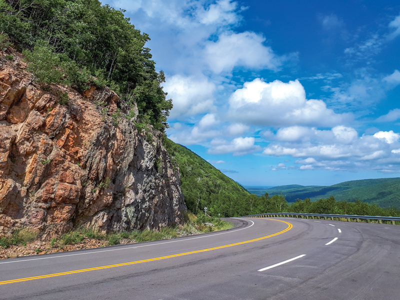
Despite the fact that it is a 186-mile loop, the hours you spend in the saddle on the Cabot Trail will fly by. The three mountains — MacKenzie Mountain, French Mountain and Smokey Mountain — offer different backdrops for your ride, and the tight corners and changes in elevation will present an equal combination of challenge and thrill.


 | Ep. 69 Rider Magazine Insider Podcast")


I rode my 2011 Victory Vision from Akron Ohio to the Cabot Trail a few years ago and enjoyed the entire trip.
Going up through Canada it seemed that I had the road all to myself, and the wildflowers alongside the road kept changing in color and scent.
I did see quite a few moose on that trip, even more than on my Alaska trip.
As the author noted, fuel stations are far and few between.
I chose to ride the Cabot Trail in a counter-clockwise path which put me right up against the cliffs overlooking the water.
I rode the Cabot Trail 3 times in 3 days in 1999 on an ST1100 at high speed. What a great ride! I did it clockwise twice, and counter clockwise once. Great roads, friendly people, great views (it was sunny everyday!), great food, and great music. Your article brought back some great memories – Thanks!
What time of year did you ride? I’m trying to figure out if August or late September into October would be better,
Wow!!! I wanna do this in the summer. Absolutely. Great writing, author. You sold me on this adventure.
Wanted to share our motorcycle experience on the Cabot Trail in 2021.
https://youtu.be/svkWc3EI1sE
Any suggestions on the best or better time of year to ride? Thinking precipitation.
Auto-correct. Was saying that I’m trying to determine if we should go August or late Sept into early October.
Great write up and photos! I had never heard of the Cabot Trail until this weekend while riding SE Massachusetts with a friend she mentioned she wanted to take a trip up there. Now after your article I want to go too!