story and photography by Olaf Wolff
[Southern California Motorcycle Touring: The Tehachapi Loop was originally published as a Favorite Ride in the September 2008 issue of Rider magazine]During the past four decades I’ve learned plenty from riding motorcycles. I’ve come to value the power of patience, the definitive purity and peace in self-discipline and the total pristine beauty of focusing only on the moment.
I’ve learned the tough lesson that motorcycles don’t suffer fools well–that split-second decisions made by overriding ego and arrogance ultimately and always meet head-on with the unflinching laws of physics. I understand to my core that with every ride I live and accept life more as it was intended, rather than I could have by playing it “safe.” And, I clearly recognize without second guessing that the shortest, most direct path to my destination is hardly ever the most rewarding passage.
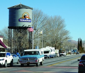
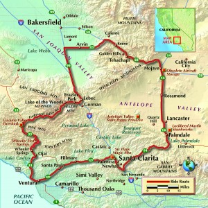
I have family and friends who have settled in Tehachapi, located in the Sierra Nevada mountains, a 40-minute ride east on Highway 58 from Bakersfield, California. I visit often and hardly ever take the path of least resistance. One of my favorite rides to Tehachapi is up Highway 33 and through Lockwood Valley.
California 33 is a historic route, following most of what was U.S. 399 prior to 1964. The highway begins in Ventura as a freeway, but it quickly changes to a scenic rural character that improves expeditiously with every passing mile as it ascends the San Rafael Mountains near Ojai. The stretch of 33 leaving Ojai up and over the 5,160-foot Pine Mountain summit and down into Cuyama Valley is my go-to ride when the need for twisting mountain roads hits. It is in fact the rage for nearly anyone who navigates it.
The highway is also popular with many car manufacturers for road testing or photo shoots. During my last trip up the mountain a rainbow caravan of 10 brand-new Land Rovers blew by me as I was stopped to take in one of the many spectacular views. It’s also very well liked by this magazine: many Rider motorcycle tests involve Highway 33 at some point, either at the beginning of the test, the end, or both.
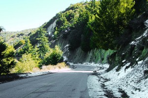
The highway is well maintained year-round and offers banked sweepers, tight switchbacks and long, picturesque straights–just about everything you could order. But the real brilliance of this highway is that it’s viscerally never the same twice. The feel and aromatic impact changes not only with the seasons, but also from the bottom to the summit. The morning I began the climb, the temperature in Ojai was 68 degrees, while at the top a smattering of snow lightly blanketed the hillsides. By the time I descended down the other side into the Cuyama Valley and made the right turn into the Lockwood Valley, the temperature was back in the 60s.
Lockwood Valley Road can be impassable during the rainy season due to flash flooding, but generally there’s just a single shallow water crossing. Roughly about a mile into the road there’s the Chumash Buffalo Ranch, worth a visit if you’ve never seen a huge herd of bison or if you’re a fan of buffalo jerky. But my favorite stop comes about four miles down the road. There’s a sign and a turnoff for Scheideck Lodge, an easy 1.5 miles south off the road but worth the slight detour. It’s only open on weekends, and year-round the lodge (nestled and hidden away by the surrounding mountains) is a favorite stop for riders in search of breakfast or burgers. It sits among about 35 rustic cabins, and there’s a campground next to it.
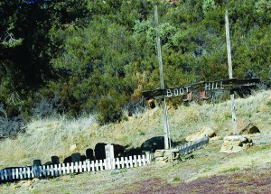
Bucolic and wide-open Lockwood Valley Road rolls along gently for 34 miles to the stop sign at Frazier Park. From there it’s a right turn and five miles to Interstate 5 at the top of the Grapevine. I then take I-5 north to the Arvin exit and head east on Laval Road to State Route 223. Turn east and this route passes through the small farming town of Arvin, then up the hill to where it ends at Highway 58. From there it’s only about another 20 miles to the Tehachapi exit.
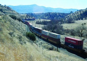
Tehachapi is best known for the Tehachapi train loop. Constructed in 1874-1876 and commemorated in October 1998, this steep line (which averages 2.2 percent in gradient in its 28 miles) was created to climb the rugged mountains out of the San Joaquin Valley and through the Tehachapi Mountains. It has 18 tunnels, 10 bridges and numerous water towers for the old steam locomotives that required it. This feat of civil engineering genius was the crowning achievement of engineer William Hood of the Southern Pacific Railway Company, and is considered one of the seven wonders of the railroad world. This line was part of the final link of the first railroad line connecting San Francisco to Los Angeles, and it was a key factor in the early growth of not only the city of Los Angeles, but also the entire state of California.
To make this ride a true loop when I leave Tehachapi I continue east on Highway 58, past the electricity-generating wind farms and down to the Mojave exit. From there I head back west on Highway 14 through Lancaster and Palmdale, exiting at Santa Clarita, where I continue on surface streets past the Magic Mountain amusement park and finally onto Highway 126 headed back toward Ventura.
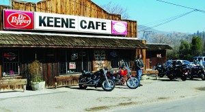
The entire ride is roughly about 300 miles, depending upon the number of turnoffs and detours I make. A must-stop, regardless of which direction I carry out this loop (I sometimes reverse the ride), is the Keene Café. The town of Keene is 10 miles west of the Tehachapi exit, visible from Highway 58…assuming you don’t blink. Keene consists of a fire station, a post office and the café. The café is biker friendly and serves up heaping helpings of comfort food. But its best feature is sharing stories and lessons learned with other motorcyclists in a genuine piece of small-town USA.



Olaf,
I just wanted to say hi. I remember when you taught me how to ride motorcycles on Dell Valley Street in Woodland Hills. just wanted to say hi I looked you up on the Internet you still look the same PS remember the time I pissed you off so bad you punched me in the nose. Taught me a big lesson I’ll never forget those days I have been a rider ever since. I still laugh about it. Write me back if you get a chance.